Nilgiris Pincodes
Enter the Pincode or Location Below in the Box
Pin Codes of Nilgiris
Nilgiris Pincodes: Your Gateway to the Queen of Hills
Explore the picturesque Nilgiris district in Tamil Nadu, India, with ease using our comprehensive list of Nilgiris pincodes. Nestled amidst lush green valleys and rolling hills, Nilgiris, also known as the ‘Queen of Hills,’ is a haven for nature enthusiasts. Whether you’re planning a visit to Ooty, Coonoor, or any other charming town in Nilgiris, our website, ‘Pincodes of My Location,’ provides you with a quick and convenient way to find accurate pincodes for hassle-free navigation. Discover the hidden gems, tea estates, and serene landscapes of Nilgiris effortlessly by using our user-friendly pincodes database.”
Here is a list of Nilgiris Pincodes
About Nilgiris
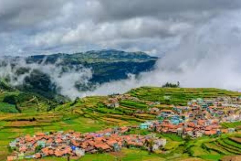
The Nilgiris district, located in the southern Indian state of Tamil Nadu, is among the 38 administrative districts. The name ‘Nilgiri,’ meaning ‘Blue Mountains’ in English, aptly describes the mountain range that spans across the borders of Tamil Nadu, Karnataka, and Kerala. These captivating Nilgiri Hills are an integral part of the expansive Western Ghats mountain chain. The highest pinnacle, Doddabetta, soars to a majestic height of 2,637 meters. This district primarily encompasses the magnificent Nilgiri Mountains range, inviting travelers to explore its scenic beauty, lush landscapes, and rich biodiversity.
History
“The settlement history of the Nilgiri Hills spans countless centuries, leaving behind a rich historical tapestry. The moniker ‘Blue Mountains’ finds its origin, possibly attributed to the profusion of the vibrant blue Strobilanthes flower that carpets the region, or the ethereal, smoky veil that often shrouds this enchanting landscape. Through the annals of time, the Nilgiri Hills have borne witness to the ebb and flow of diverse communities, each contributing to the captivating history etched into these ancient, misty peaks.
Demography
As of the 2011 census, the Nilgiris district boasted a population of 735,394, displaying a commendable sex ratio of 1,042 females per 1,000 males, surpassing the national average of 929 females. A substantial 59.24% of the population resided in urban areas, while 66,799 individuals, comprising 33,648 males and 33,151 females, were under the age of six. Scheduled Castes represented 32.08% of the population, with Scheduled Tribes at 4.46%. The district exhibited an impressive average literacy rate of 77.46%, exceeding the national average of 72.99%. These statistics reflect the district’s diverse and educated populace.
Geography
“Covering an expanse of 2,552.50 square kilometers, the Nilgiris district is predominantly characterized by its undulating terrain, nestled at elevations ranging from 1,000 to 2,600 meters above Mean Sea Level (MSL). It is geographically divided into the expansive Nilgiri plateau and the smaller Wayanad plateau. Positioned at the convergence point of the Western Ghats and the Eastern Ghats, the district occupies a pivotal location with latitudinal coordinates spanning 11°12′ N to 11°37′ N and longitudinal coordinates ranging from 76°30′ E to 76°55′ E, encompassing an area where the natural beauty of hills and plateaus seamlessly intertwines.