Pincodes of Barwani
Barwani, located in the state of Madhya Pradesh, India, is a town known for its rich cultural heritage and scenic beauty. It is nestled near the Narmada River, providing a picturesque landscape. The town is a blend of historical significance and modern development. Barwani is characterized by its diverse population and vibrant local markets. The area is well-connected, with various pincodes serving its different regions, making it easily accessible. Key attractions include ancient temples and the annual religious fair, attracting numerous visitors. Barwani pincodes include 451551, 451552, and 451553, among others.
Here is a list of Barwani Pincodes
| No. | Location | Pincode | District | State |
|---|---|---|---|---|
| 1 | Achli | 451666 | Barwani | Madhya Pradesh |
| 2 | Anjad | 451556 | Barwani | Madhya Pradesh |
| 3 | Anjarada | 451551 | Barwani | Madhya Pradesh |
| 4 | Attarsambha | 451551 | Barwani | Madhya Pradesh |
| 5 | Badgaon | 451447 | Barwani | Madhya Pradesh |
| 6 | Baghadi | 451449 | Barwani | Madhya Pradesh |
| 7 | Bakwadi | 451449 | Barwani | Madhya Pradesh |
| 8 | Balkuwan | 451556 | Barwani | Madhya Pradesh |
| 9 | Balsamund | 451449 | Barwani | Madhya Pradesh |
| 10 | Balwadi | 451666 | Barwani | Madhya Pradesh |
| 11 | Bandhara Bujurg | 451770 | Barwani | Madhya Pradesh |
| 12 | Barda | 451556 | Barwani | Madhya Pradesh |
| 13 | Baruphatak | 451449 | Barwani | Madhya Pradesh |
| 14 | Barwani | 451551 | Barwani | Madhya Pradesh |
| 15 | Baswi | 451449 | Barwani | Madhya Pradesh |
| 16 | Bawangaja | 451551 | Barwani | Madhya Pradesh |
| 17 | Bawdad | 451666 | Barwani | Madhya Pradesh |
| 18 | Bhakarli | 451666 | Barwani | Madhya Pradesh |
| 19 | Bhatki | 451881 | Barwani | Madhya Pradesh |
| 20 | Bhawati | 451551 | Barwani | Madhya Pradesh |
| 21 | Bhorwada | 451449 | Barwani | Madhya Pradesh |
| 22 | Bilwa Road | 451556 | Barwani | Madhya Pradesh |
| 23 | Bokrata | 451551 | Barwani | Madhya Pradesh |
| 24 | Borlay | 451551 | Barwani | Madhya Pradesh |
| 25 | Brahamngaon | 451660 | Barwani | Madhya Pradesh |
| 26 | Chachariya | 451666 | Barwani | Madhya Pradesh |
| 27 | Chatli | 451666 | Barwani | Madhya Pradesh |
| 28 | Chichali (d) | 451660 | Barwani | Madhya Pradesh |
| 29 | Chikliya | 451447 | Barwani | Madhya Pradesh |
| 30 | Chitawal | 451442 | Barwani | Madhya Pradesh |
| 31 | Danod | 451447 | Barwani | Madhya Pradesh |
| 32 | Dawana | 451660 | Barwani | Madhya Pradesh |
| 33 | Deola | 451660 | Barwani | Madhya Pradesh |
| 34 | Dhanora | 451666 | Barwani | Madhya Pradesh |
| 35 | Dhawali | 451666 | Barwani | Madhya Pradesh |
| 36 | Diwaniya | 451666 | Barwani | Madhya Pradesh |
| 37 | Dondwada | 451770 | Barwani | Madhya Pradesh |
| 38 | Dugani | 451666 | Barwani | Madhya Pradesh |
| 39 | Fatyapur | 451556 | Barwani | Madhya Pradesh |
| 40 | Gandhawal | 451551 | Barwani | Madhya Pradesh |
| 41 | Ghatwa | 451660 | Barwani | Madhya Pradesh |
| 42 | Ghusgaon | 451449 | Barwani | Madhya Pradesh |
| 43 | Goi | 451666 | Barwani | Madhya Pradesh |
| 44 | Haribad | 451447 | Barwani | Madhya Pradesh |
| 45 | Indrapur | 451449 | Barwani | Madhya Pradesh |
| 46 | Jahur | 451881 | Barwani | Madhya Pradesh |
| 47 | Jalgone | 451770 | Barwani | Madhya Pradesh |
| 48 | Jamathi | 451666 | Barwani | Madhya Pradesh |
| 49 | Jhopali | 451666 | Barwani | Madhya Pradesh |
| 50 | Jogwada | 451666 | Barwani | Madhya Pradesh |
| 51 | Julwania | 451449 | Barwani | Madhya Pradesh |
| 52 | Junapani | 451770 | Barwani | Madhya Pradesh |
| 53 | Kansul | 451770 | Barwani | Madhya Pradesh |
| 54 | Kasrawad (s) | 451551 | Barwani | Madhya Pradesh |
| 55 | Khajuri | 451449 | Barwani | Madhya Pradesh |
| 56 | Khetya | 451881 | Barwani | Madhya Pradesh |
| 57 | Khurrampura | 451660 | Barwani | Madhya Pradesh |
| 58 | Koradiya | 451556 | Barwani | Madhya Pradesh |
| 59 | Kunjari | 451666 | Barwani | Madhya Pradesh |
| 60 | Kuwan | 451660 | Barwani | Madhya Pradesh |
| 61 | Lakhangaon | 451660 | Barwani | Madhya Pradesh |
| 62 | Limbi | 451551 | Barwani | Madhya Pradesh |
| 63 | Lonsara Khurd | 451556 | Barwani | Madhya Pradesh |
| 64 | Mahitgaon | 451666 | Barwani | Madhya Pradesh |
| 65 | Malfa | 451881 | Barwani | Madhya Pradesh |
| 66 | Malwan | 451666 | Barwani | Madhya Pradesh |
| 67 | Mandwada | 451556 | Barwani | Madhya Pradesh |
| 68 | Matali | 451447 | Barwani | Madhya Pradesh |
| 69 | Mehgaon Deb | 451660 | Barwani | Madhya Pradesh |
| 70 | Menimata | 451447 | Barwani | Madhya Pradesh |
| 71 | Mohipura | 451556 | Barwani | Madhya Pradesh |
| 72 | Moida | 451770 | Barwani | Madhya Pradesh |
| 73 | Mortalai | 451881 | Barwani | Madhya Pradesh |
| 74 | Nagalwadi | 451449 | Barwani | Madhya Pradesh |
| 75 | Nawalpura | 451666 | Barwani | Madhya Pradesh |
| 76 | Nisarpur | 451881 | Barwani | Madhya Pradesh |
| 77 | Niwali | 451667 | Barwani | Madhya Pradesh |
| 78 | Ojhar | 451449 | Barwani | Madhya Pradesh |
| 79 | Palsud | 451447 | Barwani | Madhya Pradesh |
| 80 | Panchpula(n) | 451551 | Barwani | Madhya Pradesh |
| 81 | Pansemal | 451770 | Barwani | Madhya Pradesh |
| 82 | Pati | 451661 | Barwani | Madhya Pradesh |
| 83 | Pipari Bujurg | 451447 | Barwani | Madhya Pradesh |
| 84 | Piplaj | 451551 | Barwani | Madhya Pradesh |
| 85 | Rajpur Barwani | 451447 | Barwani | Madhya Pradesh |
| 86 | Rakhibujurg | 451881 | Barwani | Madhya Pradesh |
| 87 | Rangaon Deb | 451447 | Barwani | Madhya Pradesh |
| 88 | Rangaon Road | 451449 | Barwani | Madhya Pradesh |
| 89 | Revaja | 451447 | Barwani | Madhya Pradesh |
| 90 | Rui | 451449 | Barwani | Madhya Pradesh |
| 91 | Sajwani | 451551 | Barwani | Madhya Pradesh |
| 92 | Sali | 451556 | Barwani | Madhya Pradesh |
| 93 | Salikalan | 451449 | Barwani | Madhya Pradesh |
| 94 | Sangaon | 451447 | Barwani | Madhya Pradesh |
| 95 | Segwal | 451660 | Barwani | Madhya Pradesh |
| 96 | Semali | 451551 | Barwani | Madhya Pradesh |
| 97 | Sendhwa | 451666 | Barwani | Madhya Pradesh |
| 98 | Shahpura | 451666 | Barwani | Madhya Pradesh |
| 99 | Solwan | 451666 | Barwani | Madhya Pradesh |
| 100 | Sondul | 451551 | Barwani | Madhya Pradesh |
| 101 | Sustikheda | 451447 | Barwani | Madhya Pradesh |
| 102 | Talun Khurd | 451551 | Barwani | Madhya Pradesh |
| 103 | Talwada Bujurg | 451556 | Barwani | Madhya Pradesh |
| 104 | Talwada Deb | 451556 | Barwani | Madhya Pradesh |
| 105 | Temala | 451881 | Barwani | Madhya Pradesh |
| 106 | Thikari | 451660 | Barwani | Madhya Pradesh |
| 107 | Uchawad | 451556 | Barwani | Madhya Pradesh |
| 108 | Upla | 451447 | Barwani | Madhya Pradesh |
| 109 | Wajhar | 451447 | Barwani | Madhya Pradesh |
| 110 | Warla | 451666 | Barwani | Madhya Pradesh |
About Barwani
Barwani district, located in the southwestern part of Madhya Pradesh, India, serves as an administrative region with its headquarters in the town of Barwani. Covering an area of 5,427 square kilometers, it had a population of 1,385,881 as per the 2011 census. The district is bordered by the Narmada River to the north, creating a natural boundary. To its south lies the Satpura Range. Geographically, it is surrounded by Maharashtra state to the south, Gujarat state to the west, Dhar District to the north, and Khargone District to the east.
History:
The history of the western Nimar district, now part of Madhya Pradesh, India, is a mosaic of various dynasties’ influence. Initially, it was under the control of empires like the Satavahanas and the Imperial Guptas. However, in the 5th century, a significant shift occurred when Maharaja Subandhu, an independent ruler, took over, as evidenced by a copper plate dating to 468 A.D. The region was later governed by the Sisodias of Barwani until the 14th century, when it fell under the Malwa Sultans’ reign.
A pivotal figure in Barwani’s history is a Suryavanshi prince from the Guhilot dynasty, who migrated from Rajasthan’s Sisoda village to the Narmada Valley in the 14th century, establishing the state of Avasgadh. This state was later renamed Barwani when Rana Chandra Singh, successor to Rana Limbaji, founded the modern town of Barwani, then known as Sidhnagar, in 1640.
The 18th and early 19th centuries witnessed the decline of the Ranas’ power due to Maratha incursions, reducing their territory significantly. By 1819, their domain was confined to a narrow strip along the Satpura range.
The British colonization in the early 19th century brought upheavals. The first two decades were marked by unrest and resistance, highlighted by the 1857 Rebellion, in which local leaders like Bhima Nayak and Khajia Naik participated. Despite their efforts, the British eventually subdued the rebellion.
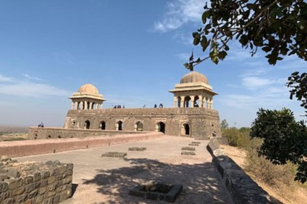
After Indian independence in 1948, Barwani, historically known as Badnagar and Siddha Nagar, was integrated into the newly formed state of Madhya Bharat. The town, famous for its Jain pilgrimage center Bawangaja, also hosts the historic TIR-GOLA monument on the Khandwa-Baroda Road.
Geography:
Barwani, located in the southwestern part of Madhya Pradesh, India, is characterized by its diverse geography, blending natural beauty with cultural richness. The district spans an area of approximately 5,427 square kilometers, showcasing a varied landscape that includes the fertile valleys of the Narmada River and the rugged terrains of the Satpura Range.
The Narmada River, one of India’s major rivers, forms the northern boundary of Barwani. This river is not only a crucial water source for agriculture and daily use but also a significant cultural and spiritual landmark. The region’s proximity to the river contributes to its rich alluvial soil, making it conducive for agriculture and supporting a variety of crops.
South of Barwani, the landscape transforms as the Satpura Range rises. These hills provide a natural barrier and contribute to the district’s scenic beauty. The topography here is more rugged and forested, home to diverse flora and fauna. This contrast between the river valley and the hills offers a unique ecological diversity within the district.
Barwani’s geographical location also marks it as a point of convergence between different states. It borders Maharashtra to the south and Gujarat to the west, while Dhar and Khargone districts lie to its north and east, respectively. This positioning makes Barwani an important link in the region, influencing its cultural and economic exchanges. The district’s climate is typically tropical, with marked variations between summer and monsoon seasons, influencing the lifestyle and agricultural practices of its inhabitants.
Administration:
Barwani district, located in Madhya Pradesh, India, is administratively divided into several divisions and sub-divisions, facilitating efficient governance and management of its diverse and expansive area. These divisions are essential for administrative purposes, including law and order, development projects, and local governance.
The district is divided into five tehsils or revenue subdivisions: Barwani, Sendhwa, Pansemal, Rajpur, and Thikri. Each tehsil functions as an administrative and revenue unit, headed by a Tehsildar, who oversees the implementation of government policies and programs at the local level.
Further, for more localized administration, these tehsils are subdivided into blocks, which are crucial for the implementation of various developmental and welfare schemes. Blocks in Barwani include Barwani, Pati, Sendhwa, Pansemal, Rajpur, and Thikri, among others. These blocks comprise several villages, forming the grassroots level of administration.
Each village in these blocks has a Gram Panchayat, which is the basic unit of local self-government. The Gram Panchayats play a vital role in local governance, addressing the needs and issues of the rural population. They are responsible for the execution of development programs, maintenance of basic infrastructure, and ensuring the well-being of village communities.
Additionally, Barwani district encompasses a number of towns and cities, including the district headquarters, Barwani town. These urban centers are important for the district’s economic activities and provide various urban amenities and services to the residents.
Overall, the administrative structure of Barwani district is designed to cater to the needs of its diverse population, ensuring effective governance and the efficient delivery of services across its rural and urban areas.
Demographics:
Barwani District, located in Madhya Pradesh, India, had a population of 1,385,881 as per the 2011 census. This population size ranked it 354th among the 640 districts in India. The district has a relatively moderate population density, with 256 people living in each square kilometer. An interesting aspect of Barwani’s demographic profile is its sex ratio, which stands at 982 females for every 1,000 males. However, the literacy rate in the district is relatively low, at 49.08%.
The linguistic diversity in Barwani is notable. Almost half of the district’s population, about 49.58%, speaks Bareli as their primary language. Nimadi is spoken by 23.84% of the population, while Hindi is spoken by 9.71%. Other languages include Bhilali, spoken by 4.95%, Bhili by 3.75%, Khandeshi by 2.10%, Gujarati by 1.31%, Marathi by 1.26%, and Banjari by 1.04%.
Among these languages, there are three distinct Bareli languages: Palya, a Bhil language with around 10,000 speakers; Pauri, spoken by approximately 175,000 people and written in the Devanagari script; and Rathwi, which has about 64,000 speakers. Additionally, Bhilali is spoken by around 1,150,000 people. These languages, rich in their cultural and linguistic heritage, add to the diverse tapestry of Barwani’s social fabric.