Pincodes of Burhanpur
Burhanpur, located in Madhya Pradesh, India, is a historic city known for its architectural and cultural heritage. Rich in Mughal history, it features various historical monuments and mosques. The city is nestled along the Tapti River, adding to its scenic beauty. Burhanpur pincodes facilitate efficient postal services and communication in and around Burhanpur.
Here is a list of Burhanpur Pincodes
| No. | Location | Pincode | District | State |
|---|---|---|---|---|
| 1 | Ambada | 450331 | Burhanpur | Madhya Pradesh |
| 2 | Amulla | 450001 | Burhanpur | Madhya Pradesh |
| 3 | Asirgarh | 450331 | Burhanpur | Madhya Pradesh |
| 4 | Bahadarpur | 450331 | Burhanpur | Madhya Pradesh |
| 5 | Bambhada | 450445 | Burhanpur | Madhya Pradesh |
| 6 | Basad | 450331 | Burhanpur | Madhya Pradesh |
| 7 | Bhatkheda | 450221 | Burhanpur | Madhya Pradesh |
| 8 | Bhawasa | 450445 | Burhanpur | Madhya Pradesh |
| 9 | Biroda | 450331 | Burhanpur | Madhya Pradesh |
| 10 | Bodarli | 450331 | Burhanpur | Madhya Pradesh |
| 11 | Bori Bujurg | 450331 | Burhanpur | Madhya Pradesh |
| 12 | Borsar | 450445 | Burhanpur | Madhya Pradesh |
| 13 | Burhanpur | 450331 | Burhanpur | Madhya Pradesh |
| 14 | Burhanpur City | 450331 | Burhanpur | Madhya Pradesh |
| 15 | Burhanpur R.s. | 450331 | Burhanpur | Madhya Pradesh |
| 16 | Burhanpur Rajpura | 450331 | Burhanpur | Madhya Pradesh |
| 17 | Chandani | 450221 | Burhanpur | Madhya Pradesh |
| 18 | Chapora | 450445 | Burhanpur | Madhya Pradesh |
| 19 | Dabhiyakheda | 450221 | Burhanpur | Madhya Pradesh |
| 20 | Dapora | 450445 | Burhanpur | Madhya Pradesh |
| 21 | Dargah-e-hakimi | 450331 | Burhanpur | Madhya Pradesh |
| 22 | Daryapur | 450331 | Burhanpur | Madhya Pradesh |
| 23 | Dedtalai | 450332 | Burhanpur | Madhya Pradesh |
| 24 | Dhamangaon | 450445 | Burhanpur | Madhya Pradesh |
| 25 | Dhulkot | 450331 | Burhanpur | Madhya Pradesh |
| 26 | Doifodia | 450331 | Burhanpur | Madhya Pradesh |
| 27 | Ghagharla | 450221 | Burhanpur | Madhya Pradesh |
| 28 | Gulai | 450331 | Burhanpur | Madhya Pradesh |
| 29 | Haidarpur | 450221 | Burhanpur | Madhya Pradesh |
| 30 | Hasinabad | 450331 | Burhanpur | Madhya Pradesh |
| 31 | Ichhapur | 450445 | Burhanpur | Madhya Pradesh |
| 32 | Jainabad | 450331 | Burhanpur | Madhya Pradesh |
| 33 | Jasondi | 450331 | Burhanpur | Madhya Pradesh |
| 34 | Khaknar | 450332 | Burhanpur | Madhya Pradesh |
| 35 | Khamni | 450445 | Burhanpur | Madhya Pradesh |
| 36 | Khatla | 450661 | Burhanpur | Madhya Pradesh |
| 37 | Loni | 450331 | Burhanpur | Madhya Pradesh |
| 38 | Mahalgurada | 450331 | Burhanpur | Madhya Pradesh |
| 39 | Manjrodkala | 450332 | Burhanpur | Madhya Pradesh |
| 40 | Mohad | 450445 | Burhanpur | Madhya Pradesh |
| 41 | Nachankheda | 450445 | Burhanpur | Madhya Pradesh |
| 42 | Nagjhiri | 450332 | Burhanpur | Madhya Pradesh |
| 43 | Nawara | 450221 | Burhanpur | Madhya Pradesh |
| 44 | Nepanagar | 450221 | Burhanpur | Madhya Pradesh |
| 45 | Nimbola | 450331 | Burhanpur | Madhya Pradesh |
| 46 | Palasur | 450221 | Burhanpur | Madhya Pradesh |
| 47 | Paretha | 450332 | Burhanpur | Madhya Pradesh |
| 48 | Patonda | 450331 | Burhanpur | Madhya Pradesh |
| 49 | Phophanar | 450445 | Burhanpur | Madhya Pradesh |
| 50 | Pipalpani | 450332 | Burhanpur | Madhya Pradesh |
| 51 | Raitalai | 450332 | Burhanpur | Madhya Pradesh |
| 52 | Sangrampur | 450445 | Burhanpur | Madhya Pradesh |
| 53 | Sarola | 450331 | Burhanpur | Madhya Pradesh |
| 54 | Shahbazar Burhanpur | 450331 | Burhanpur | Madhya Pradesh |
| 55 | Shahpur | 450445 | Burhanpur | Madhya Pradesh |
| 56 | Sheikhpur | 450332 | Burhanpur | Madhya Pradesh |
| 57 | Sheikhpura | 450332 | Burhanpur | Madhya Pradesh |
| 58 | Sirpur | 450331 | Burhanpur | Madhya Pradesh |
| 59 | Siwal | 450221 | Burhanpur | Madhya Pradesh |
| 60 | Tukaithad | 450332 | Burhanpur | Madhya Pradesh |
| 61 | Turakgurada | 450445 | Burhanpur | Madhya Pradesh |
About Burhanpur
Burhanpur District, located in central India’s Madhya Pradesh, has its district headquarters in the city of Burhanpur. Established on August 15, 2003, it was formed from the southern part of the Khandwa District. The district is notable for the Tapti River, which flows from east to west through it. It is bordered to the north by the Satpura Range, separating it from Khandwa District and marking the division between the Narmada River valley and the Tapti valley. The Satpura pass, a key route linking northern and southern India, features the strategic Asirgarh fortress, often referred to as the “Key to the Deccan”.
Administratively, the district comprises two development blocks, Burhanpur and Khaknar, and three tehsils: Nepanagar, Burhanpur, and Khaknar. It is a part of the Indore Division.
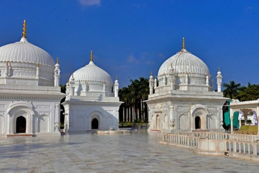
Burhanpur is significant for the Dawoodi Bohra Community, as it is home to the revered and large Dargh-E-Hakimi. The historical city of Burhanpur is encircled by gates, giving it a fort-like appearance.
History:
The Burhanpur district has a rich history, once being a part of the Nimar and Khandesh regions and the Khandesh province. It was ruled by various dynasties over time. Initially part of Avanti during the Buddhist era, it was later governed by the Mauryas, followed by the Satavahanas and Vakatakas. After the decline of the Gupta Empire, it came under Harshavardhana’s rule in 608 CE. The Asirgarh area was then controlled by the Tak Rajputs until Alauddin Khilji conquered it in 1296.
During Mughal rule, Burhanpur was the capital of the Khandesh province. Humayun, a Mughal ruler, visited in 1536 and brought the region under Mughal control. Akbar had to suppress a rebellion here, and Shah Jahan stayed in Asirgarh fort for two years, where his wife Mumtaz Mahal passed away and was initially buried.
In the late 17th century, under Aurangzeb, the Marathas raided and looted Burhanpur in 1681. The Nizam of Hyderabad took control in 1720, only to face continuous Maratha opposition until it was ceded to them. The Scindias or Holkars controlled the district until the British took over in 1818 after the Third Anglo-Maratha War.
In 1857, Tatya Tope, a prominent figure in the Indian Rebellion, passed through the district. Post-independence, Burhanpur became part of Madhya Pradesh.
Geography:
Burhanpur district is surrounded by the state of Maharashtra to its south and southeast, Khandwa district to the north, and Khargone district to the west. The Tapi River runs through the district.
Demographics:
The 2011 census recorded Burhanpur District’s population at 757,847, ranking it 490th among the 640 districts in India. It has a population density of 221 people per square kilometer. The gender ratio in the district is 900 females to every 1,000 males, and the literacy rate is 65.28%. A significant portion, 34.35%, of the population resides in urban areas.
During the 2011 Census of India, the linguistic diversity of the district was evident. Marathi was spoken by 26.97% of the population, followed by Hindi at 17.18%, Urdu at 16.52%, Korku at 10.42%, Bareli at 6.23%, Bhilali at 5.33%, Banjari at 3.78%, Bhili at 2.81%, Gujarati at 2.54%, and Nimadi at 2.24%.