Pincodes of Deoria
Welcome to our Deoria Pincodes directory, a useful tool for learning the postal index numbers (PIN codes) of many locations in Uttar Pradesh’s culturally diverse Deoria district. Deoria is renowned for its rich customs, varied communities, and historical significance. PIN numbers are an essential component of the postal system that guarantee timely mail and package delivery and sorting. Every community in Deoria has a distinct PIN code, which enables postal services to precisely route and deliver mail to the correct recipients. To guarantee that your mail arrives at its destination on time, use the correct PIN code.
Here is a list of Deoria Pincodes
| No. | Location | Pincode | District | State |
|---|---|---|---|---|
| 1 | Ahirauli | 274509 | Deoria | Uttar Pradesh |
| 2 | Ahirauli Baghel | 274702 | Deoria | Uttar Pradesh |
| 3 | Ajana | 274508 | Deoria | Uttar Pradesh |
| 4 | Ametahi | 274405 | Deoria | Uttar Pradesh |
| 5 | Andila | 274604 | Deoria | Uttar Pradesh |
| 6 | Babhani | 274001 | Deoria | Uttar Pradesh |
| 7 | Babhnauli Pandey | 274502 | Deoria | Uttar Pradesh |
| 8 | Badhaya Buzurg | 274001 | Deoria | Uttar Pradesh |
| 9 | Bagaha | 274505 | Deoria | Uttar Pradesh |
| 10 | Baghara | 274404 | Deoria | Uttar Pradesh |
| 11 | Baghauchghat | 274404 | Deoria | Uttar Pradesh |
| 12 | Bahiari Baghel | 274702 | Deoria | Uttar Pradesh |
| 13 | Baida | 274208 | Deoria | Uttar Pradesh |
| 14 | Baidauli | 274501 | Deoria | Uttar Pradesh |
| 15 | Baikunth Pur | 274501 | Deoria | Uttar Pradesh |
| 16 | Bairauna | 274001 | Deoria | Uttar Pradesh |
| 17 | Baitalpur | 274201 | Deoria | Uttar Pradesh |
| 18 | Bajaratar Mahuawa | 274408 | Deoria | Uttar Pradesh |
| 19 | Bakhara Khas | 274202 | Deoria | Uttar Pradesh |
| 20 | Bakuchi | 274509 | Deoria | Uttar Pradesh |
| 21 | Balepur | 274509 | Deoria | Uttar Pradesh |
| 22 | Baliawan | 274405 | Deoria | Uttar Pradesh |
| 23 | Balua | 274704 | Deoria | Uttar Pradesh |
| 24 | Balua Afgan | 274705 | Deoria | Uttar Pradesh |
| 25 | Banjaria | 274408 | Deoria | Uttar Pradesh |
| 26 | Bankata | 274704 | Deoria | Uttar Pradesh |
| 27 | Bankata Amethia | 274702 | Deoria | Uttar Pradesh |
| 28 | Bankata Misir | 274506 | Deoria | Uttar Pradesh |
| 29 | Bankul | 274703 | Deoria | Uttar Pradesh |
| 30 | Bansopatti | 274703 | Deoria | Uttar Pradesh |
| 31 | Bara Dixit | 274603 | Deoria | Uttar Pradesh |
| 32 | Barakagaon | 274601 | Deoria | Uttar Pradesh |
| 33 | Baraon | 274205 | Deoria | Uttar Pradesh |
| 34 | Bardgonia | 274201 | Deoria | Uttar Pradesh |
| 35 | Bardiha Parsuram | 274505 | Deoria | Uttar Pradesh |
| 36 | Bardihadal | 274204 | Deoria | Uttar Pradesh |
| 37 | Barhaj | 274601 | Deoria | Uttar Pradesh |
| 38 | Barhara | 274501 | Deoria | Uttar Pradesh |
| 39 | Bariarpur | 274001 | Deoria | Uttar Pradesh |
| 40 | Barka Gaon | 274702 | Deoria | Uttar Pradesh |
| 41 | Barpar | 274201 | Deoria | Uttar Pradesh |
| 42 | Barthi | 274509 | Deoria | Uttar Pradesh |
| 43 | Batrauli | 274001 | Deoria | Uttar Pradesh |
| 44 | Batulahi | 274201 | Deoria | Uttar Pradesh |
| 45 | Baurdih | 274502 | Deoria | Uttar Pradesh |
| 46 | Baurdih Tiwari | 274201 | Deoria | Uttar Pradesh |
| 47 | Belawa Dubauli | 274208 | Deoria | Uttar Pradesh |
| 48 | Belkunda | 274202 | Deoria | Uttar Pradesh |
| 49 | Belwa | 274405 | Deoria | Uttar Pradesh |
| 50 | Belwa Baboo | 274701 | Deoria | Uttar Pradesh |
| 51 | Belwania | 274001 | Deoria | Uttar Pradesh |
| 52 | Bhagalpur | 274602 | Deoria | Uttar Pradesh |
| 53 | Bhaidava | 274601 | Deoria | Uttar Pradesh |
| 54 | Bhaluani | 274182 | Deoria | Uttar Pradesh |
| 55 | Bharahey Chaura | 274701 | Deoria | Uttar Pradesh |
| 56 | Bhathwa Tiwari | 274702 | Deoria | Uttar Pradesh |
| 57 | Bhatni | 274701 | Deoria | Uttar Pradesh |
| 58 | Bhatpar Rani | 274702 | Deoria | Uttar Pradesh |
| 59 | Bhawani Chapar | 274703 | Deoria | Uttar Pradesh |
| 60 | Bhelaur | 274208 | Deoria | Uttar Pradesh |
| 61 | Bhera Pakar | 274506 | Deoria | Uttar Pradesh |
| 62 | Bhikhampura | 274405 | Deoria | Uttar Pradesh |
| 63 | Bhingari Bazar | 274702 | Deoria | Uttar Pradesh |
| 64 | Bhopatpura | 274703 | Deoria | Uttar Pradesh |
| 65 | Bhulaipur | 274603 | Deoria | Uttar Pradesh |
| 66 | Bijapur Jhantaur | 274501 | Deoria | Uttar Pradesh |
| 67 | Bishunpura Bazar | 274404 | Deoria | Uttar Pradesh |
| 68 | Bishunpura Dewar | 274603 | Deoria | Uttar Pradesh |
| 69 | Chakarawa Bahordas | 274509 | Deoria | Uttar Pradesh |
| 70 | Chakarwa | 274205 | Deoria | Uttar Pradesh |
| 71 | Chanuki | 274506 | Deoria | Uttar Pradesh |
| 72 | Chariayan Buzurg | 274202 | Deoria | Uttar Pradesh |
| 73 | Chero | 274509 | Deoria | Uttar Pradesh |
| 74 | Chhapauli | 274204 | Deoria | Uttar Pradesh |
| 75 | Chhitahi Bazar | 274201 | Deoria | Uttar Pradesh |
| 76 | Chordiha | 274509 | Deoria | Uttar Pradesh |
| 77 | Churia | 274502 | Deoria | Uttar Pradesh |
| 78 | D.B. ashram | 274505 | Deoria | Uttar Pradesh |
| 79 | Deogaon | 274202 | Deoria | Uttar Pradesh |
| 80 | Deoria | 274001 | Deoria | Uttar Pradesh |
| 81 | Deoria urf shampur | 274509 | Deoria | Uttar Pradesh |
| 82 | Deoria Budhoo khan | 274405 | Deoria | Uttar Pradesh |
| 83 | Deoria Kutchary | 274001 | Deoria | Uttar Pradesh |
| 84 | Deoria Meer | 274001 | Deoria | Uttar Pradesh |
| 85 | Deoria New colony | 274001 | Deoria | Uttar Pradesh |
| 86 | Deoria Sadar r.s. | 274001 | Deoria | Uttar Pradesh |
| 87 | Deosia | 274602 | Deoria | Uttar Pradesh |
| 88 | Dhanauti Khurd | 274001 | Deoria | Uttar Pradesh |
| 89 | Dharmer | 274505 | Deoria | Uttar Pradesh |
| 90 | Dhaula Pandit | 274604 | Deoria | Uttar Pradesh |
| 91 | Dol Chhapra | 274509 | Deoria | Uttar Pradesh |
| 92 | Dumari | 274701 | Deoria | Uttar Pradesh |
| 93 | Dumwalia | 274509 | Deoria | Uttar Pradesh |
| 94 | Ekauna | 274208 | Deoria | Uttar Pradesh |
| 95 | Ekla Mishraulia | 274204 | Deoria | Uttar Pradesh |
| 96 | Fatehpur | 274204 | Deoria | Uttar Pradesh |
| 97 | G.I.estate | 274121 | Deoria | Uttar Pradesh |
| 98 | Garauna | 274604 | Deoria | Uttar Pradesh |
| 99 | Garer | 274001 | Deoria | Uttar Pradesh |
| 100 | Gaura | 274405 | Deoria | Uttar Pradesh |
| 101 | Gaura Jai nagar | 274603 | Deoria | Uttar Pradesh |
| 102 | Gauri Bazar | 274202 | Deoria | Uttar Pradesh |
| 103 | Ghanti | 274705 | Deoria | Uttar Pradesh |
| 104 | Gotha Rasoolpur | 274201 | Deoria | Uttar Pradesh |
| 105 | Govindpur | 274405 | Deoria | Uttar Pradesh |
| 106 | Hanuman Mandir | 274001 | Deoria | Uttar Pradesh |
| 107 | Hata | 274703 | Deoria | Uttar Pradesh |
| 108 | Hata Banuadih | 274001 | Deoria | Uttar Pradesh |
| 109 | Indupur | 274202 | Deoria | Uttar Pradesh |
| 110 | Inguri Bazar | 274704 | Deoria | Uttar Pradesh |
| 111 | Israuli | 274602 | Deoria | Uttar Pradesh |
| 112 | Itahua Chandauli | 274509 | Deoria | Uttar Pradesh |
| 113 | Jaitpura | 274501 | Deoria | Uttar Pradesh |
| 114 | Jamira | 274205 | Deoria | Uttar Pradesh |
| 115 | Jogam | 274202 | Deoria | Uttar Pradesh |
| 116 | Jogia Buzurg | 274204 | Deoria | Uttar Pradesh |
| 117 | Jokaha Khas | 274204 | Deoria | Uttar Pradesh |
| 118 | Kalaban | 274202 | Deoria | Uttar Pradesh |
| 119 | Kanchanpur | 274408 | Deoria | Uttar Pradesh |
| 120 | Kanhauli | 274001 | Deoria | Uttar Pradesh |
| 121 | Kaparwar | 274603 | Deoria | Uttar Pradesh |
| 122 | Karail Shukla | 274603 | Deoria | Uttar Pradesh |
| 123 | Karaundi | 274501 | Deoria | Uttar Pradesh |
| 124 | Karauta | 274204 | Deoria | Uttar Pradesh |
| 125 | Karjahan | 274201 | Deoria | Uttar Pradesh |
| 126 | Karmajeetpur | 274202 | Deoria | Uttar Pradesh |
| 127 | Karmtar Sher khan | 274182 | Deoria | Uttar Pradesh |
| 128 | Kasili | 274604 | Deoria | Uttar Pradesh |
| 129 | Kataura | 274202 | Deoria | Uttar Pradesh |
| 130 | Katrari | 274001 | Deoria | Uttar Pradesh |
| 131 | Kauntey Nagar | 274201 | Deoria | Uttar Pradesh |
| 132 | Khaira Banua | 274202 | Deoria | Uttar Pradesh |
| 133 | Khairatia | 274202 | Deoria | Uttar Pradesh |
| 134 | Khampar | 274702 | Deoria | Uttar Pradesh |
| 135 | Khareshar | 274205 | Deoria | Uttar Pradesh |
| 136 | Kharwania | 274508 | Deoria | Uttar Pradesh |
| 137 | Khema Dei | 274508 | Deoria | Uttar Pradesh |
| 138 | Khori | 274603 | Deoria | Uttar Pradesh |
| 139 | Khukhundoo | 274501 | Deoria | Uttar Pradesh |
| 140 | Khurwasia | 274703 | Deoria | Uttar Pradesh |
| 141 | Kodara | 274506 | Deoria | Uttar Pradesh |
| 142 | Koilgarha | 274204 | Deoria | Uttar Pradesh |
| 143 | Korawa | 274204 | Deoria | Uttar Pradesh |
| 144 | Koraya | 274182 | Deoria | Uttar Pradesh |
| 145 | Kothilwa | 274702 | Deoria | Uttar Pradesh |
| 146 | Kotpur Pipra | 274603 | Deoria | Uttar Pradesh |
| 147 | Kotwa Misir | 274404 | Deoria | Uttar Pradesh |
| 148 | Kukur Ghanti | 274702 | Deoria | Uttar Pradesh |
| 149 | Kushahari | 274001 | Deoria | Uttar Pradesh |
| 150 | Labkani | 274202 | Deoria | Uttar Pradesh |
| 151 | Lahilpar | 274001 | Deoria | Uttar Pradesh |
| 152 | Langra Bazar | 274182 | Deoria | Uttar Pradesh |
| 153 | Lar | 274502 | Deoria | Uttar Pradesh |
| 154 | Lar Road | 274505 | Deoria | Uttar Pradesh |
| 155 | Laxmipur | 274204 | Deoria | Uttar Pradesh |
| 156 | Lerha | 274202 | Deoria | Uttar Pradesh |
| 157 | Madanpur | 274205 | Deoria | Uttar Pradesh |
| 158 | Madhawapur | 274509 | Deoria | Uttar Pradesh |
| 159 | Madrapali Bharth rai | 274405 | Deoria | Uttar Pradesh |
| 160 | Mahen | 274603 | Deoria | Uttar Pradesh |
| 161 | Mahiganj | 274204 | Deoria | Uttar Pradesh |
| 162 | Mahuapatan | 274408 | Deoria | Uttar Pradesh |
| 163 | Mahuja | 274506 | Deoria | Uttar Pradesh |
| 164 | Majha Narain | 274208 | Deoria | Uttar Pradesh |
| 165 | Majhauli Raj | 274506 | Deoria | Uttar Pradesh |
| 166 | Majhgaon | 274001 | Deoria | Uttar Pradesh |
| 167 | Majhwalia | 274501 | Deoria | Uttar Pradesh |
| 168 | Malkauli ` | 274505 | Deoria | Uttar Pradesh |
| 169 | Manga Kodar | 274204 | Deoria | Uttar Pradesh |
| 170 | Marhawa | 274182 | Deoria | Uttar Pradesh |
| 171 | Maripar | 274702 | Deoria | Uttar Pradesh |
| 172 | Markara | 274601 | Deoria | Uttar Pradesh |
| 173 | Mathia Sahu | 274202 | Deoria | Uttar Pradesh |
| 174 | Mathura Chhapar | 274405 | Deoria | Uttar Pradesh |
| 175 | Matiara Jagdish | 274502 | Deoria | Uttar Pradesh |
| 176 | Mauna Garhwa | 274604 | Deoria | Uttar Pradesh |
| 177 | Mehaharhangpur | 274404 | Deoria | Uttar Pradesh |
| 178 | Mehraunaghat | 274502 | Deoria | Uttar Pradesh |
| 179 | Mirjapur | 274603 | Deoria | Uttar Pradesh |
| 180 | Mushari | 274408 | Deoria | Uttar Pradesh |
| 181 | Nadauli | 274502 | Deoria | Uttar Pradesh |
| 182 | Nagawa Khas | 274208 | Deoria | Uttar Pradesh |
| 183 | Nai Bazar | 274001 | Deoria | Uttar Pradesh |
| 184 | Naini | 274502 | Deoria | Uttar Pradesh |
| 185 | Naipur | 274205 | Deoria | Uttar Pradesh |
| 186 | Nakail | 274205 | Deoria | Uttar Pradesh |
| 187 | Nandana | 274601 | Deoria | Uttar Pradesh |
| 188 | Nariaon | 274602 | Deoria | Uttar Pradesh |
| 189 | Nawapar | 274601 | Deoria | Uttar Pradesh |
| 190 | Nema | 274602 | Deoria | Uttar Pradesh |
| 191 | Nonapar | 274701 | Deoria | Uttar Pradesh |
| 192 | Noonkhar | 274001 | Deoria | Uttar Pradesh |
| 193 | Pach Lari | 274208 | Deoria | Uttar Pradesh |
| 194 | Pachrukha | 274208 | Deoria | Uttar Pradesh |
| 195 | Padari Bazar | 274701 | Deoria | Uttar Pradesh |
| 196 | Paikauli Maharaj | 274001 | Deoria | Uttar Pradesh |
| 197 | Paina | 274604 | Deoria | Uttar Pradesh |
| 198 | Pakaha | 274404 | Deoria | Uttar Pradesh |
| 199 | Pakri Baboo | 274702 | Deoria | Uttar Pradesh |
| 200 | Pandaypur | 274404 | Deoria | Uttar Pradesh |
| 201 | Panika Bazar | 274505 | Deoria | Uttar Pradesh |
| 202 | Paratappur | 274703 | Deoria | Uttar Pradesh |
| 203 | Parsia Chhitani singh | 274704 | Deoria | Uttar Pradesh |
| 204 | Parsia Dewar | 274601 | Deoria | Uttar Pradesh |
| 205 | Parsia Jaddu | 274001 | Deoria | Uttar Pradesh |
| 206 | Parsia Mishir | 274501 | Deoria | Uttar Pradesh |
| 207 | Patherdewa | 274404 | Deoria | Uttar Pradesh |
| 208 | Patherhat | 274202 | Deoria | Uttar Pradesh |
| 209 | Payasi | 274506 | Deoria | Uttar Pradesh |
| 210 | Peokol | 274701 | Deoria | Uttar Pradesh |
| 211 | Phulwaria Lachhi | 274001 | Deoria | Uttar Pradesh |
| 212 | Pindi | 274508 | Deoria | Uttar Pradesh |
| 213 | Pipara Bithal | 274705 | Deoria | Uttar Pradesh |
| 214 | Pipara Chandrabhan | 274001 | Deoria | Uttar Pradesh |
| 215 | Pipara Dixit | 274701 | Deoria | Uttar Pradesh |
| 216 | Pipara Kachhar | 274204 | Deoria | Uttar Pradesh |
| 217 | Pipara Mishir | 274505 | Deoria | Uttar Pradesh |
| 218 | Pipara Ramdhar | 274509 | Deoria | Uttar Pradesh |
| 219 | Pipara Shukul | 274501 | Deoria | Uttar Pradesh |
| 220 | Piperpanti | 274001 | Deoria | Uttar Pradesh |
| 221 | Pipra Madan gopal | 274405 | Deoria | Uttar Pradesh |
| 222 | Pipra Uttar patti | 274702 | Deoria | Uttar Pradesh |
| 223 | Piprajham | 274408 | Deoria | Uttar Pradesh |
| 224 | Puraini | 274701 | Deoria | Uttar Pradesh |
| 225 | Rahimpur | 274703 | Deoria | Uttar Pradesh |
| 226 | Raibari | 274705 | Deoria | Uttar Pradesh |
| 227 | Ram Gulam tola | 274001 | Deoria | Uttar Pradesh |
| 228 | Rampur | 274405 | Deoria | Uttar Pradesh |
| 229 | Rampur Awasthi | 274001 | Deoria | Uttar Pradesh |
| 230 | Rampur Buzurg | 274509 | Deoria | Uttar Pradesh |
| 231 | Rampur Khori bari | 274701 | Deoria | Uttar Pradesh |
| 232 | Rampur Mahuabari | 274404 | Deoria | Uttar Pradesh |
| 233 | Rampurgarh | 274408 | Deoria | Uttar Pradesh |
| 234 | Ranihawa | 274201 | Deoria | Uttar Pradesh |
| 235 | Ratsia | 274703 | Deoria | Uttar Pradesh |
| 236 | Rawatpar Amethia | 274502 | Deoria | Uttar Pradesh |
| 237 | Reoli | 274602 | Deoria | Uttar Pradesh |
| 238 | Ropan Chhapara | 274502 | Deoria | Uttar Pradesh |
| 239 | Rudrapur | 274204 | Deoria | Uttar Pradesh |
| 240 | S.V.marg | 274001 | Deoria | Uttar Pradesh |
| 241 | Sadhopur | 274202 | Deoria | Uttar Pradesh |
| 242 | Sajaon | 274508 | Deoria | Uttar Pradesh |
| 243 | Sakutai | 274404 | Deoria | Uttar Pradesh |
| 244 | Salaempur | 274509 | Deoria | Uttar Pradesh |
| 245 | Sallahpur | 274501 | Deoria | Uttar Pradesh |
| 246 | Samogar | 274205 | Deoria | Uttar Pradesh |
| 247 | Saraon | 274208 | Deoria | Uttar Pradesh |
| 248 | Sarya | 274702 | Deoria | Uttar Pradesh |
| 249 | Satraon | 274604 | Deoria | Uttar Pradesh |
| 250 | Sawarenji | 274702 | Deoria | Uttar Pradesh |
| 251 | Shahjahanpur | 274408 | Deoria | Uttar Pradesh |
| 252 | Shahpur Shukla | 274404 | Deoria | Uttar Pradesh |
| 253 | Shitalmajha | 274204 | Deoria | Uttar Pradesh |
| 254 | Sidhua | 274405 | Deoria | Uttar Pradesh |
| 255 | Sirjam Khas | 274202 | Deoria | Uttar Pradesh |
| 256 | Sirsia Gotha | 274408 | Deoria | Uttar Pradesh |
| 257 | Sirsia Khohia | 274408 | Deoria | Uttar Pradesh |
| 258 | Sisawa | 274701 | Deoria | Uttar Pradesh |
| 259 | Siswa Panday | 274001 | Deoria | Uttar Pradesh |
| 260 | Sohanpur | 274704 | Deoria | Uttar Pradesh |
| 261 | Sohasa | 274202 | Deoria | Uttar Pradesh |
| 262 | Sohnag | 274509 | Deoria | Uttar Pradesh |
| 263 | Sohnaria | 274408 | Deoria | Uttar Pradesh |
| 264 | Sonari | 274601 | Deoria | Uttar Pradesh |
| 265 | Sonughat | 274001 | Deoria | Uttar Pradesh |
| 266 | Srinagar | 274509 | Deoria | Uttar Pradesh |
| 267 | Sutawar | 274502 | Deoria | Uttar Pradesh |
| 268 | Takia | 274602 | Deoria | Uttar Pradesh |
| 269 | Tara Sara | 274204 | Deoria | Uttar Pradesh |
| 270 | Tarkulwa | 274408 | Deoria | Uttar Pradesh |
| 271 | Tekua | 274182 | Deoria | Uttar Pradesh |
| 272 | Telia Kalan | 274604 | Deoria | Uttar Pradesh |
| 273 | Thakur Deoria | 274182 | Deoria | Uttar Pradesh |
| 274 | Thengval Dubey | 274509 | Deoria | Uttar Pradesh |
| 275 | Tikampar | 274702 | Deoria | Uttar Pradesh |
| 276 | Tikar | 274604 | Deoria | Uttar Pradesh |
| 277 | Tiwai | 274204 | Deoria | Uttar Pradesh |
| 278 | Tulsi Bara | 274509 | Deoria | Uttar Pradesh |
| 279 | Udhopur | 274201 | Deoria | Uttar Pradesh |
About Deoria
Districts Kushinagar in the north, Gopalganj & Siwan (Bihar state) in the east, Mau & Ballia in the south, and Gorakhpur in the west encircle District Deoria. The Deoria district headquarters is located 53 kilometers east of Gorakhpur on a road. The district’s principal rivers include the Ghaghara, Rapti, and Chhoti Gandak.
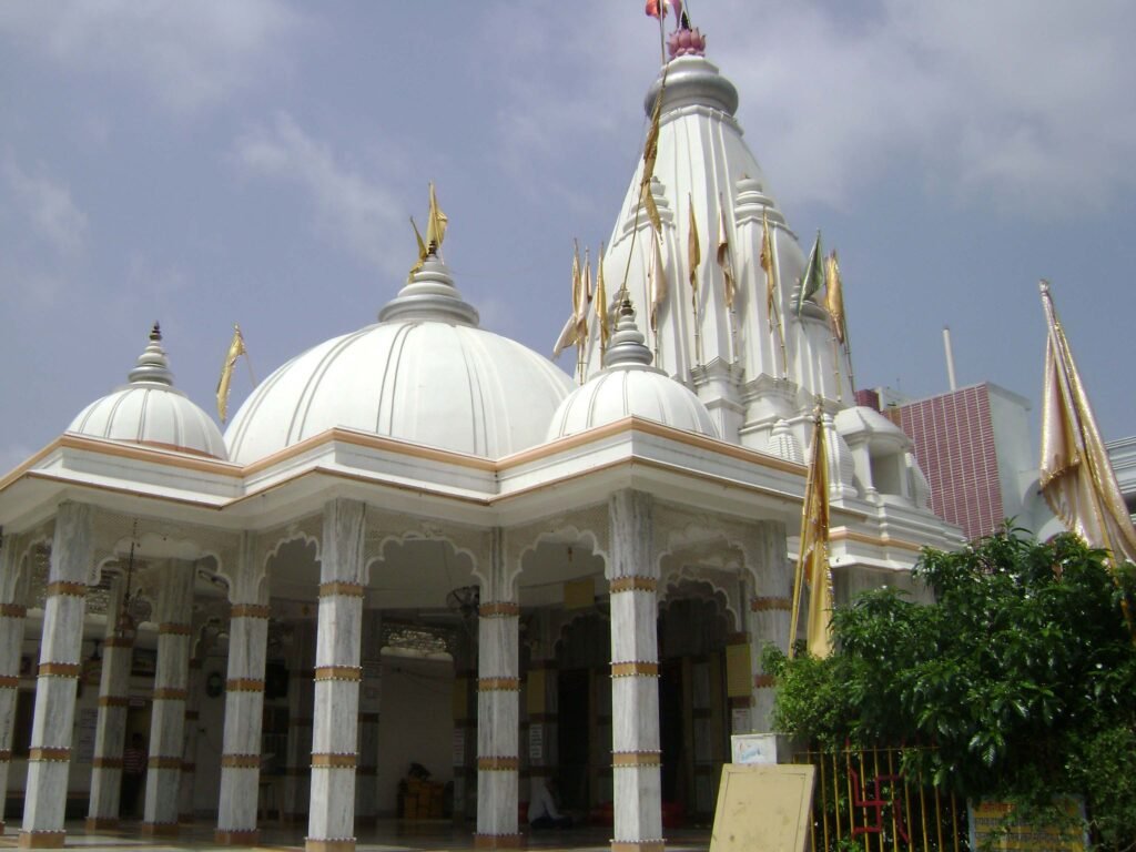
Gorakhpur district gave way to Deoria district on March 16, 1946. The term “Devaranya” or, more likely, “Devpuria,” is whence the name DEORIA originates. Official gazzettes state that the district name “Deoria” is derived from the name of the headquarters, “Deoria,” which normally refers to a location with temples. A fossilized (broken) Shiva temple at the north bank of the Kurna River gave rise to the name DEORIA.
History
The region that is currently the Deoria District was formerly a part of the Kosala Kingdom, which was bounded by the Himalayas to the north, the Shyandika River to the south, the Panchala Kingdom to the west, and the Magadh Kingdom in Bihar to the east. The Kosala Kingdom was a major center of ancient Aryan civilization. In addition to the numerous myths associated with this location, there are archeological artifacts such sculptures, coins, bricks, and temples. In the Deoria District, the majority of people with the surname Rao are members of the Kshatriya caste.
Geography
The Deoria district lies between latitudes 26° 6′ and 26° 48′ north and longitudes 83° 23′ and 84° 16′ east. The districts of Kushinagar in the north, Gopalganj and Siwan in Bihar’s east, Mau and Ballia in the south, and Gorakhpur in the west encircle it. There are two Nagar Palika Parishads in the district: Deoria and Gaura Barhaj. Baitalpur, Hetimpur, Rudrapur, Rampur Karkhana, Bariyarpur, Bhatni Bazar, Bhatpar Rani, Gauri Bazar, Lar, Majhauli Raj, and Salempur are its nine Nagar Panchayats.
Demography
3,100,946 people live in the Deoria district, according to the 2011 census. As a result, it is ranked 114th in India. The population density of the district is 1,220 people per square kilometer, or 3,200 people per square mile. From 2001 to 2011, the population grew at a pace of 14.23%. In Deoria, there are 1013 females for every 1000 men and a 73.53% literacy rate. The population that resides in cities is 10.22%. 15.11% of people are members of Scheduled Castes, while 3.54% are members of Scheduled Tribes.