Pincodes of Dhalai
Greetings and welcome to the Dhalai Pincodes directory, your go-to resource for precise and current pincode data in the fascinating Dhalai area. Postal Index Numbers (PINs), sometimes referred to as pincodes, are a crucial component of the postal system that enable effective letter delivery, precise location determination, and smooth communication. Postal codes, or pincodes, are distinct codes that are linked to a particular region and make mail, shipments, and parcel delivery easier. You can quickly locate the pincode for any location in Dhalai with our easy-to-use search tool. Our database is made to help you find the right pincode for your needs.
Here is a list of Dhalai Pincodes
| No. | Location | Pincode | District | State |
|---|---|---|---|---|
| 1 | Abhanga | 799286 | Dhalai | Tripura |
| 2 | Ambassa | 799289 | Dhalai | Tripura |
| 3 | Apareshkar | 799286 | Dhalai | Tripura |
| 4 | Bagaicherri | 799285 | Dhalai | Tripura |
| 5 | Balarambazar | 799204 | Dhalai | Tripura |
| 6 | Baligaon | 799285 | Dhalai | Tripura |
| 7 | Bamancherra | 799286 | Dhalai | Tripura |
| 8 | Baralutma | 799286 | Dhalai | Tripura |
| 9 | Bhagirathpara | 799284 | Dhalai | Tripura |
| 10 | Bullongbassa | 799284 | Dhalai | Tripura |
| 11 | Chailengta | 799273 | Dhalai | Tripura |
| 12 | Chandraipara | 799289 | Dhalai | Tripura |
| 13 | Chawmanu | 799273 | Dhalai | Tripura |
| 14 | Chengkap | 799286 | Dhalai | Tripura |
| 15 | Chotosarma | 799285 | Dhalai | Tripura |
| 16 | Dalapatipara | 799284 | Dhalai | Tripura |
| 17 | Demchedrra Colony | 799275 | Dhalai | Tripura |
| 18 | Dhumacherra | 799275 | Dhalai | Tripura |
| 19 | East Masli | 799275 | Dhalai | Tripura |
| 20 | Fulcherri | 799285 | Dhalai | Tripura |
| 21 | Ganganagar Tribalcolony | 799289 | Dhalai | Tripura |
| 22 | Garodtilla | 799285 | Dhalai | Tripura |
| 23 | Halahali | 799286 | Dhalai | Tripura |
| 24 | Harincherra | 799289 | Dhalai | Tripura |
| 25 | Jagabandhu Para | 799284 | Dhalai | Tripura |
| 26 | Jamthing | 799286 | Dhalai | Tripura |
| 27 | Jarulcherra | 799275 | Dhalai | Tripura |
| 28 | Kachucherra | 799278 | Dhalai | Tripura |
| 29 | Kamalacherra | 799289 | Dhalai | Tripura |
| 30 | Kamalpur | 799285 | Dhalai | Tripura |
| 31 | Kamalpur Aerodrome | 799287 | Dhalai | Tripura |
| 32 | Kamalpur Bazar | 799285 | Dhalai | Tripura |
| 33 | Kanchanpur Colony | 799289 | Dhalai | Tripura |
| 34 | Karatichesdrra | 799275 | Dhalai | Tripura |
| 35 | Karnamunipara | 799289 | Dhalai | Tripura |
| 36 | Katalutma | 799286 | Dhalai | Tripura |
| 37 | Kuchainala | 799287 | Dhalai | Tripura |
| 38 | Kulaibazar | 799204 | Dhalai | Tripura |
| 39 | Lakraichowdhuripara | 799289 | Dhalai | Tripura |
| 40 | Laldingabari | 799273 | Dhalai | Tripura |
| 41 | Laxmipur | 799284 | Dhalai | Tripura |
| 42 | Longtharai | 799275 | Dhalai | Tripura |
| 43 | Maharani Bus stop | 799278 | Dhalai | Tripura |
| 44 | Mainerma | 799275 | Dhalai | Tripura |
| 45 | Manikbhander | 799287 | Dhalai | Tripura |
| 46 | Manikpur | 799273 | Dhalai | Tripura |
| 47 | Manughat | 799275 | Dhalai | Tripura |
| 48 | Maracherra | 799285 | Dhalai | Tripura |
| 49 | Maslicherra | 799275 | Dhalai | Tripura |
| 50 | Mechuria | 799278 | Dhalai | Tripura |
| 51 | Mendihaor | 799278 | Dhalai | Tripura |
| 52 | Nagbangshi | 799287 | Dhalai | Tripura |
| 53 | Nalicherra | 799204 | Dhalai | Tripura |
| 54 | Natinmanu | 799273 | Dhalai | Tripura |
| 55 | Noagoan | 799285 | Dhalai | Tripura |
| 56 | Paschim Dalucherra | 799278 | Dhalai | Tripura |
| 57 | Ramdurlavpur | 799285 | Dhalai | Tripura |
| 58 | Ranipukur | 799284 | Dhalai | Tripura |
| 59 | Salema | 799278 | Dhalai | Tripura |
| 60 | Sarma | 799284 | Dhalai | Tripura |
| 61 | Sikaribari | 799289 | Dhalai | Tripura |
| 62 | Sindhukumarpara | 799275 | Dhalai | Tripura |
| 63 | Singibill | 799285 | Dhalai | Tripura |
| 64 | Srirampur Lambucherra | 799287 | Dhalai | Tripura |
About Dhalai
In the Indian state of Tripura, there is an administrative district called Dhalai. Ambassa is home to the district headquarters. Despite being the largest district in the state, it has the least population in Tripura as of 2011.
History
In 1995, a portion of the Amarpur Sub-Division of the South Tripura District and the North Tripura District were split apart to form the Dhalai District. It was developed with the administrative necessity of delivering development and sound government to the primarily tribal and unreachable areas in mind. The Dhalai River, which rises in the area, is the source of the district’s name.
Geography
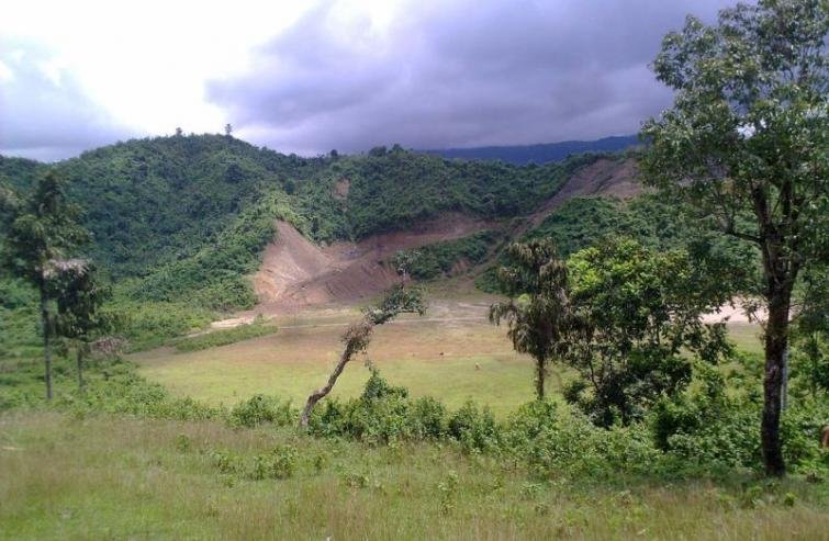
The district is located in the northeastern region of Tripura, with a total area of roughly 2426 sq km. It is primarily situated between the Sakhan Range and the Atharamura Range. Over 70% of the land is forested and hilly. The landscape is primarily steep and undulating, with fertile valleys, rivers, and little water streams (chharas) interspersed. The main rivers that rise in Dhalai are the Khowai, Manu, Gomati, and Dhalai. Atharamura, Longtharai, Kalajhari, and a portion of Sakhan are the main hills. About 85 kilometers separate the district headquarters at Ambassa from Agartala, the state capital.
Climate
The district experiences extended rainy seasons, warm winters, and hot, muggy summers due to its tropical climate. In March and April, there is a lot of rain. The highest summer and winter temperatures are 36 °C and 28 °C, respectively. Summer minimums are 17 degrees Celsius, while winter minimums are 5.3 degrees Celsius.
Demography
Dhalai district’s population, as of the 2011 census, is 378,230, or almost the same as the Maldives. As a result, it is ranked 564th in India. There are 157 people living in the district per square kilometer (410/sq mi). Between 2001 and 2011, the population of the area grew at a pace of 22.78%. Dhalai has an 86.82% literacy rate and a sex ratio of 945 females for every 1000 males. The proportions of Scheduled Castes and Scheduled Tribes to the total population are 16.31% and 55.68%, respectively.
Administration
Under the direction of a Zonal Development Officer, the district comprises a Zone of Tripura Tribal Areas Autonomous District Council. A Superintendent of Police oversees the whole police force. Gandacherra and Kamalpur are sub-jails. A Sub-Divisional Magistrate and Collector oversees the Sub-divisions and is responsible for revenue, elections, land records, birth and death registration, tribal welfare, and peace and order. A Block Development Officer serves as the administrative head of the R.D. Block and is responsible for implementing all government development projects, such as MGNREGS, Indira Awaas Yojana, Swachh Bharat Abhiyan, and others, in the villages.
Economy
Dhalai was identified as one of the 250 most backward districts in the nation by the Ministry of Panchayati Raj in 2006. It is the only district in Tripura that is getting funding from the program known as the Backward Regions Grant Fund (BRGF). The district’s economy is primarily agrarian, while there are a few small- and micro-scale industrial businesses.