Pincodes of Firozpur
Firozpur Pincodes: Navigate Firozpur’s diverse locales effortlessly with our definitive list of pincodes. Whether in the heart of the city or its outskirts, access accurate postal codes for efficient communication and logistics. ‘Pincodes of My Location’ ensures you’re equipped with the right code for every area, streamlining your mailing and courier needs. Explore the rich tapestry of Firozpur’s neighborhoods through our user-friendly platform. From bustling commercial zones to tranquil residential pockets, discover the key to precise addressing in Firozpur. Trust us to simplify your postal navigation, ensuring your letters and packages reach their destination promptly and accurately.
Here is a list of Firozpur Pincodes
| No. | Location | Pincode | District | State |
|---|---|---|---|---|
| 1 | Abohar | 152116 | Firozpur | Punjab |
| 2 | Abohar Mandi | 152116 | Firozpur | Punjab |
| 3 | Ahmad Dhandi | 152022 | Firozpur | Punjab |
| 4 | Alamgarh | 152116 | Firozpur | Punjab |
| 5 | Aliwal Lines ferozepur | 152001 | Firozpur | Punjab |
| 6 | Amir Khas | 152024 | Firozpur | Punjab |
| 7 | Arif Ke | 152021 | Firozpur | Punjab |
| 8 | Arniwala Sheikh subhan | 152124 | Firozpur | Punjab |
| 9 | Aslamwala | 152124 | Firozpur | Punjab |
| 10 | Azamwala | 152121 | Firozpur | Punjab |
| 11 | Bagge Ke uttar | 152024 | Firozpur | Punjab |
| 12 | Bahadur Khera | 152117 | Firozpur | Punjab |
| 13 | Bahamni Wala | 152024 | Firozpur | Punjab |
| 14 | Bahawal Bassi | 152117 | Firozpur | Punjab |
| 15 | Bakainwala | 152128 | Firozpur | Punjab |
| 16 | Balluana | 152117 | Firozpur | Punjab |
| 17 | Bazidpur | 152004 | Firozpur | Punjab |
| 18 | Bazidpur Bhooma | 152116 | Firozpur | Punjab |
| 19 | Bazidpur Kattianwali | 152122 | Firozpur | Punjab |
| 20 | Behak | 152123 | Firozpur | Punjab |
| 21 | Behak Gujjaran | 142044 | Firozpur | Punjab |
| 22 | Bhagoo | 152116 | Firozpur | Punjab |
| 23 | Bhangali Kalan | 142052 | Firozpur | Punjab |
| 24 | Bhangar Khera | 152132 | Firozpur | Punjab |
| 25 | Bhanger | 142052 | Firozpur | Punjab |
| 26 | Bhangerkhera | 152117 | Firozpur | Punjab |
| 27 | Bharana | 142052 | Firozpur | Punjab |
| 28 | Bhinder | 142041 | Firozpur | Punjab |
| 29 | Bhungal | 152117 | Firozpur | Punjab |
| 30 | Bsf Campus chak araian | 152024 | Firozpur | Punjab |
| 31 | Burj Mohar | 152116 | Firozpur | Punjab |
| 32 | Canal Colony ferozepur | 152003 | Firozpur | Punjab |
| 33 | Cantt Railway station ferozepu | 152001 | Firozpur | Punjab |
| 34 | Chak Badhoke | 152033 | Firozpur | Punjab |
| 35 | Chak Banwala | 152123 | Firozpur | Punjab |
| 36 | Chak Gulam rasool wala | 152024 | Firozpur | Punjab |
| 37 | Chak Haraj | 152002 | Firozpur | Punjab |
| 38 | Chak Janisar | 152033 | Firozpur | Punjab |
| 39 | Chak Kherewala | 152033 | Firozpur | Punjab |
| 40 | Chak Mahantan wala | 152022 | Firozpur | Punjab |
| 41 | Chak Saidoke | 152024 | Firozpur | Punjab |
| 42 | Chak Suterian | 152123 | Firozpur | Punjab |
| 43 | Chanan Khera | 152117 | Firozpur | Punjab |
| 44 | Changa Rai uttar | 152022 | Firozpur | Punjab |
| 45 | Chhanga Khurd | 152023 | Firozpur | Punjab |
| 46 | Chimnewala | 152123 | Firozpur | Punjab |
| 47 | Chowk Arya samaj ferozepur | 152002 | Firozpur | Punjab |
| 48 | Chuchak Wind | 142047 | Firozpur | Punjab |
| 49 | Chugatte Wala | 152021 | Firozpur | Punjab |
| 50 | Churiwala Dhanna | 152122 | Firozpur | Punjab |
| 51 | D.A.v campus abohar | 152116 | Firozpur | Punjab |
| 52 | Dabwala Kalan | 152124 | Firozpur | Punjab |
| 53 | Dalmir Khera | 152132 | Firozpur | Punjab |
| 54 | Danewala | 152128 | Firozpur | Punjab |
| 55 | Danger Khera | 152122 | Firozpur | Punjab |
| 56 | Dastoor Sahib | 152004 | Firozpur | Punjab |
| 57 | Datta | 142041 | Firozpur | Punjab |
| 58 | Dhab Kokerian | 152117 | Firozpur | Punjab |
| 59 | Dhandian | 142047 | Firozpur | Punjab |
| 60 | Dhanna Shahid | 142050 | Firozpur | Punjab |
| 61 | Dharampura | 152128 | Firozpur | Punjab |
| 62 | Dharangwala | 152122 | Firozpur | Punjab |
| 63 | Dhigan Wali | 152132 | Firozpur | Punjab |
| 64 | Dhindsa | 142052 | Firozpur | Punjab |
| 65 | Dhippanwali | 152124 | Firozpur | Punjab |
| 66 | Dhira Patra | 152003 | Firozpur | Punjab |
| 67 | District Board ferozpeur | 152002 | Firozpur | Punjab |
| 68 | Diwan Khera | 152128 | Firozpur | Punjab |
| 69 | Dod R.s | 142052 | Firozpur | Punjab |
| 70 | Dodewala | 152116 | Firozpur | Punjab |
| 71 | Dulchike | 152002 | Firozpur | Punjab |
| 72 | Dutaran Wala | 152116 | Firozpur | Punjab |
| 73 | Faridewala | 152004 | Firozpur | Punjab |
| 74 | Fatehgarh Sabrah | 142044 | Firozpur | Punjab |
| 75 | Fatttuwala | 152003 | Firozpur | Punjab |
| 76 | Fazilka | 152123 | Firozpur | Punjab |
| 77 | Ferozepur | 152001 | Firozpur | Punjab |
| 78 | Ferozepur City | 152002 | Firozpur | Punjab |
| 79 | Ferozeshah | 142052 | Firozpur | Punjab |
| 80 | Gaddan Dob | 152117 | Firozpur | Punjab |
| 81 | Gandhi Nagar fazilka | 152123 | Firozpur | Punjab |
| 82 | General Bus stand ferozepur | 152002 | Firozpur | Punjab |
| 83 | Ghall Khurd | 142052 | Firozpur | Punjab |
| 84 | Ghallu | 152122 | Firozpur | Punjab |
| 85 | Ghattianwali Jattan | 152124 | Firozpur | Punjab |
| 86 | Ghubaya | 152024 | Firozpur | Punjab |
| 87 | Giddranwali | 152132 | Firozpur | Punjab |
| 88 | Gill | 142060 | Firozpur | Punjab |
| 89 | Gobindgarh | 152117 | Firozpur | Punjab |
| 90 | Govt Seed form | 152116 | Firozpur | Punjab |
| 91 | Guddar Dhandi | 152022 | Firozpur | Punjab |
| 92 | Gumjal | 152132 | Firozpur | Punjab |
| 93 | Guruharsahai | 152022 | Firozpur | Punjab |
| 94 | Hamad | 152023 | Firozpur | Punjab |
| 95 | Haraj | 142050 | Firozpur | Punjab |
| 96 | Haripura | 152128 | Firozpur | Punjab |
| 97 | Hasta Kalan | 152123 | Firozpur | Punjab |
| 98 | Hazara Singh wala | 152023 | Firozpur | Punjab |
| 99 | Himatpura | 152116 | Firozpur | Punjab |
| 100 | Itanwali | 142052 | Firozpur | Punjab |
| 101 | Jalalabad (t) | 152024 | Firozpur | Punjab |
| 102 | Jalalabad (w) | 152024 | Firozpur | Punjab |
| 103 | Jandwala | 152022 | Firozpur | Punjab |
| 104 | Jandwala Bhimeshah | 152124 | Firozpur | Punjab |
| 105 | Jandwala Hanumanta | 152132 | Firozpur | Punjab |
| 106 | Jandwala Mira sangla | 152128 | Firozpur | Punjab |
| 107 | Jaurki Andhewali | 152123 | Firozpur | Punjab |
| 108 | Jhanda Bagga purana | 152028 | Firozpur | Punjab |
| 109 | Jhariwala | 152022 | Firozpur | Punjab |
| 110 | Jhatre | 152028 | Firozpur | Punjab |
| 111 | Jhok Tehal singh | 152002 | Firozpur | Punjab |
| 112 | Jhoke Harihar | 152003 | Firozpur | Punjab |
| 113 | Jhottianwali | 152124 | Firozpur | Punjab |
| 114 | Jhummianwali | 152122 | Firozpur | Punjab |
| 115 | Jhurar Khera | 152116 | Firozpur | Punjab |
| 116 | Jiwan Araian | 152024 | Firozpur | Punjab |
| 117 | Jodhpura | 152117 | Firozpur | Punjab |
| 118 | Kabbar Wacha | 142060 | Firozpur | Punjab |
| 119 | Kamal Wala | 152021 | Firozpur | Punjab |
| 120 | Kandwala Amarkot | 152116 | Firozpur | Punjab |
| 121 | Karma | 152023 | Firozpur | Punjab |
| 122 | Karmuwala | 142052 | Firozpur | Punjab |
| 123 | Karni Khera | 152123 | Firozpur | Punjab |
| 124 | Kassoana | 142050 | Firozpur | Punjab |
| 125 | Katehra | 152121 | Firozpur | Punjab |
| 126 | Kera Khera | 152117 | Firozpur | Punjab |
| 127 | Khai Pheme ki | 152003 | Firozpur | Punjab |
| 128 | Khairpur | 152116 | Firozpur | Punjab |
| 129 | Khandwala Hazarakhan | 152124 | Firozpur | Punjab |
| 130 | Kheowali Dhab | 152121 | Firozpur | Punjab |
| 131 | Khippanwali | 152121 | Firozpur | Punjab |
| 132 | Khosa Dal singh | 142052 | Firozpur | Punjab |
| 133 | Khuban | 152116 | Firozpur | Punjab |
| 134 | Khui Khera | 152121 | Firozpur | Punjab |
| 135 | Khunder Uttar | 152023 | Firozpur | Punjab |
| 136 | Khuranj | 152033 | Firozpur | Punjab |
| 137 | Khuyian Sarwar | 152128 | Firozpur | Punjab |
| 138 | Kikar Khera | 152116 | Firozpur | Punjab |
| 139 | Killianwali | 152128 | Firozpur | Punjab |
| 140 | Kirianwali | 152123 | Firozpur | Punjab |
| 141 | Kohar Singh wala | 152002 | Firozpur | Punjab |
| 142 | Kohrianwali | 152122 | Firozpur | Punjab |
| 143 | Koil Khera | 152128 | Firozpur | Punjab |
| 144 | Kokri Wehniwal | 142041 | Firozpur | Punjab |
| 145 | Kot Karor kalan | 142060 | Firozpur | Punjab |
| 146 | Krishna Nagari abohar | 152116 | Firozpur | Punjab |
| 147 | Kular | 152116 | Firozpur | Punjab |
| 148 | Kundal | 152117 | Firozpur | Punjab |
| 149 | Ladhuka | 152123 | Firozpur | Punjab |
| 150 | Ladhuwala Uttar | 152024 | Firozpur | Punjab |
| 151 | Lakho Ke behram | 152023 | Firozpur | Punjab |
| 152 | Lalle | 142050 | Firozpur | Punjab |
| 153 | Lamochar Kalan | 152024 | Firozpur | Punjab |
| 154 | Loham | 142060 | Firozpur | Punjab |
| 155 | Lohgarh | 142052 | Firozpur | Punjab |
| 156 | Longodeva | 152028 | Firozpur | Punjab |
| 157 | Machhi Bugra | 142052 | Firozpur | Punjab |
| 158 | Mahalam | 152002 | Firozpur | Punjab |
| 159 | Mahuana Bodla | 152124 | Firozpur | Punjab |
| 160 | Makhu | 142044 | Firozpur | Punjab |
| 161 | Makhu Canal colony | 142044 | Firozpur | Punjab |
| 162 | Makhu Gate ferozepur city | 152002 | Firozpur | Punjab |
| 163 | Mallanwala | 152021 | Firozpur | Punjab |
| 164 | Malloke | 142047 | Firozpur | Punjab |
| 165 | Mallukpur | 152117 | Firozpur | Punjab |
| 166 | Malluwalia Wala | 152021 | Firozpur | Punjab |
| 167 | Mamdot | 152023 | Firozpur | Punjab |
| 168 | Mamu Khera | 152121 | Firozpur | Punjab |
| 169 | Mana Singh wala | 142052 | Firozpur | Punjab |
| 170 | Manawan | 152028 | Firozpur | Punjab |
| 171 | Mandi Amin ganj | 152033 | Firozpur | Punjab |
| 172 | Mandi Ladhuka | 152123 | Firozpur | Punjab |
| 173 | Mansoor Deva | 152028 | Firozpur | Punjab |
| 174 | Markhai | 142047 | Firozpur | Punjab |
| 175 | Maste Ke | 152002 | Firozpur | Punjab |
| 176 | Maujgarh | 152132 | Firozpur | Punjab |
| 177 | Maujzam | 152123 | Firozpur | Punjab |
| 178 | Mehar Singh wala | 142047 | Firozpur | Punjab |
| 179 | Mehma | 152002 | Firozpur | Punjab |
| 180 | Mehrana | 152116 | Firozpur | Punjab |
| 181 | Mohianwala Kalan | 142047 | Firozpur | Punjab |
| 182 | Mudki | 142060 | Firozpur | Punjab |
| 183 | Mullianwali | 152124 | Firozpur | Punjab |
| 184 | Muradwala Dal singh | 152122 | Firozpur | Punjab |
| 185 | Nai Abadi abohar | 152116 | Firozpur | Punjab |
| 186 | New Grain market abohar | 152116 | Firozpur | Punjab |
| 187 | Nihal Khera | 152122 | Firozpur | Punjab |
| 188 | Nukerian | 152033 | Firozpur | Punjab |
| 189 | Nurpur Sethan | 152004 | Firozpur | Punjab |
| 190 | Pakka Kale wala | 152024 | Firozpur | Punjab |
| 191 | Pakkan | 152124 | Firozpur | Punjab |
| 192 | Palla Megha | 152002 | Firozpur | Punjab |
| 193 | Pandori Khatrian | 142050 | Firozpur | Punjab |
| 194 | Panjawan Mandal | 152132 | Firozpur | Punjab |
| 195 | Panje Ke uttar | 152024 | Firozpur | Punjab |
| 196 | Panjkosi | 152128 | Firozpur | Punjab |
| 197 | Panniwala Mohala | 152132 | Firozpur | Punjab |
| 198 | Patel Nagar | 152004 | Firozpur | Punjab |
| 199 | Patrewala | 152128 | Firozpur | Punjab |
| 200 | Patti Sadiq | 152116 | Firozpur | Punjab |
| 201 | Pheroke | 142047 | Firozpur | Punjab |
| 202 | Piareana | 142052 | Firozpur | Punjab |
| 203 | Pindi | 152022 | Firozpur | Punjab |
| 204 | Pir Mohamad | 142044 | Firozpur | Punjab |
| 205 | Raipura | 152116 | Firozpur | Punjab |
| 206 | Rajanwali | 152116 | Firozpur | Punjab |
| 207 | Rajpura | 152116 | Firozpur | Punjab |
| 208 | Ramgarh | 152117 | Firozpur | Punjab |
| 209 | Rampura | 152116 | Firozpur | Punjab |
| 210 | Ramsara | 152116 | Firozpur | Punjab |
| 211 | Rana | 152123 | Firozpur | Punjab |
| 212 | Ranjitgarh | 152022 | Firozpur | Punjab |
| 213 | Ratta Khera | 152033 | Firozpur | Punjab |
| 214 | Ratta Khera pb. singh | 142052 | Firozpur | Punjab |
| 215 | Roharian Wali | 152122 | Firozpur | Punjab |
| 216 | Roop Nagar | 152128 | Firozpur | Punjab |
| 217 | Rukanpura | 152116 | Firozpur | Punjab |
| 218 | Rukna Begu | 152004 | Firozpur | Punjab |
| 219 | Rukne Wala | 152021 | Firozpur | Punjab |
| 220 | S.B.s engg colleger ferozpeur | 152004 | Firozpur | Punjab |
| 221 | Sabuana | 152123 | Firozpur | Punjab |
| 222 | Sabzi Mandi ferozepur city | 152002 | Firozpur | Punjab |
| 223 | Sadar Bazar | 152001 | Firozpur | Punjab |
| 224 | Sahitya Sadan abohar | 152116 | Firozpur | Punjab |
| 225 | Saidanwala | 152004 | Firozpur | Punjab |
| 226 | Sandhe Hasham | 152004 | Firozpur | Punjab |
| 227 | Sanehar | 152028 | Firozpur | Punjab |
| 228 | Santuwala | 142047 | Firozpur | Punjab |
| 229 | Sappanwali | 152128 | Firozpur | Punjab |
| 230 | Sardarpura | 152116 | Firozpur | Punjab |
| 231 | Sarhali | 142044 | Firozpur | Punjab |
| 232 | Sayadwala | 152128 | Firozpur | Punjab |
| 233 | Sayianwala | 152004 | Firozpur | Punjab |
| 234 | Sekhwan | 142050 | Firozpur | Punjab |
| 235 | Shah Abu bakkar | 142043 | Firozpur | Punjab |
| 236 | Shahid Gurdas ram road zira | 142047 | Firozpur | Punjab |
| 237 | Shahwala | 142047 | Firozpur | Punjab |
| 238 | Shahzadi | 142052 | Firozpur | Punjab |
| 239 | Shajrana | 152121 | Firozpur | Punjab |
| 240 | Shakur | 142052 | Firozpur | Punjab |
| 241 | Sharienwala | 152022 | Firozpur | Punjab |
| 242 | Shatirwala | 152121 | Firozpur | Punjab |
| 243 | Shazada Sant singh | 142047 | Firozpur | Punjab |
| 244 | Sher Khan wala | 152004 | Firozpur | Punjab |
| 245 | Sherewala | 152116 | Firozpur | Punjab |
| 246 | Shergarh | 152132 | Firozpur | Punjab |
| 247 | Shianpari | 142044 | Firozpur | Punjab |
| 248 | Sitto Gunno | 152116 | Firozpur | Punjab |
| 249 | Sodhi Nagar | 142052 | Firozpur | Punjab |
| 250 | Sodhiwala | 142050 | Firozpur | Punjab |
| 251 | Sohangarh Thakkran | 152022 | Firozpur | Punjab |
| 252 | Sudh Singh wala | 152021 | Firozpur | Punjab |
| 253 | Sulhani | 142050 | Firozpur | Punjab |
| 254 | Tahliwal Bodla | 152124 | Firozpur | Punjab |
| 255 | Tahliwala Jattan | 152124 | Firozpur | Punjab |
| 256 | Talwandi Bhai | 142050 | Firozpur | Punjab |
| 257 | Talwandi Jallekhan | 152028 | Firozpur | Punjab |
| 258 | Talwandi Mallian | 142041 | Firozpur | Punjab |
| 259 | Thatha Kishan singh | 142047 | Firozpur | Punjab |
| 260 | Thethar Kalan | 142052 | Firozpur | Punjab |
| 261 | Tibbi Khurd | 152023 | Firozpur | Punjab |
| 262 | Toot | 152004 | Firozpur | Punjab |
| 263 | Tootwala | 152132 | Firozpur | Punjab |
| 264 | Tumber Bhan | 142050 | Firozpur | Punjab |
| 265 | Usman Khera | 152132 | Firozpur | Punjab |
| 266 | Valtoha | 142047 | Firozpur | Punjab |
| 267 | Wahabwala | 152116 | Firozpur | Punjab |
| 268 | Wakilanwali | 142047 | Firozpur | Punjab |
| 269 | Wara Bhai ka | 142052 | Firozpur | Punjab |
| 270 | Wara Waryam singh | 142050 | Firozpur | Punjab |
| 271 | Waryam Khera | 152116 | Firozpur | Punjab |
| 272 | Wool Market fazilka | 152123 | Firozpur | Punjab |
| 273 | Zira | 142047 | Firozpur | Punjab |
About Firozpur
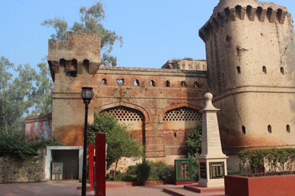
Firozpur, alternatively spelled Ferozepur, rests alongside the Sutlej River in Firozpur District, Punjab, India. Post-India’s partition in 1947, it transformed into a pivotal border city straddling the India-Pakistan border. Notably, Firozpur houses poignant memorials honoring soldiers who valiantly sacrificed their lives defending India. This historic city boasts a rich cultural heritage and strategic significance owing to its border-town status. Nestled by the Sutlej’s banks, Firozpur continues to symbolize resilience, narrating tales of valor and commemorating the bravery of those who stood unwaveringly for their nation amidst the trials of the partition era.