Pincodes of Gumla
Gumla Pincodes
Welcome to “Pincodes of My Location,” your one-stop destination for all postal code information in Gumla, Jharkhand. Gumla, a picturesque district known for its lush greenery and tribal culture, boasts several unique pincodes that define its geographic diversity. Our website offers a comprehensive list of Gumla’s pincodes, enabling you to easily locate and access postal services in this region. Whether you’re a resident, traveler, or business owner, our user-friendly interface ensures you find the right code quickly and efficiently. Stay connected with us to stay updated on Gumla’s postal information, making your mail and package deliveries hassle-free.
Here is a list of Gumla Pincodes
| No. | Location | Pincode | District | State |
|---|---|---|---|---|
| 1 | Adar | 835231 | Gumla | Jharkhand |
| 2 | Amalia | 835203 | Gumla | Jharkhand |
| 3 | Amgaon | 835232 | Gumla | Jharkhand |
| 4 | Anjan | 835233 | Gumla | Jharkhand |
| 5 | Arangu | 835208 | Gumla | Jharkhand |
| 6 | Arko | 835324 | Gumla | Jharkhand |
| 7 | Armai | 835207 | Gumla | Jharkhand |
| 8 | Asani | 835207 | Gumla | Jharkhand |
| 9 | Asro | 835203 | Gumla | Jharkhand |
| 10 | Baghima | 835207 | Gumla | Jharkhand |
| 11 | Banaghutu | 835229 | Gumla | Jharkhand |
| 12 | Banai | 835229 | Gumla | Jharkhand |
| 13 | Banari | 835231 | Gumla | Jharkhand |
| 14 | Bargaon | 835324 | Gumla | Jharkhand |
| 15 | Barwenagar | 835206 | Gumla | Jharkhand |
| 16 | Basia | 835229 | Gumla | Jharkhand |
| 17 | Basua | 835233 | Gumla | Jharkhand |
| 18 | Belagara | 835208 | Gumla | Jharkhand |
| 19 | Bhagitoli | 835230 | Gumla | Jharkhand |
| 20 | Bhandra | 835306 | Gumla | Jharkhand |
| 21 | Bharno | 835203 | Gumla | Jharkhand |
| 22 | Bhikhampur | 835230 | Gumla | Jharkhand |
| 23 | Bhurso | 835324 | Gumla | Jharkhand |
| 24 | Bilingbira | 835220 | Gumla | Jharkhand |
| 25 | Bindora | 835206 | Gumla | Jharkhand |
| 26 | Binkera | 835232 | Gumla | Jharkhand |
| 27 | Bishunpur | 835231 | Gumla | Jharkhand |
| 28 | Chainpur | 835206 | Gumla | Jharkhand |
| 29 | Chharda | 835324 | Gumla | Jharkhand |
| 30 | Chiraiyan | 835230 | Gumla | Jharkhand |
| 31 | Danekera | 835203 | Gumla | Jharkhand |
| 32 | Datia | 835324 | Gumla | Jharkhand |
| 33 | Deoki | 835208 | Gumla | Jharkhand |
| 34 | Dhedhouli | 835207 | Gumla | Jharkhand |
| 35 | Dina | 835230 | Gumla | Jharkhand |
| 36 | Dumardih | 835207 | Gumla | Jharkhand |
| 37 | Dumarpath | 835206 | Gumla | Jharkhand |
| 38 | Eori | 835233 | Gumla | Jharkhand |
| 39 | Gamharia | 835208 | Gumla | Jharkhand |
| 40 | Gangara | 835229 | Gumla | Jharkhand |
| 41 | Gara | 835229 | Gumla | Jharkhand |
| 42 | Ghaghra | 835208 | Gumla | Jharkhand |
| 43 | Ghatgaon | 835233 | Gumla | Jharkhand |
| 44 | Govindpur | 835230 | Gumla | Jharkhand |
| 45 | Gumla | 835207 | Gumla | Jharkhand |
| 46 | Gumla Bazar | 835207 | Gumla | Jharkhand |
| 47 | Gunia | 835233 | Gumla | Jharkhand |
| 48 | Haphu | 835229 | Gumla | Jharkhand |
| 49 | Harra | 835206 | Gumla | Jharkhand |
| 50 | Harup | 835231 | Gumla | Jharkhand |
| 51 | Hesag | 835206 | Gumla | Jharkhand |
| 52 | Hisri | 835230 | Gumla | Jharkhand |
| 53 | Hutar | 835208 | Gumla | Jharkhand |
| 54 | Icha | 835208 | Gumla | Jharkhand |
| 55 | Jamgain | 835203 | Gumla | Jharkhand |
| 56 | Jamti | 835231 | Gumla | Jharkhand |
| 57 | Janawal | 835206 | Gumla | Jharkhand |
| 58 | Jari | 835206 | Gumla | Jharkhand |
| 59 | Jarigutua | 835231 | Gumla | Jharkhand |
| 60 | Jhikochatti | 835203 | Gumla | Jharkhand |
| 61 | Jori | 835231 | Gumla | Jharkhand |
| 62 | Jura | 835324 | Gumla | Jharkhand |
| 63 | Kaliga | 835207 | Gumla | Jharkhand |
| 64 | Kamdara | 835227 | Gumla | Jharkhand |
| 65 | Kamta | 835232 | Gumla | Jharkhand |
| 66 | Karanj | 835324 | Gumla | Jharkhand |
| 67 | Karida | 835232 | Gumla | Jharkhand |
| 68 | Karkari | 835324 | Gumla | Jharkhand |
| 69 | Karomdajovasisai | 835324 | Gumla | Jharkhand |
| 70 | Karomdi | 835207 | Gumla | Jharkhand |
| 71 | Karounda | 835207 | Gumla | Jharkhand |
| 72 | Kartick Oraon college | 835207 | Gumla | Jharkhand |
| 73 | Katkahi | 835206 | Gumla | Jharkhand |
| 74 | Kensir | 835206 | Gumla | Jharkhand |
| 75 | Kereng | 835206 | Gumla | Jharkhand |
| 76 | Keshipara | 835207 | Gumla | Jharkhand |
| 77 | Kharka | 835233 | Gumla | Jharkhand |
| 78 | Khetli | 835230 | Gumla | Jharkhand |
| 79 | Khora | 835207 | Gumla | Jharkhand |
| 80 | Koleng | 835207 | Gumla | Jharkhand |
| 81 | Konbirnawatoli | 835229 | Gumla | Jharkhand |
| 82 | Kondra | 835232 | Gumla | Jharkhand |
| 83 | Konkel | 835232 | Gumla | Jharkhand |
| 84 | Kotam | 835233 | Gumla | Jharkhand |
| 85 | Kugaon | 835208 | Gumla | Jharkhand |
| 86 | Kumhari | 835229 | Gumla | Jharkhand |
| 87 | Kurag | 835231 | Gumla | Jharkhand |
| 88 | Kurum | 835220 | Gumla | Jharkhand |
| 89 | Kurumgarh | 835206 | Gumla | Jharkhand |
| 90 | Latra | 835227 | Gumla | Jharkhand |
| 91 | Longa | 835229 | Gumla | Jharkhand |
| 92 | Lotwa | 835220 | Gumla | Jharkhand |
| 93 | Lowabar | 835230 | Gumla | Jharkhand |
| 94 | Lungtu | 835229 | Gumla | Jharkhand |
| 95 | Luru | 835206 | Gumla | Jharkhand |
| 96 | Mahadeo Chegri | 835203 | Gumla | Jharkhand |
| 97 | Majhigaon | 835230 | Gumla | Jharkhand |
| 98 | Malai | 835207 | Gumla | Jharkhand |
| 99 | Mamarla | 835229 | Gumla | Jharkhand |
| 100 | Marasili | 835203 | Gumla | Jharkhand |
| 101 | Marda | 835207 | Gumla | Jharkhand |
| 102 | Marwa | 835231 | Gumla | Jharkhand |
| 103 | Marwai | 835231 | Gumla | Jharkhand |
| 104 | Moreng | 835229 | Gumla | Jharkhand |
| 105 | Murgu | 835324 | Gumla | Jharkhand |
| 106 | Murkunda | 835207 | Gumla | Jharkhand |
| 107 | Nagar | 835324 | Gumla | Jharkhand |
| 108 | Nagpheni | 835324 | Gumla | Jharkhand |
| 109 | Nathpur | 835220 | Gumla | Jharkhand |
| 110 | Nawadih | 835233 | Gumla | Jharkhand |
| 111 | Nawagarh | 835232 | Gumla | Jharkhand |
| 112 | Noadih | 835230 | Gumla | Jharkhand |
| 113 | Obera Sundarpur | 835220 | Gumla | Jharkhand |
| 114 | Olmunda | 835324 | Gumla | Jharkhand |
| 115 | Pabeya | 835203 | Gumla | Jharkhand |
| 116 | Pak R.s. | 835227 | Gumla | Jharkhand |
| 117 | Palkot | 835220 | Gumla | Jharkhand |
| 118 | Parsa | 835207 | Gumla | Jharkhand |
| 119 | Patia | 835207 | Gumla | Jharkhand |
| 120 | Pimpi | 835227 | Gumla | Jharkhand |
| 121 | Pojenga | 835220 | Gumla | Jharkhand |
| 122 | Pok R.s. | 835227 | Gumla | Jharkhand |
| 123 | Pulung | 835232 | Gumla | Jharkhand |
| 124 | Puto | 835208 | Gumla | Jharkhand |
| 125 | Putrungi | 835206 | Gumla | Jharkhand |
| 126 | Raidih | 835232 | Gumla | Jharkhand |
| 127 | Rajawal | 835230 | Gumla | Jharkhand |
| 128 | Ramtolaya | 835227 | Gumla | Jharkhand |
| 129 | Ruki | 835231 | Gumla | Jharkhand |
| 130 | Sakarpur Gamharia | 835233 | Gumla | Jharkhand |
| 131 | Sakrauli | 835324 | Gumla | Jharkhand |
| 132 | Salegutu | 835227 | Gumla | Jharkhand |
| 133 | Salemnawatoli | 835231 | Gumla | Jharkhand |
| 134 | Sarango | 835231 | Gumla | Jharkhand |
| 135 | Sarita | 835227 | Gumla | Jharkhand |
| 136 | Sato | 835231 | Gumla | Jharkhand |
| 137 | Sewsoreng | 835208 | Gumla | Jharkhand |
| 138 | Shiwnathpur | 835324 | Gumla | Jharkhand |
| 139 | Sikri | 835206 | Gumla | Jharkhand |
| 140 | Silam | 835207 | Gumla | Jharkhand |
| 141 | Sisai | 835324 | Gumla | Jharkhand |
| 142 | Sogra | 835324 | Gumla | Jharkhand |
| 143 | Srinagar | 835206 | Gumla | Jharkhand |
| 144 | Sukurda | 835229 | Gumla | Jharkhand |
| 145 | Sundaridih | 835220 | Gumla | Jharkhand |
| 146 | Surhu | 835227 | Gumla | Jharkhand |
| 147 | Sursang | 835232 | Gumla | Jharkhand |
| 148 | Tabela | 835206 | Gumla | Jharkhand |
| 149 | Taisera | 835207 | Gumla | Jharkhand |
| 150 | Tangaria | 835220 | Gumla | Jharkhand |
| 151 | Tapkara | 835220 | Gumla | Jharkhand |
| 152 | Telgaon | 835207 | Gumla | Jharkhand |
| 153 | Tongo | 835206 | Gumla | Jharkhand |
| 154 | Totambi | 835208 | Gumla | Jharkhand |
| 155 | Toto | 835233 | Gumla | Jharkhand |
| 156 | Turiamba | 835203 | Gumla | Jharkhand |
| 157 | Tusgaon | 835206 | Gumla | Jharkhand |
About Gumla District
Gumla district, nestled in the eastern Indian state of Jharkhand, stands as one of its twenty-four distinctive administrative regions. At the heart of this district lies Gumla town, serving as the pivotal administrative hub. This picturesque town, with its unique blend of cultural heritage and natural beauty, hosts the administrative headquarters of Gumla district. As a vibrant part of Jharkhand, Gumla district boasts a rich tapestry of traditions and landscapes, making it an intriguing destination for both residents and visitors alike. Explore this enchanting district, where history meets modernity against the backdrop of Jharkhand’s scenic beauty.
History
Gumla’s historical journey is closely intertwined with the changing administrative landscape. During the British colonial era, Gumla was initially part of the Lohardaga district. In 1843, it was incorporated into the Bishunpur province, later renamed Ranchi. It wasn’t until 1899 that Ranchi district formally emerged. In 1902, Gumla was designated as a sub-division under the Ranchi district. The pivotal moment arrived on 18th May 1983 when Gumla District finally gained independent status. Sri Jagannath Mishra, then Chief Minister of Bihar, officiated its inauguration, and Sri Dwarika Nath Sinha assumed the role of its first Deputy Commissioner, marking a significant milestone in Gumla’s administrative history.
Demography
According to the 2011 census, Gumla district, situated in the eastern part of India, recorded a total population of 1,025,213 residents. This figure is approximately equivalent to the entire population of Cyprus or the U.S. state of Montana. Gumla’s population places it at the 439th rank among Indian districts, out of a total of 640. The district boasts a population density of 193 individuals per square kilometer. Over the decade from 2001 to 2011, Gumla experienced a notable population growth rate of 23.21%. In terms of gender distribution, there are 993 females for every 1000 males, while the literacy rate stands at 65.73%. Additionally, 6.35% of the population resides in urban areas.
Geography
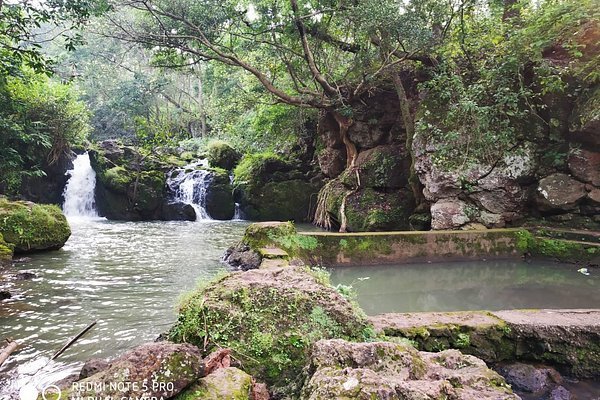
Gumla, situated at coordinates 23°N and 84.50°E, is nestled in the southern region of the Chota Nagpur plateau, marking the eastern boundary of the Deccan plateau system. This scenic district is crisscrossed by three significant rivers: the South Koel, North Koel, and Sankh, each contributing to the region’s natural beauty. Gumla also boasts numerous streams and tributaries, adorned with picturesque waterfalls like the enchanting Sadni Falls. The landscape is characterized by its undulating terrain, adorned with lush forests covering 27% of the district’s total land area, spanning approximately 1.35 lakh hectares out of a total 5.21 lakh hectares.
Economy
Gumla district, renowned for its abundant natural and mineral resources, hosts a wealth of opportunities. With 23 bauxite mines, 68 stone mines, and a thriving community of brick makers, it’s a hub of industrial potential. The district’s treasures include bauxite and laterite, primarily located in villages such as Amkipani, Langdatanr, Chirodih, Jalim, Narma, Bahagara, and Gurdari in Bishunpur block, Langatanr, Lupungpat, and Chota-Agiatu in Chainpur block, as well as Harup, Serengdag, and Jalim in Ghaghra block. Additionally, China clay can be found in select areas of the district. Furthermore, mining activities such as stone crushing, brick kilns, and stone chip mining leases are available in various parts of Gumla district.
FAQs
Why is Gumla famous?
Gumla is famous for its rich tribal culture, natural beauty, and abundant mineral resources, including bauxite and laterite. It is also known for its picturesque landscapes and serene environment.
What is the old name of the city of Gumla?
The old name of the city of Gumla was "Gauṃ lākha," which is believed to have been derived from the Mundari words "Gauṃ" meaning 'village' and "Lākha" meaning 'deep water.'
Which hill station is near to Gumla jharkhand?
The hill station near Gumla, Jharkhand, is Netarhat. It is known for its cool climate, lush greenery, and scenic beauty, making it a popular tourist destination in the region.
Which is the nearest airport to Gumla Jharkhand?
The nearest airport to Gumla, Jharkhand, is Birsa Munda Airport, located in Ranchi. It is approximately 125 kilometers (78 miles) away from Gumla and is the most convenient option for air travel to the region.
Is Gumla a district?
Yes, Gumla is a district in the Indian state of Jharkhand. It is known for its tribal culture, natural beauty, and mineral resources, including bauxite and laterite.