Pincodes of Hoshangabad
Hoshangabad District in Madhya Pradesh is celebrated for its picturesque landscapes and rich cultural heritage. Situated by the sacred Narmada River, it boasts lush forests, diverse wildlife, and vibrant tribal cultures. Renowned for its historical monuments and ancient temples, the district attracts many tourists and pilgrims. Agriculture, greatly supported by the Narmada’s irrigation, forms the backbone of its economy. Hoshangabad is a vibrant showcase of India’s natural beauty and historical depth.Hoshangabad district encompasses a range of areas, each identified by unique Hoshangabad pincodes, which are essential for efficient mail delivery and location identification.
Here is a list of Hoshangabad Pincodes
| No. | Location | Pincode | District | State |
|---|---|---|---|---|
| 1 | Aari | 461661 | Hoshangabad | Madhya Pradesh |
| 2 | Adampur | 461331 | Hoshangabad | Madhya Pradesh |
| 3 | Anchalkheda | 461661 | Hoshangabad | Madhya Pradesh |
| 4 | Anhai | 461990 | Hoshangabad | Madhya Pradesh |
| 5 | Archnagaon | 461223 | Hoshangabad | Madhya Pradesh |
| 6 | Avgaonkala | 461331 | Hoshangabad | Madhya Pradesh |
| 7 | B.Jamani | 461223 | Hoshangabad | Madhya Pradesh |
| 8 | Babadiabhau | 461223 | Hoshangabad | Madhya Pradesh |
| 9 | Babai | 461661 | Hoshangabad | Madhya Pradesh |
| 10 | Babri | 461221 | Hoshangabad | Madhya Pradesh |
| 11 | Bachwada | 461661 | Hoshangabad | Madhya Pradesh |
| 12 | Bagda Tawa | 461111 | Hoshangabad | Madhya Pradesh |
| 13 | Baghwara | 461221 | Hoshangabad | Madhya Pradesh |
| 14 | Baharpur | 461668 | Hoshangabad | Madhya Pradesh |
| 15 | Bajania | 461228 | Hoshangabad | Madhya Pradesh |
| 16 | Bajjarwada | 461661 | Hoshangabad | Madhya Pradesh |
| 17 | Bakabedi | 461223 | Hoshangabad | Madhya Pradesh |
| 18 | Balagaon | 461331 | Hoshangabad | Madhya Pradesh |
| 19 | Bamhangaon | 461116 | Hoshangabad | Madhya Pradesh |
| 20 | Banapura | 461221 | Hoshangabad | Madhya Pradesh |
| 21 | Bankhedi | 461990 | Hoshangabad | Madhya Pradesh |
| 22 | Bankhedi Reva | 461771 | Hoshangabad | Madhya Pradesh |
| 23 | Banwari | 461775 | Hoshangabad | Madhya Pradesh |
| 24 | Bchavani | 461990 | Hoshangabad | Madhya Pradesh |
| 25 | Bedi | 461331 | Hoshangabad | Madhya Pradesh |
| 26 | Bediakala | 461441 | Hoshangabad | Madhya Pradesh |
| 27 | Beekor | 461661 | Hoshangabad | Madhya Pradesh |
| 28 | Bhadugaon | 461228 | Hoshangabad | Madhya Pradesh |
| 29 | Bhamedi Dev | 461221 | Hoshangabad | Madhya Pradesh |
| 30 | Bhansideh | 461223 | Hoshangabad | Madhya Pradesh |
| 31 | Bharlay | 461223 | Hoshangabad | Madhya Pradesh |
| 32 | Bharonpur | 461223 | Hoshangabad | Madhya Pradesh |
| 33 | Bhatgaon | 461771 | Hoshangabad | Madhya Pradesh |
| 34 | Bhatti | 461115 | Hoshangabad | Madhya Pradesh |
| 35 | Bhiladia | 461221 | Hoshangabad | Madhya Pradesh |
| 36 | Bhilakhedi | 461115 | Hoshangabad | Madhya Pradesh |
| 37 | Bhokhedi Kala | 461771 | Hoshangabad | Madhya Pradesh |
| 38 | Bhunnas | 461331 | Hoshangabad | Madhya Pradesh |
| 39 | Bichhapur | 461228 | Hoshangabad | Madhya Pradesh |
| 40 | Bichuwa | 461111 | Hoshangabad | Madhya Pradesh |
| 41 | Bisonikala | 461223 | Hoshangabad | Madhya Pradesh |
| 42 | Budhni | 461661 | Hoshangabad | Madhya Pradesh |
| 43 | Burra | 461111 | Hoshangabad | Madhya Pradesh |
| 44 | Chandon | 461990 | Hoshangabad | Madhya Pradesh |
| 45 | Chaplasar | 461001 | Hoshangabad | Madhya Pradesh |
| 46 | Charkheda | 461228 | Hoshangabad | Madhya Pradesh |
| 47 | Chatarkheda | 461221 | Hoshangabad | Madhya Pradesh |
| 48 | Cheepaner | 461228 | Hoshangabad | Madhya Pradesh |
| 49 | Chindgaon | 461228 | Hoshangabad | Madhya Pradesh |
| 50 | Chippawad | 461441 | Hoshangabad | Madhya Pradesh |
| 51 | Chithlay | 461221 | Hoshangabad | Madhya Pradesh |
| 52 | Chokwdi | 461441 | Hoshangabad | Madhya Pradesh |
| 53 | Chourahet | 461668 | Hoshangabad | Madhya Pradesh |
| 54 | Cpe Itarsi | 461114 | Hoshangabad | Madhya Pradesh |
| 55 | Cpr Itarsi | 461111 | Hoshangabad | Madhya Pradesh |
| 56 | Dabri | 461111 | Hoshangabad | Madhya Pradesh |
| 57 | Damjipura | 461441 | Hoshangabad | Madhya Pradesh |
| 58 | Dangrai | 461990 | Hoshangabad | Madhya Pradesh |
| 59 | Datwasa | 461221 | Hoshangabad | Madhya Pradesh |
| 60 | Dawakhurd | 461116 | Hoshangabad | Madhya Pradesh |
| 61 | Deepgaon | 461441 | Hoshangabad | Madhya Pradesh |
| 62 | Dhanashri | 461775 | Hoshangabad | Madhya Pradesh |
| 63 | Dhanwara | 461441 | Hoshangabad | Madhya Pradesh |
| 64 | Dhekna | 461228 | Hoshangabad | Madhya Pradesh |
| 65 | Dhikwada | 461771 | Hoshangabad | Madhya Pradesh |
| 66 | Dodhra Mardu | 461111 | Hoshangabad | Madhya Pradesh |
| 67 | Dolaria | 461116 | Hoshangabad | Madhya Pradesh |
| 68 | Domour | 461990 | Hoshangabad | Madhya Pradesh |
| 69 | Fathpur | 461990 | Hoshangabad | Madhya Pradesh |
| 70 | Gahal | 461331 | Hoshangabad | Madhya Pradesh |
| 71 | Gajpur | 461111 | Hoshangabad | Madhya Pradesh |
| 72 | Gamunia | 461990 | Hoshangabad | Madhya Pradesh |
| 73 | Ganera | 461661 | Hoshangabad | Madhya Pradesh |
| 74 | Garhaghat | 461775 | Hoshangabad | Madhya Pradesh |
| 75 | Ghatli | 461111 | Hoshangabad | Madhya Pradesh |
| 76 | Ghuradia | 461223 | Hoshangabad | Madhya Pradesh |
| 77 | Gondalwara | 461990 | Hoshangabad | Madhya Pradesh |
| 78 | Gondgaonkala | 461228 | Hoshangabad | Madhya Pradesh |
| 79 | Goura | 461001 | Hoshangabad | Madhya Pradesh |
| 80 | Gujjarwada | 461661 | Hoshangabad | Madhya Pradesh |
| 81 | Gunera | 461001 | Hoshangabad | Madhya Pradesh |
| 82 | Handia | 461331 | Hoshangabad | Madhya Pradesh |
| 83 | Harda Khurd | 461331 | Hoshangabad | Madhya Pradesh |
| 84 | Hasalpur | 461001 | Hoshangabad | Madhya Pradesh |
| 85 | Hirankheda | 461221 | Hoshangabad | Madhya Pradesh |
| 86 | Hoshangabad | 461001 | Hoshangabad | Madhya Pradesh |
| 87 | Hoshangabad City | 461001 | Hoshangabad | Madhya Pradesh |
| 88 | Isharpur | 461990 | Hoshangabad | Madhya Pradesh |
| 89 | Itarsi | 461111 | Hoshangabad | Madhya Pradesh |
| 90 | Jamani | 461115 | Hoshangabad | Madhya Pradesh |
| 91 | Jasalapur | 461001 | Hoshangabad | Madhya Pradesh |
| 92 | Jawali | 461661 | Hoshangabad | Madhya Pradesh |
| 93 | Jhadbeeda | 461228 | Hoshangabad | Madhya Pradesh |
| 94 | Jhaklay | 461223 | Hoshangabad | Madhya Pradesh |
| 95 | Jhardpa | 461228 | Hoshangabad | Madhya Pradesh |
| 96 | Jiggaonkhurd | 461228 | Hoshangabad | Madhya Pradesh |
| 97 | Jinwania | 461331 | Hoshangabad | Madhya Pradesh |
| 98 | Jujharpur | 461111 | Hoshangabad | Madhya Pradesh |
| 99 | Junheta | 461990 | Hoshangabad | Madhya Pradesh |
| 100 | Kajal Khedi | 461661 | Hoshangabad | Madhya Pradesh |
| 101 | Kala Akhar | 461111 | Hoshangabad | Madhya Pradesh |
| 102 | Kalmeshra | 461771 | Hoshangabad | Madhya Pradesh |
| 103 | Kamtawada | 461331 | Hoshangabad | Madhya Pradesh |
| 104 | Karpa | 461990 | Hoshangabad | Madhya Pradesh |
| 105 | Kesla | 461111 | Hoshangabad | Madhya Pradesh |
| 106 | Khaglay | 461331 | Hoshangabad | Madhya Pradesh |
| 107 | Khamria | 461221 | Hoshangabad | Madhya Pradesh |
| 108 | Khanwar | 461990 | Hoshangabad | Madhya Pradesh |
| 109 | Khaparkheda | 461775 | Hoshangabad | Madhya Pradesh |
| 110 | Khariakala | 461775 | Hoshangabad | Madhya Pradesh |
| 111 | Khidia | 461775 | Hoshangabad | Madhya Pradesh |
| 112 | Kothra | 461223 | Hoshangabad | Madhya Pradesh |
| 113 | Kudabamafi | 461441 | Hoshangabad | Madhya Pradesh |
| 114 | Lodhdi | 461221 | Hoshangabad | Madhya Pradesh |
| 115 | Luchgaon | 461223 | Hoshangabad | Madhya Pradesh |
| 116 | Luharia | 461111 | Hoshangabad | Madhya Pradesh |
| 117 | Machar Kala | 461990 | Hoshangabad | Madhya Pradesh |
| 118 | Machha | 461775 | Hoshangabad | Madhya Pradesh |
| 119 | Maf Babai | 461661 | Hoshangabad | Madhya Pradesh |
| 120 | Magardha | 461228 | Hoshangabad | Madhya Pradesh |
| 121 | Magrol | 461001 | Hoshangabad | Madhya Pradesh |
| 122 | Mahandgaon | 461331 | Hoshangabad | Madhya Pradesh |
| 123 | Makdai | 461331 | Hoshangabad | Madhya Pradesh |
| 124 | Malhanwara | 461990 | Hoshangabad | Madhya Pradesh |
| 125 | Malothar | 461115 | Hoshangabad | Madhya Pradesh |
| 126 | Managaon | 461111 | Hoshangabad | Madhya Pradesh |
| 127 | Mandla | 461441 | Hoshangabad | Madhya Pradesh |
| 128 | Mangalwara Piparia | 461775 | Hoshangabad | Madhya Pradesh |
| 129 | Maniakhedi | 461228 | Hoshangabad | Madhya Pradesh |
| 130 | Manwara | 461661 | Hoshangabad | Madhya Pradesh |
| 131 | Masangaon | 461331 | Hoshangabad | Madhya Pradesh |
| 132 | Matkuli | 461775 | Hoshangabad | Madhya Pradesh |
| 133 | Mehragaon | 461115 | Hoshangabad | Madhya Pradesh |
| 134 | Misrod | 461116 | Hoshangabad | Madhya Pradesh |
| 135 | Mohari | 461116 | Hoshangabad | Madhya Pradesh |
| 136 | Mohta | 461441 | Hoshangabad | Madhya Pradesh |
| 137 | Mokhalwara | 461775 | Hoshangabad | Madhya Pradesh |
| 138 | Mourgarhi | 461441 | Hoshangabad | Madhya Pradesh |
| 139 | N.S.hoshangabad | 461001 | Hoshangabad | Madhya Pradesh |
| 140 | Naharkolakala | 461223 | Hoshangabad | Madhya Pradesh |
| 141 | Naikhedi | 461001 | Hoshangabad | Madhya Pradesh |
| 142 | Nandara | 461331 | Hoshangabad | Madhya Pradesh |
| 143 | Nandarwada | 461223 | Hoshangabad | Madhya Pradesh |
| 144 | Nayagaon | 461228 | Hoshangabad | Madhya Pradesh |
| 145 | Nimgaon | 461331 | Hoshangabad | Madhya Pradesh |
| 146 | Nimsadia | 461001 | Hoshangabad | Madhya Pradesh |
| 147 | Nosar | 461228 | Hoshangabad | Madhya Pradesh |
| 148 | Nyc Itarsi | 461115 | Hoshangabad | Madhya Pradesh |
| 149 | Of Iatsri | 461446 | Hoshangabad | Madhya Pradesh |
| 150 | Ofe Itarsi | 461222 | Hoshangabad | Madhya Pradesh |
| 151 | Pachlawara | 461775 | Hoshangabad | Madhya Pradesh |
| 152 | Pachmarhi | 461881 | Hoshangabad | Madhya Pradesh |
| 153 | Pachmarhi Bazar | 461881 | Hoshangabad | Madhya Pradesh |
| 154 | Pachmarhi Cantt | 461881 | Hoshangabad | Madhya Pradesh |
| 155 | Paghdhar | 461223 | Hoshangabad | Madhya Pradesh |
| 156 | Palasner | 461331 | Hoshangabad | Madhya Pradesh |
| 157 | Palia Pipria | 461990 | Hoshangabad | Madhya Pradesh |
| 158 | Pamli | 461668 | Hoshangabad | Madhya Pradesh |
| 159 | Panjara Kala | 461001 | Hoshangabad | Madhya Pradesh |
| 160 | Pantalai | 461228 | Hoshangabad | Madhya Pradesh |
| 161 | Pathra | 461221 | Hoshangabad | Madhya Pradesh |
| 162 | Pathrota | 461111 | Hoshangabad | Madhya Pradesh |
| 163 | Pb Itarsi | 461111 | Hoshangabad | Madhya Pradesh |
| 164 | Phokharni | 461441 | Hoshangabad | Madhya Pradesh |
| 165 | Pipar Pani | 461990 | Hoshangabad | Madhya Pradesh |
| 166 | Piparia | 461775 | Hoshangabad | Madhya Pradesh |
| 167 | Piplia | 461331 | Hoshangabad | Madhya Pradesh |
| 168 | Pipliakala | 461223 | Hoshangabad | Madhya Pradesh |
| 169 | Pokhrani | 461228 | Hoshangabad | Madhya Pradesh |
| 170 | Posera | 461775 | Hoshangabad | Madhya Pradesh |
| 171 | Powarkheda | 461110 | Hoshangabad | Madhya Pradesh |
| 172 | Pratapura | 461441 | Hoshangabad | Madhya Pradesh |
| 173 | Punor | 461775 | Hoshangabad | Madhya Pradesh |
| 174 | Rachheda | 461775 | Hoshangabad | Madhya Pradesh |
| 175 | Raikhedi | 461775 | Hoshangabad | Madhya Pradesh |
| 176 | Raipur | 461001 | Hoshangabad | Madhya Pradesh |
| 177 | Rampur | 461775 | Hoshangabad | Madhya Pradesh |
| 178 | Ramtek | 461441 | Hoshangabad | Madhya Pradesh |
| 179 | Ranhai Kala | 461331 | Hoshangabad | Madhya Pradesh |
| 180 | Ranipiparia | 461775 | Hoshangabad | Madhya Pradesh |
| 181 | Rehatwara | 461990 | Hoshangabad | Madhya Pradesh |
| 182 | Rehda | 461221 | Hoshangabad | Madhya Pradesh |
| 183 | Rehtakala | 461441 | Hoshangabad | Madhya Pradesh |
| 184 | Reshalpur | 461110 | Hoshangabad | Madhya Pradesh |
| 185 | Ridge Gaon | 461331 | Hoshangabad | Madhya Pradesh |
| 186 | Rohna | 461001 | Hoshangabad | Madhya Pradesh |
| 187 | Rolgaon | 461331 | Hoshangabad | Madhya Pradesh |
| 188 | Roopadeh | 461223 | Hoshangabad | Madhya Pradesh |
| 189 | Sadhpura | 461111 | Hoshangabad | Madhya Pradesh |
| 190 | Saheli | 461111 | Hoshangabad | Madhya Pradesh |
| 191 | Sahelwara | 461775 | Hoshangabad | Madhya Pradesh |
| 192 | Saket | 461111 | Hoshangabad | Madhya Pradesh |
| 193 | Samardha | 461228 | Hoshangabad | Madhya Pradesh |
| 194 | Samnapur | 461990 | Hoshangabad | Madhya Pradesh |
| 195 | Samon | 461661 | Hoshangabad | Madhya Pradesh |
| 196 | Sandia | 461775 | Hoshangabad | Madhya Pradesh |
| 197 | Sangakheda Kala | 461001 | Hoshangabad | Madhya Pradesh |
| 198 | Sangakhedakhurd | 461668 | Hoshangabad | Madhya Pradesh |
| 199 | Sankheda | 461111 | Hoshangabad | Madhya Pradesh |
| 200 | Satwasa | 461221 | Hoshangabad | Madhya Pradesh |
| 201 | Sawalkheda | 461001 | Hoshangabad | Madhya Pradesh |
| 202 | Semri Harchand | 461668 | Hoshangabad | Madhya Pradesh |
| 203 | Semri Khurd | 461116 | Hoshangabad | Madhya Pradesh |
| 204 | Semritala | 461775 | Hoshangabad | Madhya Pradesh |
| 205 | Seoni Malwa | 461223 | Hoshangabad | Madhya Pradesh |
| 206 | Shobhapur | 461772 | Hoshangabad | Madhya Pradesh |
| 207 | Shodalpur | 461228 | Hoshangabad | Madhya Pradesh |
| 208 | Shukkarwara | 461001 | Hoshangabad | Madhya Pradesh |
| 209 | Silwani | 461111 | Hoshangabad | Madhya Pradesh |
| 210 | Simrodha | 461668 | Hoshangabad | Madhya Pradesh |
| 211 | Singhodi | 461990 | Hoshangabad | Madhya Pradesh |
| 212 | Singhpur | 461990 | Hoshangabad | Madhya Pradesh |
| 213 | Sirwar | 461661 | Hoshangabad | Madhya Pradesh |
| 214 | Sivpur | 461223 | Hoshangabad | Madhya Pradesh |
| 215 | Sohagpur | 461771 | Hoshangabad | Madhya Pradesh |
| 216 | Sohagpur R.s. | 461771 | Hoshangabad | Madhya Pradesh |
| 217 | Somalwada | 461221 | Hoshangabad | Madhya Pradesh |
| 218 | Somgaonkala | 461441 | Hoshangabad | Madhya Pradesh |
| 219 | Son Talai | 461111 | Hoshangabad | Madhya Pradesh |
| 220 | Sonatalai | 461331 | Hoshangabad | Madhya Pradesh |
| 221 | Sp Mills hoshangabad | 461005 | Hoshangabad | Madhya Pradesh |
| 222 | Sukh Tawal | 461111 | Hoshangabad | Madhya Pradesh |
| 223 | Sukhras | 461331 | Hoshangabad | Madhya Pradesh |
| 224 | Suraj Nagar-itarsi | 461111 | Hoshangabad | Madhya Pradesh |
| 225 | Surelakala | 461775 | Hoshangabad | Madhya Pradesh |
| 226 | Tajpur | 461228 | Hoshangabad | Madhya Pradesh |
| 227 | Taku | 461111 | Hoshangabad | Madhya Pradesh |
| 228 | Tal Keshri | 461661 | Hoshangabad | Madhya Pradesh |
| 229 | Tamcharu | 461661 | Hoshangabad | Madhya Pradesh |
| 230 | Tangna | 461115 | Hoshangabad | Madhya Pradesh |
| 231 | Taronkala | 461775 | Hoshangabad | Madhya Pradesh |
| 232 | Tawa Nagar | 461551 | Hoshangabad | Madhya Pradesh |
| 233 | Teekhard | 461115 | Hoshangabad | Madhya Pradesh |
| 234 | Temagaon | 461228 | Hoshangabad | Madhya Pradesh |
| 235 | Tigria | 461116 | Hoshangabad | Madhya Pradesh |
| 236 | Tili Awnali | 461221 | Hoshangabad | Madhya Pradesh |
| 237 | Uda | 461331 | Hoshangabad | Madhya Pradesh |
| 238 | Umradha | 461990 | Hoshangabad | Madhya Pradesh |
About Hoshangabad
The district of Hoshangabad, now officially known as Narmadapuram district, is located in the state of Madhya Pradesh, India, with the city of Hoshangabad serving as its administrative center.
History:
Originally a part of the Nerbudda (Narmada) Division in the Central Provinces and Berar, Hoshangabad district became a part of the newly formed state of Madhya Bharat, which later evolved into Madhya Pradesh, following India’s independence in 1947. The district, initially named after the Narmada River, was later renamed Hoshangabad in honor of Sultan Hoshang Shah of Malwa, and is also known as Narmadapuram.
Geography:
Covering 5,408.23 km², Hoshangabad District in Madhya Pradesh is bordered by Raisen, Narsinghpur, Chhindwara, Betul, Harda, and Sehore districts. In 1998, its western part was separated to form Harda District. Positioned in the Narmada River valley, the Narmada River marks its northern edge, and the district is a part of the Narmadapuram Division. The Tawa River, originating in the Satpura Range, is its longest tributary, joining the Narmada at Bandra Bhan. The district features the Tawa Reservoir in its south-central area.
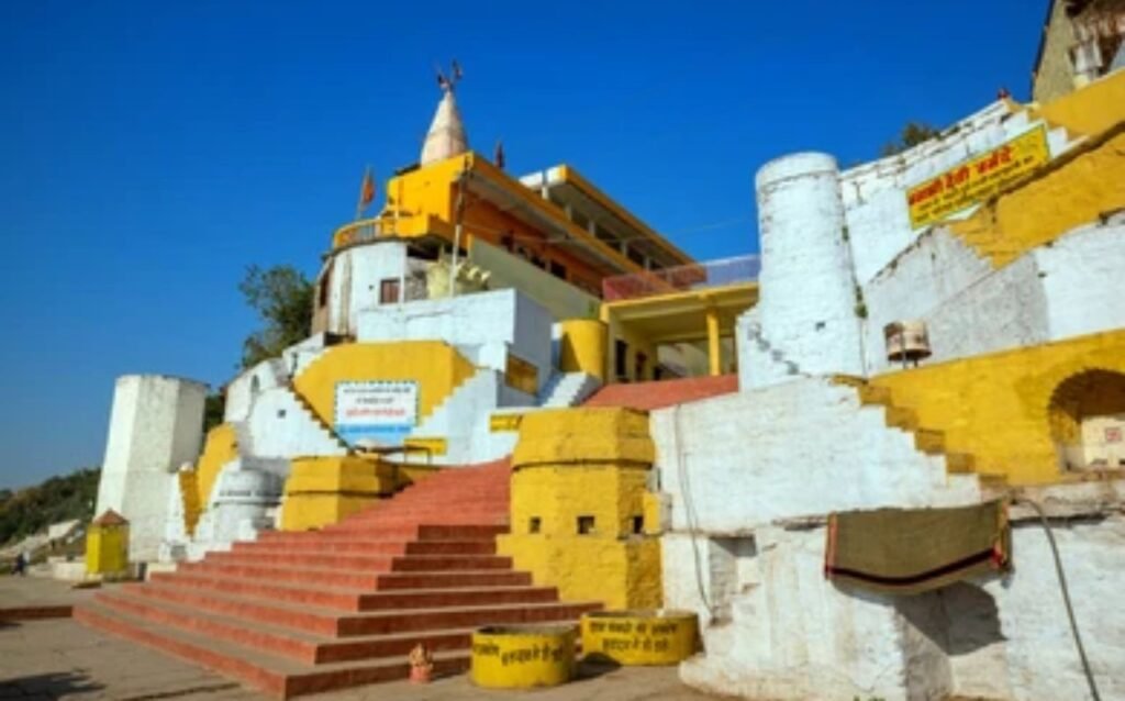
Notably, Hoshangabad includes Pachmarhi, a renowned hill station and former British Raj summer capital in the Satpuras. This district houses the Pachmarhi Sanctuary, a segment of the larger Pachmarhi Biosphere Preserve extending into Betul and Chhindwara. Attractions in Pachmarhi include the Rajat Prapat waterfall, Bee Falls, Duchess Falls, and Dupgrah, the Satpuras’ highest peak.
Demographics:
As of the 2011 census, the population of Hoshangabad District was 1,241,350, placing it 387th among India’s 640 districts. With 185 people per square kilometer, it has a moderate population density. The gender ratio is 912 women for every 1,000 men, and the literacy rate stands at 76.52%. Over 31% of the district’s residents live in urban areas. Linguistically, a vast majority of 96.03% speak Hindi as their first language, followed by 0.97% who speak Gondi and 0.96% who speak Korku.