Indore Pincodes
Enter the Pincode or Location Below in the Box
Pincodes of Indore
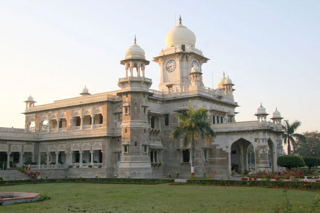
Indore, the largest city in Madhya Pradesh, India, is renowned for its blend of rich history and modernity. It’s famous for its vibrant street food, especially Poha-Jalebi, and bustling bazaars. Indore’s cultural heritage is reflected in its majestic palaces and temples, and it’s celebrated as India’s cleanest city. The city is also a commercial hub, known for its textile industry. Indore’s educational institutions, like the Indian Institute of Technology (IIT) and Indian Institute of Management (IIM), add to its prestige, making it a key destination for both tourists and professionals. Indore pincodes are created for essential for precise mail delivery and location mapping.
Here is a list of Indore Pincodes
About Indore
Indore District, located in the central part of Madhya Pradesh, India, is thought to be named after the Indreshwar Mahadev Temple, where the deity Indra is worshipped. Historical Gupta inscriptions refer to it as “Indrapura”. Often referred to as the administrative capital, the district is a part of the Indore Division. As of the 2011 census, it held the distinction of being the most populous among Madhya Pradesh’s 50 districts.
History:
Indore District, in the heart of Madhya Pradesh, India, boasts a rich history dating back to the 16th century. Originally a small trading hub, it grew under the rule of local chieftains, the Rajputs. The region gained prominence in the 18th century under the Holkar dynasty, particularly under the leadership of Malhar Rao Holkar. It became a key political and commercial center during this period.
The city of Indore, the district’s heart, was planned and built by Rani Ahilyabai Holkar, a revered and just ruler known for her administrative acumen. Under her reign, Indore flourished in trade, arts, and culture, attracting merchants and artisans from various regions.
Post-independence, Indore continued to develop rapidly, evolving into an educational and industrial hub of central India. The city played a pivotal role in India’s modern history, blending its royal heritage with contemporary growth. Today, Indore District is a testament to its historical significance, marked by its blend of ancient traditions and modern developments.
Geography:
Indore District covers an area of 3,898 square kilometers and is surrounded by Ujjain to the north, Dewas to the east, Khargone (West Nimar) to the south, and Dhar to the west. The district’s main rivers are the Chambal in the west, which originates from the Vindhya range south of Mhow, and the Kshipra, a tributary of the Chambal, in the east. Additionally, smaller rivers like the Gambhir and the Kanh, both feeding into the Kshipra River, flow through the district.
Administration:
Indore district is divided into 10 areas known as tehsils, which are Bicholi Hapsi, Depalpur, Dr. Ambedkar Nagar, Hatod, Juni Indore, Kanadia, Khudel, Malharganj, Rau, and Sanwer. In addition, there are four blocks: Indore, Dr. Ambedkar Nagar, Sanwer, and Depalpur. Across these blocks, there are 51 police stations. The district includes a total of 335 Panchayats (local government councils) and 649 villages.
Demographics:
As per the 2011 census, Indore District has a population of 3,276,697, ranking it as the 105th most populous among India’s 640 districts. The area has a density of 841 people per square kilometer. The gender ratio is 928 women for every 1,000 men, with an overall literacy rate of 80.87% (87.25% for males and 74.02% for females). A significant 74.09% of the population resides in urban areas. Language-wise, 71.39% speak Hindi, followed by 15.05% speaking Malvi, 3.54% Marathi, 2.81% Urdu, 1.74% Sindhi, 1.39% Nimadi, 0.98% Gujarati, 0.81% Punjabi, and 0.49% Bhili as their primary language.