Jharkhand Pincodes
Enter the Pincode or Location Below in the Box
Pincodes of Jharkhand
Explore the Jharkhand Pincodes on our website, “Pincodes of My Location.” Jharkhand, known for its rich cultural heritage and natural beauty, is divided into multiple districts, each with its unique identity. Our comprehensive list provides you with easy access to the pincodes of every district in Jharkhand. Whether you’re sending mail, searching for a specific location, or planning a visit, knowing the accurate pincode is essential. With our user-friendly interface, finding Jharkhand district pincodes has never been easier. Trust us to assist you in locating the correct pincode for your destination in this vibrant Indian state.
Here is a list of Jharkhand Pincodes
About Jharkhand District
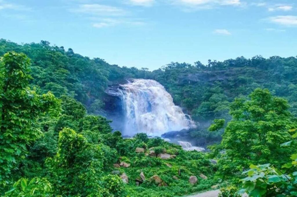
Jharkhand, often referred to as ‘the land of forests,’ is an eastern Indian state that shares its borders with West Bengal, Chhattisgarh, Uttar Pradesh, Bihar, and Odisha. It ranks 15th in terms of area and 14th in population size. Hindi serves as the official language, with Ranchi as the capital and Dumka as the sub-capital. The state boasts stunning waterfalls, picturesque hills, and significant religious sites like Baidyanath Dham, Parasnath, Dewri, and Rajrappa. Despite its abundant mineral resources, Jharkhand faces socio-economic challenges, with a high poverty rate and child malnutrition. Nevertheless, it exhibits strong economic growth, with a 10.22% GDP growth rate in 2017-18.
History
This region has a rich history dating back to the Mesolithic-Chalcolithic era, evident through ancient cave paintings and stone tools unearthed in the Chota Nagpur plateau. Notably, Isko in Hazaribagh district boasts Meso-chalcolithic cave paintings from 9000–5000 BCE. In the 2nd millennium BCE, Copper Hoard Culture emerged across the Chota Nagpur Plateau. The Kabra-Kala mound in Palamu district reveals artifacts spanning from the Neolithic to medieval periods, including various pottery styles. Singhbhum district has yielded iron slags, microliths, and potsherds dating to around 1400 BCE, as per carbon dating. The region’s history is marked by various ruling empires, including the Nanda, Maurya, and Gupta dynasties.
Demography
Based on the 2011 Indian Census, Jharkhand boasts a population of 32.96 million, consisting of 16.93 million males and 16.03 million females, with a sex ratio of 947 females for every 1,000 males. The state’s literacy rate stands at 67.63%, with Ranchi district leading at 77.13%, while rural Pakur district lags at 50.17%. In terms of social demographics, Jharkhand is home to 3,985,644 Scheduled Caste members (12.08%) and 8,646,189 Scheduled Tribes individuals (26.21%), ranking 14th and 6th nationally within these groups, comprising 1.98% and 8.29% of the overall population, primarily concentrated in south-western districts like Simdega (78.23%), Khunti (77.77%), Gumla (72.11%), Paschim Singhbhum (71.1%), Latehar (66.85%), and Lohardaga (60.21%).
Geography
Economy
Jharkhand’s GDP stood at ₹3.83 lakh crore (US$48 billion) for the fiscal year 2020–21, showcasing its robust economic growth. In 2018-19, the per capita GDP was ₹82,430 (US$1,000), indicating the improving living standards of its residents. With an urbanization ratio of 24.1%, Jharkhand boasts numerous towns and villages equipped with essential civic amenities. The state is a treasure trove of mineral resources, including iron ore (4th), coal (3rd), copper ore (1st), mica (1st), and various others. These resources support industrial hubs like Jamshedpur, Dhanbad, Bokaro, and Ranchi, where companies like Tata Steel thrive, reporting substantial revenues, such as ₹204,910 million in 2005. Additionally, NTPC is set to commence coal production in the state, investing around Rs 18 billion in 2011–12.