Jind Pincodes
Uncover your journey in “Jind Pincodes,” your gateway to unravel the diverse postal codes shaping Haryana’s landscapes. Delve into the heart of Jind’s Pin Codes, pivotal for streamlined postal services. Explore our detailed compilation encompassing 160 post offices across Jind district, unveiling precise post office appellations matched with their respective pin codes. This comprehensive catalog fosters improved communication and heightened connectivity, bridging distances within this vibrant region of Haryana.
Here is a list of Jind Pincodes
| No. | Location | Pincode | District | State |
|---|---|---|---|---|
| 1 | Ahirka | 126102 | Jind | Haryana |
| 2 | Alewa | 126102 | Jind | Haryana |
| 3 | Amargarh | 126116 | Jind | Haryana |
| 4 | Anchra Kalan | 126112 | Jind | Haryana |
| 5 | Assan | 126113 | Jind | Haryana |
| 6 | Badanpur | 126152 | Jind | Haryana |
| 7 | Badhana | 126102 | Jind | Haryana |
| 8 | Bagru Kalan | 126112 | Jind | Haryana |
| 9 | Bambhewa | 126113 | Jind | Haryana |
| 10 | Baniya Khera | 126110 | Jind | Haryana |
| 11 | Baroda | 126115 | Jind | Haryana |
| 12 | Baroli | 126114 | Jind | Haryana |
| 13 | Barsola | 126115 | Jind | Haryana |
| 14 | Barthana | 126113 | Jind | Haryana |
| 15 | Belarkhan | 126116 | Jind | Haryana |
| 16 | Bhana Brahmana | 126116 | Jind | Haryana |
| 17 | Bhongra | 126115 | Jind | Haryana |
| 18 | Bhuslana Kalan | 126112 | Jind | Haryana |
| 19 | Bhutani | 126112 | Jind | Haryana |
| 20 | Bibipur | 126102 | Jind | Haryana |
| 21 | Bighana | 126102 | Jind | Haryana |
| 22 | Bikhiwala | 126152 | Jind | Haryana |
| 23 | Bishanpura | 126114 | Jind | Haryana |
| 24 | Buana | 126114 | Jind | Haryana |
| 25 | Budain | 126115 | Jind | Haryana |
| 26 | Budda Khera lather | 126101 | Jind | Haryana |
| 27 | Budha Khera | 126113 | Jind | Haryana |
| 28 | Chhatar | 126102 | Jind | Haryana |
| 29 | Chuharpur | 126102 | Jind | Haryana |
| 30 | Dablain Kalan | 126116 | Jind | Haryana |
| 31 | Dalamwala | 126110 | Jind | Haryana |
| 32 | Dariyawala | 126102 | Jind | Haryana |
| 33 | Dehola | 126102 | Jind | Haryana |
| 34 | Deorer | 126101 | Jind | Haryana |
| 35 | Dhabitek Singh | 126116 | Jind | Haryana |
| 36 | Dhakal | 126116 | Jind | Haryana |
| 37 | Dhamtan Sahib | 126116 | Jind | Haryana |
| 38 | Dhanoda Kalan | 126152 | Jind | Haryana |
| 39 | Dhanori | 126116 | Jind | Haryana |
| 40 | Dharamgarh | 126112 | Jind | Haryana |
| 41 | Dharodi | 126116 | Jind | Haryana |
| 42 | Dharthrath | 126110 | Jind | Haryana |
| 43 | Dhigana | 126114 | Jind | Haryana |
| 44 | Didwara | 126112 | Jind | Haryana |
| 45 | Dilwala | 126102 | Jind | Haryana |
| 46 | Dumarkhan Kalan | 126116 | Jind | Haryana |
| 47 | Durana | 126102 | Jind | Haryana |
| 48 | Durjanpur | 126152 | Jind | Haryana |
| 49 | Fateh Garh | 126101 | Jind | Haryana |
| 50 | Gangoli | 126113 | Jind | Haryana |
| 51 | Garhi | 126116 | Jind | Haryana |
| 52 | Garhwali | 126114 | Jind | Haryana |
| 53 | Gatauli | 126114 | Jind | Haryana |
| 54 | Ghason Kalan | 126116 | Jind | Haryana |
| 55 | Gogrian | 126115 | Jind | Haryana |
| 56 | Gulkani | 126102 | Jind | Haryana |
| 57 | Hadwa | 126113 | Jind | Haryana |
| 58 | Hamir Garh | 126116 | Jind | Haryana |
| 59 | Hathwala | 126101 | Jind | Haryana |
| 60 | Hatt | 126112 | Jind | Haryana |
| 61 | Igrah | 126102 | Jind | Haryana |
| 62 | Ikkas | 126102 | Jind | Haryana |
| 63 | Intal Kalan | 126102 | Jind | Haryana |
| 64 | Jajanwala | 126152 | Jind | Haryana |
| 65 | Jajwan | 126102 | Jind | Haryana |
| 66 | Jamni | 126113 | Jind | Haryana |
| 67 | Jhanjkalan | 126102 | Jind | Haryana |
| 68 | Jheel | 126116 | Jind | Haryana |
| 69 | Jind | 126102 | Jind | Haryana |
| 70 | Jind Mini sectt. | 126102 | Jind | Haryana |
| 71 | Jind Palika bazar | 126102 | Jind | Haryana |
| 72 | Jind Patiala chowk | 126102 | Jind | Haryana |
| 73 | Jind Punjabi bazar | 126102 | Jind | Haryana |
| 74 | Jind Railway station | 126102 | Jind | Haryana |
| 75 | Jind Rohtak road | 126102 | Jind | Haryana |
| 76 | Julana | 126101 | Jind | Haryana |
| 77 | Kabarchha | 126115 | Jind | Haryana |
| 78 | Kakrod | 126115 | Jind | Haryana |
| 79 | Kalwan | 126116 | Jind | Haryana |
| 80 | Karamgarh | 126116 | Jind | Haryana |
| 81 | Karkhana | 126112 | Jind | Haryana |
| 82 | Karsaula | 126101 | Jind | Haryana |
| 83 | Karsindhu | 126115 | Jind | Haryana |
| 84 | Karsindu | 126112 | Jind | Haryana |
| 85 | Kasun | 126115 | Jind | Haryana |
| 86 | Kendela | 126102 | Jind | Haryana |
| 87 | Kerela | 126101 | Jind | Haryana |
| 88 | Khanda | 126102 | Jind | Haryana |
| 89 | Kharakbhura | 126115 | Jind | Haryana |
| 90 | Kharakramji | 126102 | Jind | Haryana |
| 91 | Kharal | 126116 | Jind | Haryana |
| 92 | Khatkar | 126115 | Jind | Haryana |
| 93 | Kheri Khermawati | 126112 | Jind | Haryana |
| 94 | Khrindwal | 126116 | Jind | Haryana |
| 95 | Khunga Kothi | 126110 | Jind | Haryana |
| 96 | Kila Zaffargarh | 126101 | Jind | Haryana |
| 97 | Kinana | 126114 | Jind | Haryana |
| 98 | Kuchrana Kalan | 126102 | Jind | Haryana |
| 99 | Lajwan Kalan | 126101 | Jind | Haryana |
| 100 | Lodhar | 126102 | Jind | Haryana |
| 101 | Lowan | 126116 | Jind | Haryana |
| 102 | Ludana | 126113 | Jind | Haryana |
| 103 | Makhand | 126115 | Jind | Haryana |
| 104 | Malhar | 126112 | Jind | Haryana |
| 105 | Malikpur | 126112 | Jind | Haryana |
| 106 | Malwi | 126101 | Jind | Haryana |
| 107 | Mandi Kalan | 126102 | Jind | Haryana |
| 108 | Mangalpur | 126152 | Jind | Haryana |
| 109 | Manohar Pur | 126102 | Jind | Haryana |
| 110 | Mehrara | 126101 | Jind | Haryana |
| 111 | Mohammad Khera | 126110 | Jind | Haryana |
| 112 | Mohangarh | 126115 | Jind | Haryana |
| 113 | Morkhi | 126113 | Jind | Haryana |
| 114 | Mowana | 126112 | Jind | Haryana |
| 115 | Naguran | 126102 | Jind | Haryana |
| 116 | Nandgarh | 126101 | Jind | Haryana |
| 117 | Narwana | 126116 | Jind | Haryana |
| 118 | Narwana City | 126116 | Jind | Haryana |
| 119 | Nidana | 126114 | Jind | Haryana |
| 120 | Nidani | 126102 | Jind | Haryana |
| 121 | Nimnabad | 126112 | Jind | Haryana |
| 122 | Nirjan | 126102 | Jind | Haryana |
| 123 | Paju Kalan | 126112 | Jind | Haryana |
| 124 | Pauli | 126101 | Jind | Haryana |
| 125 | Pegan | 126102 | Jind | Haryana |
| 126 | Pharain Kalan | 126116 | Jind | Haryana |
| 127 | Phullian Kalan | 126116 | Jind | Haryana |
| 128 | Pillukhera | 126113 | Jind | Haryana |
| 129 | Pindara | 126102 | Jind | Haryana |
| 130 | Pipaltha | 126116 | Jind | Haryana |
| 131 | Radhana | 126102 | Jind | Haryana |
| 132 | Rajgarh Gurthali | 126116 | Jind | Haryana |
| 133 | Ram Nagar | 126112 | Jind | Haryana |
| 134 | Ram Rai | 126102 | Jind | Haryana |
| 135 | Rasidan | 126116 | Jind | Haryana |
| 136 | Ritauli | 126110 | Jind | Haryana |
| 137 | Rohar | 126112 | Jind | Haryana |
| 138 | Rojhla | 126112 | Jind | Haryana |
| 139 | Roopgarh | 126102 | Jind | Haryana |
| 140 | Sachha Khera | 126152 | Jind | Haryana |
| 141 | Safidon | 126112 | Jind | Haryana |
| 142 | Safidon City | 126112 | Jind | Haryana |
| 143 | Sainthali | 126152 | Jind | Haryana |
| 144 | Sandil | 126102 | Jind | Haryana |
| 145 | Shahpur | 126102 | Jind | Haryana |
| 146 | Shamlo Kalan | 126114 | Jind | Haryana |
| 147 | Silakheri | 126112 | Jind | Haryana |
| 148 | Sindhwi Kheri | 126102 | Jind | Haryana |
| 149 | Singhana | 126112 | Jind | Haryana |
| 150 | Singhwal | 126116 | Jind | Haryana |
| 151 | Sinsar | 126116 | Jind | Haryana |
| 152 | Siwaha | 126113 | Jind | Haryana |
| 153 | Siwan Mal | 126112 | Jind | Haryana |
| 154 | Sudkain Kalan | 126115 | Jind | Haryana |
| 155 | Sudkain Khurd | 126116 | Jind | Haryana |
| 156 | Sulhera | 126116 | Jind | Haryana |
| 157 | Thua | 126102 | Jind | Haryana |
| 158 | Uchana | 126115 | Jind | Haryana |
| 159 | Uchana Khrud | 126115 | Jind | Haryana |
| 160 | Ujhana | 126116 | Jind | Haryana |
About Jind District
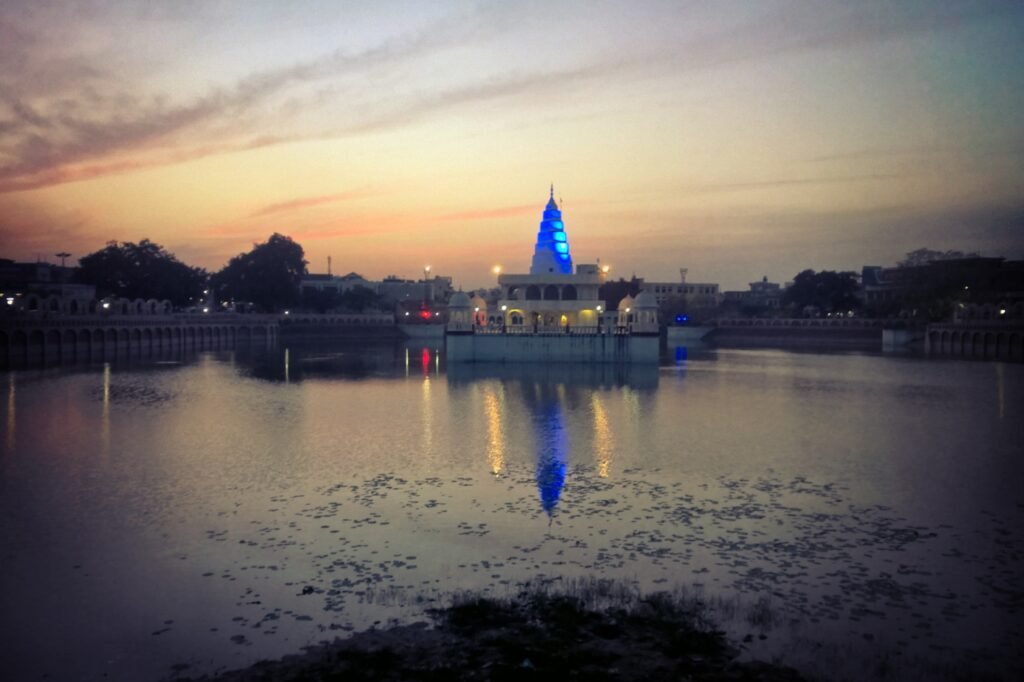
Jind, a prominent and ancient city within Haryana’s Jind district, stands as a pivotal administrative center. Rani Talab emerges as a key tourist attraction, drawing visitors, while Pandu Pindara and Ramrai serve as revered religious sites, alluring devotees for sacred Amavasya baths. The majestic Jind Fort, crafted in 1776 AD by Sidhu Jat Sikh ruler Maharaja Gajpat Singh, stands as a testament to the city’s historical legacy, embodying architectural grandeur and preserving the region’s rich heritage.