Pincodes of Krishna
Krishna Pincodes : Krishna district, with its district headquarters at Machilipatnam was formerly called Machilipatnam district. Later it was renamed as Krishna district, by adding certain taluks of the Guntur district of united Andhra Pradesh in 1859. It was named after the Krishna River (also known as Krishnaveni in literature) the third longest river in India. The river flows through the district before it empties itself into Bay of Bengal, near Hamsaladevi village. Krishna district’s blend of agriculture, history, culture, and economic activities makes it an important region in Andhra Pradesh and contributes to the overall development and diversity of the state.
Here is a list of Krishna Pincodes
| No. | Location | Pincode | District | State |
|---|---|---|---|---|
| 1 | A.C.company | 520003 | Krishna | Andhra Pradesh |
| 2 | A.P.h.b.colony | 520012 | Krishna | Andhra Pradesh |
| 3 | A.P.u.h.s | 520008 | Krishna | Andhra Pradesh |
| 4 | Achavaram | 521333 | Krishna | Andhra Pradesh |
| 5 | Adavinekkalam | 521212 | Krishna | Andhra Pradesh |
| 6 | Addada | 521390 | Krishna | Andhra Pradesh |
| 7 | Agniparru | 521250 | Krishna | Andhra Pradesh |
| 8 | Akkireddygudem | 521213 | Krishna | Andhra Pradesh |
| 9 | Akulamannadu | 521366 | Krishna | Andhra Pradesh |
| 10 | Akumarru | 521149 | Krishna | Andhra Pradesh |
| 11 | Akunuru | 521245 | Krishna | Andhra Pradesh |
| 12 | Alapadu R.s. | 521340 | Krishna | Andhra Pradesh |
| 13 | Allapuram | 521101 | Krishna | Andhra Pradesh |
| 14 | Alluru | 521343 | Krishna | Andhra Pradesh |
| 15 | Ambapuram | 521109 | Krishna | Andhra Pradesh |
| 16 | Ambedkarnagar | 521165 | Krishna | Andhra Pradesh |
| 17 | Aminapuram | 521250 | Krishna | Andhra Pradesh |
| 18 | Ammireddigudem | 521403 | Krishna | Andhra Pradesh |
| 19 | Amudalapalli | 521312 | Krishna | Andhra Pradesh |
| 20 | Anamanapudi | 521327 | Krishna | Andhra Pradesh |
| 21 | Angaluru | 521330 | Krishna | Andhra Pradesh |
| 22 | Anigandlapadu | 521190 | Krishna | Andhra Pradesh |
| 23 | Annaraopet | 521215 | Krishna | Andhra Pradesh |
| 24 | Annavaram | 521201 | Krishna | Andhra Pradesh |
| 25 | Anumanchipalli | 521175 | Krishna | Andhra Pradesh |
| 26 | Appikatla | 521261 | Krishna | Andhra Pradesh |
| 27 | Aripirala | 521106 | Krishna | Andhra Pradesh |
| 28 | Arlapadu | 521403 | Krishna | Andhra Pradesh |
| 29 | Arthamuru | 521369 | Krishna | Andhra Pradesh |
| 30 | Arugolanu | 521106 | Krishna | Andhra Pradesh |
| 31 | Arundalpet | 520002 | Krishna | Andhra Pradesh |
| 32 | Aswaraopalem | 521121 | Krishna | Andhra Pradesh |
| 33 | Atapaka | 521333 | Krishna | Andhra Pradesh |
| 34 | Atkur | 521286 | Krishna | Andhra Pradesh |
| 35 | Atkuru | 521229 | Krishna | Andhra Pradesh |
| 36 | Aukiripalli | 521211 | Krishna | Andhra Pradesh |
| 37 | Autonagar | 520007 | Krishna | Andhra Pradesh |
| 38 | Avanigadda | 521121 | Krishna | Andhra Pradesh |
| 39 | Ayyanki | 521138 | Krishna | Andhra Pradesh |
| 40 | Ayyavarirudravaram | 521345 | Krishna | Andhra Pradesh |
| 41 | Azitnagar | 520015 | Krishna | Andhra Pradesh |
| 42 | Azzampudi | 521101 | Krishna | Andhra Pradesh |
| 43 | Bacon Factory | 521102 | Krishna | Andhra Pradesh |
| 44 | Bahubalendrunigudem | 521101 | Krishna | Andhra Pradesh |
| 45 | Balaramunipet | 521001 | Krishna | Andhra Pradesh |
| 46 | Balive | 521207 | Krishna | Andhra Pradesh |
| 47 | Balusupadu | 521175 | Krishna | Andhra Pradesh |
| 48 | Bandarugudem | 521109 | Krishna | Andhra Pradesh |
| 49 | Bandipalem | 521178 | Krishna | Andhra Pradesh |
| 50 | Bandlaicheruvu | 521121 | Krishna | Andhra Pradesh |
| 51 | Bantumilli | 521324 | Krishna | Andhra Pradesh |
| 52 | Bapulapadu | 521105 | Krishna | Andhra Pradesh |
| 53 | Barlapudi | 521136 | Krishna | Andhra Pradesh |
| 54 | Batchupet | 521001 | Krishna | Andhra Pradesh |
| 55 | Besant Road | 520011 | Krishna | Andhra Pradesh |
| 56 | Bethavolu | 521301 | Krishna | Andhra Pradesh |
| 57 | Bhadrirajupalem | 521163 | Krishna | Andhra Pradesh |
| 58 | Bhaskarapuram | 521001 | Krishna | Andhra Pradesh |
| 59 | Bhatlapenumarru | 521138 | Krishna | Andhra Pradesh |
| 60 | Bhavadevarapalli | 521120 | Krishna | Andhra Pradesh |
| 61 | Bhavanipuram | 520012 | Krishna | Andhra Pradesh |
| 62 | Bhimavaram | 521178 | Krishna | Andhra Pradesh |
| 63 | Bhogireddipalli | 521131 | Krishna | Andhra Pradesh |
| 64 | Bhujabalapatnam | 521340 | Krishna | Andhra Pradesh |
| 65 | Bhushanagulla | 521263 | Krishna | Andhra Pradesh |
| 66 | Bhyravapatnam | 521345 | Krishna | Andhra Pradesh |
| 67 | Billanapalli | 521111 | Krishna | Andhra Pradesh |
| 68 | Bobbellapadu | 521182 | Krishna | Andhra Pradesh |
| 69 | Boddapadu | 521151 | Krishna | Andhra Pradesh |
| 70 | Bokinala | 521260 | Krishna | Andhra Pradesh |
| 71 | Bollapadu | 521261 | Krishna | Andhra Pradesh |
| 72 | Bomminampadu | 521343 | Krishna | Andhra Pradesh |
| 73 | Bommuluru | 521330 | Krishna | Andhra Pradesh |
| 74 | Borrapothupalem | 521366 | Krishna | Andhra Pradesh |
| 75 | Boruvancha | 521201 | Krishna | Andhra Pradesh |
| 76 | Brahmapuram | 521366 | Krishna | Andhra Pradesh |
| 77 | Buckinghampet | 520002 | Krishna | Andhra Pradesh |
| 78 | Budavada | 521175 | Krishna | Andhra Pradesh |
| 79 | Budhavaram | 521101 | Krishna | Andhra Pradesh |
| 80 | Buthumillipadu | 521101 | Krishna | Andhra Pradesh |
| 81 | Buttaipet | 521001 | Krishna | Andhra Pradesh |
| 82 | Chagantipadu | 521163 | Krishna | Andhra Pradesh |
| 83 | Challapalli | 521126 | Krishna | Andhra Pradesh |
| 84 | Chandapuram | 521185 | Krishna | Andhra Pradesh |
| 85 | Chandarlapadu | 521182 | Krishna | Andhra Pradesh |
| 86 | Chandrala | 521230 | Krishna | Andhra Pradesh |
| 87 | Chandramoulipuram | 520010 | Krishna | Andhra Pradesh |
| 88 | Chandrgudem | 521230 | Krishna | Andhra Pradesh |
| 89 | Chandrupatla | 521215 | Krishna | Andhra Pradesh |
| 90 | Chatrai | 521214 | Krishna | Andhra Pradesh |
| 91 | Chavalipadu | 521333 | Krishna | Andhra Pradesh |
| 92 | Chavutapalli | 521227 | Krishna | Andhra Pradesh |
| 93 | Cheemalapadu | 521227 | Krishna | Andhra Pradesh |
| 94 | Chekkapalli | 521213 | Krishna | Andhra Pradesh |
| 95 | Chennaraopalem | 521181 | Krishna | Andhra Pradesh |
| 96 | Chennuru | 521366 | Krishna | Andhra Pradesh |
| 97 | Cherukumilli | 521324 | Krishna | Andhra Pradesh |
| 98 | Cheruvu Madhavaram | 521229 | Krishna | Andhra Pradesh |
| 99 | Cheruvukommupalem | 521185 | Krishna | Andhra Pradesh |
| 100 | Chevendra | 521366 | Krishna | Andhra Pradesh |
| 101 | Chevitikallu | 521180 | Krishna | Andhra Pradesh |
| 102 | Chevuru | 521329 | Krishna | Andhra Pradesh |
| 103 | Chevutur | 521229 | Krishna | Andhra Pradesh |
| 104 | Chigurukota | 521345 | Krishna | Andhra Pradesh |
| 105 | Chikkavaram | 521101 | Krishna | Andhra Pradesh |
| 106 | Chilakalapudi | 521002 | Krishna | Andhra Pradesh |
| 107 | Chillakallu | 521178 | Krishna | Andhra Pradesh |
| 108 | Chilukuru | 521456 | Krishna | Andhra Pradesh |
| 109 | China Nandigama | 521230 | Krishna | Andhra Pradesh |
| 110 | Chinakallepalli | 521132 | Krishna | Andhra Pradesh |
| 111 | Chinamuttevi | 521136 | Krishna | Andhra Pradesh |
| 112 | Chinaogirala | 521245 | Krishna | Andhra Pradesh |
| 113 | Chinapalaparru | 521325 | Krishna | Andhra Pradesh |
| 114 | Chinaparupudi | 521148 | Krishna | Andhra Pradesh |
| 115 | Chinatummidi | 521329 | Krishna | Andhra Pradesh |
| 116 | Chinayerukapadu | 521322 | Krishna | Andhra Pradesh |
| 117 | Chinnampet | 521214 | Krishna | Andhra Pradesh |
| 118 | Chinnapuram | 521001 | Krishna | Andhra Pradesh |
| 119 | Chintaguntapalem | 521001 | Krishna | Andhra Pradesh |
| 120 | Chintalanerva | 521401 | Krishna | Andhra Pradesh |
| 121 | Chintalapadu | 521235 | Krishna | Andhra Pradesh |
| 122 | Chintalavalli | 521207 | Krishna | Andhra Pradesh |
| 123 | Chintapadu | 521333 | Krishna | Andhra Pradesh |
| 124 | Chiravada | 521109 | Krishna | Andhra Pradesh |
| 125 | Chiruvolulanka | 521125 | Krishna | Andhra Pradesh |
| 126 | Chittapur | 521213 | Krishna | Andhra Pradesh |
| 127 | Chittiguduru | 521149 | Krishna | Andhra Pradesh |
| 128 | Chittinagar | 520001 | Krishna | Andhra Pradesh |
| 129 | Chittipalem | 521366 | Krishna | Andhra Pradesh |
| 130 | Chitturu | 521150 | Krishna | Andhra Pradesh |
| 131 | Chitturupu | 521132 | Krishna | Andhra Pradesh |
| 132 | Chodavaram | 521120 | Krishna | Andhra Pradesh |
| 133 | Chopparametla | 521211 | Krishna | Andhra Pradesh |
| 134 | Choragudi | 521250 | Krishna | Andhra Pradesh |
| 135 | Chorampudi | 521324 | Krishna | Andhra Pradesh |
| 136 | Chowtapalli | 521170 | Krishna | Andhra Pradesh |
| 137 | Civil Coursts | 520002 | Krishna | Andhra Pradesh |
| 138 | Dabbakupalli | 521402 | Krishna | Andhra Pradesh |
| 139 | Dachavaram | 521181 | Krishna | Andhra Pradesh |
| 140 | Daggumailli | 521356 | Krishna | Andhra Pradesh |
| 141 | Daggumilli(z) | 521157 | Krishna | Andhra Pradesh |
| 142 | Daliparru | 521131 | Krishna | Andhra Pradesh |
| 143 | Damulur | 521170 | Krishna | Andhra Pradesh |
| 144 | Damuluru | 521180 | Krishna | Andhra Pradesh |
| 145 | Dandiganapudi | 521327 | Krishna | Andhra Pradesh |
| 146 | Dd.Puram | 521120 | Krishna | Andhra Pradesh |
| 147 | Desaipet | 521001 | Krishna | Andhra Pradesh |
| 148 | Devapudi | 521343 | Krishna | Andhra Pradesh |
| 149 | Devaragunta | 521201 | Krishna | Andhra Pradesh |
| 150 | Devarakota | 521133 | Krishna | Andhra Pradesh |
| 151 | Devarapalli | 521163 | Krishna | Andhra Pradesh |
| 152 | Digavalli | 521213 | Krishna | Andhra Pradesh |
| 153 | Divigollapalem | 521328 | Krishna | Andhra Pradesh |
| 154 | Doddadevarapadu | 521170 | Krishna | Andhra Pradesh |
| 155 | Doddipatla | 521340 | Krishna | Andhra Pradesh |
| 156 | Dokiparru | 521332 | Krishna | Andhra Pradesh |
| 157 | Dondapadu | 521323 | Krishna | Andhra Pradesh |
| 158 | Dosapadu | 521321 | Krishna | Andhra Pradesh |
| 159 | Dt.Court | 521001 | Krishna | Andhra Pradesh |
| 160 | Duggiralapadu | 521401 | Krishna | Andhra Pradesh |
| 161 | Dum Dum gardens | 521201 | Krishna | Andhra Pradesh |
| 162 | Durga Agraharam | 520002 | Krishna | Andhra Pradesh |
| 163 | Durgapuram | 520003 | Krishna | Andhra Pradesh |
| 164 | Edara | 521211 | Krishna | Andhra Pradesh |
| 165 | Eddanapudi | 521136 | Krishna | Andhra Pradesh |
| 166 | Edlalanka | 521121 | Krishna | Andhra Pradesh |
| 167 | Edulamaddali | 521148 | Krishna | Andhra Pradesh |
| 168 | Edupugallu | 521151 | Krishna | Andhra Pradesh |
| 169 | Edurumondi | 521120 | Krishna | Andhra Pradesh |
| 170 | Elakurru | 521156 | Krishna | Andhra Pradesh |
| 171 | Elamarru | 521148 | Krishna | Andhra Pradesh |
| 172 | Ellapuram | 521207 | Krishna | Andhra Pradesh |
| 173 | Enamadala | 521201 | Krishna | Andhra Pradesh |
| 174 | Endakuduru | 521131 | Krishna | Andhra Pradesh |
| 175 | Enikepadu | 521108 | Krishna | Andhra Pradesh |
| 176 | Erramadu | 521403 | Krishna | Andhra Pradesh |
| 177 | Etimogga | 521120 | Krishna | Andhra Pradesh |
| 178 | Eturu | 521183 | Krishna | Andhra Pradesh |
| 179 | G Konduru | 521229 | Krishna | Andhra Pradesh |
| 180 | Galigopuram | 521109 | Krishna | Andhra Pradesh |
| 181 | Gampalagudem | 521403 | Krishna | Andhra Pradesh |
| 182 | Ganapavaram | 521230 | Krishna | Andhra Pradesh |
| 183 | Ganapeswaram | 521120 | Krishna | Andhra Pradesh |
| 184 | Gandepalli | 521185 | Krishna | Andhra Pradesh |
| 185 | Gandhi Asramam | 521322 | Krishna | Andhra Pradesh |
| 186 | Gandhikshetram | 521121 | Krishna | Andhra Pradesh |
| 187 | Gandhinagaram | 521201 | Krishna | Andhra Pradesh |
| 188 | Gandigunta | 521165 | Krishna | Andhra Pradesh |
| 189 | Gandrai | 521175 | Krishna | Andhra Pradesh |
| 190 | Gangapadu | 521227 | Krishna | Andhra Pradesh |
| 191 | Ganginenipalem | 521229 | Krishna | Andhra Pradesh |
| 192 | Ganguru | 521139 | Krishna | Andhra Pradesh |
| 193 | Gani Atkuru | 521180 | Krishna | Andhra Pradesh |
| 194 | Gannavaram | 521345 | Krishna | Andhra Pradesh |
| 195 | Gannavaram Centre | 521101 | Krishna | Andhra Pradesh |
| 196 | Garapadu | 521312 | Krishna | Andhra Pradesh |
| 197 | Garikiparru | 521165 | Krishna | Andhra Pradesh |
| 198 | Ghantasala | 521133 | Krishna | Andhra Pradesh |
| 199 | Ghantasalapalem | 521133 | Krishna | Andhra Pradesh |
| 200 | Gilakaladindi | 521001 | Krishna | Andhra Pradesh |
| 201 | Godavarru | 521151 | Krishna | Andhra Pradesh |
| 202 | Godugupet | 521001 | Krishna | Andhra Pradesh |
| 203 | Gollamandala | 521227 | Krishna | Andhra Pradesh |
| 204 | Gollamudi | 521185 | Krishna | Andhra Pradesh |
| 205 | Gollanapalli | 521101 | Krishna | Andhra Pradesh |
| 206 | Gollapalli | 521111 | Krishna | Andhra Pradesh |
| 207 | Gollapudi | 521225 | Krishna | Andhra Pradesh |
| 208 | Golvepalli (zami) | 521322 | Krishna | Andhra Pradesh |
| 209 | Gopavaram | 521207 | Krishna | Andhra Pradesh |
| 210 | Gopavarapugudem | 521101 | Krishna | Andhra Pradesh |
| 211 | Gopinenipalem | 521190 | Krishna | Andhra Pradesh |
| 212 | Gopuvanipalem | 521256 | Krishna | Andhra Pradesh |
| 213 | Gosavedu | 521403 | Krishna | Andhra Pradesh |
| 214 | Gottumukkala | 521180 | Krishna | Andhra Pradesh |
| 215 | Gowravaram | 521178 | Krishna | Andhra Pradesh |
| 216 | Gudapadu | 521135 | Krishna | Andhra Pradesh |
| 217 | Gudavalli | 521104 | Krishna | Andhra Pradesh |
| 218 | Gudem Madhavaram | 521181 | Krishna | Andhra Pradesh |
| 219 | Gudimetla | 521182 | Krishna | Andhra Pradesh |
| 220 | Gudipadu | 521213 | Krishna | Andhra Pradesh |
| 221 | Gudivada | 521301 | Krishna | Andhra Pradesh |
| 222 | Gudivada Railway station | 521301 | Krishna | Andhra Pradesh |
| 223 | Gudlavalleru | 521356 | Krishna | Andhra Pradesh |
| 224 | Guduru | 521149 | Krishna | Andhra Pradesh |
| 225 | Gullapudi | 521213 | Krishna | Andhra Pradesh |
| 226 | Gummadidurru | 521190 | Krishna | Andhra Pradesh |
| 227 | Gunadala | 520004 | Krishna | Andhra Pradesh |
| 228 | Gundupalem | 521001 | Krishna | Andhra Pradesh |
| 229 | Gunnanapudi | 521326 | Krishna | Andhra Pradesh |
| 230 | Guntakoduru | 521323 | Krishna | Andhra Pradesh |
| 231 | Guntupalli | 521241 | Krishna | Andhra Pradesh |
| 232 | Guraza | 521325 | Krishna | Andhra Pradesh |
| 233 | Gurazada | 521256 | Krishna | Andhra Pradesh |
| 234 | Guruvindagunta | 521263 | Krishna | Andhra Pradesh |
| 235 | Guruvindapalli | 521247 | Krishna | Andhra Pradesh |
| 236 | Guttavaripalem | 521183 | Krishna | Andhra Pradesh |
| 237 | H Mutyalampadu | 521229 | Krishna | Andhra Pradesh |
| 238 | Hamsaladeevi | 521328 | Krishna | Andhra Pradesh |
| 239 | Hanuman Junction | 521105 | Krishna | Andhra Pradesh |
| 240 | Hanumanthapuram | 521246 | Krishna | Andhra Pradesh |
| 241 | Hanumanthunigudem | 521201 | Krishna | Andhra Pradesh |
| 242 | Ibrahimpatnam | 521456 | Krishna | Andhra Pradesh |
| 243 | Ida Kondaplli | 521228 | Krishna | Andhra Pradesh |
| 244 | Idulagudem | 521211 | Krishna | Andhra Pradesh |
| 245 | Ilaparru | 521321 | Krishna | Andhra Pradesh |
| 246 | Ilaprolu | 521228 | Krishna | Andhra Pradesh |
| 247 | Iluru | 521247 | Krishna | Andhra Pradesh |
| 248 | Inagudurupet | 521001 | Krishna | Andhra Pradesh |
| 249 | Inampudi | 521138 | Krishna | Andhra Pradesh |
| 250 | Inapur | 521247 | Krishna | Andhra Pradesh |
| 251 | Indupalli | 521311 | Krishna | Andhra Pradesh |
| 252 | Industrial Estate | 520007 | Krishna | Andhra Pradesh |
| 253 | Ingilipakalanka | 521326 | Krishna | Andhra Pradesh |
| 254 | Ithavaram | 521185 | Krishna | Andhra Pradesh |
| 255 | Jaccampudi | 520012 | Krishna | Andhra Pradesh |
| 256 | Jagannadhapuram | 521215 | Krishna | Andhra Pradesh |
| 257 | Jaggaiahpet | 521175 | Krishna | Andhra Pradesh |
| 258 | Jakkamcherla | 521332 | Krishna | Andhra Pradesh |
| 259 | Jami Annavaram | 521175 | Krishna | Andhra Pradesh |
| 260 | Jammavaram | 521180 | Krishna | Andhra Pradesh |
| 261 | Janardhanapuram | 521321 | Krishna | Andhra Pradesh |
| 262 | Janardhanavaram | 521214 | Krishna | Andhra Pradesh |
| 263 | Jangamgudem | 521201 | Krishna | Andhra Pradesh |
| 264 | Jayanthi | 521170 | Krishna | Andhra Pradesh |
| 265 | Jayanthipuram | 521457 | Krishna | Andhra Pradesh |
| 266 | Jayapuram | 521328 | Krishna | Andhra Pradesh |
| 267 | Jinjeru | 521369 | Krishna | Andhra Pradesh |
| 268 | Jonnalagadda | 521185 | Krishna | Andhra Pradesh |
| 269 | Jujjuvaram | 521157 | Krishna | Andhra Pradesh |
| 270 | Jupudi | 521456 | Krishna | Andhra Pradesh |
| 271 | Juzzuru | 521181 | Krishna | Andhra Pradesh |
| 272 | K.Kothapalem | 521125 | Krishna | Andhra Pradesh |
| 273 | K.P.agraharam | 521325 | Krishna | Andhra Pradesh |
| 274 | K.P.centre | 521136 | Krishna | Andhra Pradesh |
| 275 | K.P.lock | 521366 | Krishna | Andhra Pradesh |
| 276 | K.P.pur | 521002 | Krishna | Andhra Pradesh |
| 277 | Kadavakollu | 521164 | Krishna | Andhra Pradesh |
| 278 | Kaikalur | 521333 | Krishna | Andhra Pradesh |
| 279 | Kaja | 521150 | Krishna | Andhra Pradesh |
| 280 | Kakaravai | 521402 | Krishna | Andhra Pradesh |
| 281 | Kakarla | 521227 | Krishna | Andhra Pradesh |
| 282 | Kakarlamudi | 521369 | Krishna | Andhra Pradesh |
| 283 | Kakulapadu | 521106 | Krishna | Andhra Pradesh |
| 284 | Kalagara | 521214 | Krishna | Andhra Pradesh |
| 285 | Kalavapamula | 521164 | Krishna | Andhra Pradesh |
| 286 | Kalidindi | 521444 | Krishna | Andhra Pradesh |
| 287 | Kalidindi Centre | 521444 | Krishna | Andhra Pradesh |
| 288 | Kallapalem | 521333 | Krishna | Andhra Pradesh |
| 289 | Kamakotinagar | 520012 | Krishna | Andhra Pradesh |
| 290 | Kammanamoulu | 521120 | Krishna | Andhra Pradesh |
| 291 | Kammavaricheruvu | 521001 | Krishna | Andhra Pradesh |
| 292 | Kammavaripalem | 521185 | Krishna | Andhra Pradesh |
| 293 | Kanakavalli | 521165 | Krishna | Andhra Pradesh |
| 294 | Kanasanapalli | 521212 | Krishna | Andhra Pradesh |
| 295 | Kanchadam | 521369 | Krishna | Andhra Pradesh |
| 296 | Kanchakoduru | 521150 | Krishna | Andhra Pradesh |
| 297 | Kanchala | 521185 | Krishna | Andhra Pradesh |
| 298 | Kanchikacharla | 521180 | Krishna | Andhra Pradesh |
| 299 | Kankata | 521149 | Krishna | Andhra Pradesh |
| 300 | Kankipadu | 521151 | Krishna | Andhra Pradesh |
| 301 | Kannevidu | 521190 | Krishna | Andhra Pradesh |
| 302 | Kanukollu | 521325 | Krishna | Andhra Pradesh |
| 303 | Kanumolu | 521106 | Krishna | Andhra Pradesh |
| 304 | Kanumuru | 521256 | Krishna | Andhra Pradesh |
| 305 | Kanuru | 520007 | Krishna | Andhra Pradesh |
| 306 | Kapileswarapuram | 521246 | Krishna | Andhra Pradesh |
| 307 | Kappaladoddi | 521366 | Krishna | Andhra Pradesh |
| 308 | Karagraharam | 521002 | Krishna | Andhra Pradesh |
| 309 | Kasarabad | 521182 | Krishna | Andhra Pradesh |
| 310 | Katrenipadu | 521207 | Krishna | Andhra Pradesh |
| 311 | Katuru | 521164 | Krishna | Andhra Pradesh |
| 312 | Kavipuram | 521331 | Krishna | Andhra Pradesh |
| 313 | Kavuluru | 521228 | Krishna | Andhra Pradesh |
| 314 | Kavutaram | 521331 | Krishna | Andhra Pradesh |
| 315 | Kesarapalli | 521102 | Krishna | Andhra Pradesh |
| 316 | Ketanakonda | 521456 | Krishna | Andhra Pradesh |
| 317 | Kethaveerunipadu | 521185 | Krishna | Andhra Pradesh |
| 318 | Khambampadu | 521402 | Krishna | Andhra Pradesh |
| 319 | Khambhampadu | 521227 | Krishna | Andhra Pradesh |
| 320 | Kodali | 521132 | Krishna | Andhra Pradesh |
| 321 | Kodavatikallu | 521182 | Krishna | Andhra Pradesh |
| 322 | Koduru | 521325 | Krishna | Andhra Pradesh |
| 323 | Kokanarayanapalem | 521149 | Krishna | Andhra Pradesh |
| 324 | Kokilampadu | 521235 | Krishna | Andhra Pradesh |
| 325 | Kokkiligadda | 521125 | Krishna | Andhra Pradesh |
| 326 | Kolavennu | 521153 | Krishna | Andhra Pradesh |
| 327 | Kolletikota | 521340 | Krishna | Andhra Pradesh |
| 328 | Komallapudi | 521324 | Krishna | Andhra Pradesh |
| 329 | Komaravolu | 521322 | Krishna | Andhra Pradesh |
| 330 | Komarru | 521325 | Krishna | Andhra Pradesh |
| 331 | Komatigunta Lock | 521260 | Krishna | Andhra Pradesh |
| 332 | Kommireddipalli | 521235 | Krishna | Andhra Pradesh |
| 333 | Konakanchi | 521178 | Krishna | Andhra Pradesh |
| 334 | Konathamatmakur | 521170 | Krishna | Andhra Pradesh |
| 335 | Konayapalem | 521182 | Krishna | Andhra Pradesh |
| 336 | Kondangi | 521444 | Krishna | Andhra Pradesh |
| 337 | Kondapalli | 521228 | Krishna | Andhra Pradesh |
| 338 | Kondaparva | 521213 | Krishna | Andhra Pradesh |
| 339 | Kondiparru | 521157 | Krishna | Andhra Pradesh |
| 340 | Konduru | 521230 | Krishna | Andhra Pradesh |
| 341 | Kondurupadu | 521110 | Krishna | Andhra Pradesh |
| 342 | Kongamcherla | 521331 | Krishna | Andhra Pradesh |
| 343 | Konijerla | 521401 | Krishna | Andhra Pradesh |
| 344 | Konkepudi | 521366 | Krishna | Andhra Pradesh |
| 345 | Kontalapalli | 521181 | Krishna | Andhra Pradesh |
| 346 | Korlagunta | 521201 | Krishna | Andhra Pradesh |
| 347 | Korlamanda | 521214 | Krishna | Andhra Pradesh |
| 348 | Korlapadu | 521324 | Krishna | Andhra Pradesh |
| 349 | Korraguntapalem | 521329 | Krishna | Andhra Pradesh |
| 350 | Korukollu | 521343 | Krishna | Andhra Pradesh |
| 351 | Kosuru | 521150 | Krishna | Andhra Pradesh |
| 352 | Kotapadu | 521214 | Krishna | Andhra Pradesh |
| 353 | Kotha Edara | 521211 | Krishna | Andhra Pradesh |
| 354 | Kothapalli | 521403 | Krishna | Andhra Pradesh |
| 355 | Kothapet | 520001 | Krishna | Andhra Pradesh |
| 356 | Kothapet(divi) | 521121 | Krishna | Andhra Pradesh |
| 357 | Kotikalapudi | 521456 | Krishna | Andhra Pradesh |
| 358 | Kottada | 521340 | Krishna | Andhra Pradesh |
| 359 | Koyyagurapadu | 521312 | Krishna | Andhra Pradesh |
| 360 | Koyyuru | 521105 | Krishna | Andhra Pradesh |
| 361 | Krishnalanka | 520013 | Krishna | Andhra Pradesh |
| 362 | Krishnanagar | 520007 | Krishna | Andhra Pradesh |
| 363 | Krishnapuram | 521250 | Krishna | Andhra Pradesh |
| 364 | Krishnaraopalem | 521214 | Krishna | Andhra Pradesh |
| 365 | Krishnavaram | 521211 | Krishna | Andhra Pradesh |
| 366 | Krithivennu | 521324 | Krishna | Andhra Pradesh |
| 367 | Kudapa | 521215 | Krishna | Andhra Pradesh |
| 368 | Kudaravalli | 521321 | Krishna | Andhra Pradesh |
| 369 | Kuderu | 521247 | Krishna | Andhra Pradesh |
| 370 | Kumaraswamy Raja nagar | 521457 | Krishna | Andhra Pradesh |
| 371 | Kummaripalem | 521130 | Krishna | Andhra Pradesh |
| 372 | Kunaparajaparva | 521215 | Krishna | Andhra Pradesh |
| 373 | Kunderu | 521245 | Krishna | Andhra Pradesh |
| 374 | Kuntamukkala | 521230 | Krishna | Andhra Pradesh |
| 375 | Kurada | 521356 | Krishna | Andhra Pradesh |
| 376 | Kurumaddali | 521157 | Krishna | Andhra Pradesh |
| 377 | L.K.gunta | 521366 | Krishna | Andhra Pradesh |
| 378 | Lakshmana Nagar | 521165 | Krishna | Andhra Pradesh |
| 379 | Lakshminagar | 520011 | Krishna | Andhra Pradesh |
| 380 | Lakshminarasimhapuram | 521321 | Krishna | Andhra Pradesh |
| 381 | Lakshmipuram | 521235 | Krishna | Andhra Pradesh |
| 382 | Lankapalli | 521131 | Krishna | Andhra Pradesh |
| 383 | Lankapalli Agraharam | 521311 | Krishna | Andhra Pradesh |
| 384 | Lellagaruvu | 521366 | Krishna | Andhra Pradesh |
| 385 | Lime Stone town ship | 521175 | Krishna | Andhra Pradesh |
| 386 | Lingagudem | 521190 | Krishna | Andhra Pradesh |
| 387 | Lingala | 521325 | Krishna | Andhra Pradesh |
| 388 | Lingalapadu | 521185 | Krishna | Andhra Pradesh |
| 389 | Lingareddipalem | 521328 | Krishna | Andhra Pradesh |
| 390 | Lingavaram | 521327 | Krishna | Andhra Pradesh |
| 391 | Lodidalanka | 521444 | Krishna | Andhra Pradesh |
| 392 | Lopudi | 521213 | Krishna | Andhra Pradesh |
| 393 | Machavaram | 520004 | Krishna | Andhra Pradesh |
| 394 | Machilipatnam | 521001 | Krishna | Andhra Pradesh |
| 395 | Machinenipalem | 521402 | Krishna | Andhra Pradesh |
| 396 | Maddipatla | 521150 | Krishna | Andhra Pradesh |
| 397 | Maddulaparva | 521215 | Krishna | Andhra Pradesh |
| 398 | Madduru | 521151 | Krishna | Andhra Pradesh |
| 399 | Madhurapuram | 521247 | Krishna | Andhra Pradesh |
| 400 | Magallu | 521185 | Krishna | Andhra Pradesh |
| 401 | Majeru | 521131 | Krishna | Andhra Pradesh |
| 402 | Makkapeta | 521190 | Krishna | Andhra Pradesh |
| 403 | Malakapatnam | 521001 | Krishna | Andhra Pradesh |
| 404 | Malkapuram | 521175 | Krishna | Andhra Pradesh |
| 405 | Mallampalli | 521150 | Krishna | Andhra Pradesh |
| 406 | Mallavalli | 521111 | Krishna | Andhra Pradesh |
| 407 | Mallavolu | 521162 | Krishna | Andhra Pradesh |
| 408 | Mallela | 521235 | Krishna | Andhra Pradesh |
| 409 | Malleswaram | 521324 | Krishna | Andhra Pradesh |
| 410 | Mamidikolla | 521356 | Krishna | Andhra Pradesh |
| 411 | Mandapakala | 521328 | Krishna | Andhra Pradesh |
| 412 | Mandavalli | 521345 | Krishna | Andhra Pradesh |
| 413 | Mangalapuram | 521131 | Krishna | Andhra Pradesh |
| 414 | Manginapudi | 521002 | Krishna | Andhra Pradesh |
| 415 | Mangollu | 521178 | Krishna | Andhra Pradesh |
| 416 | Manikonda | 521260 | Krishna | Andhra Pradesh |
| 417 | Mantada | 521256 | Krishna | Andhra Pradesh |
| 418 | Manthena | 521151 | Krishna | Andhra Pradesh |
| 419 | Mantripalem | 521156 | Krishna | Andhra Pradesh |
| 420 | Marrivada | 521256 | Krishna | Andhra Pradesh |
| 421 | Matlam | 521324 | Krishna | Andhra Pradesh |
| 422 | Mattagunta | 521444 | Krishna | Andhra Pradesh |
| 423 | Medicherla | 521105 | Krishna | Andhra Pradesh |
| 424 | Meduru | 521247 | Krishna | Andhra Pradesh |
| 425 | Mirzapuram | 521111 | Krishna | Andhra Pradesh |
| 426 | Modumudi | 521121 | Krishna | Andhra Pradesh |
| 427 | Moghalrajpuram | 520010 | Krishna | Andhra Pradesh |
| 428 | Moguluru | 521180 | Krishna | Andhra Pradesh |
| 429 | Mokasakalvapudi | 521345 | Krishna | Andhra Pradesh |
| 430 | Moparru | 521321 | Krishna | Andhra Pradesh |
| 431 | Mopidevi | 521125 | Krishna | Andhra Pradesh |
| 432 | Morsapudi | 521111 | Krishna | Andhra Pradesh |
| 433 | Morusumilli | 521230 | Krishna | Andhra Pradesh |
| 434 | Moturu | 521323 | Krishna | Andhra Pradesh |
| 435 | Movva | 521135 | Krishna | Andhra Pradesh |
| 436 | Mpm Fort | 521001 | Krishna | Andhra Pradesh |
| 437 | Muchinapalli | 521215 | Krishna | Andhra Pradesh |
| 438 | Muchintala | 521190 | Krishna | Andhra Pradesh |
| 439 | Mudinepalli | 521325 | Krishna | Andhra Pradesh |
| 440 | Mudunuru | 521261 | Krishna | Andhra Pradesh |
| 441 | Mukkollu | 521332 | Krishna | Andhra Pradesh |
| 442 | Mukkollupadu | 521201 | Krishna | Andhra Pradesh |
| 443 | Muktyala | 521457 | Krishna | Andhra Pradesh |
| 444 | Mulapadu | 521456 | Krishna | Andhra Pradesh |
| 445 | Mulaparru | 521324 | Krishna | Andhra Pradesh |
| 446 | Mulaupparagudem | 521444 | Krishna | Andhra Pradesh |
| 447 | Munagacherla | 521185 | Krishna | Andhra Pradesh |
| 448 | Mundlapadu | 521190 | Krishna | Andhra Pradesh |
| 449 | Munipeda | 521324 | Krishna | Andhra Pradesh |
| 450 | Munjuluru | 521369 | Krishna | Andhra Pradesh |
| 451 | Munnaluru | 521180 | Krishna | Andhra Pradesh |
| 452 | Munukulla | 521235 | Krishna | Andhra Pradesh |
| 453 | Muppalla | 521183 | Krishna | Andhra Pradesh |
| 454 | Mustabad | 521107 | Krishna | Andhra Pradesh |
| 455 | Musunuru | 521207 | Krishna | Andhra Pradesh |
| 456 | Mutcherla | 521366 | Krishna | Andhra Pradesh |
| 457 | Mylavaram | 521230 | Krishna | Andhra Pradesh |
| 458 | Nadakuduru | 521126 | Krishna | Andhra Pradesh |
| 459 | Nadupuru | 521366 | Krishna | Andhra Pradesh |
| 460 | Nagavaram | 521331 | Krishna | Andhra Pradesh |
| 461 | Nagayalanka | 521120 | Krishna | Andhra Pradesh |
| 462 | Nagayalanka East | 521120 | Krishna | Andhra Pradesh |
| 463 | Nagayatippa | 521125 | Krishna | Andhra Pradesh |
| 464 | Naguluru | 521230 | Krishna | Andhra Pradesh |
| 465 | Nali | 521120 | Krishna | Andhra Pradesh |
| 466 | Nandamuru | 521311 | Krishna | Andhra Pradesh |
| 467 | Nandigama | 521366 | Krishna | Andhra Pradesh |
| 468 | Nandigama Bazar | 521185 | Krishna | Andhra Pradesh |
| 469 | Nandigamalanka | 521326 | Krishna | Andhra Pradesh |
| 470 | Nandivada | 521321 | Krishna | Andhra Pradesh |
| 471 | Nangegadda | 521120 | Krishna | Andhra Pradesh |
| 472 | Narasapuram | 521215 | Krishna | Andhra Pradesh |
| 473 | Narasimharaopalem | 521181 | Krishna | Andhra Pradesh |
| 474 | Narasingapalem | 521211 | Krishna | Andhra Pradesh |
| 475 | Nawabpet | 521185 | Krishna | Andhra Pradesh |
| 476 | Neelipudi | 521324 | Krishna | Andhra Pradesh |
| 477 | Nemali | 521401 | Krishna | Andhra Pradesh |
| 478 | Nepalli | 521245 | Krishna | Andhra Pradesh |
| 479 | Nidamanuru | 521104 | Krishna | Andhra Pradesh |
| 480 | Nidamarru | 521324 | Krishna | Andhra Pradesh |
| 481 | Nidumolu | 521156 | Krishna | Andhra Pradesh |
| 482 | Nimmakuru | 521158 | Krishna | Andhra Pradesh |
| 483 | Nimmaluru | 521158 | Krishna | Andhra Pradesh |
| 484 | Nugondapalli | 521211 | Krishna | Andhra Pradesh |
| 485 | Nunna | 521212 | Krishna | Andhra Pradesh |
| 486 | Nuzella | 521330 | Krishna | Andhra Pradesh |
| 487 | Nuzvid | 521201 | Krishna | Andhra Pradesh |
| 488 | P.G.lanka | 521156 | Krishna | Andhra Pradesh |
| 489 | Pagolu | 521126 | Krishna | Andhra Pradesh |
| 490 | Paidurupadu | 521241 | Krishna | Andhra Pradesh |
| 491 | Palankipadu | 521158 | Krishna | Andhra Pradesh |
| 492 | Pallagiri | 521185 | Krishna | Andhra Pradesh |
| 493 | Pallerlamudi | 521105 | Krishna | Andhra Pradesh |
| 494 | Pallevada | 521340 | Krishna | Andhra Pradesh |
| 495 | Pamarru | 521157 | Krishna | Andhra Pradesh |
| 496 | Pamarru Bazar | 521157 | Krishna | Andhra Pradesh |
| 497 | Pamidimukkala | 521250 | Krishna | Andhra Pradesh |
| 498 | Pamulalanka | 521163 | Krishna | Andhra Pradesh |
| 499 | Panditnehru Bus station | 520013 | Krishna | Andhra Pradesh |
| 500 | Pandraka | 521324 | Krishna | Andhra Pradesh |
| 501 | Papanasanam | 521132 | Krishna | Andhra Pradesh |
| 502 | Paritala | 521180 | Krishna | Andhra Pradesh |
| 503 | Parrachivara | 521120 | Krishna | Andhra Pradesh |
| 504 | Pasumarru | 521157 | Krishna | Andhra Pradesh |
| 505 | Patamata | 520010 | Krishna | Andhra Pradesh |
| 506 | Patamata Lanka | 520010 | Krishna | Andhra Pradesh |
| 507 | Patamatalankapalli | 521247 | Krishna | Andhra Pradesh |
| 508 | Pathapadu | 521212 | Krishna | Andhra Pradesh |
| 509 | Payakapuram. | 520015 | Krishna | Andhra Pradesh |
| 510 | Peda Modugapalli | 521178 | Krishna | Andhra Pradesh |
| 511 | Pedagonnuru | 521329 | Krishna | Andhra Pradesh |
| 512 | Pedakallepalli | 521130 | Krishna | Andhra Pradesh |
| 513 | Pedakamanapudi | 521325 | Krishna | Andhra Pradesh |
| 514 | Pedakammavaripalem | 521120 | Krishna | Andhra Pradesh |
| 515 | Pedalanka | 521444 | Krishna | Andhra Pradesh |
| 516 | Pedalingala | 521106 | Krishna | Andhra Pradesh |
| 517 | Pedamaddali | 521390 | Krishna | Andhra Pradesh |
| 518 | Pedamuttevi | 521136 | Krishna | Andhra Pradesh |
| 519 | Pedana | 521366 | Krishna | Andhra Pradesh |
| 520 | Pedanabazar | 521366 | Krishna | Andhra Pradesh |
| 521 | Pedaogirala | 521245 | Krishna | Andhra Pradesh |
| 522 | Pedapalaparru | 521323 | Krishna | Andhra Pradesh |
| 523 | Pedaparupudi | 521263 | Krishna | Andhra Pradesh |
| 524 | Pedapatnam | 521002 | Krishna | Andhra Pradesh |
| 525 | Pedaprolu | 521125 | Krishna | Andhra Pradesh |
| 526 | Pedapulipaka | 521137 | Krishna | Andhra Pradesh |
| 527 | Pedasanagallu | 521138 | Krishna | Andhra Pradesh |
| 528 | Pedatummidi | 521329 | Krishna | Andhra Pradesh |
| 529 | Pedavirivada | 521321 | Krishna | Andhra Pradesh |
| 530 | Pedavutapalli | 521286 | Krishna | Andhra Pradesh |
| 531 | Pedayadara | 521001 | Krishna | Andhra Pradesh |
| 532 | Peddapuram | 521181 | Krishna | Andhra Pradesh |
| 533 | Penamakuru | 521165 | Krishna | Andhra Pradesh |
| 534 | Penamaluru | 521139 | Krishna | Andhra Pradesh |
| 535 | Penchikalamarru | 521340 | Krishna | Andhra Pradesh |
| 536 | Pendurru | 521324 | Krishna | Andhra Pradesh |
| 537 | Pendyala | 521185 | Krishna | Andhra Pradesh |
| 538 | Penjendra | 521356 | Krishna | Andhra Pradesh |
| 539 | Pentalavarigudem | 521402 | Krishna | Andhra Pradesh |
| 540 | Penuganchiprolu | 521190 | Krishna | Andhra Pradesh |
| 541 | Penugolanu | 521401 | Krishna | Andhra Pradesh |
| 542 | Penumalli | 521369 | Krishna | Andhra Pradesh |
| 543 | Penumatcha | 521250 | Krishna | Andhra Pradesh |
| 544 | Perekegudem | 521345 | Krishna | Andhra Pradesh |
| 545 | Perikeedu Bridge | 521105 | Krishna | Andhra Pradesh |
| 546 | Perisepalli | 521157 | Krishna | Andhra Pradesh |
| 547 | Peruru | 521325 | Krishna | Andhra Pradesh |
| 548 | Pesaramilli | 521332 | Krishna | Andhra Pradesh |
| 549 | Peyyeru | 521325 | Krishna | Andhra Pradesh |
| 550 | Pinapaka | 521228 | Krishna | Andhra Pradesh |
| 551 | Pittalalanka | 521121 | Krishna | Andhra Pradesh |
| 552 | Pochampalli | 521178 | Krishna | Andhra Pradesh |
| 553 | Pokkunuru | 521182 | Krishna | Andhra Pradesh |
| 554 | Polampalli | 521402 | Krishna | Andhra Pradesh |
| 555 | Polasanipalli | 521111 | Krishna | Andhra Pradesh |
| 556 | Polatitippa | 521001 | Krishna | Andhra Pradesh |
| 557 | Polavaram | 521214 | Krishna | Andhra Pradesh |
| 558 | Polavaram(k) | 521162 | Krishna | Andhra Pradesh |
| 559 | Polisettipadu | 521227 | Krishna | Andhra Pradesh |
| 560 | Polukonda | 521327 | Krishna | Andhra Pradesh |
| 561 | Pondugula | 521230 | Krishna | Andhra Pradesh |
| 562 | Ponnavaram | 521180 | Krishna | Andhra Pradesh |
| 563 | Ponukumada | 521312 | Krishna | Andhra Pradesh |
| 564 | Popuru | 521182 | Krishna | Andhra Pradesh |
| 565 | Poranki | 521137 | Krishna | Andhra Pradesh |
| 566 | Pothanapalli | 521214 | Krishna | Andhra Pradesh |
| 567 | Pothepalli | 521002 | Krishna | Andhra Pradesh |
| 568 | Pothireddipalem | 521002 | Krishna | Andhra Pradesh |
| 569 | Pothumarru | 521444 | Krishna | Andhra Pradesh |
| 570 | Pothureddipalli | 521201 | Krishna | Andhra Pradesh |
| 571 | Pottipadu | 521286 | Krishna | Andhra Pradesh |
| 572 | Prathipadu | 521345 | Krishna | Andhra Pradesh |
| 573 | Proddutur | 521151 | Krishna | Andhra Pradesh |
| 574 | Prodduvaka | 521343 | Krishna | Andhra Pradesh |
| 575 | Puligadda | 521121 | Krishna | Andhra Pradesh |
| 576 | Pulluru | 521230 | Krishna | Andhra Pradesh |
| 577 | Punadipadu | 521151 | Krishna | Andhra Pradesh |
| 578 | Punnamathota | 520010 | Krishna | Andhra Pradesh |
| 579 | Punnavalli | 521182 | Krishna | Andhra Pradesh |
| 580 | Purnanandampet | 520003 | Krishna | Andhra Pradesh |
| 581 | Purushothapatnam | 521101 | Krishna | Andhra Pradesh |
| 582 | Putlacheruvu | 521326 | Krishna | Andhra Pradesh |
| 583 | Putrela | 521227 | Krishna | Andhra Pradesh |
| 584 | Puttagunta | 521106 | Krishna | Andhra Pradesh |
| 585 | Raghavapuram | 521185 | Krishna | Andhra Pradesh |
| 586 | Railway Wagon work shop | 521241 | Krishna | Andhra Pradesh |
| 587 | Rajagopalapuram | 521110 | Krishna | Andhra Pradesh |
| 588 | Rajendranagar Colony | 521301 | Krishna | Andhra Pradesh |
| 589 | Rajupet | 521001 | Krishna | Andhra Pradesh |
| 590 | Ramachandrapuram | 521227 | Krishna | Andhra Pradesh |
| 591 | Ramachandrapuram(divi) | 521121 | Krishna | Andhra Pradesh |
| 592 | Ramanakkapet | 521213 | Krishna | Andhra Pradesh |
| 593 | Ramannagudem | 521106 | Krishna | Andhra Pradesh |
| 594 | Ramannapet | 521162 | Krishna | Andhra Pradesh |
| 595 | Ramapuram | 521321 | Krishna | Andhra Pradesh |
| 596 | Ramavarappadu | 521108 | Krishna | Andhra Pradesh |
| 597 | Ramireddipalli | 521185 | Krishna | Andhra Pradesh |
| 598 | Rangannagudem | 521110 | Krishna | Andhra Pradesh |
| 599 | Ravicherla | 521201 | Krishna | Andhra Pradesh |
| 600 | Rayanapadu | 521241 | Krishna | Andhra Pradesh |
| 601 | Rayavaram | 521162 | Krishna | Andhra Pradesh |
| 602 | Reddigudem | 521215 | Krishna | Andhra Pradesh |
| 603 | Remalle | 521110 | Krishna | Andhra Pradesh |
| 604 | Repudi | 521227 | Krishna | Andhra Pradesh |
| 605 | Rimmanapudi | 521157 | Krishna | Andhra Pradesh |
| 606 | Rolupadu | 521235 | Krishna | Andhra Pradesh |
| 607 | Roynagar | 521101 | Krishna | Andhra Pradesh |
| 608 | Royyur | 521151 | Krishna | Andhra Pradesh |
| 609 | Rudrapaka | 521326 | Krishna | Andhra Pradesh |
| 610 | Rudravaram | 521227 | Krishna | Andhra Pradesh |
| 611 | S.N.gollapalem | 521001 | Krishna | Andhra Pradesh |
| 612 | Sagguru | 521211 | Krishna | Andhra Pradesh |
| 613 | Saipuram | 521256 | Krishna | Andhra Pradesh |
| 614 | Salempalem | 521121 | Krishna | Andhra Pradesh |
| 615 | Sanagapadu | 521185 | Krishna | Andhra Pradesh |
| 616 | Sanarudravaram | 521343 | Krishna | Andhra Pradesh |
| 617 | Sankarshanapuram | 521325 | Krishna | Andhra Pradesh |
| 618 | Santhoshapuram | 521444 | Krishna | Andhra Pradesh |
| 619 | Saradanagar | 521001 | Krishna | Andhra Pradesh |
| 620 | Satulru | 521369 | Krishna | Andhra Pradesh |
| 621 | Satyalapadu | 521401 | Krishna | Andhra Pradesh |
| 622 | Satyanarayanapuram | 520011 | Krishna | Andhra Pradesh |
| 623 | Savaragudem | 521107 | Krishna | Andhra Pradesh |
| 624 | Seetanapalli | 521340 | Krishna | Andhra Pradesh |
| 625 | Seetharampuram | 521211 | Krishna | Andhra Pradesh |
| 626 | Serigolvepalli | 521323 | Krishna | Andhra Pradesh |
| 627 | Serikalavapudi | 521330 | Krishna | Andhra Pradesh |
| 628 | Serinarasannapalem | 521105 | Krishna | Andhra Pradesh |
| 629 | Shermohammadpet | 521175 | Krishna | Andhra Pradesh |
| 630 | Siddantham | 521330 | Krishna | Andhra Pradesh |
| 631 | Siddharthanagar | 521201 | Krishna | Andhra Pradesh |
| 632 | Singanapudi | 521345 | Krishna | Andhra Pradesh |
| 633 | Singarayapalem | 521329 | Krishna | Andhra Pradesh |
| 634 | Singavaram | 521190 | Krishna | Andhra Pradesh |
| 635 | Sitaramapuram | 521105 | Krishna | Andhra Pradesh |
| 636 | Sivapuram | 521190 | Krishna | Andhra Pradesh |
| 637 | Sobhanapuram | 521211 | Krishna | Andhra Pradesh |
| 638 | Somavaram | 521185 | Krishna | Andhra Pradesh |
| 639 | Sorlagondhi | 521120 | Krishna | Andhra Pradesh |
| 640 | Srikakulam | 521132 | Krishna | Andhra Pradesh |
| 641 | Sriniketan | 521235 | Krishna | Andhra Pradesh |
| 642 | Srinivasa Nagar colony | 521175 | Krishna | Andhra Pradesh |
| 643 | Srirangapuram | 521247 | Krishna | Andhra Pradesh |
| 644 | Subbayyagudem | 521190 | Krishna | Andhra Pradesh |
| 645 | Sunnampadu | 521229 | Krishna | Andhra Pradesh |
| 646 | Surampalli | 521212 | Krishna | Andhra Pradesh |
| 647 | Suravaram | 521109 | Krishna | Andhra Pradesh |
| 648 | Surepalli | 521213 | Krishna | Andhra Pradesh |
| 649 | Suryaraopet | 520002 | Krishna | Andhra Pradesh |
| 650 | Swatantrapuram | 521328 | Krishna | Andhra Pradesh |
| 651 | T.Kothapalem | 521120 | Krishna | Andhra Pradesh |
| 652 | Tadanki | 521256 | Krishna | Andhra Pradesh |
| 653 | Tadepalli | 520012 | Krishna | Andhra Pradesh |
| 654 | Tadigadapa | 521137 | Krishna | Andhra Pradesh |
| 655 | Tadinada | 521333 | Krishna | Andhra Pradesh |
| 656 | Takkellapadu | 521345 | Krishna | Andhra Pradesh |
| 657 | Talagadadeevi | 521120 | Krishna | Andhra Pradesh |
| 658 | Tallapalem | 521002 | Krishna | Andhra Pradesh |
| 659 | Talluru | 521402 | Krishna | Andhra Pradesh |
| 660 | Tamarakollu | 521343 | Krishna | Andhra Pradesh |
| 661 | Tamirisa | 521327 | Krishna | Andhra Pradesh |
| 662 | Tarakaturu | 521156 | Krishna | Andhra Pradesh |
| 663 | Tarigoppula R.s. | 521260 | Krishna | Andhra Pradesh |
| 664 | Tatakuntla | 521215 | Krishna | Andhra Pradesh |
| 665 | Tativarru | 521322 | Krishna | Andhra Pradesh |
| 666 | Telaprolu | 521109 | Krishna | Andhra Pradesh |
| 667 | Telladevarapalli | 521215 | Krishna | Andhra Pradesh |
| 668 | Tempalli | 521286 | Krishna | Andhra Pradesh |
| 669 | Tenneru | 521260 | Krishna | Andhra Pradesh |
| 670 | Thotapalli | 521211 | Krishna | Andhra Pradesh |
| 671 | Thotaravulapadu | 521183 | Krishna | Andhra Pradesh |
| 672 | Thotlavalluru | 521163 | Krishna | Andhra Pradesh |
| 673 | Tippanagunta | 521106 | Krishna | Andhra Pradesh |
| 674 | Tirumalagiri | 521178 | Krishna | Andhra Pradesh |
| 675 | Tiruvuru | 521235 | Krishna | Andhra Pradesh |
| 676 | Tolukodu | 521230 | Krishna | Andhra Pradesh |
| 677 | Torragudipadu | 521185 | Krishna | Andhra Pradesh |
| 678 | Tsanubanda | 521214 | Krishna | Andhra Pradesh |
| 679 | Tukkuluru | 521201 | Krishna | Andhra Pradesh |
| 680 | Tummagudem | 521213 | Krishna | Andhra Pradesh |
| 681 | Tummalacheruvu | 521001 | Krishna | Andhra Pradesh |
| 682 | Tummalapalli | 521321 | Krishna | Andhra Pradesh |
| 683 | Tunikipadu | 521401 | Krishna | Andhra Pradesh |
| 684 | Turakapalem | 521150 | Krishna | Andhra Pradesh |
| 685 | Turlapadu | 521183 | Krishna | Andhra Pradesh |
| 686 | U.G.c.works | 521001 | Krishna | Andhra Pradesh |
| 687 | Ullipalem | 521328 | Krishna | Andhra Pradesh |
| 688 | Undrapudi | 521157 | Krishna | Andhra Pradesh |
| 689 | Unikili | 521326 | Krishna | Andhra Pradesh |
| 690 | Uppaluru | 521151 | Krishna | Andhra Pradesh |
| 691 | Urivi | 521329 | Krishna | Andhra Pradesh |
| 692 | Uruturu | 521157 | Krishna | Andhra Pradesh |
| 693 | Utukuru | 521329 | Krishna | Andhra Pradesh |
| 694 | V.Kothapalem | 521121 | Krishna | Andhra Pradesh |
| 695 | V.Rudravaram | 521133 | Krishna | Andhra Pradesh |
| 696 | Vtps | 521456 | Krishna | Andhra Pradesh |
| 697 | Vadali | 521325 | Krishna | Andhra Pradesh |
| 698 | Vadapalem | 521001 | Krishna | Andhra Pradesh |
| 699 | Vadarlapadu | 521340 | Krishna | Andhra Pradesh |
| 700 | Vadavalli | 521329 | Krishna | Andhra Pradesh |
| 701 | Vadlamannadu | 521331 | Krishna | Andhra Pradesh |
| 702 | Vaivaka | 521329 | Krishna | Andhra Pradesh |
| 703 | Vakkalagadda | 521126 | Krishna | Andhra Pradesh |
| 704 | Valandapalem | 521002 | Krishna | Andhra Pradesh |
| 705 | Valasapalli | 521213 | Krishna | Andhra Pradesh |
| 706 | Valivarthipadu | 521327 | Krishna | Andhra Pradesh |
| 707 | Vallampatla | 521227 | Krishna | Andhra Pradesh |
| 708 | Valluripalem | 521163 | Krishna | Andhra Pradesh |
| 709 | Vamukuntla | 521235 | Krishna | Andhra Pradesh |
| 710 | Vanapumala | 521263 | Krishna | Andhra Pradesh |
| 711 | Vanudurru | 521329 | Krishna | Andhra Pradesh |
| 712 | Vanukuru | 521151 | Krishna | Andhra Pradesh |
| 713 | Varahapatnam | 521333 | Krishna | Andhra Pradesh |
| 714 | Vasanthanagar | 520007 | Krishna | Andhra Pradesh |
| 715 | Vatsavai | 521402 | Krishna | Andhra Pradesh |
| 716 | Vattigudipadu | 521211 | Krishna | Andhra Pradesh |
| 717 | Vavilala | 521235 | Krishna | Andhra Pradesh |
| 718 | Vedadri | 521457 | Krishna | Andhra Pradesh |
| 719 | Veerapanenigudem | 521286 | Krishna | Andhra Pradesh |
| 720 | Veeravalli | 521110 | Krishna | Andhra Pradesh |
| 721 | Veerullapadu | 521170 | Krishna | Andhra Pradesh |
| 722 | Vekanuru | 521121 | Krishna | Andhra Pradesh |
| 723 | Veladikothapalem | 521182 | Krishna | Andhra Pradesh |
| 724 | Velagaleru | 521229 | Krishna | Andhra Pradesh |
| 725 | Veldipadu | 521312 | Krishna | Andhra Pradesh |
| 726 | Veleru | 521110 | Krishna | Andhra Pradesh |
| 727 | Velinuthala | 521312 | Krishna | Andhra Pradesh |
| 728 | Velivolu | 521132 | Krishna | Andhra Pradesh |
| 729 | Vellanki | 521181 | Krishna | Andhra Pradesh |
| 730 | Vellaturu | 521229 | Krishna | Andhra Pradesh |
| 731 | Velpucherla | 521207 | Krishna | Andhra Pradesh |
| 732 | Velpuru | 521104 | Krishna | Andhra Pradesh |
| 733 | Velvdam | 521230 | Krishna | Andhra Pradesh |
| 734 | Vemanda | 521311 | Krishna | Andhra Pradesh |
| 735 | Vemavaram | 521190 | Krishna | Andhra Pradesh |
| 736 | Vemavarappadu | 521343 | Krishna | Andhra Pradesh |
| 737 | Vemireddipalle | 521227 | Krishna | Andhra Pradesh |
| 738 | Vempadu | 521260 | Krishna | Andhra Pradesh |
| 739 | Vemulamada | 521135 | Krishna | Andhra Pradesh |
| 740 | Vemulanarva | 521402 | Krishna | Andhra Pradesh |
| 741 | Vemulapalli | 521185 | Krishna | Andhra Pradesh |
| 742 | Venaktapuram | 521130 | Krishna | Andhra Pradesh |
| 743 | Venkatapuram | 521190 | Krishna | Andhra Pradesh |
| 744 | Venkateswarapuram | 520010 | Krishna | Andhra Pradesh |
| 745 | Vennanapudi | 521321 | Krishna | Andhra Pradesh |
| 746 | Ventrapragada | 521263 | Krishna | Andhra Pradesh |
| 747 | Venturumilli | 521332 | Krishna | Andhra Pradesh |
| 748 | Vibharintapadu | 521182 | Krishna | Andhra Pradesh |
| 749 | Vidyadharapuram | 520012 | Krishna | Andhra Pradesh |
| 750 | Vidyanagar | 521201 | Krishna | Andhra Pradesh |
| 751 | Vijayawada | 520001 | Krishna | Andhra Pradesh |
| 752 | Vijayawada Bus stand | 520002 | Krishna | Andhra Pradesh |
| 753 | Vijayawada Municipal offi | 520001 | Krishna | Andhra Pradesh |
| 754 | Vinagadapa | 521403 | Krishna | Andhra Pradesh |
| 755 | Vinjaram | 521333 | Krishna | Andhra Pradesh |
| 756 | Vinnakota | 521325 | Krishna | Andhra Pradesh |
| 757 | Virankilock | 521250 | Krishna | Andhra Pradesh |
| 758 | Vissannapet | 521215 | Krishna | Andhra Pradesh |
| 759 | Vissannapet Bazar | 521215 | Krishna | Andhra Pradesh |
| 760 | Viswanadhapalli | 521121 | Krishna | Andhra Pradesh |
| 761 | Vj Polytechnic | 520008 | Krishna | Andhra Pradesh |
| 762 | Vja Railway junction | 520001 | Krishna | Andhra Pradesh |
| 763 | Vja Rly divl office | 520001 | Krishna | Andhra Pradesh |
| 764 | Vunguturu | 521312 | Krishna | Andhra Pradesh |
| 765 | Vutukuru | 521401 | Krishna | Andhra Pradesh |
| 766 | Vuyyuru | 521165 | Krishna | Andhra Pradesh |
| 767 | Vuyyuru College | 521165 | Krishna | Andhra Pradesh |
| 768 | Vuyyuru East | 521165 | Krishna | Andhra Pradesh |
| 769 | Wnchipet | 520001 | Krishna | Andhra Pradesh |
| 770 | Yakamuru | 521165 | Krishna | Andhra Pradesh |
| 771 | Yanamalakuduru | 520007 | Krishna | Andhra Pradesh |
| 772 | Yarlagadda | 521126 | Krishna | Andhra Pradesh |
| 773 | Zakkulanekkalam | 521102 | Krishna | Andhra Pradesh |
About Krishna
Krishna city
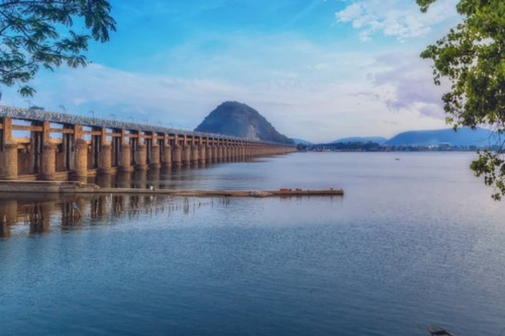
Krishna district, located in the coastal Andhra Region of the Indian state of Andhra Pradesh, has its administrative headquarters in Machilipatnam. Geographically, it is bounded by the Bay of Bengal to the east, Guntur and Bapatla to the west, and Eluru and NTR districts to the north. To the south, it is once again bordered by the Bay of Bengal. An important development in 2022 was the division of Krishna district into Krishna and NTR districts.
History:
The formation of the Krishna District can be traced back to 1859 when it was carved out from the Rajahmundry district. At that time, it encompassed not only Guntur but also the West Godavari districts within the unified Andhra Pradesh. Later, in 1904, the Guntur district was established by dividing it from Krishna. Similarly, in 1925, the West Godavari district was created from portions of the Krishna district.
Over the years, the administrative structure of the Krishna District underwent several changes. In 1971, it was composed of 10 Talukas, which increased to 21 by 1978. Furthermore, in 1985, the Mandal system was introduced, resulting in the formation of 50 mandals in the district. The most recent development occurred in 2022 when the NTR district was formed, taking its origins from parts of the original united Krishna district.
Geography:
Krishna district is bordered by the Bay of Bengal to the east, while it is flanked by Guntur and Bapatla districts to the west. To the north, it shares boundaries with Eluru and NTR districts, and to the south, it is once again bordered by the Bay of Bengal. Covering an expanse of 3,775 square kilometers, the district boasts a total coastline stretching over 88 kilometers.
Demographics:
Following the district’s reorganization, the population of Krishna district stood at 17,35,079. Among this population, 482,513 individuals, accounting for 27.81%, reside in urban areas. The district exhibits a sex ratio of 996 females for every 1000 males, along with a literacy rate of 73.75%. Furthermore, Scheduled Castes and Scheduled Tribes constitute 20.00% and 2.17% of the population, respectively.
As per the 2011 Census, the languages spoken in Krishna district are as follows: Telugu, spoken by 93.30% of the population; Urdu, the first language of 5.97% of the residents; and other languages, spoken by 0.73% of the population.