Pincodes of Kurnool
Here is a list of Kurnool Pincodes
| No. | Location | Pincode | District | State |
|---|---|---|---|---|
| 1 | A.Gokulapadu | 518468 | Kurnool | Andhra Pradesh |
| 2 | A.Kodur | 518523 | Kurnool | Andhra Pradesh |
| 3 | Abdullapuram | 518533 | Kurnool | Andhra Pradesh |
| 4 | Adoni | 518301 | Kurnool | Andhra Pradesh |
| 5 | Adoni Arts college | 518302 | Kurnool | Andhra Pradesh |
| 6 | Adoni-town | 518301 | Kurnool | Andhra Pradesh |
| 7 | Agaveli | 518225 | Kurnool | Andhra Pradesh |
| 8 | Ahobilam | 518543 | Kurnool | Andhra Pradesh |
| 9 | Akkampalli | 518145 | Kurnool | Andhra Pradesh |
| 10 | Akumalla | 518196 | Kurnool | Andhra Pradesh |
| 11 | Alaganur | 518405 | Kurnool | Andhra Pradesh |
| 12 | Alamur | 518112 | Kurnool | Andhra Pradesh |
| 13 | Alardinne | 518465 | Kurnool | Andhra Pradesh |
| 14 | Alavakonda | 518165 | Kurnool | Andhra Pradesh |
| 15 | Alavala | 518463 | Kurnool | Andhra Pradesh |
| 16 | Albad | 518220 | Kurnool | Andhra Pradesh |
| 17 | Aligera | 518347 | Kurnool | Andhra Pradesh |
| 18 | Allagadda | 518543 | Kurnool | Andhra Pradesh |
| 19 | Allur | 518134 | Kurnool | Andhra Pradesh |
| 20 | Alur | 518395 | Kurnool | Andhra Pradesh |
| 21 | Amadaguntla | 518468 | Kurnool | Andhra Pradesh |
| 22 | Amakathadu | 518216 | Kurnool | Andhra Pradesh |
| 23 | Aminabad | 518390 | Kurnool | Andhra Pradesh |
| 24 | Ammireddinagar | 518135 | Kurnool | Andhra Pradesh |
| 25 | Ankireddypalli | 518123 | Kurnool | Andhra Pradesh |
| 26 | Anugonda | 518468 | Kurnool | Andhra Pradesh |
| 27 | Anupur | 518176 | Kurnool | Andhra Pradesh |
| 28 | Appalapuram | 518124 | Kurnool | Andhra Pradesh |
| 29 | Arekallu | 518302 | Kurnool | Andhra Pradesh |
| 30 | Arikera | 518395 | Kurnool | Andhra Pradesh |
| 31 | Arlabanda | 518313 | Kurnool | Andhra Pradesh |
| 32 | Ashoknagar | 518005 | Kurnool | Andhra Pradesh |
| 33 | Aspari | 518347 | Kurnool | Andhra Pradesh |
| 34 | Atikalagundu | 518347 | Kurnool | Andhra Pradesh |
| 35 | Atmakur | 518422 | Kurnool | Andhra Pradesh |
| 36 | Ayalur | 518502 | Kurnool | Andhra Pradesh |
| 37 | B.Agraharam | 518350 | Kurnool | Andhra Pradesh |
| 38 | B.Kodur | 518523 | Kurnool | Andhra Pradesh |
| 39 | B.Ramadurgam | 518222 | Kurnool | Andhra Pradesh |
| 40 | Bachepalle | 518543 | Kurnool | Andhra Pradesh |
| 41 | Badinehal | 518344 | Kurnool | Andhra Pradesh |
| 42 | Baichigeri | 518302 | Kurnool | Andhra Pradesh |
| 43 | Bairluty | 518422 | Kurnool | Andhra Pradesh |
| 44 | Balaji Nagar | 518006 | Kurnool | Andhra Pradesh |
| 45 | Balapanur | 518112 | Kurnool | Andhra Pradesh |
| 46 | Balavegammanagar | 518573 | Kurnool | Andhra Pradesh |
| 47 | Banaganapalle | 518124 | Kurnool | Andhra Pradesh |
| 48 | Banaganapalle South | 518124 | Kurnool | Andhra Pradesh |
| 49 | Banakacherla | 518533 | Kurnool | Andhra Pradesh |
| 50 | Banavanur | 518350 | Kurnool | Andhra Pradesh |
| 51 | Banavasi | 518323 | Kurnool | Andhra Pradesh |
| 52 | Bandi Atmakur | 518523 | Kurnool | Andhra Pradesh |
| 53 | Bannuru | 518401 | Kurnool | Andhra Pradesh |
| 54 | Bantanahal | 518396 | Kurnool | Andhra Pradesh |
| 55 | Bantanahallu | 518396 | Kurnool | Andhra Pradesh |
| 56 | Bapalapalli | 518598 | Kurnool | Andhra Pradesh |
| 57 | Bapuram | 518344 | Kurnool | Andhra Pradesh |
| 58 | Basapuram | 518302 | Kurnool | Andhra Pradesh |
| 59 | Basarkodur | 518347 | Kurnool | Andhra Pradesh |
| 60 | Bastipadu | 518218 | Kurnool | Andhra Pradesh |
| 61 | Bathalur | 518510 | Kurnool | Andhra Pradesh |
| 62 | Beeravolu | 518583 | Kurnool | Andhra Pradesh |
| 63 | Belagal | 518462 | Kurnool | Andhra Pradesh |
| 64 | Belagallu | 518313 | Kurnool | Andhra Pradesh |
| 65 | Beldona | 518396 | Kurnool | Andhra Pradesh |
| 66 | Belum | 518122 | Kurnool | Andhra Pradesh |
| 67 | Bethamcherla | 518599 | Kurnool | Andhra Pradesh |
| 68 | Bevinahal | 518348 | Kurnool | Andhra Pradesh |
| 69 | Bhagya Nagar-kurnool | 518004 | Kurnool | Andhra Pradesh |
| 70 | Bhanumukkala | 518422 | Kurnool | Andhra Pradesh |
| 71 | Bhar Peta adoni | 518301 | Kurnool | Andhra Pradesh |
| 72 | Bhillalapuram | 518502 | Kurnool | Andhra Pradesh |
| 73 | Bhimavaram | 518523 | Kurnool | Andhra Pradesh |
| 74 | Bhimunipadu | 518134 | Kurnool | Andhra Pradesh |
| 75 | Bhojanam | 518533 | Kurnool | Andhra Pradesh |
| 76 | Bhupanapadu | 518112 | Kurnool | Andhra Pradesh |
| 77 | Bijanavemula | 518134 | Kurnool | Andhra Pradesh |
| 78 | Bijina Vemula | 518411 | Kurnool | Andhra Pradesh |
| 79 | Bilahalu | 518395 | Kurnool | Andhra Pradesh |
| 80 | Bilakalaguduru | 518508 | Kurnool | Andhra Pradesh |
| 81 | Billekallu | 518347 | Kurnool | Andhra Pradesh |
| 82 | Biravolu | 518412 | Kurnool | Andhra Pradesh |
| 83 | Bodemmanur | 518155 | Kurnool | Andhra Pradesh |
| 84 | Bogolu | 518222 | Kurnool | Andhra Pradesh |
| 85 | Bollavaram | 518512 | Kurnool | Andhra Pradesh |
| 86 | Bommireddipalli | 518216 | Kurnool | Andhra Pradesh |
| 87 | Bondimadugula | 518468 | Kurnool | Andhra Pradesh |
| 88 | Boyalakuntla | 518583 | Kurnool | Andhra Pradesh |
| 89 | Boyanacheruvupalle | 518220 | Kurnool | Andhra Pradesh |
| 90 | Boyarevula | 518533 | Kurnool | Andhra Pradesh |
| 91 | Brahmanadoddi | 518462 | Kurnool | Andhra Pradesh |
| 92 | Brahmanakotkur | 518432 | Kurnool | Andhra Pradesh |
| 93 | Bugganipalli | 518206 | Kurnool | Andhra Pradesh |
| 94 | Bukkapuram | 518002 | Kurnool | Andhra Pradesh |
| 95 | Burandoddi | 518462 | Kurnool | Andhra Pradesh |
| 96 | Burugula | 518220 | Kurnool | Andhra Pradesh |
| 97 | Buruzula | 518380 | Kurnool | Andhra Pradesh |
| 98 | Byluppala | 518350 | Kurnool | Andhra Pradesh |
| 99 | Cement Nagar | 518206 | Kurnool | Andhra Pradesh |
| 100 | Chabolu | 518502 | Kurnool | Andhra Pradesh |
| 101 | Chagalamarri | 518553 | Kurnool | Andhra Pradesh |
| 102 | Chakarajuvemula | 518135 | Kurnool | Andhra Pradesh |
| 103 | Chakkaralla | 518380 | Kurnool | Andhra Pradesh |
| 104 | Chalama | 518502 | Kurnool | Andhra Pradesh |
| 105 | Chandalur | 518594 | Kurnool | Andhra Pradesh |
| 106 | Chandoli | 518380 | Kurnool | Andhra Pradesh |
| 107 | Chandrapalli | 518221 | Kurnool | Andhra Pradesh |
| 108 | Channampalli | 518390 | Kurnool | Andhra Pradesh |
| 109 | Chanugondla | 518196 | Kurnool | Andhra Pradesh |
| 110 | Chapirevula | 518502 | Kurnool | Andhra Pradesh |
| 111 | Chatlamallapuram | 518218 | Kurnool | Andhra Pradesh |
| 112 | Chatnihalli | 518345 | Kurnool | Andhra Pradesh |
| 113 | Chelimilla | 518442 | Kurnool | Andhra Pradesh |
| 114 | Chellelichelimala | 518225 | Kurnool | Andhra Pradesh |
| 115 | Chennampalli | 518122 | Kurnool | Andhra Pradesh |
| 116 | Chennur | 518583 | Kurnool | Andhra Pradesh |
| 117 | Cherlopalli | 518122 | Kurnool | Andhra Pradesh |
| 118 | Cherukucherla | 518405 | Kurnool | Andhra Pradesh |
| 119 | Cherukulapadu | 518216 | Kurnool | Andhra Pradesh |
| 120 | Cheruvupalle | 518176 | Kurnool | Andhra Pradesh |
| 121 | Chidukur | 518511 | Kurnool | Andhra Pradesh |
| 122 | Chigali | 518347 | Kurnool | Andhra Pradesh |
| 123 | Chilakaladona | 518345 | Kurnool | Andhra Pradesh |
| 124 | Chinna Pendekallu | 518350 | Kurnool | Andhra Pradesh |
| 125 | Chinnaharivanam | 518308 | Kurnool | Andhra Pradesh |
| 126 | Chinnahotturu | 518395 | Kurnool | Andhra Pradesh |
| 127 | Chinnahulthi | 518380 | Kurnool | Andhra Pradesh |
| 128 | Chinnahyti | 518346 | Kurnool | Andhra Pradesh |
| 129 | Chinnakambalur | 518594 | Kurnool | Andhra Pradesh |
| 130 | Chinnapodilla | 518221 | Kurnool | Andhra Pradesh |
| 131 | Chinnatekur | 518218 | Kurnool | Andhra Pradesh |
| 132 | Chinnathumbalam | 518349 | Kurnool | Andhra Pradesh |
| 133 | Chinnavangali | 518553 | Kurnool | Andhra Pradesh |
| 134 | Chintakommudinne | 518543 | Kurnool | Andhra Pradesh |
| 135 | Chintakunta | 518348 | Kurnool | Andhra Pradesh |
| 136 | Chintalacheruvu | 518553 | Kurnool | Andhra Pradesh |
| 137 | Chintalapalli | 518405 | Kurnool | Andhra Pradesh |
| 138 | Chintalayapalli | 518123 | Kurnool | Andhra Pradesh |
| 139 | Chippagiri | 518396 | Kurnool | Andhra Pradesh |
| 140 | Chirtanakallu | 518313 | Kurnool | Andhra Pradesh |
| 141 | Chityala | 518222 | Kurnool | Andhra Pradesh |
| 142 | Chowtkur | 518405 | Kurnool | Andhra Pradesh |
| 143 | Chudi | 518333 | Kurnool | Andhra Pradesh |
| 144 | Chunchu Erragudi | 518225 | Kurnool | Andhra Pradesh |
| 145 | D. kotakonda | 518350 | Kurnool | Andhra Pradesh |
| 146 | Daivamdinne | 518360 | Kurnool | Andhra Pradesh |
| 147 | Damagatla | 518432 | Kurnool | Andhra Pradesh |
| 148 | Deebaguntla | 518502 | Kurnool | Andhra Pradesh |
| 149 | Devanabanda | 518347 | Kurnool | Andhra Pradesh |
| 150 | Devanakonda | 518465 | Kurnool | Andhra Pradesh |
| 151 | Devanur | 518405 | Kurnool | Andhra Pradesh |
| 152 | Devarabanda | 518221 | Kurnool | Andhra Pradesh |
| 153 | Dhanapuram | 518302 | Kurnool | Andhra Pradesh |
| 154 | Dharmavaram | 518222 | Kurnool | Andhra Pradesh |
| 155 | Dhone | 518222 | Kurnool | Andhra Pradesh |
| 156 | Dhone-bazar | 518222 | Kurnool | Andhra Pradesh |
| 157 | Dibbanakallu | 518302 | Kurnool | Andhra Pradesh |
| 158 | Diguvapadu | 518452 | Kurnool | Andhra Pradesh |
| 159 | Dinnedevarapadu | 518002 | Kurnool | Andhra Pradesh |
| 160 | Doddanakeri | 518323 | Kurnool | Andhra Pradesh |
| 161 | Doddi | 518313 | Kurnool | Andhra Pradesh |
| 162 | Doddimekala | 518323 | Kurnool | Andhra Pradesh |
| 163 | Dommaladinne | 518344 | Kurnool | Andhra Pradesh |
| 164 | Dornipadu | 518135 | Kurnool | Andhra Pradesh |
| 165 | Dudekonda | 518380 | Kurnool | Andhra Pradesh |
| 166 | Dudyala | 518422 | Kurnool | Andhra Pradesh |
| 167 | Durvesi | 518511 | Kurnool | Andhra Pradesh |
| 168 | E.Thandrapadu | 518004 | Kurnool | Andhra Pradesh |
| 169 | Edduladoddi | 518468 | Kurnool | Andhra Pradesh |
| 170 | Edururu | 518004 | Kurnool | Andhra Pradesh |
| 171 | Eernipadu | 518512 | Kurnool | Andhra Pradesh |
| 172 | Ellarthi | 518395 | Kurnool | Andhra Pradesh |
| 173 | Enigabala | 518360 | Kurnool | Andhra Pradesh |
| 174 | Erigeri | 518344 | Kurnool | Andhra Pradesh |
| 175 | Errabadu | 518463 | Kurnool | Andhra Pradesh |
| 176 | Erradoddi | 518468 | Kurnool | Andhra Pradesh |
| 177 | Erragudidinne | 518510 | Kurnool | Andhra Pradesh |
| 178 | Erraguduru | 518442 | Kurnool | Andhra Pradesh |
| 179 | Erraguntla | 518523 | Kurnool | Andhra Pradesh |
| 180 | Erramattam | 518422 | Kurnool | Andhra Pradesh |
| 181 | Erukalacheruvu | 518225 | Kurnool | Andhra Pradesh |
| 182 | G.D.project | 518463 | Kurnool | Andhra Pradesh |
| 183 | G.Erragudi | 518390 | Kurnool | Andhra Pradesh |
| 184 | G.Hosanahalli | 518302 | Kurnool | Andhra Pradesh |
| 185 | G.Jambuladinne | 518543 | Kurnool | Andhra Pradesh |
| 186 | G.Pulla reddy eng college | 518002 | Kurnool | Andhra Pradesh |
| 187 | G.Singavaram | 518004 | Kurnool | Andhra Pradesh |
| 188 | Gadigarevula | 518511 | Kurnool | Andhra Pradesh |
| 189 | Gadivemula | 518508 | Kurnool | Andhra Pradesh |
| 190 | Gajjahalli | 518308 | Kurnool | Andhra Pradesh |
| 191 | Gajulapalle | 518583 | Kurnool | Andhra Pradesh |
| 192 | Galichennayapalem | 518513 | Kurnool | Andhra Pradesh |
| 193 | Ganapuram | 518401 | Kurnool | Andhra Pradesh |
| 194 | Gangavaram | 518583 | Kurnool | Andhra Pradesh |
| 195 | Gani | 518010 | Kurnool | Andhra Pradesh |
| 196 | Ganjihalli | 518463 | Kurnool | Andhra Pradesh |
| 197 | Gargeyapuram | 518452 | Kurnool | Andhra Pradesh |
| 198 | Garladinne | 518220 | Kurnool | Andhra Pradesh |
| 199 | Giddalur(kkt) | 518166 | Kurnool | Andhra Pradesh |
| 200 | Godiganur | 518553 | Kurnool | Andhra Pradesh |
| 201 | Gokavaram | 518422 | Kurnool | Andhra Pradesh |
| 202 | Gollagutta | 518124 | Kurnool | Andhra Pradesh |
| 203 | Gondiparla | 518004 | Kurnool | Andhra Pradesh |
| 204 | Gonegandla | 518463 | Kurnool | Andhra Pradesh |
| 205 | Gopavaram | 518583 | Kurnool | Andhra Pradesh |
| 206 | Gorantla | 518468 | Kurnool | Andhra Pradesh |
| 207 | Gorivimanipalle | 518123 | Kurnool | Andhra Pradesh |
| 208 | Gospadu | 518593 | Kurnool | Andhra Pradesh |
| 209 | Gotlur | 518553 | Kurnool | Andhra Pradesh |
| 210 | Govardhanagiri | 518216 | Kurnool | Andhra Pradesh |
| 211 | Govindapalle | 518502 | Kurnool | Andhra Pradesh |
| 212 | Govt Live stock form | 518360 | Kurnool | Andhra Pradesh |
| 213 | Grandhivemula | 518508 | Kurnool | Andhra Pradesh |
| 214 | Gudikal | 518360 | Kurnool | Andhra Pradesh |
| 215 | Gudikambali | 518333 | Kurnool | Andhra Pradesh |
| 216 | Gudipadu | 518221 | Kurnool | Andhra Pradesh |
| 217 | Gudur | 518466 | Kurnool | Andhra Pradesh |
| 218 | Gulladurthi | 518134 | Kurnool | Andhra Pradesh |
| 219 | Gulyam | 518348 | Kurnool | Andhra Pradesh |
| 220 | Gummanur | 518396 | Kurnool | Andhra Pradesh |
| 221 | Gumparamandinne | 518573 | Kurnool | Andhra Pradesh |
| 222 | Gundampadu | 518583 | Kurnool | Andhra Pradesh |
| 223 | Gundlakonda | 518468 | Kurnool | Andhra Pradesh |
| 224 | Gundrevula | 518462 | Kurnool | Andhra Pradesh |
| 225 | Gundupapala | 518134 | Kurnool | Andhra Pradesh |
| 226 | Gunjalapadu | 518134 | Kurnool | Andhra Pradesh |
| 227 | Guntakandala | 518533 | Kurnool | Andhra Pradesh |
| 228 | Guntanala | 518593 | Kurnool | Andhra Pradesh |
| 229 | Guntupalli | 518598 | Kurnool | Andhra Pradesh |
| 230 | Guvvalakunta | 518422 | Kurnool | Andhra Pradesh |
| 231 | H.Khairvadi | 518463 | Kurnool | Andhra Pradesh |
| 232 | H.Kottala | 518598 | Kurnool | Andhra Pradesh |
| 233 | H.Muravani | 518323 | Kurnool | Andhra Pradesh |
| 234 | Halaharvi | 518348 | Kurnool | Andhra Pradesh |
| 235 | Halibidu | 518395 | Kurnool | Andhra Pradesh |
| 236 | Halvi | 518333 | Kurnool | Andhra Pradesh |
| 237 | Hampa | 518385 | Kurnool | Andhra Pradesh |
| 238 | Hanavolu | 518344 | Kurnool | Andhra Pradesh |
| 239 | Hardageri | 518348 | Kurnool | Andhra Pradesh |
| 240 | Harivanam | 518308 | Kurnool | Andhra Pradesh |
| 241 | Harivaram | 518134 | Kurnool | Andhra Pradesh |
| 242 | Hattibelagallu | 518395 | Kurnool | Andhra Pradesh |
| 243 | Hebbatam | 518308 | Kurnool | Andhra Pradesh |
| 244 | Holalagondi | 518346 | Kurnool | Andhra Pradesh |
| 245 | Honnur | 518346 | Kurnool | Andhra Pradesh |
| 246 | Hosuru | 518380 | Kurnool | Andhra Pradesh |
| 247 | Hussainapuram | 518010 | Kurnool | Andhra Pradesh |
| 248 | Ibrahimpuram | 518345 | Kurnool | Andhra Pradesh |
| 249 | Illuri Kotha peta | 518186 | Kurnool | Andhra Pradesh |
| 250 | Inagandla | 518462 | Kurnool | Andhra Pradesh |
| 251 | Indireswaram | 518422 | Kurnool | Andhra Pradesh |
| 252 | Industrial Estate | 518502 | Kurnool | Andhra Pradesh |
| 253 | Ingaladahal | 518308 | Kurnool | Andhra Pradesh |
| 254 | Injedu | 518155 | Kurnool | Andhra Pradesh |
| 255 | Iranbanda | 518463 | Kurnool | Andhra Pradesh |
| 256 | Iskala | 518422 | Kurnool | Andhra Pradesh |
| 257 | Isvi | 518302 | Kurnool | Andhra Pradesh |
| 258 | Itekala | 518123 | Kurnool | Andhra Pradesh |
| 259 | Jagadurthi | 518222 | Kurnool | Andhra Pradesh |
| 260 | Jakkasanikuntla | 518221 | Kurnool | Andhra Pradesh |
| 261 | Jaladurgam | 518220 | Kurnool | Andhra Pradesh |
| 262 | Jalakanur | 518405 | Kurnool | Andhra Pradesh |
| 263 | Jalimanchi | 518323 | Kurnool | Andhra Pradesh |
| 264 | Jampapuram | 518313 | Kurnool | Andhra Pradesh |
| 265 | Jeenepalle | 518573 | Kurnool | Andhra Pradesh |
| 266 | Jilladukala | 518465 | Kurnool | Andhra Pradesh |
| 267 | Jillalla | 518176 | Kurnool | Andhra Pradesh |
| 268 | Jillella | 518563 | Kurnool | Andhra Pradesh |
| 269 | Joharapuram | 518347 | Kurnool | Andhra Pradesh |
| 270 | Joladarasi | 518134 | Kurnool | Andhra Pradesh |
| 271 | Jonnagiri | 518390 | Kurnool | Andhra Pradesh |
| 272 | Julekallu | 518462 | Kurnool | Andhra Pradesh |
| 273 | Julepalle | 518593 | Kurnool | Andhra Pradesh |
| 274 | Jummaladinne | 518313 | Kurnool | Andhra Pradesh |
| 275 | Jutur | 518401 | Kurnool | Andhra Pradesh |
| 276 | K.Markapuram | 518468 | Kurnool | Andhra Pradesh |
| 277 | K.N.puram | 518468 | Kurnool | Andhra Pradesh |
| 278 | Knl-camp-b | 518002 | Kurnool | Andhra Pradesh |
| 279 | Kadamakuntla | 518221 | Kurnool | Andhra Pradesh |
| 280 | Kadimetla | 518360 | Kurnool | Andhra Pradesh |
| 281 | Kadivella | 518350 | Kurnool | Andhra Pradesh |
| 282 | Kadumur | 518452 | Kurnool | Andhra Pradesh |
| 283 | Kaggallu | 518313 | Kurnool | Andhra Pradesh |
| 284 | Kairuppala | 518465 | Kurnool | Andhra Pradesh |
| 285 | Kakanur | 518523 | Kurnool | Andhra Pradesh |
| 286 | Kakaravada | 518145 | Kurnool | Andhra Pradesh |
| 287 | Kalchatla | 518221 | Kurnool | Andhra Pradesh |
| 288 | Kallabavaram | 518432 | Kurnool | Andhra Pradesh |
| 289 | Kalludevakuntla | 518345 | Kurnool | Andhra Pradesh |
| 290 | Kallukunta | 518323 | Kurnool | Andhra Pradesh |
| 291 | Kalluru | 518003 | Kurnool | Andhra Pradesh |
| 292 | Kalugotla | 518360 | Kurnool | Andhra Pradesh |
| 293 | Kalugotlapalle | 518553 | Kurnool | Andhra Pradesh |
| 294 | Kalva | 518010 | Kurnool | Andhra Pradesh |
| 295 | Kalvatala | 518123 | Kurnool | Andhra Pradesh |
| 296 | Kamaganikuntla | 518222 | Kurnool | Andhra Pradesh |
| 297 | Kamalapuram | 518222 | Kurnool | Andhra Pradesh |
| 298 | Kamalapuri | 518196 | Kurnool | Andhra Pradesh |
| 299 | Kamavaram | 518302 | Kurnool | Andhra Pradesh |
| 300 | Kambadahal | 518462 | Kurnool | Andhra Pradesh |
| 301 | Kambaladinne | 518360 | Kurnool | Andhra Pradesh |
| 302 | Kambalapadu | 518225 | Kurnool | Andhra Pradesh |
| 303 | Kaminehal | 518348 | Kurnool | Andhra Pradesh |
| 304 | Kaminenipalle | 518563 | Kurnool | Andhra Pradesh |
| 305 | Kammarchedu | 518302 | Kurnool | Andhra Pradesh |
| 306 | Kammavaripalle | 518166 | Kurnool | Andhra Pradesh |
| 307 | Kampamalla | 518134 | Kurnool | Andhra Pradesh |
| 308 | Kanakadripalli | 518123 | Kurnool | Andhra Pradesh |
| 309 | Kanakaveedu | 518343 | Kurnool | Andhra Pradesh |
| 310 | Kanala | 518593 | Kurnool | Andhra Pradesh |
| 311 | Kandanathi | 518350 | Kurnool | Andhra Pradesh |
| 312 | Kandikayapalli | 518206 | Kurnool | Andhra Pradesh |
| 313 | Kandukuru | 518313 | Kurnool | Andhra Pradesh |
| 314 | Kapati | 518323 | Kurnool | Andhra Pradesh |
| 315 | Kappatralla | 518465 | Kurnool | Andhra Pradesh |
| 316 | Karimaddula | 518513 | Kurnool | Andhra Pradesh |
| 317 | Karivemula | 518465 | Kurnool | Andhra Pradesh |
| 318 | Karivena | 518422 | Kurnool | Andhra Pradesh |
| 319 | Karumanchi | 518350 | Kurnool | Andhra Pradesh |
| 320 | Katarukonda | 518222 | Kurnool | Andhra Pradesh |
| 321 | Katikavanikunta | 518124 | Kurnool | Andhra Pradesh |
| 322 | Katriki | 518333 | Kurnool | Andhra Pradesh |
| 323 | Kauthalam | 518344 | Kurnool | Andhra Pradesh |
| 324 | Kavulur | 518112 | Kurnool | Andhra Pradesh |
| 325 | Kesanapalli | 518216 | Kurnool | Andhra Pradesh |
| 326 | Kethavaram | 518452 | Kurnool | Andhra Pradesh |
| 327 | Khajeepuram | 518396 | Kurnool | Andhra Pradesh |
| 328 | Knl-osmaniacollege | 518001 | Kurnool | Andhra Pradesh |
| 329 | Kodumur | 518464 | Kurnool | Andhra Pradesh |
| 330 | Kogilathota | 518346 | Kurnool | Andhra Pradesh |
| 331 | Koilakonda | 518222 | Kurnool | Andhra Pradesh |
| 332 | Koilakuntla | 518134 | Kurnool | Andhra Pradesh |
| 333 | Koilakuntla Bus stand | 518134 | Kurnool | Andhra Pradesh |
| 334 | Kokkarchedu | 518348 | Kurnool | Andhra Pradesh |
| 335 | Kolimigundla | 518123 | Kurnool | Andhra Pradesh |
| 336 | Komarole | 518010 | Kurnool | Andhra Pradesh |
| 337 | Komma Marri | 518220 | Kurnool | Andhra Pradesh |
| 338 | Kondajutur | 518511 | Kurnool | Andhra Pradesh |
| 339 | Kondamanayunipalli | 518122 | Kurnool | Andhra Pradesh |
| 340 | Kondapuram | 518462 | Kurnool | Andhra Pradesh |
| 341 | Kondupalle | 518543 | Kurnool | Andhra Pradesh |
| 342 | Konededu | 518112 | Kurnool | Andhra Pradesh |
| 343 | Konganapadu | 518218 | Kurnool | Andhra Pradesh |
| 344 | Konidela | 518411 | Kurnool | Andhra Pradesh |
| 345 | Koratamaddi | 518511 | Kurnool | Andhra Pradesh |
| 346 | Korrapolur | 518508 | Kurnool | Andhra Pradesh |
| 347 | Kosigi | 518313 | Kurnool | Andhra Pradesh |
| 348 | Kotakandukur | 518543 | Kurnool | Andhra Pradesh |
| 349 | Kotakonda | 518225 | Kurnool | Andhra Pradesh |
| 350 | Kotapadu | 518573 | Kurnool | Andhra Pradesh |
| 351 | Kotchervu | 518222 | Kurnool | Andhra Pradesh |
| 352 | Kotekallu | 518360 | Kurnool | Andhra Pradesh |
| 353 | Kothakota | 518221 | Kurnool | Andhra Pradesh |
| 354 | Kothapalle | 518502 | Kurnool | Andhra Pradesh |
| 355 | Kothur | 518390 | Kurnool | Andhra Pradesh |
| 356 | Kottala | 518502 | Kurnool | Andhra Pradesh |
| 357 | Kottapalli | 518422 | Kurnool | Andhra Pradesh |
| 358 | Krishna Puram | 518464 | Kurnool | Andhra Pradesh |
| 359 | Krishnagiri | 518225 | Kurnool | Andhra Pradesh |
| 360 | Krishnapuram | 518217 | Kurnool | Andhra Pradesh |
| 361 | Kristipadu | 518134 | Kurnool | Andhra Pradesh |
| 362 | Kulumala | 518463 | Kurnool | Andhra Pradesh |
| 363 | Kulumalapalli | 518599 | Kurnool | Andhra Pradesh |
| 364 | Kunkanur | 518465 | Kurnool | Andhra Pradesh |
| 365 | Kuntanahal | 518344 | Kurnool | Andhra Pradesh |
| 366 | Kunukuntala | 518122 | Kurnool | Andhra Pradesh |
| 367 | Kuppagallu | 518344 | Kurnool | Andhra Pradesh |
| 368 | Kurnool | 518001 | Kurnool | Andhra Pradesh |
| 369 | Kurnool Bazar | 518001 | Kurnool | Andhra Pradesh |
| 370 | Kurnool Dt court | 518001 | Kurnool | Andhra Pradesh |
| 371 | Kurnool Kothapeta | 518001 | Kurnool | Andhra Pradesh |
| 372 | Kurnool Medicalcollege | 518002 | Kurnool | Andhra Pradesh |
| 373 | Kurnool-chowk | 518001 | Kurnool | Andhra Pradesh |
| 374 | Kurukunda | 518422 | Kurnool | Andhra Pradesh |
| 375 | Kurunur | 518464 | Kurnool | Andhra Pradesh |
| 376 | Kuruvalli | 518395 | Kurnool | Andhra Pradesh |
| 377 | Kypa | 518124 | Kurnool | Andhra Pradesh |
| 378 | L.Banda | 518216 | Kurnool | Andhra Pradesh |
| 379 | Laddagiri | 518468 | Kurnool | Andhra Pradesh |
| 380 | Lakkasagaram | 518225 | Kurnool | Andhra Pradesh |
| 381 | Laxmipuram | 518218 | Kurnool | Andhra Pradesh |
| 382 | Lingadahalli | 518308 | Kurnool | Andhra Pradesh |
| 383 | Lingala | 518134 | Kurnool | Andhra Pradesh |
| 384 | Lingambodu | 518124 | Kurnool | Andhra Pradesh |
| 385 | Lingapuram | 518513 | Kurnool | Andhra Pradesh |
| 386 | Loddipalli | 518002 | Kurnool | Andhra Pradesh |
| 387 | M.Agraharam | 518385 | Kurnool | Andhra Pradesh |
| 388 | M.Chintakunta | 518593 | Kurnool | Andhra Pradesh |
| 389 | M.Krishnapuram | 518573 | Kurnool | Andhra Pradesh |
| 390 | M.Lingapuram | 518422 | Kurnool | Andhra Pradesh |
| 391 | M.S.nagar | 518002 | Kurnool | Andhra Pradesh |
| 392 | M.V. nagar | 518543 | Kurnool | Andhra Pradesh |
| 393 | Machapuram | 518343 | Kurnool | Andhra Pradesh |
| 394 | Madanantapuram | 518390 | Kurnool | Andhra Pradesh |
| 395 | Maddikera | 518385 | Kurnool | Andhra Pradesh |
| 396 | Maddur | 518533 | Kurnool | Andhra Pradesh |
| 397 | Madhavaram | 518349 | Kurnool | Andhra Pradesh |
| 398 | Madhira | 518302 | Kurnool | Andhra Pradesh |
| 399 | Mahadevapuram | 518583 | Kurnool | Andhra Pradesh |
| 400 | Mahanandi | 518673 | Kurnool | Andhra Pradesh |
| 401 | Mahanandi Cattle farm | 518502 | Kurnool | Andhra Pradesh |
| 402 | Malapalli | 518349 | Kurnool | Andhra Pradesh |
| 403 | Malkapuram | 518222 | Kurnool | Andhra Pradesh |
| 404 | Mallapuram | 518466 | Kurnool | Andhra Pradesh |
| 405 | Mallavemula | 518553 | Kurnool | Andhra Pradesh |
| 406 | Mallepalli | 518216 | Kurnool | Andhra Pradesh |
| 407 | Mallikarjunahalli | 518396 | Kurnool | Andhra Pradesh |
| 408 | Malliyala | 518222 | Kurnool | Andhra Pradesh |
| 409 | Malyala | 518401 | Kurnool | Andhra Pradesh |
| 410 | Mamidalapadu | 518004 | Kurnool | Andhra Pradesh |
| 411 | Manchalakatta | 518508 | Kurnool | Andhra Pradesh |
| 412 | Mandalur | 518543 | Kurnool | Andhra Pradesh |
| 413 | Mandlem | 518401 | Kurnool | Andhra Pradesh |
| 414 | Mangampeta | 518124 | Kurnool | Andhra Pradesh |
| 415 | Mannekurthi | 518302 | Kurnool | Andhra Pradesh |
| 416 | Mantralayam | 518345 | Kurnool | Andhra Pradesh |
| 417 | Mantriki | 518323 | Kurnool | Andhra Pradesh |
| 418 | Marakattu | 518395 | Kurnool | Andhra Pradesh |
| 419 | Marella | 518468 | Kurnool | Andhra Pradesh |
| 420 | Marlamadiki | 518346 | Kurnool | Andhra Pradesh |
| 421 | Masapeta | 518452 | Kurnool | Andhra Pradesh |
| 422 | Maseedpuram | 518502 | Kurnool | Andhra Pradesh |
| 423 | Mayalur | 518155 | Kurnool | Andhra Pradesh |
| 424 | Medehal | 518348 | Kurnool | Andhra Pradesh |
| 425 | Meedivemula | 518002 | Kurnool | Andhra Pradesh |
| 426 | Meerapuram | 518124 | Kurnool | Andhra Pradesh |
| 427 | Meerjapuram | 518123 | Kurnool | Andhra Pradesh |
| 428 | Mekadona | 518323 | Kurnool | Andhra Pradesh |
| 429 | Mettupalle | 518122 | Kurnool | Andhra Pradesh |
| 430 | Mettupalli | 518221 | Kurnool | Andhra Pradesh |
| 431 | Miduthur | 518405 | Kurnool | Andhra Pradesh |
| 432 | Mitnala | 518593 | Kurnool | Andhra Pradesh |
| 433 | Mittakandala | 518442 | Kurnool | Andhra Pradesh |
| 434 | Mittapalle | 518124 | Kurnool | Andhra Pradesh |
| 435 | Molagavelli | 518395 | Kurnool | Andhra Pradesh |
| 436 | Mothukuru | 518533 | Kurnool | Andhra Pradesh |
| 437 | Mpendakallu | 518217 | Kurnool | Andhra Pradesh |
| 438 | Mudamalakurthi | 518464 | Kurnool | Andhra Pradesh |
| 439 | Muddanageri | 518395 | Kurnool | Andhra Pradesh |
| 440 | Muddavaram | 518599 | Kurnool | Andhra Pradesh |
| 441 | Mudumala | 518462 | Kurnool | Andhra Pradesh |
| 442 | Mugati | 518360 | Kurnool | Andhra Pradesh |
| 443 | Mukkamalla | 518165 | Kurnool | Andhra Pradesh |
| 444 | Mukkella | 518468 | Kurnool | Andhra Pradesh |
| 445 | Mulagundam | 518350 | Kurnool | Andhra Pradesh |
| 446 | Munagala | 518466 | Kurnool | Andhra Pradesh |
| 447 | Musalayamadugu | 518599 | Kurnool | Andhra Pradesh |
| 448 | Musalimadugu | 518422 | Kurnool | Andhra Pradesh |
| 449 | Musanahalli | 518302 | Kurnool | Andhra Pradesh |
| 450 | Muthalur | 518543 | Kurnool | Andhra Pradesh |
| 451 | Muthukur | 518347 | Kurnool | Andhra Pradesh |
| 452 | Muthyalapadu | 518553 | Kurnool | Andhra Pradesh |
| 453 | Mutsumarri | 518411 | Kurnool | Andhra Pradesh |
| 454 | N R peta knl | 518004 | Kurnool | Andhra Pradesh |
| 455 | N.G.o.s coloy | 518501 | Kurnool | Andhra Pradesh |
| 456 | N.Khairavadi | 518345 | Kurnool | Andhra Pradesh |
| 457 | N.Konthalapadu | 518010 | Kurnool | Andhra Pradesh |
| 458 | N.Rangapuram | 518221 | Kurnool | Andhra Pradesh |
| 459 | N.S.c.form | 518401 | Kurnool | Andhra Pradesh |
| 460 | N.Venkatapuram | 518216 | Kurnool | Andhra Pradesh |
| 461 | Nadichagi | 518333 | Kurnool | Andhra Pradesh |
| 462 | Nagaladinne | 518360 | Kurnool | Andhra Pradesh |
| 463 | Naganathanahalli | 518308 | Kurnool | Andhra Pradesh |
| 464 | Nagardona | 518396 | Kurnool | Andhra Pradesh |
| 465 | Nagaruru | 518347 | Kurnool | Andhra Pradesh |
| 466 | Nallachelimala | 518468 | Kurnool | Andhra Pradesh |
| 467 | Nallagatla | 518510 | Kurnool | Andhra Pradesh |
| 468 | Nallakalva | 518422 | Kurnool | Andhra Pradesh |
| 469 | Nancherla | 518385 | Kurnool | Andhra Pradesh |
| 470 | Nandanapalli | 518452 | Kurnool | Andhra Pradesh |
| 471 | Nandavaram | 518343 | Kurnool | Andhra Pradesh |
| 472 | Nandikotkur | 518401 | Kurnool | Andhra Pradesh |
| 473 | Nandikotkur-bazar | 518401 | Kurnool | Andhra Pradesh |
| 474 | Nandikunta | 518422 | Kurnool | Andhra Pradesh |
| 475 | Nandipadu | 518123 | Kurnool | Andhra Pradesh |
| 476 | Nandipalle | 518502 | Kurnool | Andhra Pradesh |
| 477 | Nandivargam | 518176 | Kurnool | Andhra Pradesh |
| 478 | Nandyal | 518501 | Kurnool | Andhra Pradesh |
| 479 | Nandyal Bazar | 518501 | Kurnool | Andhra Pradesh |
| 480 | Nandyal R.s. | 518502 | Kurnool | Andhra Pradesh |
| 481 | Nannuru | 518002 | Kurnool | Andhra Pradesh |
| 482 | Narayanapauram | 518533 | Kurnool | Andhra Pradesh |
| 483 | Nayakallu | 518218 | Kurnool | Andhra Pradesh |
| 484 | Neepudu Cherla | 518220 | Kurnool | Andhra Pradesh |
| 485 | Nehru Nagar | 518411 | Kurnool | Andhra Pradesh |
| 486 | Nelampadu | 518553 | Kurnool | Andhra Pradesh |
| 487 | Nelatalamarri | 518465 | Kurnool | Andhra Pradesh |
| 488 | Nellibanda | 518465 | Kurnool | Andhra Pradesh |
| 489 | Nemakallu | 518396 | Kurnool | Andhra Pradesh |
| 490 | Nerniki | 518395 | Kurnool | Andhra Pradesh |
| 491 | Nidjur | 518004 | Kurnool | Andhra Pradesh |
| 492 | Nitravatti | 518348 | Kurnool | Andhra Pradesh |
| 493 | Noone Palle | 518502 | Kurnool | Andhra Pradesh |
| 494 | Nossam | 518145 | Kurnool | Andhra Pradesh |
| 495 | Obulampalle | 518543 | Kurnool | Andhra Pradesh |
| 496 | Om Nagar | 518349 | Kurnool | Andhra Pradesh |
| 497 | Owk | 518122 | Kurnool | Andhra Pradesh |
| 498 | P.Devalapuram | 518533 | Kurnool | Andhra Pradesh |
| 499 | P.Lingala | 518401 | Kurnool | Andhra Pradesh |
| 500 | P.R.palli | 518221 | Kurnool | Andhra Pradesh |
| 501 | Padakandla | 518543 | Kurnool | Andhra Pradesh |
| 502 | Padidempadu | 518452 | Kurnool | Andhra Pradesh |
| 503 | Pagidala | 518412 | Kurnool | Andhra Pradesh |
| 504 | Pagidirai | 518390 | Kurnool | Andhra Pradesh |
| 505 | Pallidoddi | 518465 | Kurnool | Andhra Pradesh |
| 506 | Palukudoddi | 518462 | Kurnool | Andhra Pradesh |
| 507 | Palukur | 518176 | Kurnool | Andhra Pradesh |
| 508 | Pamulapadu | 518442 | Kurnool | Andhra Pradesh |
| 509 | Panchalingala | 518004 | Kurnool | Andhra Pradesh |
| 510 | Pandikona | 518380 | Kurnool | Andhra Pradesh |
| 511 | Panem | 518112 | Kurnool | Andhra Pradesh |
| 512 | Panem Bus stand | 518112 | Kurnool | Andhra Pradesh |
| 513 | Parla | 518468 | Kurnool | Andhra Pradesh |
| 514 | Parlapalli | 518360 | Kurnool | Andhra Pradesh |
| 515 | Parnapalle | 518523 | Kurnool | Andhra Pradesh |
| 516 | Parumanchala | 518401 | Kurnool | Andhra Pradesh |
| 517 | Pasupula | 518452 | Kurnool | Andhra Pradesh |
| 518 | Pasurapadu | 518593 | Kurnool | Andhra Pradesh |
| 519 | Pathakandukur | 518543 | Kurnool | Andhra Pradesh |
| 520 | Pathapadu | 518124 | Kurnool | Andhra Pradesh |
| 521 | Pattikonda | 518380 | Kurnool | Andhra Pradesh |
| 522 | Peapully | 518221 | Kurnool | Andhra Pradesh |
| 523 | Peddabodanam | 518543 | Kurnool | Andhra Pradesh |
| 524 | Peddachintakunta | 518543 | Kurnool | Andhra Pradesh |
| 525 | Peddaemmanur | 518155 | Kurnool | Andhra Pradesh |
| 526 | Peddahothur | 518395 | Kurnool | Andhra Pradesh |
| 527 | Peddakadubur | 518323 | Kurnool | Andhra Pradesh |
| 528 | Peddakambalur | 518594 | Kurnool | Andhra Pradesh |
| 529 | Peddakopperla | 518134 | Kurnool | Andhra Pradesh |
| 530 | Peddakothali | 518360 | Kurnool | Andhra Pradesh |
| 531 | Peddamarriveedu | 518463 | Kurnool | Andhra Pradesh |
| 532 | Peddanelatur | 518463 | Kurnool | Andhra Pradesh |
| 533 | Peddapadu | 518003 | Kurnool | Andhra Pradesh |
| 534 | Peddapaya | 518221 | Kurnool | Andhra Pradesh |
| 535 | Peddapodilla | 518221 | Kurnool | Andhra Pradesh |
| 536 | Peddathumbalam | 518302 | Kurnool | Andhra Pradesh |
| 537 | Peddavangali | 518553 | Kurnool | Andhra Pradesh |
| 538 | Peddavanthurla | 518166 | Kurnool | Andhra Pradesh |
| 539 | Pendekallu | 518468 | Kurnool | Andhra Pradesh |
| 540 | Pendekallu Bus stand | 518468 | Kurnool | Andhra Pradesh |
| 541 | Peravali | 518390 | Kurnool | Andhra Pradesh |
| 542 | Perusomula | 518166 | Kurnool | Andhra Pradesh |
| 543 | Pesalabanda | 518323 | Kurnool | Andhra Pradesh |
| 544 | Pesaravai | 518513 | Kurnool | Andhra Pradesh |
| 545 | Petnikota | 518123 | Kurnool | Andhra Pradesh |
| 546 | Pinnapuram | 518422 | Kurnool | Andhra Pradesh |
| 547 | Polukallu | 518462 | Kurnool | Andhra Pradesh |
| 548 | Polur | 518511 | Kurnool | Andhra Pradesh |
| 549 | Pothidoddi | 518221 | Kurnool | Andhra Pradesh |
| 550 | Pothugal | 518225 | Kurnool | Andhra Pradesh |
| 551 | Pottipadu | 518134 | Kurnool | Andhra Pradesh |
| 552 | Prakash Nagar | 518004 | Kurnool | Andhra Pradesh |
| 553 | Prathakota | 518412 | Kurnool | Andhra Pradesh |
| 554 | Prathakota-east | 518412 | Kurnool | Andhra Pradesh |
| 555 | Pudur | 518432 | Kurnool | Andhra Pradesh |
| 556 | Pulakurthi | 518462 | Kurnool | Andhra Pradesh |
| 557 | Pulichinta | 518343 | Kurnool | Andhra Pradesh |
| 558 | Pulikonda | 518380 | Kurnool | Andhra Pradesh |
| 559 | Pulimaddi | 518511 | Kurnool | Andhra Pradesh |
| 560 | Pullagummi | 518217 | Kurnool | Andhra Pradesh |
| 561 | Puricherla | 518452 | Kurnool | Andhra Pradesh |
| 562 | Pusulur | 518593 | Kurnool | Andhra Pradesh |
| 563 | Putchakayalamada | 518380 | Kurnool | Andhra Pradesh |
| 564 | Pyalakurthi | 518464 | Kurnool | Andhra Pradesh |
| 565 | R.Jammuladinne | 518155 | Kurnool | Andhra Pradesh |
| 566 | R.Kanapuram | 518466 | Kurnool | Andhra Pradesh |
| 567 | R.Konthalapadu | 518004 | Kurnool | Andhra Pradesh |
| 568 | R.Kottapalli | 518598 | Kurnool | Andhra Pradesh |
| 569 | R.Krishnapuram | 518543 | Kurnool | Andhra Pradesh |
| 570 | R.Lingamdinne | 518166 | Kurnool | Andhra Pradesh |
| 571 | R.Papampalle | 518543 | Kurnool | Andhra Pradesh |
| 572 | Racherla | 518220 | Kurnool | Andhra Pradesh |
| 573 | Rahimanpuram | 518598 | Kurnool | Andhra Pradesh |
| 574 | Raithunagaram | 518502 | Kurnool | Andhra Pradesh |
| 575 | Rajanagaram | 518573 | Kurnool | Andhra Pradesh |
| 576 | Rakasamarri | 518349 | Kurnool | Andhra Pradesh |
| 577 | Ramachandrapuram | 518135 | Kurnool | Andhra Pradesh |
| 578 | Ramadurgam | 518396 | Kurnool | Andhra Pradesh |
| 579 | Ramakrishnapuram | 518123 | Kurnool | Andhra Pradesh |
| 580 | Ramalla Kota | 518217 | Kurnool | Andhra Pradesh |
| 581 | Ramapuram | 518513 | Kurnool | Andhra Pradesh |
| 582 | Ramapvaram | 518122 | Kurnool | Andhra Pradesh |
| 583 | Ramathirtham | 518176 | Kurnool | Andhra Pradesh |
| 584 | Ramireddipalle | 518166 | Kurnool | Andhra Pradesh |
| 585 | Rampalli | 518468 | Kurnool | Andhra Pradesh |
| 586 | Rangapuram | 518598 | Kurnool | Andhra Pradesh |
| 587 | Ratana | 518380 | Kurnool | Andhra Pradesh |
| 588 | Rayamalpuram | 518511 | Kurnool | Andhra Pradesh |
| 589 | Regadagudur | 518508 | Kurnool | Andhra Pradesh |
| 590 | Remata | 518466 | Kurnool | Andhra Pradesh |
| 591 | Revanur | 518134 | Kurnool | Andhra Pradesh |
| 592 | Rollapadu | 518405 | Kurnool | Andhra Pradesh |
| 593 | Rtc Complex adoni | 518301 | Kurnool | Andhra Pradesh |
| 594 | Rudravaram | 518452 | Kurnool | Andhra Pradesh |
| 595 | Rudur | 518344 | Kurnool | Andhra Pradesh |
| 596 | Rupanagudi | 518155 | Kurnool | Andhra Pradesh |
| 597 | S.Erragudi | 518468 | Kurnool | Andhra Pradesh |
| 598 | S.K.d.nagar | 518301 | Kurnool | Andhra Pradesh |
| 599 | S.Kothur | 518176 | Kurnool | Andhra Pradesh |
| 600 | S.Lingam dinne | 518543 | Kurnool | Andhra Pradesh |
| 601 | S.Nagulavaram | 518593 | Kurnool | Andhra Pradesh |
| 602 | S.R.p.m | 518004 | Kurnool | Andhra Pradesh |
| 603 | S.S.dam east | 518102 | Kurnool | Andhra Pradesh |
| 604 | Sap Camp-knl | 518003 | Kurnool | Andhra Pradesh |
| 605 | Salkapuram | 518468 | Kurnool | Andhra Pradesh |
| 606 | Sammatageri | 518346 | Kurnool | Andhra Pradesh |
| 607 | Sangapatnam | 518196 | Kurnool | Andhra Pradesh |
| 608 | Sanjamala | 518165 | Kurnool | Andhra Pradesh |
| 609 | Sanjeeva Nagar | 518501 | Kurnool | Andhra Pradesh |
| 610 | Sankirenipalli | 518412 | Kurnool | Andhra Pradesh |
| 611 | Santajutur | 518513 | Kurnool | Andhra Pradesh |
| 612 | Santhakudlur | 518308 | Kurnool | Andhra Pradesh |
| 613 | Sarparajapuram | 518217 | Kurnool | Andhra Pradesh |
| 614 | Sarvaipalle | 518543 | Kurnool | Andhra Pradesh |
| 615 | Sathanikota | 518401 | Kurnool | Andhra Pradesh |
| 616 | Sathanur | 518313 | Kurnool | Andhra Pradesh |
| 617 | Sboyanapalli | 518217 | Kurnool | Andhra Pradesh |
| 618 | Sebhaspuram | 518221 | Kurnool | Andhra Pradesh |
| 619 | Seetharamapuram | 518599 | Kurnool | Andhra Pradesh |
| 620 | Sekunala | 518010 | Kurnool | Andhra Pradesh |
| 621 | Siddapuram | 518422 | Kurnool | Andhra Pradesh |
| 622 | Siddepalli | 518422 | Kurnool | Andhra Pradesh |
| 623 | Singanapalle | 518196 | Kurnool | Andhra Pradesh |
| 624 | Singavaram | 518513 | Kurnool | Andhra Pradesh |
| 625 | Sirvel | 518563 | Kurnool | Andhra Pradesh |
| 626 | Sivapuram | 518422 | Kurnool | Andhra Pradesh |
| 627 | Sivavaram | 518122 | Kurnool | Andhra Pradesh |
| 628 | Somayajulapalli | 518010 | Kurnool | Andhra Pradesh |
| 629 | Sri Krishna nagar | 518002 | Kurnool | Andhra Pradesh |
| 630 | Srinivasa Nagar | 518501 | Kurnool | Andhra Pradesh |
| 631 | Srirangapuram | 518583 | Kurnool | Andhra Pradesh |
| 632 | Srisailam | 518101 | Kurnool | Andhra Pradesh |
| 633 | Suddamalla | 518155 | Kurnool | Andhra Pradesh |
| 634 | Sudepalli | 518222 | Kurnool | Andhra Pradesh |
| 635 | Sugalithanda | 518112 | Kurnool | Andhra Pradesh |
| 636 | Sugur | 518349 | Kurnool | Andhra Pradesh |
| 637 | Sulekeri | 518333 | Kurnool | Andhra Pradesh |
| 638 | Sunkesula | 518196 | Kurnool | Andhra Pradesh |
| 639 | Sunkeswari | 518349 | Kurnool | Andhra Pradesh |
| 640 | T Samala gudur | 518462 | Kurnool | Andhra Pradesh |
| 641 | T.Lingamdinne | 518594 | Kurnool | Andhra Pradesh |
| 642 | T.Sakibanda | 518348 | Kurnool | Andhra Pradesh |
| 643 | T.Sallakudlur | 518360 | Kurnool | Andhra Pradesh |
| 644 | T.Sanugondla | 518468 | Kurnool | Andhra Pradesh |
| 645 | Tadakanapalli | 518218 | Kurnool | Andhra Pradesh |
| 646 | Talamudipi | 518508 | Kurnool | Andhra Pradesh |
| 647 | Tall Gokulapadu | 518216 | Kurnool | Andhra Pradesh |
| 648 | Tamballapalle | 518124 | Kurnool | Andhra Pradesh |
| 649 | Tangadancha | 518401 | Kurnool | Andhra Pradesh |
| 650 | Tangaradona | 518347 | Kurnool | Andhra Pradesh |
| 651 | Tangatur | 518124 | Kurnool | Andhra Pradesh |
| 652 | Tarigopula | 518401 | Kurnool | Andhra Pradesh |
| 653 | Tarturu | 518401 | Kurnool | Andhra Pradesh |
| 654 | Tbp.Colony | 518360 | Kurnool | Andhra Pradesh |
| 655 | Tekke | 518501 | Kurnool | Andhra Pradesh |
| 656 | Tellapuri | 518124 | Kurnool | Andhra Pradesh |
| 657 | Ternekallu | 518465 | Kurnool | Andhra Pradesh |
| 658 | Thammadapalle | 518512 | Kurnool | Andhra Pradesh |
| 659 | Thammarajupalle | 518112 | Kurnool | Andhra Pradesh |
| 660 | Thatipadu | 518412 | Kurnool | Andhra Pradesh |
| 661 | Thilisapuram | 518004 | Kurnool | Andhra Pradesh |
| 662 | Thimmanayanipeta | 518123 | Kurnool | Andhra Pradesh |
| 663 | Thimmandoddi | 518462 | Kurnool | Andhra Pradesh |
| 664 | Thimmapuram | 518512 | Kurnool | Andhra Pradesh |
| 665 | Thippanuru | 518463 | Kurnool | Andhra Pradesh |
| 666 | Thollamadugu | 518123 | Kurnool | Andhra Pradesh |
| 667 | Thudicherla | 518508 | Kurnool | Andhra Pradesh |
| 668 | Thudumaladinne | 518155 | Kurnool | Andhra Pradesh |
| 669 | Thummalapenta | 518123 | Kurnool | Andhra Pradesh |
| 670 | Togarchedu | 518502 | Kurnool | Andhra Pradesh |
| 671 | Togerchedu | 518216 | Kurnool | Andhra Pradesh |
| 672 | Tuggali | 518390 | Kurnool | Andhra Pradesh |
| 673 | Tummalur | 518401 | Kurnool | Andhra Pradesh |
| 674 | Tungabhadra | 518397 | Kurnool | Andhra Pradesh |
| 675 | U.Govindinne | 518135 | Kurnool | Andhra Pradesh |
| 676 | U.Kothapalle | 518135 | Kurnool | Andhra Pradesh |
| 677 | Udumalpuram | 518502 | Kurnool | Andhra Pradesh |
| 678 | Udumulapadu | 518222 | Kurnool | Andhra Pradesh |
| 679 | Ulchala | 518468 | Kurnool | Andhra Pradesh |
| 680 | Ulindakonda | 518218 | Kurnool | Andhra Pradesh |
| 681 | Ungaranigundla | 518222 | Kurnool | Andhra Pradesh |
| 682 | Uppalapadu | 518002 | Kurnool | Andhra Pradesh |
| 683 | Upparahal | 518344 | Kurnool | Andhra Pradesh |
| 684 | Upparlapalli | 518390 | Kurnool | Andhra Pradesh |
| 685 | Urukunda | 518344 | Kurnool | Andhra Pradesh |
| 686 | Utakonda | 518220 | Kurnool | Andhra Pradesh |
| 687 | Uyyalawada | 518155 | Kurnool | Andhra Pradesh |
| 688 | Vaddeman | 518432 | Kurnool | Andhra Pradesh |
| 689 | Vaddugandla | 518112 | Kurnool | Andhra Pradesh |
| 690 | Vadlaramapuram | 518422 | Kurnool | Andhra Pradesh |
| 691 | Vagarur | 518349 | Kurnool | Andhra Pradesh |
| 692 | Vanala | 518508 | Kurnool | Andhra Pradesh |
| 693 | Vandagallu | 518313 | Kurnool | Andhra Pradesh |
| 694 | Vandavagaili | 518308 | Kurnool | Andhra Pradesh |
| 695 | Varkur | 518464 | Kurnool | Andhra Pradesh |
| 696 | Vasanthapuram | 518196 | Kurnool | Andhra Pradesh |
| 697 | Veepanagandla | 518405 | Kurnool | Andhra Pradesh |
| 698 | Veerareddypalle | 518573 | Kurnool | Andhra Pradesh |
| 699 | Veldurthi | 518216 | Kurnool | Andhra Pradesh |
| 700 | Velgode | 518533 | Kurnool | Andhra Pradesh |
| 701 | Velpanur | 518533 | Kurnool | Andhra Pradesh |
| 702 | Vempenta | 518533 | Kurnool | Andhra Pradesh |
| 703 | Vengalampalli | 518221 | Kurnool | Andhra Pradesh |
| 704 | Venkatagiri | 518360 | Kurnool | Andhra Pradesh |
| 705 | Venkatapuram | 518225 | Kurnool | Andhra Pradesh |
| 706 | Virupapuram | 518346 | Kurnool | Andhra Pradesh |
| 707 | Vonteddupalle | 518145 | Kurnool | Andhra Pradesh |
| 708 | Vorvakallu | 518010 | Kurnool | Andhra Pradesh |
| 709 | Vuyyalawada | 518002 | Kurnool | Andhra Pradesh |
| 710 | Yagantipalle | 518124 | Kurnool | Andhra Pradesh |
| 711 | Yallur | 518573 | Kurnool | Andhra Pradesh |
| 712 | Yanakandla | 518124 | Kurnool | Andhra Pradesh |
| 713 | Yatakallu | 518465 | Kurnool | Andhra Pradesh |
| 714 | Yelamakur | 518465 | Kurnool | Andhra Pradesh |
| 715 | Yellavathula | 518583 | Kurnool | Andhra Pradesh |
| 716 | Yembai | 518599 | Kurnool | Andhra Pradesh |
| 717 | Yemmiganur | 518360 | Kurnool | Andhra Pradesh |
| 718 | Yemmiganur-bazar | 518360 | Kurnool | Andhra Pradesh |
| 719 | Yenugumarri | 518221 | Kurnool | Andhra Pradesh |
| 720 | Yerragudi | 518166 | Kurnool | Andhra Pradesh |
| 721 | Yerraguntla | 518510 | Kurnool | Andhra Pradesh |
| 722 | Yeruru | 518396 | Kurnool | Andhra Pradesh |
About Kurnool
Kurnool, a city situated in the state of Andhra Pradesh, India, has a rich historical and administrative significance. It once served as the capital of Andhra State from 1953 to 1956, and it is anticipated to become the judicial capital of Andhra Pradesh in 2024. Often referred to as “The Gateway of Rayalaseema,” Kurnool is also renowned as “The City of Gem Stones.” Furthermore, it functions as the district headquarters for Kurnool district.
The city is strategically situated on the banks of the Tungabhadra river. Furthermore, while the area boasts a rich history of human settlement, modern Kurnool began to take form in the 16th century CE with the establishment of the Konda Reddy Fort.
HISTORY:
Kurnool served as the capital of the former Andhra State from October 1, 1953, to October 31, 1956. Subsequently, the state was amalgamated with the Telugu-speaking districts of Hyderabad State, leading to the formation of Andhra Pradesh with Hyderabad as its capital on November 1, 1956. Currently, Kurnool is situated within the divided state of Andhra Pradesh.
GEOGRAPHY:
Kurnool, with an average elevation of 273 meters (898 feet), is situated on the banks of the Tungabhadra River. Additionally, the city is traversed by the Hundri and Neeva rivers. Notably, the K.C. Canal (Kurnool–Cuddapah), originally constructed by the Dutch for transportation purposes, was later repurposed for irrigation.
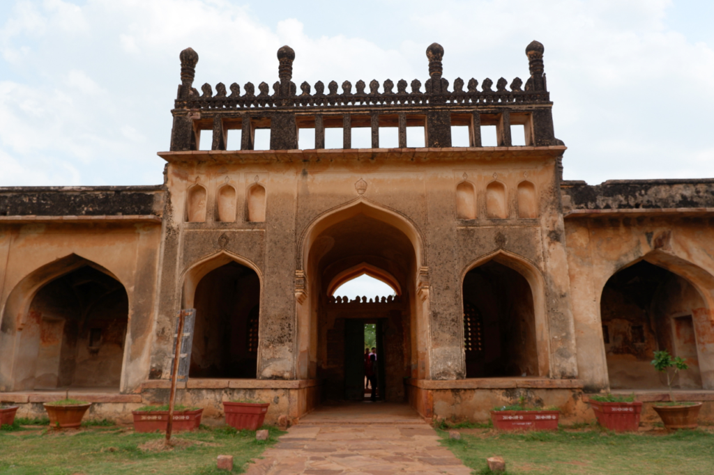
In terms of landmarks in and around the city, Konda Reddy Fort, formerly known as Kondareddy Burj, stands as a historical monument and a prominent tourist attraction. It is positioned in the northeast part of the city. On the other hand, Orvakal Rock Gardens, a sculpture garden with ancient caves, can be found to the southeast of the city
DEMOGRAPHICS:
According to the 2011 census data, Kurnool urban agglomeration had a population of 484,327, ranking it as the fifth largest city in the state of Andhra Pradesh. Additionally, during the same census, Kurnool reported a literacy rate of 77.37 percent.
In the Kurnool urban agglomeration, Hindus constituted the majority, as per the 2011 census figures. Furthermore, the city was home to various other religious groups, including Muslims, Christians, and Jains.
Regarding languages, Telugu, with a majority of 67.91 percent, held the status of the official and most widely spoken language in Kurnool. In addition to Telugu, Urdu (28.17 percent) and Hindi (1.02 percent) were also spoken in the region.