Lahaul & Spiti Pincodes
Uncover Lahaul and Spiti Pincodes , nestled in the Himalayas, boast an array of pin codes mapping its remote yet breathtaking landscape. With an intricately woven postal network, these regions exhibit a captivating blend of high-altitude beauty and cultural richness. The pin codes of Lahaul and Spiti intricately link hamlets, monasteries, and valleys, reflecting the resilience and connectivity in these Himalayan terrains. Each code signifies a unique facet of this terrain, facilitating communication amidst the towering peaks and serene vistas, encapsulating the essence of these mystical lands within a numerical address system.
Here is a list of Lahul & spiti Pincodes
| no. | Location | Pincode | District | State |
|---|---|---|---|---|
| 1 | Chimrat | 175142 | Lahul And spiti | Himachal Pradesh |
| 2 | Demul | 172114 | Lahul And spiti | Himachal Pradesh |
| 3 | Dhanker | 172113 | Lahul And spiti | Himachal Pradesh |
| 4 | Gemour | 175132 | Lahul And spiti | Himachal Pradesh |
| 5 | Gondhla | 175140 | Lahul And spiti | Himachal Pradesh |
| 6 | Goshal | 175132 | Lahul And spiti | Himachal Pradesh |
| 7 | Gue | 172111 | Lahul And spiti | Himachal Pradesh |
| 8 | Gulling | 172117 | Lahul And spiti | Himachal Pradesh |
| 9 | Hansa | 172114 | Lahul And spiti | Himachal Pradesh |
| 10 | Hikkam | 172114 | Lahul And spiti | Himachal Pradesh |
| 11 | Hull | 172114 | Lahul And spiti | Himachal Pradesh |
| 12 | Jahalman | 175139 | Lahul And spiti | Himachal Pradesh |
| 13 | Jispa | 175132 | Lahul And spiti | Himachal Pradesh |
| 14 | Jobrang | 175133 | Lahul And spiti | Himachal Pradesh |
| 15 | Karpat | 175142 | Lahul And spiti | Himachal Pradesh |
| 16 | Kaza | 172114 | Lahul And spiti | Himachal Pradesh |
| 17 | Kee Gompa | 172114 | Lahul And spiti | Himachal Pradesh |
| 18 | Keylong | 175132 | Lahul And spiti | Himachal Pradesh |
| 19 | Kibber | 172114 | Lahul And spiti | Himachal Pradesh |
| 20 | Koksar | 175140 | Lahul And spiti | Himachal Pradesh |
| 21 | Kolang | 175132 | Lahul And spiti | Himachal Pradesh |
| 22 | Kordang | 175132 | Lahul And spiti | Himachal Pradesh |
| 23 | Lalung | 172113 | Lahul And spiti | Himachal Pradesh |
| 24 | Lara | 172114 | Lahul And spiti | Himachal Pradesh |
| 25 | Losser | 172114 | Lahul And spiti | Himachal Pradesh |
| 26 | Lote | 175133 | Lahul And spiti | Himachal Pradesh |
| 27 | Malang | 175132 | Lahul And spiti | Himachal Pradesh |
| 28 | Mane | 172113 | Lahul And spiti | Himachal Pradesh |
| 29 | Mooling | 175132 | Lahul And spiti | Himachal Pradesh |
| 30 | Mooring | 175139 | Lahul And spiti | Himachal Pradesh |
| 31 | Mud | 172117 | Lahul And spiti | Himachal Pradesh |
| 32 | Peokar | 175132 | Lahul And spiti | Himachal Pradesh |
| 33 | Rangrik | 172114 | Lahul And spiti | Himachal Pradesh |
| 34 | Sagnam | 172117 | Lahul And spiti | Himachal Pradesh |
| 35 | Salugran | 175142 | Lahul And spiti | Himachal Pradesh |
| 36 | Samdoh | 175132 | Lahul And spiti | Himachal Pradesh |
| 37 | Samdoo | 172111 | Lahul And spiti | Himachal Pradesh |
| 38 | Shansha | 175133 | Lahul And spiti | Himachal Pradesh |
| 39 | Sissu | 175140 | Lahul And spiti | Himachal Pradesh |
| 40 | Tabo | 172113 | Lahul And spiti | Himachal Pradesh |
| 41 | Tandi | 175132 | Lahul And spiti | Himachal Pradesh |
| 42 | Thirot | 175139 | Lahul And spiti | Himachal Pradesh |
| 43 | Tindi | 175142 | Lahul And spiti | Himachal Pradesh |
| 44 | Trilokinath | 175142 | Lahul And spiti | Himachal Pradesh |
| 45 | Udaipur | 175142 | Lahul And spiti | Himachal Pradesh |
| 46 | Yurnath | 175132 | Lahul And spiti | Himachal Pradesh |
About Lahaul & Spiti District
History
Lahaul-Spiti likely belonged to Kalakluta or Mandamati historically. The Himalayas were once within the Ashokan empire. During Kanishka’s era, a significant Janapada Ki Pin spanned from Kashmir to Kafiristan. Along the Yamuna Sutlej, and Beas rivers, the Kuinidas tribe held sway, shaping the local landscape.
Demography
As per the 2011 census, Lahaul and Spiti district embrace a population of 31,564, ranking 638th among 640 districts in India. Spanning across vast terrains, it maintains a low population density of 2 individuals per square kilometre (5.2/sq mi) and experienced a -5% growth from 2001 to 2011. With a sex ratio of 903 females per 1000 males, the district holds a commendable literacy rate of 76.81%. Predominantly rural, the population consists entirely of rural inhabitants. Scheduled Castes account for 7.08% while Scheduled Tribes form a significant 81.44% of this diverse populace.
Geography
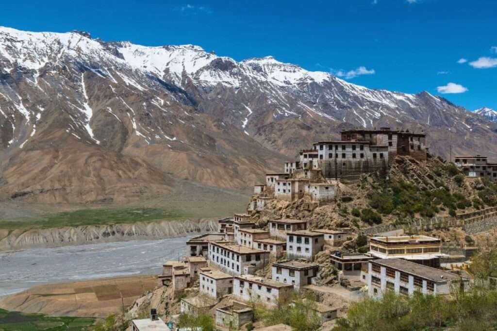
Nestled amidst the Himalayas and Tibetan Plateau, Lahaul and Spiti district connect to Manali via the Rohtang Pass, while Kunzum la (at 4,551 m altitude) marks the passage from Lahaul to Spiti Valley, merely 21 km from Chandra Tal. Spiti, barren and elevated at 4,270 m, resides amidst towering ranges, its river converging with the Sutlej after a southeastern gorge journey. A high-altitude desert with scant rainfall (averaging 170 mm annually), it echoes cultural ties with Tibet’s Ngari Prefecture. Its challenging terrain, 24 km from Tabo, converges with Kinnaur at Sumdo, entwining Lahaul and Spiti within a breathtaking, rugged landscape.