Lohit Pincodes

Enter the Pincode or Location Below in the Box

Pincodes of Lohit

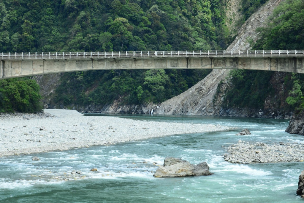
Lohit district offers scenic beauty and is gradually gaining recognition as a tourist destination. Visitors can explore the natural beauty of the district, go trekking, and visit places like Walong, Dong, and Parasuram Kund. Lohit district is connected to the rest of Arunachal Pradesh and the country by road and air. The nearest airport is in Tezu, and the district is accessible by road from other major towns in Arunachal Pradesh. These pincodes facilitate mail and communication services, ensuring that residents in this remote region can stay connected with the rest of the country. 

Lohit Pincodes

Here is a list of Lohit Pincodes

No.LocationPincodeDistrictState
1Alubari792102LohitArunachal Pradesh
2Chakma792102LohitArunachal Pradesh
3Changliang792001LohitArunachal Pradesh
4Chowkham792102LohitArunachal Pradesh
5Danglat792001LohitArunachal Pradesh
6Diyun792103LohitArunachal Pradesh
7Gohaingaon792001LohitArunachal Pradesh
8Innao792103LohitArunachal Pradesh
9Jaipur792103LohitArunachal Pradesh
10Kamlang Nagar792102LohitArunachal Pradesh
11Kherem792102LohitArunachal Pradesh
12Kumari Kachari792051LohitArunachal Pradesh
13Kumsai792103LohitArunachal Pradesh
14Lathao792103LohitArunachal Pradesh
15Lohitpur792001LohitArunachal Pradesh
16Loiliang792001LohitArunachal Pradesh
17Mahadevpur792051LohitArunachal Pradesh
18Manmao792103LohitArunachal Pradesh
19Medo792102LohitArunachal Pradesh
20Momong792102LohitArunachal Pradesh
21Nampong792103LohitArunachal Pradesh
22Namsai792103LohitArunachal Pradesh
23Nanam792103LohitArunachal Pradesh
24Peyong792103LohitArunachal Pradesh
25Podumani792051LohitArunachal Pradesh
26Sunpura792111LohitArunachal Pradesh
27Tafragram792001LohitArunachal Pradesh
28Tezu792001LohitArunachal Pradesh
29Tezu Covt.college792001LohitArunachal Pradesh
30Tindolong792001LohitArunachal Pradesh
31Udaipur792103LohitArunachal Pradesh
32Wakro792102LohitArunachal Pradesh
33Wingko792103LohitArunachal Pradesh
34Yealing792111LohitArunachal Pradesh

About Lohit

Lohit district, a significant region in Arunachal Pradesh, spans an area of 3735 square kilometers, with its headquarters located in Tezu at an average elevation of 185 meters (606 feet). Tezu is one of the oldest district headquarters in Arunachal Pradesh and, as of 2011, the third most populous district in the state, following Papum Pare and Changlang.

Geography

Geographically, the district includes the vital sub-divisions of Wakro, a term originating from the local Miju Mishmi dialect, and Sunpura, situated near the border of Assam and Arunachal. Covering an expansive 11,402 square kilometers, Lohit district was home to a population of 143,478 as of 2001.

Demography

In terms of demographics, the district counted 49,776 residents in the 2011 population census, comprising 26,365 males and 23,411 females. This marked a substantial increase from the 2001 population count of 42,928, indicating a growth of 6,848 individuals over the last decade, with a decennial population growth rate of 15.95 percent. Lohit district also boasts 30,753 literate individuals, including 17,929 males and 12,824 females, resulting in an overall average literacy rate of 72.1 percent. This literacy rate is further broken down into 78.9 percent for males and 64.2 percent for females.

The district’s population density stands at 13 individuals per square kilometer, with a sex ratio of 888 females per 1000 males, as of the 2011 population census. Additionally, the Child Sex Ratio is 944 females per 1000 males. Lohit district comprises 115 villages and one urban area.

The district is home to various tribes, including the Taraon-Mishmi, Kaman-Mishmi, Idu-Mishmi, Adi, and Tai-Khampti, known for their rich customs, vibrant traditional attire, and cultural traditions and values. Lohit district is a tapestry of diverse cultures and traditions, offering a glimpse into the rich heritage of the region’s indigenous tribes.

FAQs

What is Lohit famous for?

Renowned for its picturesque landscapes, Tezu offers opportunities for adventure enthusiasts to partake in activities such as trekking, hiking, and river rafting. Additionally, there are trekking options, including a day-long journey to Glow Lake, as well as opportunities for hiking, river rafting, and angling along the Lohit River.

What are the tribes in Lohit?

The Lohit district is home to diverse tribes, including the Taraon-Mishmi, Kaman-Mishmi, Idu-Mishmi, Adi, and Tai-Khampti. These indigenous communities are renowned for their vibrant customs, cultural heritage, colorful traditional attire, and deeply rooted traditions and values.

What is the old name of Lohit district?

As per the North East Frontier Areas (Administration) Regulation of 1954, the region formerly known as the North-East Frontier Tract was rechristened as the North-East Frontier Agency. Simultaneously, the Mishmi Hills District underwent a name change, becoming the Lohit Frontier Division.

Why is Lohit called Bloody river?

The river, often tempestuous and turbulent, earned the moniker "river of blood," partly due to the presence of lateritic soil. It courses through the Mishmi Hills before merging with the Siang River (Brahmaputra) at the head of the Brahmaputra valley.

What is the culture of Lohit district?

During festive occasions, one can savor their traditional dances, games, and sports. The indigenous populace consists of various tribal communities, primarily the Mishmi, Khamtis, and Singphos. These communities contribute to the vibrant cultural tapestry of the region.