Pincodes of Panch Mahals
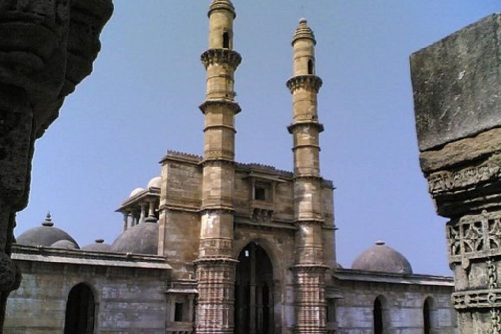
Panch Mahals District, located in Gujarat, India, is a region steeped in history and culture. Known for its diverse heritage, it boasts a mix of rural and urban areas. Panch Mahals pincodes facilitate easy navigation in this district. With a total area of about 5,815 square kilometers, it offers a picturesque landscape featuring hills and forests. The district is famous for its historical monuments, including Champaner-Pavagadh Archaeological Park, a UNESCO World Heritage Site. Agriculture is a significant occupation, with various crops cultivated. Panch Mahals combines the charm of its past with the promise of a vibrant future.
Here is a list of Panch Mahals Pincodes
| No. | Location | Pincode | District | State |
|---|---|---|---|---|
| 1 | Adadra | 389341 | Panch Mahals | Gujarat |
| 2 | Agarwada | 389115 | Panch Mahals | Gujarat |
| 3 | Alwa | 389310 | Panch Mahals | Gujarat |
| 4 | Ambali | 389001 | Panch Mahals | Gujarat |
| 5 | Amthni | 389240 | Panch Mahals | Gujarat |
| 6 | Aniyad | 389210 | Panch Mahals | Gujarat |
| 7 | Anjanwa | 389110 | Panch Mahals | Gujarat |
| 8 | Ankalia | 389240 | Panch Mahals | Gujarat |
| 9 | Antalwada | 389240 | Panch Mahals | Gujarat |
| 10 | Arad | 389350 | Panch Mahals | Gujarat |
| 11 | Bablia | 389232 | Panch Mahals | Gujarat |
| 12 | Babrol | 389260 | Panch Mahals | Gujarat |
| 13 | Bachkaria | 389240 | Panch Mahals | Gujarat |
| 14 | Bahi | 389001 | Panch Mahals | Gujarat |
| 15 | Bakkhar | 389120 | Panch Mahals | Gujarat |
| 16 | Bakor | 389232 | Panch Mahals | Gujarat |
| 17 | Bakrol | 389365 | Panch Mahals | Gujarat |
| 18 | Bamroda | 389230 | Panch Mahals | Gujarat |
| 19 | Bapotia | 389370 | Panch Mahals | Gujarat |
| 20 | Baska | 389350 | Panch Mahals | Gujarat |
| 21 | Bedhiya | 389310 | Panch Mahals | Gujarat |
| 22 | Bhadrala | 389210 | Panch Mahals | Gujarat |
| 23 | Bhadrod | 389230 | Panch Mahals | Gujarat |
| 24 | Bhadroli Khurd | 389320 | Panch Mahals | Gujarat |
| 25 | Bhalada | 388270 | Panch Mahals | Gujarat |
| 26 | Bhalania | 389340 | Panch Mahals | Gujarat |
| 27 | Bhamaiya | 389120 | Panch Mahals | Gujarat |
| 28 | Bhamaria | 389360 | Panch Mahals | Gujarat |
| 29 | Bhandoi | 389115 | Panch Mahals | Gujarat |
| 30 | Bhilod | 389341 | Panch Mahals | Gujarat |
| 31 | Bhuvar | 389110 | Panch Mahals | Gujarat |
| 32 | Bodidra Buzarg | 389120 | Panch Mahals | Gujarat |
| 33 | Bodidra Khurd | 389210 | Panch Mahals | Gujarat |
| 34 | Bor | 389380 | Panch Mahals | Gujarat |
| 35 | Boriavi | 389210 | Panch Mahals | Gujarat |
| 36 | Boriya | 389210 | Panch Mahals | Gujarat |
| 37 | Boru Bakorl | 389330 | Panch Mahals | Gujarat |
| 38 | Borvai | 389232 | Panch Mahals | Gujarat |
| 39 | Chalali | 389341 | Panch Mahals | Gujarat |
| 40 | Champeli | 388270 | Panch Mahals | Gujarat |
| 41 | Chandranagar | 389360 | Panch Mahals | Gujarat |
| 42 | Chandrpura | 389350 | Panch Mahals | Gujarat |
| 43 | Chapra | 389360 | Panch Mahals | Gujarat |
| 44 | Charangam | 388270 | Panch Mahals | Gujarat |
| 45 | Chatkabeli | 389230 | Panch Mahals | Gujarat |
| 46 | Chelawada | 389360 | Panch Mahals | Gujarat |
| 47 | Chhanip | 389210 | Panch Mahals | Gujarat |
| 48 | Chhavad | 389120 | Panch Mahals | Gujarat |
| 49 | Chhogala | 389210 | Panch Mahals | Gujarat |
| 50 | Chitwa | 389260 | Panch Mahals | Gujarat |
| 51 | Chori | 388270 | Panch Mahals | Gujarat |
| 52 | Dadhalia | 389250 | Panch Mahals | Gujarat |
| 53 | Dalwada | 389210 | Panch Mahals | Gujarat |
| 54 | Damavav | 389380 | Panch Mahals | Gujarat |
| 55 | Daneshwar | 389365 | Panch Mahals | Gujarat |
| 56 | Dangaria | 389115 | Panch Mahals | Gujarat |
| 57 | Davadra | 389365 | Panch Mahals | Gujarat |
| 58 | Delol | 389310 | Panch Mahals | Gujarat |
| 59 | Derol Gam | 389320 | Panch Mahals | Gujarat |
| 60 | Derol R s | 389320 | Panch Mahals | Gujarat |
| 61 | Dhamnod | 389120 | Panch Mahals | Gujarat |
| 62 | Dhamod | 388270 | Panch Mahals | Gujarat |
| 63 | Dhandhalpur | 389210 | Panch Mahals | Gujarat |
| 64 | Dhanitra | 389001 | Panch Mahals | Gujarat |
| 65 | Dhankuva | 389360 | Panch Mahals | Gujarat |
| 66 | Dhanol | 388713 | Panch Mahals | Gujarat |
| 67 | Dharapur | 389220 | Panch Mahals | Gujarat |
| 68 | Dhesia | 388270 | Panch Mahals | Gujarat |
| 69 | Dhingalwada | 389240 | Panch Mahals | Gujarat |
| 70 | Dhinkva | 389360 | Panch Mahals | Gujarat |
| 71 | Dhrola | 389001 | Panch Mahals | Gujarat |
| 72 | Ditwas | 389240 | Panch Mahals | Gujarat |
| 73 | Diwda Colony | 389250 | Panch Mahals | Gujarat |
| 74 | Doli | 389110 | Panch Mahals | Gujarat |
| 75 | Duma | 389390 | Panch Mahals | Gujarat |
| 76 | Eral | 389340 | Panch Mahals | Gujarat |
| 77 | Erandi | 389120 | Panch Mahals | Gujarat |
| 78 | Farod | 389365 | Panch Mahals | Gujarat |
| 79 | Gada | 389260 | Panch Mahals | Gujarat |
| 80 | Gadia | 389110 | Panch Mahals | Gujarat |
| 81 | Gamani | 389365 | Panch Mahals | Gujarat |
| 82 | Gangadiya | 389210 | Panch Mahals | Gujarat |
| 83 | Gangta | 389230 | Panch Mahals | Gujarat |
| 84 | Ghansar Muvadi | 389350 | Panch Mahals | Gujarat |
| 85 | Ghaswada | 389240 | Panch Mahals | Gujarat |
| 86 | Ghoghmba | 389365 | Panch Mahals | Gujarat |
| 87 | Godhar | 389230 | Panch Mahals | Gujarat |
| 88 | Godhar( North) | 389240 | Panch Mahals | Gujarat |
| 89 | Godhra | 389001 | Panch Mahals | Gujarat |
| 90 | Godli | 389380 | Panch Mahals | Gujarat |
| 91 | Gollav | 389380 | Panch Mahals | Gujarat |
| 92 | Gothibada | 389230 | Panch Mahals | Gujarat |
| 93 | Govindi | 389001 | Panch Mahals | Gujarat |
| 94 | Goya Sundal | 389341 | Panch Mahals | Gujarat |
| 95 | Gundi | 389380 | Panch Mahals | Gujarat |
| 96 | Guneli | 389220 | Panch Mahals | Gujarat |
| 97 | Gunesia | 389341 | Panch Mahals | Gujarat |
| 98 | Halol | 389350 | Panch Mahals | Gujarat |
| 99 | Hardaspur | 389230 | Panch Mahals | Gujarat |
| 100 | Hareda | 389110 | Panch Mahals | Gujarat |
| 101 | Harkundi | 389340 | Panch Mahals | Gujarat |
| 102 | Hathivan | 389220 | Panch Mahals | Gujarat |
| 103 | Haveli | 389390 | Panch Mahals | Gujarat |
| 104 | Hirapur | 389260 | Panch Mahals | Gujarat |
| 105 | Indral | 389350 | Panch Mahals | Gujarat |
| 106 | Jaban | 389390 | Panch Mahals | Gujarat |
| 107 | Jambughoda | 389390 | Panch Mahals | Gujarat |
| 108 | Jantral | 389320 | Panch Mahals | Gujarat |
| 109 | Janvad | 389260 | Panch Mahals | Gujarat |
| 110 | Jepura | 389360 | Panch Mahals | Gujarat |
| 111 | Jhara | 389220 | Panch Mahals | Gujarat |
| 112 | Jitpura | 389340 | Panch Mahals | Gujarat |
| 113 | Juni Dhari | 388710 | Panch Mahals | Gujarat |
| 114 | Kadachhala | 388270 | Panch Mahals | Gujarat |
| 115 | Kadadara | 389115 | Panch Mahals | Gujarat |
| 116 | Kadana | 389240 | Panch Mahals | Gujarat |
| 117 | Kajali | 389265 | Panch Mahals | Gujarat |
| 118 | Kakachiya | 389230 | Panch Mahals | Gujarat |
| 119 | Kakana Bhesavada | 389230 | Panch Mahals | Gujarat |
| 120 | Kakanpur | 388713 | Panch Mahals | Gujarat |
| 121 | Kalibel | 389230 | Panch Mahals | Gujarat |
| 122 | Kalol | 389330 | Panch Mahals | Gujarat |
| 123 | Kalyana | 388710 | Panch Mahals | Gujarat |
| 124 | Kandach | 389310 | Panch Mahals | Gujarat |
| 125 | Kanesar | 389230 | Panch Mahals | Gujarat |
| 126 | Kanjipani | 389390 | Panch Mahals | Gujarat |
| 127 | Kanjra | 389260 | Panch Mahals | Gujarat |
| 128 | Kanjri | 389350 | Panch Mahals | Gujarat |
| 129 | Kanod | 389320 | Panch Mahals | Gujarat |
| 130 | Kanpur | 389365 | Panch Mahals | Gujarat |
| 131 | Kanteli | 389370 | Panch Mahals | Gujarat |
| 132 | Kantu | 389380 | Panch Mahals | Gujarat |
| 133 | Karada | 389320 | Panch Mahals | Gujarat |
| 134 | Karanta | 389230 | Panch Mahals | Gujarat |
| 135 | Karoli | 389341 | Panch Mahals | Gujarat |
| 136 | Kavali | 389210 | Panch Mahals | Gujarat |
| 137 | Kelamul | 389265 | Panch Mahals | Gujarat |
| 138 | Kenpur | 389110 | Panch Mahals | Gujarat |
| 139 | Khadodi | 389232 | Panch Mahals | Gujarat |
| 140 | Khandivav | 389390 | Panch Mahals | Gujarat |
| 141 | Khanpur | 389230 | Panch Mahals | Gujarat |
| 142 | Kharkhadi | 389365 | Panch Mahals | Gujarat |
| 143 | Kharod | 389365 | Panch Mahals | Gujarat |
| 144 | Kharol | 389220 | Panch Mahals | Gujarat |
| 145 | Khojalvasa | 389210 | Panch Mahals | Gujarat |
| 146 | Kidia | 388270 | Panch Mahals | Gujarat |
| 147 | Kolvan | 388270 | Panch Mahals | Gujarat |
| 148 | Kotha | 389210 | Panch Mahals | Gujarat |
| 149 | Kothamba | 389220 | Panch Mahals | Gujarat |
| 150 | Kuwazar | 389115 | Panch Mahals | Gujarat |
| 151 | Labadadhara | 389365 | Panch Mahals | Gujarat |
| 152 | Ladpur | 389265 | Panch Mahals | Gujarat |
| 153 | Ladvel | 389220 | Panch Mahals | Gujarat |
| 154 | Lakdi Poyada | 388270 | Panch Mahals | Gujarat |
| 155 | Limadia | 389230 | Panch Mahals | Gujarat |
| 156 | Limbhola | 389250 | Panch Mahals | Gujarat |
| 157 | Limbodara | 389230 | Panch Mahals | Gujarat |
| 158 | Limdi Doli | 389110 | Panch Mahals | Gujarat |
| 159 | Limdi Timba | 389232 | Panch Mahals | Gujarat |
| 160 | Lunawada | 389230 | Panch Mahals | Gujarat |
| 161 | Madar | 389350 | Panch Mahals | Gujarat |
| 162 | Madhvas | 389230 | Panch Mahals | Gujarat |
| 163 | Maghasar | 389330 | Panch Mahals | Gujarat |
| 164 | Mahulia | 389001 | Panch Mahals | Gujarat |
| 165 | Makhalia | 389210 | Panch Mahals | Gujarat |
| 166 | Malav | 389310 | Panch Mahals | Gujarat |
| 167 | Malekpur | 389230 | Panch Mahals | Gujarat |
| 168 | Malu | 389365 | Panch Mahals | Gujarat |
| 169 | Malvan | 389265 | Panch Mahals | Gujarat |
| 170 | Manchi Haveli | 389360 | Panch Mahals | Gujarat |
| 171 | Mangliana | 389210 | Panch Mahals | Gujarat |
| 172 | Manipur (c) | 388713 | Panch Mahals | Gujarat |
| 173 | Masabar | 389390 | Panch Mahals | Gujarat |
| 174 | Mataria Vadi | 389120 | Panch Mahals | Gujarat |
| 175 | Mataria Vejam | 389115 | Panch Mahals | Gujarat |
| 176 | Matariya Vyas | 389210 | Panch Mahals | Gujarat |
| 177 | Medapur | 389310 | Panch Mahals | Gujarat |
| 178 | Mehlol | 389340 | Panch Mahals | Gujarat |
| 179 | Mekhar | 389115 | Panch Mahals | Gujarat |
| 180 | Metral | 389110 | Panch Mahals | Gujarat |
| 181 | Mirap | 389120 | Panch Mahals | Gujarat |
| 182 | Mithali | 389001 | Panch Mahals | Gujarat |
| 183 | Mojari | 389120 | Panch Mahals | Gujarat |
| 184 | Mol | 389365 | Panch Mahals | Gujarat |
| 185 | Mor | 389210 | Panch Mahals | Gujarat |
| 186 | Mora | 389110 | Panch Mahals | Gujarat |
| 187 | Morva ( rena) | 389001 | Panch Mahals | Gujarat |
| 188 | Morva Hadaf | 389115 | Panch Mahals | Gujarat |
| 189 | Mota Sonela | 389230 | Panch Mahals | Gujarat |
| 190 | Motal | 389001 | Panch Mahals | Gujarat |
| 191 | Moti Ghoda | 389230 | Panch Mahals | Gujarat |
| 192 | Moti Kandtdi | 388710 | Panch Mahals | Gujarat |
| 193 | Moti Sarsan | 389230 | Panch Mahals | Gujarat |
| 194 | Moti Umaravan | 389370 | Panch Mahals | Gujarat |
| 195 | Motikayar | 389260 | Panch Mahals | Gujarat |
| 196 | Motipura | 389350 | Panch Mahals | Gujarat |
| 197 | Motirath | 389240 | Panch Mahals | Gujarat |
| 198 | Motirel(w) | 389110 | Panch Mahals | Gujarat |
| 199 | Movasa | 389230 | Panch Mahals | Gujarat |
| 200 | Mudavadekh | 389230 | Panch Mahals | Gujarat |
| 201 | Munpur | 389240 | Panch Mahals | Gujarat |
| 202 | Nada | 389120 | Panch Mahals | Gujarat |
| 203 | Nadisar | 388710 | Panch Mahals | Gujarat |
| 204 | Namnar | 388270 | Panch Mahals | Gujarat |
| 205 | Nana Rajanpur | 389250 | Panch Mahals | Gujarat |
| 206 | Nanavadadala | 389230 | Panch Mahals | Gujarat |
| 207 | Nandarkha | 389340 | Panch Mahals | Gujarat |
| 208 | Nandarva | 389210 | Panch Mahals | Gujarat |
| 209 | Nani Bhugedi | 389190 | Panch Mahals | Gujarat |
| 210 | Nani Kharsoli | 389265 | Panch Mahals | Gujarat |
| 211 | Nanidenavad | 389230 | Panch Mahals | Gujarat |
| 212 | Naroda | 389230 | Panch Mahals | Gujarat |
| 213 | Narukot | 389390 | Panch Mahals | Gujarat |
| 214 | Nasikpur | 389230 | Panch Mahals | Gujarat |
| 215 | Natapur | 389120 | Panch Mahals | Gujarat |
| 216 | Nathkuwa | 389360 | Panch Mahals | Gujarat |
| 217 | Nava Muvada | 389230 | Panch Mahals | Gujarat |
| 218 | Navagam | 389110 | Panch Mahals | Gujarat |
| 219 | Navakuwa | 389360 | Panch Mahals | Gujarat |
| 220 | Nesda | 389320 | Panch Mahals | Gujarat |
| 221 | Orvada | 389120 | Panch Mahals | Gujarat |
| 222 | Padardi | 389210 | Panch Mahals | Gujarat |
| 223 | Padedi Ador | 389260 | Panch Mahals | Gujarat |
| 224 | Padedi Rampur | 389230 | Panch Mahals | Gujarat |
| 225 | Padhiyar | 388713 | Panch Mahals | Gujarat |
| 226 | Palikhanda | 389370 | Panch Mahals | Gujarat |
| 227 | Palla | 389365 | Panch Mahals | Gujarat |
| 228 | Pandaravada | 389232 | Panch Mahals | Gujarat |
| 229 | Pandhora | 389365 | Panch Mahals | Gujarat |
| 230 | Paroli | 389365 | Panch Mahals | Gujarat |
| 231 | Parvadi | 389120 | Panch Mahals | Gujarat |
| 232 | Pavagadh | 389360 | Panch Mahals | Gujarat |
| 233 | Pingli | 389320 | Panch Mahals | Gujarat |
| 234 | Rabadia | 389220 | Panch Mahals | Gujarat |
| 235 | Rabod | 389310 | Panch Mahals | Gujarat |
| 236 | Rajayata | 389115 | Panch Mahals | Gujarat |
| 237 | Rambhem Na muvada | 389230 | Panch Mahals | Gujarat |
| 238 | Rampatel Na muvada | 389230 | Panch Mahals | Gujarat |
| 239 | Rampur Jodka | 389340 | Panch Mahals | Gujarat |
| 240 | Rampur Kasanpur | 389115 | Panch Mahals | Gujarat |
| 241 | Ramshera | 389350 | Panch Mahals | Gujarat |
| 242 | Ranijini Padedi | 389230 | Panch Mahals | Gujarat |
| 243 | Ranjitnagar | 389360 | Panch Mahals | Gujarat |
| 244 | Rasulpur | 389120 | Panch Mahals | Gujarat |
| 245 | Ratanpur (r) | 388713 | Panch Mahals | Gujarat |
| 246 | Ratanpur Kantdi | 388710 | Panch Mahals | Gujarat |
| 247 | Ratanpura | 389330 | Panch Mahals | Gujarat |
| 248 | Ravalia | 389350 | Panch Mahals | Gujarat |
| 249 | Rayan Muvada | 389365 | Panch Mahals | Gujarat |
| 250 | Rayanwadia | 389360 | Panch Mahals | Gujarat |
| 251 | Rena | 389001 | Panch Mahals | Gujarat |
| 252 | Rinchhia | 389340 | Panch Mahals | Gujarat |
| 253 | Rinchhvani | 389380 | Panch Mahals | Gujarat |
| 254 | Sagawada | 389115 | Panch Mahals | Gujarat |
| 255 | Sajivav | 389210 | Panch Mahals | Gujarat |
| 256 | Sajora | 389341 | Panch Mahals | Gujarat |
| 257 | Sama | 389320 | Panch Mahals | Gujarat |
| 258 | Samalkuva | 389365 | Panch Mahals | Gujarat |
| 259 | Samli | 389001 | Panch Mahals | Gujarat |
| 260 | Sampa | 389001 | Panch Mahals | Gujarat |
| 261 | Sangavada | 389260 | Panch Mahals | Gujarat |
| 262 | Saniada | 389380 | Panch Mahals | Gujarat |
| 263 | Sansoli | 389320 | Panch Mahals | Gujarat |
| 264 | Sant | 389260 | Panch Mahals | Gujarat |
| 265 | Sant Road | 389120 | Panch Mahals | Gujarat |
| 266 | Santrampur | 389260 | Panch Mahals | Gujarat |
| 267 | Saraswa | 389110 | Panch Mahals | Gujarat |
| 268 | Saraswa( North) | 389240 | Panch Mahals | Gujarat |
| 269 | Sarsadi | 389240 | Panch Mahals | Gujarat |
| 270 | Sarsav | 389120 | Panch Mahals | Gujarat |
| 271 | Sat Talav | 389230 | Panch Mahals | Gujarat |
| 272 | Sathrota | 389350 | Panch Mahals | Gujarat |
| 273 | Satmana | 389320 | Panch Mahals | Gujarat |
| 274 | Shamna | 389230 | Panch Mahals | Gujarat |
| 275 | Shehera | 389210 | Panch Mahals | Gujarat |
| 276 | Shekpur | 389210 | Panch Mahals | Gujarat |
| 277 | Sherpura | 389341 | Panch Mahals | Gujarat |
| 278 | Shivrajpur | 389370 | Panch Mahals | Gujarat |
| 279 | Simalia | 389341 | Panch Mahals | Gujarat |
| 280 | Siyal | 389265 | Panch Mahals | Gujarat |
| 281 | Suliyat | 389110 | Panch Mahals | Gujarat |
| 282 | Sureli | 389210 | Panch Mahals | Gujarat |
| 283 | Surpur | 389260 | Panch Mahals | Gujarat |
| 284 | Tadva | 389210 | Panch Mahals | Gujarat |
| 285 | Tajpura | 389350 | Panch Mahals | Gujarat |
| 286 | Talavdi | 389370 | Panch Mahals | Gujarat |
| 287 | Tarkhanda | 389350 | Panch Mahals | Gujarat |
| 288 | Thanasavli | 389220 | Panch Mahals | Gujarat |
| 289 | Timba Gam | 388710 | Panch Mahals | Gujarat |
| 290 | Timba Road | 388710 | Panch Mahals | Gujarat |
| 291 | Timbla | 389260 | Panch Mahals | Gujarat |
| 292 | Tuwa | 388713 | Panch Mahals | Gujarat |
| 293 | Ucharpi | 388270 | Panch Mahals | Gujarat |
| 294 | Uchet | 389390 | Panch Mahals | Gujarat |
| 295 | Ujeti | 389350 | Panch Mahals | Gujarat |
| 296 | Ukhreli | 389260 | Panch Mahals | Gujarat |
| 297 | Umber | 389110 | Panch Mahals | Gujarat |
| 298 | Undra | 388270 | Panch Mahals | Gujarat |
| 299 | Vada Talav | 389360 | Panch Mahals | Gujarat |
| 300 | Vadagam | 389230 | Panch Mahals | Gujarat |
| 301 | Vadelav | 389120 | Panch Mahals | Gujarat |
| 302 | Vadi | 389001 | Panch Mahals | Gujarat |
| 303 | Vadina Gorda | 389230 | Panch Mahals | Gujarat |
| 304 | Vadodar | 389115 | Panch Mahals | Gujarat |
| 305 | Vagadiayani Andheri | 389240 | Panch Mahals | Gujarat |
| 306 | Vaghbod | 389370 | Panch Mahals | Gujarat |
| 307 | Vaghjipur | 389120 | Panch Mahals | Gujarat |
| 308 | Vallavpur | 389001 | Panch Mahals | Gujarat |
| 309 | Vandeli | 389115 | Panch Mahals | Gujarat |
| 310 | Vania Vada gorada | 389230 | Panch Mahals | Gujarat |
| 311 | Vanjiakhut | 389260 | Panch Mahals | Gujarat |
| 312 | Vankadi | 389110 | Panch Mahals | Gujarat |
| 313 | Vardhari | 388270 | Panch Mahals | Gujarat |
| 314 | Varsda | 389350 | Panch Mahals | Gujarat |
| 315 | Vav | 389390 | Panch Mahals | Gujarat |
| 316 | Vavdi Buzarg | 389001 | Panch Mahals | Gujarat |
| 317 | Vavkulli | 389341 | Panch Mahals | Gujarat |
| 318 | Veganpur | 388713 | Panch Mahals | Gujarat |
| 319 | Vejalpur | 389340 | Panch Mahals | Gujarat |
| 320 | Velanvada | 389240 | Panch Mahals | Gujarat |
| 321 | Vintoj | 389350 | Panch Mahals | Gujarat |
| 322 | Viraniya | 389230 | Panch Mahals | Gujarat |
| 323 | Vyasda | 389340 | Panch Mahals | Gujarat |
| 324 | Zankharia | 389360 | Panch Mahals | Gujarat |
| 325 | Zinzari | 389365 | Panch Mahals | Gujarat |
About Panch Mahals
Panchmahal, also known as Panch Mahal, is an eastern district in Gujarat, western India. “Panch-mahal” means “five tehsils/talukas” or sub-divisions, which were transferred from Maharaja Jivajirao Scindia of Gwalior State to the British. These include Godhra, Dahod, Halol, Kalol, Jhalod, and Devgadh Baria. The district is situated in the eastern part of the state and shares borders with Dahod, Vadodara, Chhota Udaipur, Kheda, and Mahisagar districts.
History:
The history of Panchmahals district revolves around Champaner and Pavagadh Hill. Champaner was founded in the 7th century (647) under King Vanraj Chavda. In the 13th century, Delhi Sultanate, led by Alauddin Khalji, took control. Sultan Mahmud Begada of Gujarat captured it in 1484. During the Mughal Empire (1575 to 1727), Godhra became the district center. In the 1600s, the Dahod and Champaner forests were hunting grounds for wild elephants. In 1997, Dahod became a separate district. The Mirat-i Sikandari praised the region’s mangoes and abundant sandalwood used for construction.
Geography:
Panchmahal district has lots of forests. In 2011, about 23.26% of the land here was covered in forests. Most of these forests, about 97.80%, are kept for special protection. You can find trees like mahuda, teak, and khakhra in these forests. Since 1989, the Forest Department has been planting new trees in the district to make more forests and stop the cutting down of trees.
Economy:
Most people in Panchmahal make a living through farming, with 75.88% working in agriculture in 2011, which is higher than the state average. They grow crops like rice, maize, tur, gram, castor, cotton, and wheat, with rice, maize, wheat, castor, and tur being the most common. In the hillier parts, gram is grown after rice and maize. Buffaloes, cattle, and goats are the main animals raised for dairy products, providing jobs for rural families. About 3,000 people worked in fishing, mainly in ponds due to the lack of big rivers. In places like Godhra, Kalol, and Halol, you’ll find industries like rubber, metal, machinery, and mining.
Demographics:
In 2011, Panchmahal district had a population of 2,390,776, making it the 187th most populous district in India out of 640. It had 458 people living in each square kilometer. The sex ratio was 945 females for every 1000 males, and the literacy rate stood at 72.32%.
Out of the total population, 1,642,268 lived in the divided district, with 16.95% in urban areas. This part of the district had a sex ratio of 948 females per 1000 males.
During the 2011 Census, 95.44% of the district’s population spoke Gujarati as their first language, while 2.28% spoke Urdu, and 1.48% spoke Hindi.
Tehsils:
- Godhra
- Morva (Hadaf)
- Sahera
- Ghoghamba
- Jambughoda
- Kaalol
- Halol