Poonch Pincodes

Enter the Pincode or Location Below in the Box

Poonch Pincodes​

Poonch Pincodes: Lying in the scenic valley of Jammu and Kashmir, Poonch has a wide variety of pincodes that define its area. Each code, which ranges from the lively 185101 to the serene 185121, indicates particular regions. Poonch pincodes on our platform, “Pincodes of My Location,” offer a seamless resource for both locals and visitors, enabling exact location identification for postal services, navigation, and community. Discover the many sides of Poonch by cracking its many pincodes, each of which reveals a different aspect of this amazing place.

Poonch Pincodes

Here is a list of Poonch Pincodes

About Poonch Pincodes

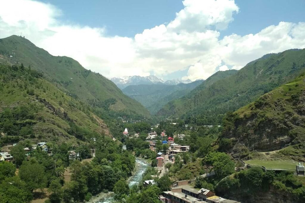
Poonch, a district in the Jammu division of Indian-administered Jammu and Kashmir, hides away within the disputed Kashmir region and carries a lot of history with it. This beautiful region was divided in two after the India-Pakistan war in 1947–1948. Its headquarters, in the town of Poonch, is separated on three sides by the Line of Control and is a symbol of determination in the face of geopolitical difficulties. Poonch, whose pincodes outline a territory rich in historical and geographical significance, is an equilibrium of cultural legacy and territorial narratives, with one portion having been absorbed by Pakistan and the other incorporated into the former state of Jammu and Kashmir.

History

The history of Jammu and Kashmir’s Poonch district is broad and varied. The area was once a part of the strong Kushan and Mauryan empires, giving it a long history. It was ruled by a number of kingdoms during the Middle Ages, including the Mughals and Afghan kings.

Poonch saw the independence struggle as well, with the residents taking an active part in the Free Kashmir movement. Poonch suffered violence and uprooted during British India’s partition. 

Poonch district is presently concentrated on development and tourism promotion, highlighting its historical value and natural beauty, despite its dangerous past.

Demography

Poonch district in India, according to the 2011 census, homes 476,835 individuals, akin to Suriname’s populace. Positioned at 548th among 640 districts, it holds a density of 285 residents per square kilometer (740/sq mi). Over a decade (2001-2011), its population surged by 27.97%. The sex ratio stands at 893 females per 1000 males, varying across religions, with a literacy rate of 68.69%. Notably, 90.45% of Poonch is Muslim, while Scheduled Castes and Tribes comprise 0.1% and 36.9%, respectively. These statistics paint a mosaic reflecting the district’s diverse cultural fabric and demographic dynamism.

Geography

In Jammu and Kashmir, the Poonch district, which covers 1,674 square kilometers (646 sq mi), creates a unique geographic landscape. It is bordered to the east by the districts of Kulgam, Shopian, and Budgam, and to the south by the lively Rajouri district. It borders the scenic areas of Baramulla to the north and shares its core with the Haveli district of Pakistan-administrated Jammu and Kashmir. It meets the Poonch district’s cultural canvas in Pakistani-administered Kashmir to the west. The borders of this district indicate not just the division of boundaries but also a complex legacy and diverse beauty that exist inside its varied settings.

Administration

Poonch district, which is located far away in Jammu and Kashmir, flourishes with administrative diversity. As the District Magistrate, Mr. Ch. Mohd. Yasin leads with Poonch city at its center. The district is divided into six active tehsils, Mandi, Mendhar, and other areas, each headed by a Tehsildar. Eleven blocks, led by Block Development Officers (BDOs), further divide the area into distinct regions such as Loran, Sathra, and Buffliaz. Sub Divisions like Surankote and Mendhar were welcomed into recent expansions, which increased the district’s activity. The 179 villages that make up Poonch’s tapestry each add something special to the distinctive cultural diversity of this amazing place.

FAQs