Siramur Pincodes
Discover Siramur Pincodes at “Pin Code of My Location,” unveiling the tapestry of Andhra Pradesh’s pin codes. In the vibrant district of Anantapur, this hub encapsulates an impressive 902 unique codes, a testament to the expansive postal framework and rich regional tapestry within southern India. Explore the diverse facets of Sirampur’s geography through its multitude of pin codes, each a gateway to understanding the cultural and geographical diversity nestled within this distinctive district
Here is a list of Sirmaur Pincodes
| No. | Location | Pincode | District | State |
|---|---|---|---|---|
| 1 | Andheri | 173023 | Sirmaur | Himachal Pradesh |
| 2 | Badag | 173023 | Sirmaur | Himachal Pradesh |
| 3 | Badol | 173023 | Sirmaur | Himachal Pradesh |
| 4 | Bagpashog | 173024 | Sirmaur | Himachal Pradesh |
| 5 | Bagthan | 173001 | Sirmaur | Himachal Pradesh |
| 6 | Bakras | 173029 | Sirmaur | Himachal Pradesh |
| 7 | Banahki Ser | 173024 | Sirmaur | Himachal Pradesh |
| 8 | Banaur | 173025 | Sirmaur | Himachal Pradesh |
| 9 | Banethi | 173001 | Sirmaur | Himachal Pradesh |
| 10 | Baru Sahib | 173101 | Sirmaur | Himachal Pradesh |
| 11 | Bella | 173027 | Sirmaur | Himachal Pradesh |
| 12 | Bhagani | 173025 | Sirmaur | Himachal Pradesh |
| 13 | Bhallan | 173024 | Sirmaur | Himachal Pradesh |
| 14 | Bhalona | 173023 | Sirmaur | Himachal Pradesh |
| 15 | Bharog Baneri | 173022 | Sirmaur | Himachal Pradesh |
| 16 | Bharoli | 171226 | Sirmaur | Himachal Pradesh |
| 17 | Bhatgarh | 173022 | Sirmaur | Himachal Pradesh |
| 18 | Bhawani | 173101 | Sirmaur | Himachal Pradesh |
| 19 | Bhudhana | 173025 | Sirmaur | Himachal Pradesh |
| 20 | Bhuira | 173101 | Sirmaur | Himachal Pradesh |
| 21 | Bhujjal | 171226 | Sirmaur | Himachal Pradesh |
| 22 | Bhujond | 173023 | Sirmaur | Himachal Pradesh |
| 23 | Bikram Bag | 173001 | Sirmaur | Himachal Pradesh |
| 24 | Birla | 173022 | Sirmaur | Himachal Pradesh |
| 25 | Bogdhar | 173101 | Sirmaur | Himachal Pradesh |
| 26 | Bramapapri | 173030 | Sirmaur | Himachal Pradesh |
| 27 | Chacheti | 173029 | Sirmaur | Himachal Pradesh |
| 28 | Chakli | 173001 | Sirmaur | Himachal Pradesh |
| 29 | Chalana | 173001 | Sirmaur | Himachal Pradesh |
| 30 | Chapand | 173101 | Sirmaur | Himachal Pradesh |
| 31 | Charna | 173101 | Sirmaur | Himachal Pradesh |
| 32 | Chaukar | 173101 | Sirmaur | Himachal Pradesh |
| 33 | Chogtalli | 173101 | Sirmaur | Himachal Pradesh |
| 34 | Churwadhar | 173101 | Sirmaur | Himachal Pradesh |
| 35 | Dadahu | 173022 | Sirmaur | Himachal Pradesh |
| 36 | Dahan | 173101 | Sirmaur | Himachal Pradesh |
| 37 | Danda Anj | 173025 | Sirmaur | Himachal Pradesh |
| 38 | Dangyar | 173024 | Sirmaur | Himachal Pradesh |
| 39 | Daro Devria | 173024 | Sirmaur | Himachal Pradesh |
| 40 | Deothi Manjghaon | 171226 | Sirmaur | Himachal Pradesh |
| 41 | Devamanal | 173101 | Sirmaur | Himachal Pradesh |
| 42 | Devna | 173101 | Sirmaur | Himachal Pradesh |
| 43 | Dhaula Kuan | 173001 | Sirmaur | Himachal Pradesh |
| 44 | Dimber | 173101 | Sirmaur | Himachal Pradesh |
| 45 | Dingar Kinner | 173001 | Sirmaur | Himachal Pradesh |
| 46 | Dugana | 173029 | Sirmaur | Himachal Pradesh |
| 47 | Gagal Shikor | 173001 | Sirmaur | Himachal Pradesh |
| 48 | Ganduri | 173101 | Sirmaur | Himachal Pradesh |
| 49 | Gawali | 173027 | Sirmaur | Himachal Pradesh |
| 50 | Girinagar | 173020 | Sirmaur | Himachal Pradesh |
| 51 | Gorkhuwala | 173025 | Sirmaur | Himachal Pradesh |
| 52 | Habban | 173101 | Sirmaur | Himachal Pradesh |
| 53 | Hallan | 173027 | Sirmaur | Himachal Pradesh |
| 54 | Haripur Khol | 173001 | Sirmaur | Himachal Pradesh |
| 55 | Haripurdhar | 173023 | Sirmaur | Himachal Pradesh |
| 56 | Harlog | 173029 | Sirmaur | Himachal Pradesh |
| 57 | Jamna | 173029 | Sirmaur | Himachal Pradesh |
| 58 | Jamniwala | 173025 | Sirmaur | Himachal Pradesh |
| 59 | Jamta | 173001 | Sirmaur | Himachal Pradesh |
| 60 | Jamu | 173022 | Sirmaur | Himachal Pradesh |
| 61 | Janot | 173024 | Sirmaur | Himachal Pradesh |
| 62 | Jarag | 173022 | Sirmaur | Himachal Pradesh |
| 63 | Jarwa | 173027 | Sirmaur | Himachal Pradesh |
| 64 | Jehar | 173024 | Sirmaur | Himachal Pradesh |
| 65 | Jhakando | 173027 | Sirmaur | Himachal Pradesh |
| 66 | Kala Amb | 173030 | Sirmaur | Himachal Pradesh |
| 67 | Kamrau | 173029 | Sirmaur | Himachal Pradesh |
| 68 | Kando Bhatnaul | 173027 | Sirmaur | Himachal Pradesh |
| 69 | Kangta Failag | 173022 | Sirmaur | Himachal Pradesh |
| 70 | Kansar | 173022 | Sirmaur | Himachal Pradesh |
| 71 | Kantimashwa | 173029 | Sirmaur | Himachal Pradesh |
| 72 | Kathali Bharan | 173101 | Sirmaur | Himachal Pradesh |
| 73 | Khadkan | 173027 | Sirmaur | Himachal Pradesh |
| 74 | Khodri | 173025 | Sirmaur | Himachal Pradesh |
| 75 | Kodga | 173029 | Sirmaur | Himachal Pradesh |
| 76 | Kolar | 173001 | Sirmaur | Himachal Pradesh |
| 77 | Korag | 173023 | Sirmaur | Himachal Pradesh |
| 78 | Koti Utraon | 173029 | Sirmaur | Himachal Pradesh |
| 79 | Kotibhunch | 173027 | Sirmaur | Himachal Pradesh |
| 80 | Kotidhiman | 173022 | Sirmaur | Himachal Pradesh |
| 81 | Kotla Molar | 173001 | Sirmaur | Himachal Pradesh |
| 82 | Kotribyas | 173021 | Sirmaur | Himachal Pradesh |
| 83 | Kuffar Kiara | 173101 | Sirmaur | Himachal Pradesh |
| 84 | Kw Bhood | 173026 | Sirmaur | Himachal Pradesh |
| 85 | Kyari Gundaha | 173029 | Sirmaur | Himachal Pradesh |
| 86 | Lanacheta | 173101 | Sirmaur | Himachal Pradesh |
| 87 | Lanapalar | 173023 | Sirmaur | Himachal Pradesh |
| 88 | Loza | 173027 | Sirmaur | Himachal Pradesh |
| 89 | Majra | 173021 | Sirmaur | Himachal Pradesh |
| 90 | Malhoti | 173024 | Sirmaur | Himachal Pradesh |
| 91 | Manal | 173027 | Sirmaur | Himachal Pradesh |
| 92 | Mangarh | 173024 | Sirmaur | Himachal Pradesh |
| 93 | Manpur Devra | 173025 | Sirmaur | Himachal Pradesh |
| 94 | Matar | 173001 | Sirmaur | Himachal Pradesh |
| 95 | Mehandobag | 173024 | Sirmaur | Himachal Pradesh |
| 96 | Millah | 173029 | Sirmaur | Himachal Pradesh |
| 97 | Misserwala | 173021 | Sirmaur | Himachal Pradesh |
| 98 | Moginand | 173030 | Sirmaur | Himachal Pradesh |
| 99 | Mohipur | 173001 | Sirmaur | Himachal Pradesh |
| 100 | Nagheta | 173025 | Sirmaur | Himachal Pradesh |
| 101 | Nahan | 173001 | Sirmaur | Himachal Pradesh |
| 102 | Nainidhar | 173027 | Sirmaur | Himachal Pradesh |
| 103 | Narag | 173024 | Sirmaur | Himachal Pradesh |
| 104 | Neripul | 171226 | Sirmaur | Himachal Pradesh |
| 105 | Nihalgarh | 173025 | Sirmaur | Himachal Pradesh |
| 106 | Nohra | 173101 | Sirmaur | Himachal Pradesh |
| 107 | Pabiana | 173101 | Sirmaur | Himachal Pradesh |
| 108 | Palio | 173030 | Sirmaur | Himachal Pradesh |
| 109 | Panar | 173022 | Sirmaur | Himachal Pradesh |
| 110 | Panjahal | 173001 | Sirmaur | Himachal Pradesh |
| 111 | Panog | 173027 | Sirmaur | Himachal Pradesh |
| 112 | Paonta | 173025 | Sirmaur | Himachal Pradesh |
| 113 | Parada | 173001 | Sirmaur | Himachal Pradesh |
| 114 | Poka | 173029 | Sirmaur | Himachal Pradesh |
| 115 | Punner | 173101 | Sirmaur | Himachal Pradesh |
| 116 | Puruwala | 173001 | Sirmaur | Himachal Pradesh |
| 117 | Rajana | 173023 | Sirmaur | Himachal Pradesh |
| 118 | Rajban | 173028 | Sirmaur | Himachal Pradesh |
| 119 | Rajgarh | 173101 | Sirmaur | Himachal Pradesh |
| 120 | Rajpur | 173025 | Sirmaur | Himachal Pradesh |
| 121 | Ramadhaun | 173001 | Sirmaur | Himachal Pradesh |
| 122 | Redali | 173023 | Sirmaur | Himachal Pradesh |
| 123 | Redughati | 173101 | Sirmaur | Himachal Pradesh |
| 124 | Ronhat | 173027 | Sirmaur | Himachal Pradesh |
| 125 | Sainj | 173023 | Sirmaur | Himachal Pradesh |
| 126 | Sainwala | 173030 | Sirmaur | Himachal Pradesh |
| 127 | Sainwala Mubarakpur | 173021 | Sirmaur | Himachal Pradesh |
| 128 | Sangana | 173023 | Sirmaur | Himachal Pradesh |
| 129 | Sangrah | 173023 | Sirmaur | Himachal Pradesh |
| 130 | Sanio Didag | 173101 | Sirmaur | Himachal Pradesh |
| 131 | Sarahan | 173024 | Sirmaur | Himachal Pradesh |
| 132 | Sarsoo | 173024 | Sirmaur | Himachal Pradesh |
| 133 | Sataun | 173029 | Sirmaur | Himachal Pradesh |
| 134 | Seon | 173023 | Sirmaur | Himachal Pradesh |
| 135 | Ser Jegas | 173101 | Sirmaur | Himachal Pradesh |
| 136 | Sertandula | 173101 | Sirmaur | Himachal Pradesh |
| 137 | Shambhuwala | 173001 | Sirmaur | Himachal Pradesh |
| 138 | Sharia | 173024 | Sirmaur | Himachal Pradesh |
| 139 | Sharlimanpur | 173029 | Sirmaur | Himachal Pradesh |
| 140 | Shawaga | 173029 | Sirmaur | Himachal Pradesh |
| 141 | Shaya Chabron | 173101 | Sirmaur | Himachal Pradesh |
| 142 | Shilla | 173029 | Sirmaur | Himachal Pradesh |
| 143 | Shillai | 173027 | Sirmaur | Himachal Pradesh |
| 144 | Shivpur | 173023 | Sirmaur | Himachal Pradesh |
| 145 | Surla | 173001 | Sirmaur | Himachal Pradesh |
| 146 | Tatiana | 173029 | Sirmaur | Himachal Pradesh |
| 147 | Thakurdwara | 173024 | Sirmaur | Himachal Pradesh |
| 148 | Thana Kashoga | 173022 | Sirmaur | Himachal Pradesh |
| 149 | Thorniwar | 173101 | Sirmaur | Himachal Pradesh |
| 150 | Tikkari Kuthar | 173024 | Sirmaur | Himachal Pradesh |
| 151 | Timbi | 173029 | Sirmaur | Himachal Pradesh |
| 152 | Trilokpur | 173030 | Sirmaur | Himachal Pradesh |
| 153 | Udaina Kathwar | 173022 | Sirmaur | Himachal Pradesh |
| 154 | Udyankathwad | 173020 | Sirmaur | Himachal Pradesh |
| 155 | Upron | 173024 | Sirmaur | Himachal Pradesh |
| 156 | Walikoti | 173027 | Sirmaur | Himachal Pradesh |
| 157 | Wasni | 173024 | Sirmaur | Himachal Pradesh |
| 158 | Watamandi | 173025 | Sirmaur | Himachal Pradesh |
About Sirmaur District
History
Demography
Geography
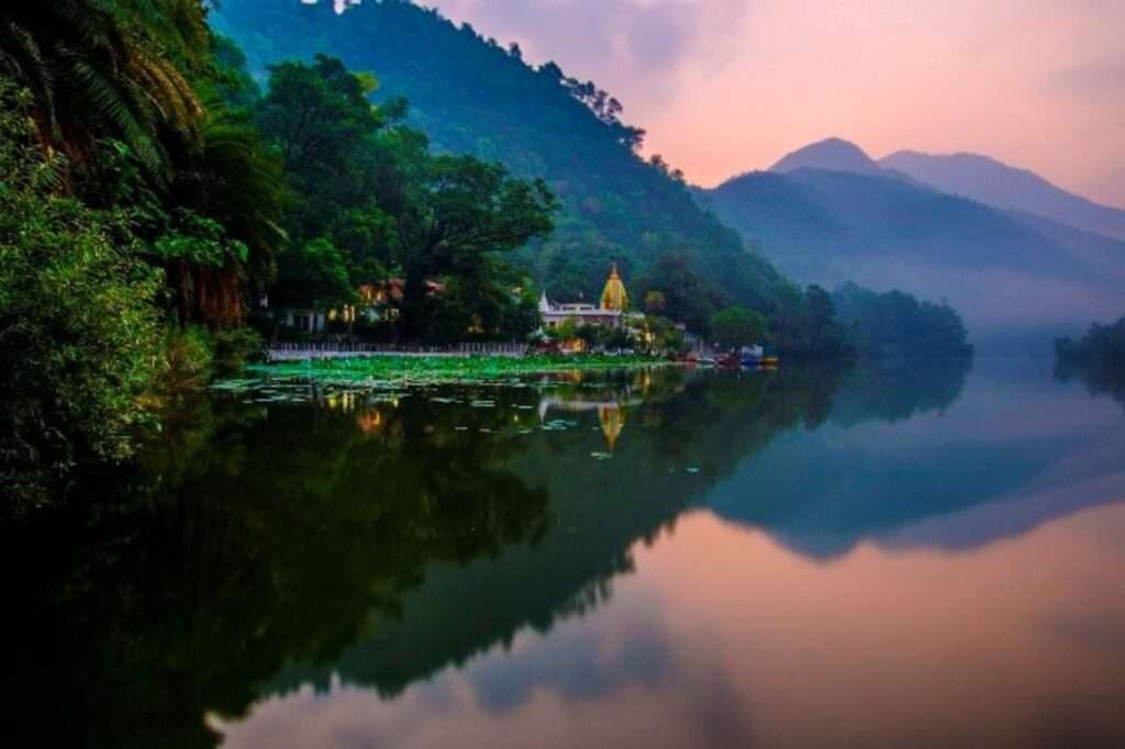
Sirmaur district spans across 224,759 hectares, with 48,682 hectares covered in forests and 75,914 hectares dedicated to cultivation. It rests at an elevation reaching 3,647 meters, situated between 77°01’12” to 77°49’40” East longitude and 30°22’30” to 31°01’20” North latitude. The district is traversed by the Yamuna and Giri rivers, defining its landscape. Seven tehsils—Nahan, Renuka, Kamrau, Shillai, Rajgarh, Pachhad, and Paonta Sahib—comprise the region. The Giri River serves as a natural divider, creating the Giripar and Giriaar sections, almost equal in size. The prominent towns within Sirmaur include Nahan, Paonta Sahib, Rajgarh, and Shillai.