Pincodes of Mammit
Mamit Pincodes for “Pincodes of My Location” is your go-to resource for accessing postal codes in the Mamit district. Mamit, a picturesque region in Mizoram, India, is known for its unique charm and rich culture. Whether you’re a resident or a visitor, our website provides a comprehensive list of Mamit’s pincodes, making it easy for you to locate specific areas, post offices, and destinations with precision. Whether you’re sending mail, ordering online, or simply exploring this beautiful district, “Mamit Pincodes” is your trusted companion. Discover the convenience of accurate location information with just a few clicks on our user-friendly platform.
Here is a list of Mammit Pincodes
| No. | Location | Pincode | District | State |
|---|---|---|---|---|
| 1 | Ailawng | 796501 | Mammit | Mizoram |
| 2 | Damparengpui | 796431 | Mammit | Mizoram |
| 3 | Dampui | 796441 | Mammit | Mizoram |
| 4 | Dapchhuah | 796410 | Mammit | Mizoram |
| 5 | Darlak | 796441 | Mammit | Mizoram |
| 6 | Darlung | 796501 | Mammit | Mizoram |
| 7 | Hmunpui | 796410 | Mammit | Mizoram |
| 8 | Hnahva | 796431 | Mammit | Mizoram |
| 9 | Kanghmun | 796501 | Mammit | Mizoram |
| 10 | Kawrtethawveng | 796441 | Mammit | Mizoram |
| 11 | Kawrthah | 796441 | Mammit | Mizoram |
| 12 | Khawhnai | 796431 | Mammit | Mizoram |
| 13 | Khawrihnim | 796501 | Mammit | Mizoram |
| 14 | Lallen | 796431 | Mammit | Mizoram |
| 15 | Lengpui | 796410 | Mammit | Mizoram |
| 16 | Lungdar 'w' | 796501 | Mammit | Mizoram |
| 17 | Mamit | 796441 | Mammit | Mizoram |
| 18 | Marpara | 796431 | Mammit | Mizoram |
| 19 | Mualkhang | 796410 | Mammit | Mizoram |
| 20 | N.Chhippui | 796431 | Mammit | Mizoram |
| 21 | N.Sabual | 796441 | Mammit | Mizoram |
| 22 | Parvatui | 796431 | Mammit | Mizoram |
| 23 | Phaileng | 796431 | Mammit | Mizoram |
| 24 | Phuldungsei | 796431 | Mammit | Mizoram |
| 25 | Ptc Lungverh | 796410 | Mammit | Mizoram |
| 26 | Pukzing | 796431 | Mammit | Mizoram |
| 27 | Rawpuichhip | 796410 | Mammit | Mizoram |
| 28 | Reiek | 796501 | Mammit | Mizoram |
| 29 | Rengdil | 796441 | Mammit | Mizoram |
| 30 | Rulpuihlim | 796501 | Mammit | Mizoram |
| 31 | S.Sabual | 796501 | Mammit | Mizoram |
| 32 | Sairang | 796410 | Mammit | Mizoram |
| 33 | Saithah | 796431 | Mammit | Mizoram |
| 34 | Serhmun | 796441 | Mammit | Mizoram |
| 35 | Silsury | 796431 | Mammit | Mizoram |
| 36 | Tlangkhang | 796441 | Mammit | Mizoram |
| 37 | Tuidam | 796441 | Mammit | Mizoram |
| 38 | Tuipuibari | 796431 | Mammit | Mizoram |
About Mammit
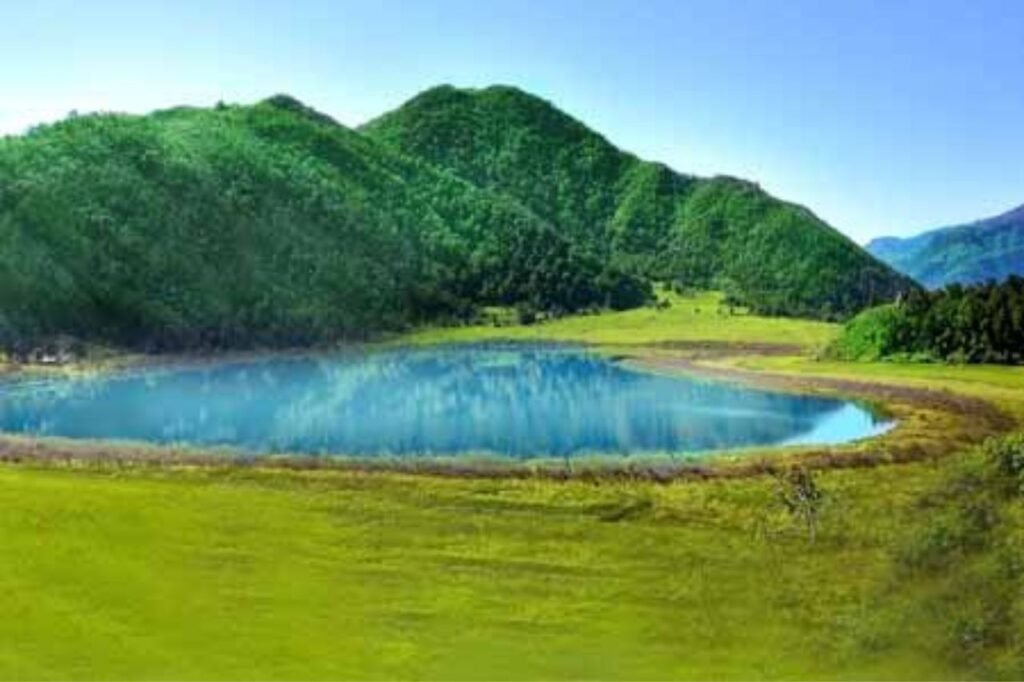
Mamit district, situated in the northeastern part of India, is one of the eleven administrative regions within the Mizoram state. It holds a significant place in Mizoram’s geography, culture, and governance. Nestled amidst the lush hills and valleys of the region, Mamit district is renowned for its natural beauty and cultural diversity. With its strategic location in the northeastern part of Mizoram, Mamit district plays a vital role in the state’s socio-economic development. It encompasses a rich tapestry of communities and traditions, contributing to the vibrant mosaic that is Mizoram. Explore Mamit’s unique blend of tradition and modernity within the captivating landscapes of this district.
History
The inaugural administrative office in Mamit, dating back to 1959, was the Project Office, established during the time when Mizoram was a constituent district under the Assam Government. By 1962, it had advanced to the status of a Community Development Block Office. The significant transformation occurred in 1978 when Mamit was designated as the Civil Sub-Division Headquarters. Nine years later, it ascended to the status of a Sub-Divisional Officer (Civil) Headquarters. Subsequently, on March 11, 1998, the Aizawl West District was officially formed, with its name subsequently revised to Mamit District, marking an important milestone in the region’s administrative evolution.
Demography
As per the 2011 census data, the Mamit district boasts a population of 86,364, a figure approximately equivalent to the entire nation of Andorra. This population count places Mamit district at the 618th position among the various districts in India, out of a total of 640 districts. The district also exhibits a population density of 29 individuals per square kilometer, or 75 people per square mile. These statistics offer valuable insights into the demographic landscape of Mamit, illustrating its relatively moderate population size and a population density that reflects its tranquil and less densely populated environment.
Geography
Mamit district is situated in the northeastern region of India and shares its borders with several neighboring areas. To the north, it is bordered by Assam’s Hailakandi district, while its western boundary extends to North Tripura district in Tripura state and Bangladesh. To the south, Mamit district is adjacent to Lunglei district, and to the east, it shares its borders with Kolasib and Aizawl districts. Covering an expanse of approximately 3025.75 square kilometers, Mamit district is a diverse and vibrant region. The administrative center of this district is the town of Mamit, serving as the hub for local governance and public services.
Economy
India has strategically established multiple Border Haats (markets) and Integrated Check Posts (ICPs) in Mizoram, aimed at enhancing border trade and strengthening Look-East connectivity. These initiatives play a pivotal role in facilitating trade and transportation along the Trans-Asian Railway and the Asian Highway Network, particularly via the vital AH1 route. Notably, within the Mamit district, Marpara and Tuipuibari serve as prominent ICPs along the India-Bangladesh border. These initiatives underscore India’s commitment to regional economic cooperation and fostering closer ties with its eastern neighbors while promoting seamless trade and connectivity in the region.