Meghalaya Pincodes
Enter the Pincode or Location Below in the Box
Pincodes of Meghalaya
The Meghalaya Pincode covers a number of districts and areas of the Indian state of Meghalaya, which is located in the northeast. These pincodes, which range from the capital city of Shillong to isolated villages tucked away in the scenic hills, sum up Meghalaya’s diverse geography. Meghalaya is a well-liked travel destination since each Pincode embodies a distinct fusion of beautiful landscapes, calm beauty, and tribal culture. Meghalaya’s pincodes unlock the door to an enchanted world of natural wonders and dynamic indigenous cultures, whether you’re exploring the living root bridges in Cherrapunji, touring sacred caverns, or immersing yourself in the Khasi and Garo traditions.
Here is a list of Meghalaya Pincodes
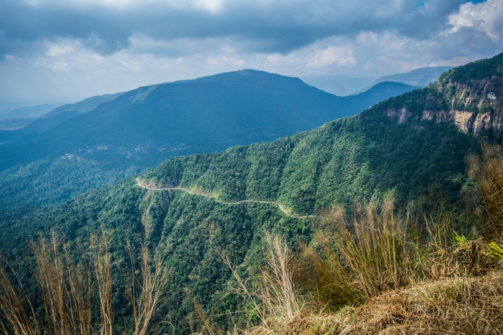
About Meghalaya
Northeast India contains the state of Meghalaya. The state of Assam was divided into two districts, the United Khasi Hills and Jaintia Hills and the Garo Hills, which became Meghalaya on January 21, 1972. As of 2014, the estimated population of Meghalaya was 3,211,474. Meghalaya’s area is roughly 22,429 square kilometers, and its length to width ratio is roughly 3:1.
History
A follower of Shah Jalal, Shah Arifin Rafiuddin moved to the Khasi and Jaintia Hills after Taraf was conquered in 1304, where he converted the locals to Islam by preaching monotheism. His mazar is located in Meghalaya on top of Laur Hill, while his khanqah is still in Sarping/Laurergarh, close to the Bangladeshi border.
Bhaitbari is an archaeological site that was originally found and excavated by A. K. Sharma in 1993. The city has been considered to have been one of Kamarupa’s capital towns. A fortification of burnt brick with mud core was discovered at the Meghalaya – Assam border and is dated to the 4th-8th century AD.
Geography
One of northeastern India’s Seven Sister States is Meghalaya. The hilly and geologically rich state of Meghalaya features valleys and highland plateaus. It is primarily made up of Archean rock formations. Valuable minerals like coal, limestone, uranium, and sillimanite are abundantly found in these rock formations. Shiba P. Chatterjee, a geography professor at Kolkata University, proposed the name Meghalaya.
Climate
Meghalaya is the wettest place on Earth with average annual rainfall reaching 12,000 mm (470 in) in some regions. The majority of the year is hot in the western portion of the plateau, which includes the lower-elevation Garo Hills region. With the highest elevations, the Shillong region typically has chilly temperatures. In this area, the highest temperature rarely rises over 28 °C (82 °F), while below-freezing winter temperatures are typical.
Demography
Out all the seven northeastern states, Meghalaya has the most decennial population growth (27.28%), according to the provisional 2011 census estimate. Meghalaya’s population was predicted to be 2,964,007 in 2011. Of that number, 1,492,668 were female and 1,471,339 were male. The state had a sex ratio of 986 females for every 1,000 males, which was much higher than the 940 national average, according to the 2011 India Census. In comparison, the rural sex ratio of 972 was lower than the urban sex ratio of 985.
Flora and fauna
Approximately 70% of the state is covered in forest, with dense primary subtropical forest covering 9,496 square kilometer (3,666 sq mi). One of Asia’s richest botanical environments is thought to be the Meghalayan forests. A wide range of floral and faunal species is supported by these forests, which get copious amounts of rainfall. There are “sacred groves” covering a little section of Meghalaya’s forest. Because of their religious and cultural convictions, the communities have been able to conserve these little areas of an old forest for hundreds of years.