Pincodes of Nagapattinam
Greetings and welcome to our Nagapattinam Pincodes directory, your reliable source for learning the postal index numbers (PIN codes) of numerous locations in the picturesque southern Tamil Nadu town of Nagapattinam. Famous for its picturesque beaches, ancient temples, and rich cultural legacy is Nagapattinam. PIN numbers are a crucial component of the postal system that guarantee timely mail and package delivery and sorting. Every area in Nagapattinam has a distinct PIN code, which enables postal services to precisely route and deliver mail to the correct recipients. To guarantee that your mail arrives at its destination on time, use the correct PIN code.
Here is a list of Nagapattinam Pincodes
| No. | Location | Pincode | District | State |
|---|---|---|---|---|
| 1 | A. kiliyanur | 609403 | Nagapattinam | Tamil Nadu |
| 2 | Achalpuram | 609101 | Nagapattinam | Tamil Nadu |
| 3 | Adalaiyur | 609701 | Nagapattinam | Tamil Nadu |
| 4 | Adhanur | 614707 | Nagapattinam | Tamil Nadu |
| 5 | Agara Kondagai | 609703 | Nagapattinam | Tamil Nadu |
| 6 | Agasthiampalli | 614810 | Nagapattinam | Tamil Nadu |
| 7 | Akkaraipettai | 611106 | Nagapattinam | Tamil Nadu |
| 8 | Akkur | 609301 | Nagapattinam | Tamil Nadu |
| 9 | Akkur Bazaar | 609301 | Nagapattinam | Tamil Nadu |
| 10 | Alakkudi | 609101 | Nagapattinam | Tamil Nadu |
| 11 | Alangudi | 609801 | Nagapattinam | Tamil Nadu |
| 12 | Alangudichery | 609703 | Nagapattinam | Tamil Nadu |
| 13 | Alathur | 609604 | Nagapattinam | Tamil Nadu |
| 14 | Alaveli | 609118 | Nagapattinam | Tamil Nadu |
| 15 | Aliyur | 611117 | Nagapattinam | Tamil Nadu |
| 16 | Ambal | 609503 | Nagapattinam | Tamil Nadu |
| 17 | Anaikaranchatram | 609102 | Nagapattinam | Tamil Nadu |
| 18 | Anaikaranchatram South | 609102 | Nagapattinam | Tamil Nadu |
| 19 | Anandatandavapuram | 609103 | Nagapattinam | Tamil Nadu |
| 20 | Andakudi | 610106 | Nagapattinam | Tamil Nadu |
| 21 | Andanapettai | 611102 | Nagapattinam | Tamil Nadu |
| 22 | Annamperumalkoil | 609109 | Nagapattinam | Tamil Nadu |
| 23 | Annapettai | 614714 | Nagapattinam | Tamil Nadu |
| 24 | Anniyur | 612201 | Nagapattinam | Tamil Nadu |
| 25 | Arangakudi | 609302 | Nagapattinam | Tamil Nadu |
| 26 | Arapallam | 609101 | Nagapattinam | Tamil Nadu |
| 27 | Arappakkam | 609111 | Nagapattinam | Tamil Nadu |
| 28 | Arkattuthurai | 614809 | Nagapattinam | Tamil Nadu |
| 29 | Arulmozhithevan | 609203 | Nagapattinam | Tamil Nadu |
| 30 | Arunthavampulam | 614711 | Nagapattinam | Tamil Nadu |
| 31 | Arupathy | 609309 | Nagapattinam | Tamil Nadu |
| 32 | Aruvapadi | 609203 | Nagapattinam | Tamil Nadu |
| 33 | Athipuliyur | 611105 | Nagapattinam | Tamil Nadu |
| 34 | Athukudi | 609117 | Nagapattinam | Tamil Nadu |
| 35 | Athur | 609204 | Nagapattinam | Tamil Nadu |
| 36 | Attikkadai | 613702 | Nagapattinam | Tamil Nadu |
| 37 | Avaranipuducherri | 611108 | Nagapattinam | Tamil Nadu |
| 38 | Avarikadu | 614806 | Nagapattinam | Tamil Nadu |
| 39 | Ayakaramvalam I sethi | 614707 | Nagapattinam | Tamil Nadu |
| 40 | Ayakarmvalam Iii sethi | 614707 | Nagapattinam | Tamil Nadu |
| 41 | Ayakkarambalam Ii sethi | 614707 | Nagapattinam | Tamil Nadu |
| 42 | Ayappadi | 609303 | Nagapattinam | Tamil Nadu |
| 43 | Aymazhai | 611102 | Nagapattinam | Tamil Nadu |
| 44 | Aymoor | 614711 | Nagapattinam | Tamil Nadu |
| 45 | Buthanur | 609312 | Nagapattinam | Tamil Nadu |
| 46 | Chandrapadi | 609307 | Nagapattinam | Tamil Nadu |
| 47 | Chettipulam | 614806 | Nagapattinam | Tamil Nadu |
| 48 | Chinnathumbur | 611102 | Nagapattinam | Tamil Nadu |
| 49 | Chittarkadu | 609003 | Nagapattinam | Tamil Nadu |
| 50 | Dharmapuram | 609001 | Nagapattinam | Tamil Nadu |
| 51 | Durgashariff | 611002 | Nagapattinam | Tamil Nadu |
| 52 | Edakiam | 609805 | Nagapattinam | Tamil Nadu |
| 53 | Edamanal | 609115 | Nagapattinam | Tamil Nadu |
| 54 | Eduthukatti | 609312 | Nagapattinam | Tamil Nadu |
| 55 | Elandangudi | 609401 | Nagapattinam | Tamil Nadu |
| 56 | Elathur | 609116 | Nagapattinam | Tamil Nadu |
| 57 | Elayalur | 609302 | Nagapattinam | Tamil Nadu |
| 58 | Enangudi | 609701 | Nagapattinam | Tamil Nadu |
| 59 | Eravancheri | 609501 | Nagapattinam | Tamil Nadu |
| 60 | Eravancherry | 611105 | Nagapattinam | Tamil Nadu |
| 61 | Erayangudi | 611109 | Nagapattinam | Tamil Nadu |
| 62 | Erukkattanchery | 609307 | Nagapattinam | Tamil Nadu |
| 63 | Erukkur | 609108 | Nagapattinam | Tamil Nadu |
| 64 | Ervadi | 609601 | Nagapattinam | Tamil Nadu |
| 65 | Ettukudi | 610212 | Nagapattinam | Tamil Nadu |
| 66 | Gangadarapuram | 609805 | Nagapattinam | Tamil Nadu |
| 67 | Gopalasamudram | 609108 | Nagapattinam | Tamil Nadu |
| 68 | Gopurajapuram | 609703 | Nagapattinam | Tamil Nadu |
| 69 | Hanumanthapuram | 609102 | Nagapattinam | Tamil Nadu |
| 70 | Idaikudi-vadapathy | 609117 | Nagapattinam | Tamil Nadu |
| 71 | Ilanthope | 609201 | Nagapattinam | Tamil Nadu |
| 72 | Iluppur | 609308 | Nagapattinam | Tamil Nadu |
| 73 | Kadavasal | 609104 | Nagapattinam | Tamil Nadu |
| 74 | Kadinavayal | 614707 | Nagapattinam | Tamil Nadu |
| 75 | Kakkalani | 611101 | Nagapattinam | Tamil Nadu |
| 76 | Kalamanallur | 609301 | Nagapattinam | Tamil Nadu |
| 77 | Kali | 609811 | Nagapattinam | Tamil Nadu |
| 78 | Kaliyappanallur | 609307 | Nagapattinam | Tamil Nadu |
| 79 | Kallimodu | 614809 | Nagapattinam | Tamil Nadu |
| 80 | Kalukkanimuttam | 609203 | Nagapattinam | Tamil Nadu |
| 81 | Kamakshipuram | 609809 | Nagapattinam | Tamil Nadu |
| 82 | Kameswaram | 611110 | Nagapattinam | Tamil Nadu |
| 83 | Kangalanchery | 610101 | Nagapattinam | Tamil Nadu |
| 84 | Kanganamputhur | 609203 | Nagapattinam | Tamil Nadu |
| 85 | Kanjanagaram | 609304 | Nagapattinam | Tamil Nadu |
| 86 | Kanjivoy | 612203 | Nagapattinam | Tamil Nadu |
| 87 | Kannukiniyanar Koil | 609104 | Nagapattinam | Tamil Nadu |
| 88 | Karaimedu | 609109 | Nagapattinam | Tamil Nadu |
| 89 | Karaiyur | 610101 | Nagapattinam | Tamil Nadu |
| 90 | Karapidagai | 611110 | Nagapattinam | Tamil Nadu |
| 91 | Kariyapattinam | 614806 | Nagapattinam | Tamil Nadu |
| 92 | Kariyapattinam R.s | 614806 | Nagapattinam | Tamil Nadu |
| 93 | Karkoil | 609112 | Nagapattinam | Tamil Nadu |
| 94 | Karunganni | 611103 | Nagapattinam | Tamil Nadu |
| 95 | Karuppanpulam | 614707 | Nagapattinam | Tamil Nadu |
| 96 | Karuvazhakarai | 609304 | Nagapattinam | Tamil Nadu |
| 97 | Katripulam | 614808 | Nagapattinam | Tamil Nadu |
| 98 | Kattiyaniruppu | 609109 | Nagapattinam | Tamil Nadu |
| 99 | Kattuchery | 609303 | Nagapattinam | Tamil Nadu |
| 100 | Kaveripattinam | 609105 | Nagapattinam | Tamil Nadu |
| 101 | Kaveripattinam Beach | 609105 | Nagapattinam | Tamil Nadu |
| 102 | Keelamaruthandanallur | 609103 | Nagapattinam | Tamil Nadu |
| 103 | Keeranallur | 609115 | Nagapattinam | Tamil Nadu |
| 104 | Kidarankondan | 609304 | Nagapattinam | Tamil Nadu |
| 105 | Kilaiyur | 609304 | Nagapattinam | Tamil Nadu |
| 106 | Kilaperumpallam | 609107 | Nagapattinam | Tamil Nadu |
| 107 | Kilasattanathapuram | 609106 | Nagapattinam | Tamil Nadu |
| 108 | Kilathanilaipadi | 611109 | Nagapattinam | Tamil Nadu |
| 109 | Kilathanjavur | 610101 | Nagapattinam | Tamil Nadu |
| 110 | Kiliyanur | 609402 | Nagapattinam | Tamil Nadu |
| 111 | Killukudi | 611109 | Nagapattinam | Tamil Nadu |
| 112 | Kilmathur | 609116 | Nagapattinam | Tamil Nadu |
| 113 | Kiloy | 609202 | Nagapattinam | Tamil Nadu |
| 114 | Kilvel R.s. | 611104 | Nagapattinam | Tamil Nadu |
| 115 | Kilvelur | 611104 | Nagapattinam | Tamil Nadu |
| 116 | Kilvelur Bazar | 611104 | Nagapattinam | Tamil Nadu |
| 117 | Kodakkaramoolai | 609101 | Nagapattinam | Tamil Nadu |
| 118 | Kodangudi | 609314 | Nagapattinam | Tamil Nadu |
| 119 | Kodiakadu | 614807 | Nagapattinam | Tamil Nadu |
| 120 | Kodiakkarai | 614807 | Nagapattinam | Tamil Nadu |
| 121 | Kodiyampalayam | 609101 | Nagapattinam | Tamil Nadu |
| 122 | Kohur | 611104 | Nagapattinam | Tamil Nadu |
| 123 | Koilkannapur | 610207 | Nagapattinam | Tamil Nadu |
| 124 | Koilpathu | 611112 | Nagapattinam | Tamil Nadu |
| 125 | Koilthirukolakkal | 609111 | Nagapattinam | Tamil Nadu |
| 126 | Kolapadu | 610207 | Nagapattinam | Tamil Nadu |
| 127 | Komal | 609805 | Nagapattinam | Tamil Nadu |
| 128 | Kondathur | 609117 | Nagapattinam | Tamil Nadu |
| 129 | Konerirajapuram | 612201 | Nagapattinam | Tamil Nadu |
| 130 | Koolaiyar | 609113 | Nagapattinam | Tamil Nadu |
| 131 | Koorathangudi | 610207 | Nagapattinam | Tamil Nadu |
| 132 | Koranad | 609001 | Nagapattinam | Tamil Nadu |
| 133 | Koranad South | 609003 | Nagapattinam | Tamil Nadu |
| 134 | Korukkai | 609203 | Nagapattinam | Tamil Nadu |
| 135 | Kothandapuram | 609101 | Nagapattinam | Tamil Nadu |
| 136 | Kottarakudi | 610101 | Nagapattinam | Tamil Nadu |
| 137 | Kovilpathu | 609111 | Nagapattinam | Tamil Nadu |
| 138 | Kozhaiyur | 609805 | Nagapattinam | Tamil Nadu |
| 139 | Kunnam | 609108 | Nagapattinam | Tamil Nadu |
| 140 | Kurukathi | 611105 | Nagapattinam | Tamil Nadu |
| 141 | Kuruvapulam | 614808 | Nagapattinam | Tamil Nadu |
| 142 | Kuthur | 611105 | Nagapattinam | Tamil Nadu |
| 143 | Kuttalam | 609801 | Nagapattinam | Tamil Nadu |
| 144 | Kuttalam East | 609801 | Nagapattinam | Tamil Nadu |
| 145 | Madanam | 609104 | Nagapattinam | Tamil Nadu |
| 146 | Madapuram | 611103 | Nagapattinam | Tamil Nadu |
| 147 | Madervelur | 609102 | Nagapattinam | Tamil Nadu |
| 148 | Madirimangalam | 609801 | Nagapattinam | Tamil Nadu |
| 149 | Mahendrapalli | 609101 | Nagapattinam | Tamil Nadu |
| 150 | Mallapuram | 612201 | Nagapattinam | Tamil Nadu |
| 151 | Malliyam | 609806 | Nagapattinam | Tamil Nadu |
| 152 | Mamakudi | 609301 | Nagapattinam | Tamil Nadu |
| 153 | Manakudi | 614712 | Nagapattinam | Tamil Nadu |
| 154 | Manalmedu | 609202 | Nagapattinam | Tamil Nadu |
| 155 | Manalmedu East | 609202 | Nagapattinam | Tamil Nadu |
| 156 | Mandai | 612203 | Nagapattinam | Tamil Nadu |
| 157 | Mangamadam | 609106 | Nagapattinam | Tamil Nadu |
| 158 | Manganallur | 609404 | Nagapattinam | Tamil Nadu |
| 159 | Manganallur Bazaar | 609404 | Nagapattinam | Tamil Nadu |
| 160 | Manickapangu | 609313 | Nagapattinam | Tamil Nadu |
| 161 | Manigramam | 609114 | Nagapattinam | Tamil Nadu |
| 162 | Manjakollai | 611106 | Nagapattinam | Tamil Nadu |
| 163 | Mannampandal | 609305 | Nagapattinam | Tamil Nadu |
| 164 | Mannipallam | 609112 | Nagapattinam | Tamil Nadu |
| 165 | Mappadugai | 609003 | Nagapattinam | Tamil Nadu |
| 166 | Maracheri | 614711 | Nagapattinam | Tamil Nadu |
| 167 | Maraignanallur | 614810 | Nagapattinam | Tamil Nadu |
| 168 | Maraiyur | 609806 | Nagapattinam | Tamil Nadu |
| 169 | Marathurai | 609204 | Nagapattinam | Tamil Nadu |
| 170 | Marudur Therkusethi | 614714 | Nagapattinam | Tamil Nadu |
| 171 | Marudur Vadakku sethi | 614714 | Nagapattinam | Tamil Nadu |
| 172 | Marungur | 609702 | Nagapattinam | Tamil Nadu |
| 173 | Maruthampallam | 609301 | Nagapattinam | Tamil Nadu |
| 174 | Mathur | 609301 | Nagapattinam | Tamil Nadu |
| 175 | Mayiladuthurai | 609001 | Nagapattinam | Tamil Nadu |
| 176 | Mayiladuthurai Bazaar | 609001 | Nagapattinam | Tamil Nadu |
| 177 | Mayiladuthurai Cutchery | 609001 | Nagapattinam | Tamil Nadu |
| 178 | Mayiladuthurai North | 609001 | Nagapattinam | Tamil Nadu |
| 179 | Mayiladuthurai R.s | 609003 | Nagapattinam | Tamil Nadu |
| 180 | Mayiladuthurai South | 609001 | Nagapattinam | Tamil Nadu |
| 181 | Mayiladuthurai West | 609003 | Nagapattinam | Tamil Nadu |
| 182 | Melaiyur Tvg | 609107 | Nagapattinam | Tamil Nadu |
| 183 | Melakottaivasal | 611001 | Nagapattinam | Tamil Nadu |
| 184 | Melapathi | 609304 | Nagapattinam | Tamil Nadu |
| 185 | Melaperumpallam | 609107 | Nagapattinam | Tamil Nadu |
| 186 | Melavanjore | 611002 | Nagapattinam | Tamil Nadu |
| 187 | Melavazhakarai | 610204 | Nagapattinam | Tamil Nadu |
| 188 | Memathur | 609309 | Nagapattinam | Tamil Nadu |
| 189 | Mohanur | 611109 | Nagapattinam | Tamil Nadu |
| 190 | Molaiyur | 609118 | Nagapattinam | Tamil Nadu |
| 191 | Moovalur | 609806 | Nagapattinam | Tamil Nadu |
| 192 | Mudikondanallur | 609309 | Nagapattinam | Tamil Nadu |
| 193 | Mutharasapuram | 610201 | Nagapattinam | Tamil Nadu |
| 194 | Muthur | 609302 | Nagapattinam | Tamil Nadu |
| 195 | Muttam | 611002 | Nagapattinam | Tamil Nadu |
| 196 | Nagakudaiyan | 614808 | Nagapattinam | Tamil Nadu |
| 197 | Nagapattinam | 611001 | Nagapattinam | Tamil Nadu |
| 198 | Nagapattinam Bazaar | 611001 | Nagapattinam | Tamil Nadu |
| 199 | Nagapattinam Collectorate | 611003 | Nagapattinam | Tamil Nadu |
| 200 | Nagore | 611002 | Nagapattinam | Tamil Nadu |
| 201 | Nagore South | 611002 | Nagapattinam | Tamil Nadu |
| 202 | Nakkampadi | 612203 | Nagapattinam | Tamil Nadu |
| 203 | Nalladai | 609306 | Nagapattinam | Tamil Nadu |
| 204 | Nallanayagapuram | 609102 | Nagapattinam | Tamil Nadu |
| 205 | Nallathukudi | 609001 | Nagapattinam | Tamil Nadu |
| 206 | Nalluchery | 609309 | Nagapattinam | Tamil Nadu |
| 207 | Naluvedapathy | 611112 | Nagapattinam | Tamil Nadu |
| 208 | Namasivayapuram | 609811 | Nagapattinam | Tamil Nadu |
| 209 | Nangur | 609106 | Nagapattinam | Tamil Nadu |
| 210 | Narasinganpettai | 609802 | Nagapattinam | Tamil Nadu |
| 211 | Narimanam | 611002 | Nagapattinam | Tamil Nadu |
| 212 | Natarajapillai Chavadi | 609109 | Nagapattinam | Tamil Nadu |
| 213 | Nathapallam | 614711 | Nagapattinam | Tamil Nadu |
| 214 | Neermulai | 614711 | Nagapattinam | Tamil Nadu |
| 215 | Neidavasal | 609105 | Nagapattinam | Tamil Nadu |
| 216 | Neipathur | 609106 | Nagapattinam | Tamil Nadu |
| 217 | Neivilakku | 614808 | Nagapattinam | Tamil Nadu |
| 218 | Nemmeli(srk) | 609116 | Nagapattinam | Tamil Nadu |
| 219 | Nidur | 609203 | Nagapattinam | Tamil Nadu |
| 220 | Nirthanamangalam | 611118 | Nagapattinam | Tamil Nadu |
| 221 | Okkur | 611002 | Nagapattinam | Tamil Nadu |
| 222 | Orathur | 611108 | Nagapattinam | Tamil Nadu |
| 223 | P.Kondagai | 609703 | Nagapattinam | Tamil Nadu |
| 224 | Pachaiperumal Nallur | 609104 | Nagapattinam | Tamil Nadu |
| 225 | Pagasalai | 609117 | Nagapattinam | Tamil Nadu |
| 226 | Pakkamkottur | 609701 | Nagapattinam | Tamil Nadu |
| 227 | Palaiyur | 611106 | Nagapattinam | Tamil Nadu |
| 228 | Palakurichi | 611109 | Nagapattinam | Tamil Nadu |
| 229 | Palayagudalur | 609801 | Nagapattinam | Tamil Nadu |
| 230 | Palayapalayam | 609101 | Nagapattinam | Tamil Nadu |
| 231 | Palayar | 609101 | Nagapattinam | Tamil Nadu |
| 232 | Palpannaichery | 611003 | Nagapattinam | Tamil Nadu |
| 233 | Panangudi | 611002 | Nagapattinam | Tamil Nadu |
| 234 | Panayadikuthagai | 614808 | Nagapattinam | Tamil Nadu |
| 235 | Panchanathikulam | 614714 | Nagapattinam | Tamil Nadu |
| 236 | Panchanathikulam East | 614714 | Nagapattinam | Tamil Nadu |
| 237 | Panchanathikulam Nadu sethi | 614714 | Nagapattinam | Tamil Nadu |
| 238 | Pandanallur | 609807 | Nagapattinam | Tamil Nadu |
| 239 | Pandur | 609203 | Nagapattinam | Tamil Nadu |
| 240 | Pannal | 614707 | Nagapattinam | Tamil Nadu |
| 241 | Parasalur | 609309 | Nagapattinam | Tamil Nadu |
| 242 | Paravakkarai | 612201 | Nagapattinam | Tamil Nadu |
| 243 | Pattamangalam | 609001 | Nagapattinam | Tamil Nadu |
| 244 | Pattavilagam | 609116 | Nagapattinam | Tamil Nadu |
| 245 | Perambur | 609406 | Nagapattinam | Tamil Nadu |
| 246 | Perambur (akc) | 609108 | Nagapattinam | Tamil Nadu |
| 247 | Periyakuthagai | 614809 | Nagapattinam | Tamil Nadu |
| 248 | Peruncheri | 609404 | Nagapattinam | Tamil Nadu |
| 249 | Perunkadambanur | 611108 | Nagapattinam | Tamil Nadu |
| 250 | Perunthottam | 609106 | Nagapattinam | Tamil Nadu |
| 251 | Pillali | 609704 | Nagapattinam | Tamil Nadu |
| 252 | Pirandiyankarai | 614806 | Nagapattinam | Tamil Nadu |
| 253 | Pirinjimoolai | 614712 | Nagapattinam | Tamil Nadu |
| 254 | Polagam | 609702 | Nagapattinam | Tamil Nadu |
| 255 | Poravachery | 611108 | Nagapattinam | Tamil Nadu |
| 256 | Porayar | 609307 | Nagapattinam | Tamil Nadu |
| 257 | Porayar Market | 609307 | Nagapattinam | Tamil Nadu |
| 258 | Porayar R.s. | 609307 | Nagapattinam | Tamil Nadu |
| 259 | Pragramam | 609703 | Nagapattinam | Tamil Nadu |
| 260 | Prathabaramapuram | 611111 | Nagapattinam | Tamil Nadu |
| 261 | Pudupalli | 611112 | Nagapattinam | Tamil Nadu |
| 262 | Pudupattinam | 609101 | Nagapattinam | Tamil Nadu |
| 263 | Puduthurai | 609106 | Nagapattinam | Tamil Nadu |
| 264 | Pulavanur | 609205 | Nagapattinam | Tamil Nadu |
| 265 | Puliyanthurai | 609101 | Nagapattinam | Tamil Nadu |
| 266 | Puliyur | 611108 | Nagapattinam | Tamil Nadu |
| 267 | Punganur | 609117 | Nagapattinam | Tamil Nadu |
| 268 | Pushpavanam | 614809 | Nagapattinam | Tamil Nadu |
| 269 | Puthur (srk) | 609108 | Nagapattinam | Tamil Nadu |
| 270 | Radhamangalam | 611109 | Nagapattinam | Tamil Nadu |
| 271 | Radhanallur (srk) | 609115 | Nagapattinam | Tamil Nadu |
| 272 | Radhanallur (srk) | 609115 | Nagapattinam | Tamil Nadu |
| 273 | Radhanallur (tvg) | 609114 | Nagapattinam | Tamil Nadu |
| 274 | Rajapuram | 614806 | Nagapattinam | Tamil Nadu |
| 275 | Sankaranpandal | 609308 | Nagapattinam | Tamil Nadu |
| 276 | Sannanallur | 609504 | Nagapattinam | Tamil Nadu |
| 277 | Sattanathapuram | 609109 | Nagapattinam | Tamil Nadu |
| 278 | Seeyathamangai | 609702 | Nagapattinam | Tamil Nadu |
| 279 | Seithur Srk | 609112 | Nagapattinam | Tamil Nadu |
| 280 | Sembadaniruppu | 609109 | Nagapattinam | Tamil Nadu |
| 281 | Sembanarkoil | 609309 | Nagapattinam | Tamil Nadu |
| 282 | Sembanarkoil East | 609309 | Nagapattinam | Tamil Nadu |
| 283 | Sembianmahadevi | 611109 | Nagapattinam | Tamil Nadu |
| 284 | Sembodai | 614820 | Nagapattinam | Tamil Nadu |
| 285 | Semmangudi(srk) | 609104 | Nagapattinam | Tamil Nadu |
| 286 | Senbagarayanallur | 614806 | Nagapattinam | Tamil Nadu |
| 287 | Sendamangalam | 609310 | Nagapattinam | Tamil Nadu |
| 288 | Sengamangalam | 611108 | Nagapattinam | Tamil Nadu |
| 289 | Serudur | 611111 | Nagapattinam | Tamil Nadu |
| 290 | Serunallur | 611105 | Nagapattinam | Tamil Nadu |
| 291 | Seshamoolai | 609702 | Nagapattinam | Tamil Nadu |
| 292 | Sholampettai | 609003 | Nagapattinam | Tamil Nadu |
| 293 | Siddamalli | 609205 | Nagapattinam | Tamil Nadu |
| 294 | Sigar | 610106 | Nagapattinam | Tamil Nadu |
| 295 | Sikkal | 611108 | Nagapattinam | Tamil Nadu |
| 296 | Sirkali | 609110 | Nagapattinam | Tamil Nadu |
| 297 | Sirkali East | 609111 | Nagapattinam | Tamil Nadu |
| 298 | Sirkali Thenpathi | 609111 | Nagapattinam | Tamil Nadu |
| 299 | Sirkali West | 609111 | Nagapattinam | Tamil Nadu |
| 300 | Sithaimur | 610203 | Nagapattinam | Tamil Nadu |
| 301 | Sodiyakudi | 609108 | Nagapattinam | Tamil Nadu |
| 302 | Solasakkaranallur | 609118 | Nagapattinam | Tamil Nadu |
| 303 | Solavidyapuram | 611103 | Nagapattinam | Tamil Nadu |
| 304 | Suraikkayur | 612203 | Nagapattinam | Tamil Nadu |
| 305 | Suramangalam | 610201 | Nagapattinam | Tamil Nadu |
| 306 | Takattur | 614714 | Nagapattinam | Tamil Nadu |
| 307 | Talachangadu | 609107 | Nagapattinam | Tamil Nadu |
| 308 | Talanayar Agraharam | 614712 | Nagapattinam | Tamil Nadu |
| 309 | Talanayar Iii sethi | 614712 | Nagapattinam | Tamil Nadu |
| 310 | Talanayar Vsk | 609201 | Nagapattinam | Tamil Nadu |
| 311 | Talanayat Iv sethi | 614712 | Nagapattinam | Tamil Nadu |
| 312 | Tarangambadi | 609313 | Nagapattinam | Tamil Nadu |
| 313 | Terizhandur | 609808 | Nagapattinam | Tamil Nadu |
| 314 | Terkupanaiyur | 610207 | Nagapattinam | Tamil Nadu |
| 315 | Terkupoigainallur | 611111 | Nagapattinam | Tamil Nadu |
| 316 | Thalaikadu | 614711 | Nagapattinam | Tamil Nadu |
| 317 | Thandavankulam | 609101 | Nagapattinam | Tamil Nadu |
| 318 | Thanikottagam | 614716 | Nagapattinam | Tamil Nadu |
| 319 | Thennampattinam | 609106 | Nagapattinam | Tamil Nadu |
| 320 | Thennampulam | 614806 | Nagapattinam | Tamil Nadu |
| 321 | Thethakudi Therkusethi | 614809 | Nagapattinam | Tamil Nadu |
| 322 | Thethakudivadakkusethi | 614809 | Nagapattinam | Tamil Nadu |
| 323 | Thevur | 611109 | Nagapattinam | Tamil Nadu |
| 324 | Thuhili | 609804 | Nagapattinam | Tamil Nadu |
| 325 | Thulajapattinam | 614714 | Nagapattinam | Tamil Nadu |
| 326 | Thulasapuram | 614711 | Nagapattinam | Tamil Nadu |
| 327 | Tillaiyadi | 609310 | Nagapattinam | Tamil Nadu |
| 328 | Tirucadaiyur | 609311 | Nagapattinam | Tamil Nadu |
| 329 | Tiruchempalli | 609309 | Nagapattinam | Tamil Nadu |
| 330 | Tiruchenkattangudi | 609704 | Nagapattinam | Tamil Nadu |
| 331 | Tiruchitrambalam | 609204 | Nagapattinam | Tamil Nadu |
| 332 | Tirukannangudi | 611104 | Nagapattinam | Tamil Nadu |
| 333 | Tirukannapuram | 609704 | Nagapattinam | Tamil Nadu |
| 334 | Tirukkalachery | 609312 | Nagapattinam | Tamil Nadu |
| 335 | Tirukuvalai | 610204 | Nagapattinam | Tamil Nadu |
| 336 | Tirumailadi | 609108 | Nagapattinam | Tamil Nadu |
| 337 | Tirumananjeri | 609801 | Nagapattinam | Tamil Nadu |
| 338 | Tirumangalakudi | 612102 | Nagapattinam | Tamil Nadu |
| 339 | Tirumangalam | 609811 | Nagapattinam | Tamil Nadu |
| 340 | Tirumarugal | 609702 | Nagapattinam | Tamil Nadu |
| 341 | Tirumeignanam | 609311 | Nagapattinam | Tamil Nadu |
| 342 | Tirumeniarkoil | 609204 | Nagapattinam | Tamil Nadu |
| 343 | Tirumullaivasal | 609113 | Nagapattinam | Tamil Nadu |
| 344 | Tirunagari | 609106 | Nagapattinam | Tamil Nadu |
| 345 | Tirunandriyur | 609118 | Nagapattinam | Tamil Nadu |
| 346 | Tirupayathangudi | 610101 | Nagapattinam | Tamil Nadu |
| 347 | Tirupugalur | 609704 | Nagapattinam | Tamil Nadu |
| 348 | Tirupundi | 611110 | Nagapattinam | Tamil Nadu |
| 349 | Tirupundi South | 611110 | Nagapattinam | Tamil Nadu |
| 350 | Tirupungur | 609112 | Nagapattinam | Tamil Nadu |
| 351 | Tiruvaimoor | 610204 | Nagapattinam | Tamil Nadu |
| 352 | Tiruvalangadu | 609810 | Nagapattinam | Tamil Nadu |
| 353 | Tiruvalaputhur | 609205 | Nagapattinam | Tamil Nadu |
| 354 | Tiruvali | 609109 | Nagapattinam | Tamil Nadu |
| 355 | Tiruvavaduthurai | 609803 | Nagapattinam | Tamil Nadu |
| 356 | Tiruvengadu | 609114 | Nagapattinam | Tamil Nadu |
| 357 | Tiruvidaikali | 609310 | Nagapattinam | Tamil Nadu |
| 358 | Tiruvidavasal | 613702 | Nagapattinam | Tamil Nadu |
| 359 | Tiruvilandur | 609001 | Nagapattinam | Tamil Nadu |
| 360 | Tiruvilayattam | 609306 | Nagapattinam | Tamil Nadu |
| 361 | Tiruvizhimazhalai | 609505 | Nagapattinam | Tamil Nadu |
| 362 | Tittachery | 609703 | Nagapattinam | Tamil Nadu |
| 363 | Tittai (srk) | 609111 | Nagapattinam | Tamil Nadu |
| 364 | Topputhurai | 614809 | Nagapattinam | Tamil Nadu |
| 365 | Umayalpathi | 609104 | Nagapattinam | Tamil Nadu |
| 366 | Umayalpuram | 609301 | Nagapattinam | Tamil Nadu |
| 367 | Umbalacheri | 614711 | Nagapattinam | Tamil Nadu |
| 368 | Uvoimedu | 614714 | Nagapattinam | Tamil Nadu |
| 369 | Vadagarai | 609701 | Nagapattinam | Tamil Nadu |
| 370 | Vadakarai | 609314 | Nagapattinam | Tamil Nadu |
| 371 | Vadakkupoigainallur | 611106 | Nagapattinam | Tamil Nadu |
| 372 | Vadamalaimanakadu | 614716 | Nagapattinam | Tamil Nadu |
| 373 | Vadamattam | 612201 | Nagapattinam | Tamil Nadu |
| 374 | Vadugachery | 611109 | Nagapattinam | Tamil Nadu |
| 375 | Vadugur | 614712 | Nagapattinam | Tamil Nadu |
| 376 | Vailankanni | 611111 | Nagapattinam | Tamil Nadu |
| 377 | Vailankanni West | 611111 | Nagapattinam | Tamil Nadu |
| 378 | Vaithiswarankoil | 609117 | Nagapattinam | Tamil Nadu |
| 379 | Vaithiswarankoil West | 609117 | Nagapattinam | Tamil Nadu |
| 380 | Valivalam | 610207 | Nagapattinam | Tamil Nadu |
| 381 | Valluvakudi | 609116 | Nagapattinam | Tamil Nadu |
| 382 | Valuvur | 609401 | Nagapattinam | Tamil Nadu |
| 383 | Vanagiri | 609105 | Nagapattinam | Tamil Nadu |
| 384 | Vanathirajapuram | 609806 | Nagapattinam | Tamil Nadu |
| 385 | Vanduvancheri | 614714 | Nagapattinam | Tamil Nadu |
| 386 | Varisapathu Vadagal | 609115 | Nagapattinam | Tamil Nadu |
| 387 | Vayalur | 612201 | Nagapattinam | Tamil Nadu |
| 388 | Vedaraniam | 614810 | Nagapattinam | Tamil Nadu |
| 389 | Velampudukudi | 609306 | Nagapattinam | Tamil Nadu |
| 390 | Velippalayam | 611001 | Nagapattinam | Tamil Nadu |
| 391 | Vellapallam | 611112 | Nagapattinam | Tamil Nadu |
| 392 | Venmanachery | 611103 | Nagapattinam | Tamil Nadu |
| 393 | Vettaikaraniruppu | 611112 | Nagapattinam | Tamil Nadu |
| 394 | Vettangudi | 609115 | Nagapattinam | Tamil Nadu |
| 395 | Vilanthida Samudram | 609111 | Nagapattinam | Tamil Nadu |
| 396 | Villiyanallur | 609203 | Nagapattinam | Tamil Nadu |
| 397 | Vilundamavadi | 611112 | Nagapattinam | Tamil Nadu |
| 398 | Virkudi | 610101 | Nagapattinam | Tamil Nadu |
| 399 | Vishnupuram | 609506 | Nagapattinam | Tamil Nadu |
About Nagapattinam
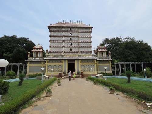
In the Indian state of Tamil Nadu, the town of Nagapattinam serves as the district’s administrative center. During the Chola era (9th–12th century CE), the town gained significance as a major harbor for eastward-facing naval operations and commerce. An significant Buddhist building at the time was the Chudamani Vihara in Nagapattinam, built by the Srivijayan king Sri Mara Vijayattungavarman of the Sailendra dynasty with assistance from Rajaraja Chola I.
History
There are Sangam era urn burials in and around the city, suggesting a certain degree of human occupation. The nearby port of Kaveripoompattinam, or present-day Poompuhar, served as the capital of the Chola monarchy during the Sangam Period and is commonly mentioned in Tamil scriptures like Paṭṭiṉappālai. The Brahmanda Purana mentions the Soundarajaperumal temple under the Utharkanda Gyana Yoga chapter. The temple is highly esteemed by Alvars in Nalayira Divya Prabandham, the Vaishnava canon from the fifth to the ninth century CE.
Geography
Positioned at 10.77°N 79.83°E is Nagapattinam. The town is bordered to the east by the Bay of Bengal, to the south by the Uppanar River, to the west by the Thiruvarur district, to the north west by the Thanjavur district, and to the north by Karaikkal and Puducherry. The town is situated below sea level. The municipality has a 14.92 sq km (5.76 sq mi) area. Thiruvarur is 25 km (16 mi) away, Mayiladuthurai is 8 km (8.7 mi) away, Kumbakonam is 40 km (25 mi) away, Thanjavur is 80 km (50 mi) away, and Nagapattinam is 350 km (220 mi) from Chennai.
Climate
Because of the northeast monsoon, Nagapattinam experiences a rainy season from August to December. The region has a tropical savanna climate. Rainfall in the city amounts to 1,350 millimeters, or 53 inches, per year. The year-round high humidity brought on by being close to the seaside exceeds 70% in August through May.
Demography
The 2011 census found that Nagapattinam had a population of 102,905 with a sex ratio of 1,026 females for every 1,000 males, which was much higher than the 929 national average. There were 11,884 children under the age of six in all, 5,795 girls and 6,089 boys. Scheduled Tribes made up 0.62% and 8.67% of the population, respectively, of Scheduled Castes. In comparison to the national average of 72.99%, the town’s average literacy rate was 78.74%. There were 24688 homes in the town.
Economy
Fishing in the Bay of Bengal is the primary industry of Nagapattinam. The fish are offered for sale at the town’s weekly and daily fish markets. There are a lot of ice factories to keep the seafood fresh. Following the December 26, 2004, tsunami that hit the coast, the industry experienced a setback. Though there isn’t much farming, the town does a lot of agricultural business. Most of the population works in the tertiary sector, which includes the services industry.
Transport
The Nagapattinam municipality has 104.539 km (64.958 mi) of roads total: 3.018 km (1.875 mi) of earthen roads, 27.328 km (16.981 mi) of cement roads, 72.993 km (45.356 mi) of bituminous roads, and 1.2 km (0.75 mi) of WBM roads. Two national highways connect Nagapattinam to Villupuram (NH 45A) and Coimbatore and Gundlupete (NH 67) in the state of Karnataka. About 175 buses a day are operated by the Tamil Nadu State Transport Corporation to connect different places with Nagapattinam. Additionally, it runs 25 town buses to meet Nagapattinam’s and the surrounding villages’ local transportation needs.