Pincodes of Pauri Garhwal
Garhwal Pincodes: Discover the postal charm of Pauri Garhwal! Our website, “Pincodes of My Location,” brings you a comprehensive list of Pauri Garhwal pincodes. Nestled in the lap of the Himalayas, Pauri Garhwal is known for its natural beauty and cultural richness. With our user-friendly interface, finding precise postal codes for this enchanting region is a breeze. Whether you’re a local resident or a traveler exploring this pristine land, our website ensures you have easy access to all the necessary postal information. Explore the breathtaking landscapes and vibrant communities of Pauri Garhwal with confidence, knowing you have the right pincodes at your fingertips!
Here is a list of Pauri Garhwal Pincodes
| No. | Location | Pincode | District | State |
|---|---|---|---|---|
| 1 | Adhariyakhal | 246188 | Pauri Garhwal | Uttarakhand |
| 2 | Adhora Walla | 246277 | Pauri Garhwal | Uttarakhand |
| 3 | Adwani | 246146 | Pauri Garhwal | Uttarakhand |
| 4 | Agrora | 246176 | Pauri Garhwal | Uttarakhand |
| 5 | Ainthi | 246285 | Pauri Garhwal | Uttarakhand |
| 6 | Amola | 246173 | Pauri Garhwal | Uttarakhand |
| 7 | Amotha | 246167 | Pauri Garhwal | Uttarakhand |
| 8 | Amsaur | 246149 | Pauri Garhwal | Uttarakhand |
| 9 | Andrauli | 246277 | Pauri Garhwal | Uttarakhand |
| 10 | Anganisain | 246155 | Pauri Garhwal | Uttarakhand |
| 11 | Apola | 246277 | Pauri Garhwal | Uttarakhand |
| 12 | Asankhet | 246155 | Pauri Garhwal | Uttarakhand |
| 13 | Ason | 246277 | Pauri Garhwal | Uttarakhand |
| 14 | B.E.l. | 246149 | Pauri Garhwal | Uttarakhand |
| 15 | Bachali | 246131 | Pauri Garhwal | Uttarakhand |
| 16 | Badiyargaon | 246170 | Pauri Garhwal | Uttarakhand |
| 17 | Badun | 246121 | Pauri Garhwal | Uttarakhand |
| 18 | Bageli | 246130 | Pauri Garhwal | Uttarakhand |
| 19 | Bagodgaon | 246121 | Pauri Garhwal | Uttarakhand |
| 20 | Bagrigar | 246169 | Pauri Garhwal | Uttarakhand |
| 21 | Bagwari | 246285 | Pauri Garhwal | Uttarakhand |
| 22 | Bagyali | 246167 | Pauri Garhwal | Uttarakhand |
| 23 | Baherakhal | 246146 | Pauri Garhwal | Uttarakhand |
| 24 | Baijrao (a) | 246275 | Pauri Garhwal | Uttarakhand |
| 25 | Bairhat Palla | 246161 | Pauri Garhwal | Uttarakhand |
| 26 | Bajwar | 246123 | Pauri Garhwal | Uttarakhand |
| 27 | Balasaur | 246149 | Pauri Garhwal | Uttarakhand |
| 28 | Balli | 246144 | Pauri Garhwal | Uttarakhand |
| 29 | Bamoli | 246128 | Pauri Garhwal | Uttarakhand |
| 30 | Banani | 246130 | Pauri Garhwal | Uttarakhand |
| 31 | Banchauri | 246121 | Pauri Garhwal | Uttarakhand |
| 32 | Bandar | 246162 | Pauri Garhwal | Uttarakhand |
| 33 | Bandun | 246129 | Pauri Garhwal | Uttarakhand |
| 34 | Bangali | 246130 | Pauri Garhwal | Uttarakhand |
| 35 | Bangaon Malla | 246159 | Pauri Garhwal | Uttarakhand |
| 36 | Bangar | 246278 | Pauri Garhwal | Uttarakhand |
| 37 | Banghat | 246172 | Pauri Garhwal | Uttarakhand |
| 38 | Bansi | 246155 | Pauri Garhwal | Uttarakhand |
| 39 | Bara | 246276 | Pauri Garhwal | Uttarakhand |
| 40 | Bareth | 246130 | Pauri Garhwal | Uttarakhand |
| 41 | Bariyun | 246172 | Pauri Garhwal | Uttarakhand |
| 42 | Barkholu | 246172 | Pauri Garhwal | Uttarakhand |
| 43 | Barkot | 246175 | Pauri Garhwal | Uttarakhand |
| 44 | Barsu | 246167 | Pauri Garhwal | Uttarakhand |
| 45 | Basola | 246275 | Pauri Garhwal | Uttarakhand |
| 46 | Baundar Khutinga | 246276 | Pauri Garhwal | Uttarakhand |
| 47 | Baunsal Talla | 246167 | Pauri Garhwal | Uttarakhand |
| 48 | Bawansi | 246144 | Pauri Garhwal | Uttarakhand |
| 49 | Bedgaon | 246113 | Pauri Garhwal | Uttarakhand |
| 50 | Bhainswara Ghandiyal | 246001 | Pauri Garhwal | Uttarakhand |
| 51 | Bhamraikhal | 246276 | Pauri Garhwal | Uttarakhand |
| 52 | Bhandalu | 246146 | Pauri Garhwal | Uttarakhand |
| 53 | Bharnao | 246275 | Pauri Garhwal | Uttarakhand |
| 54 | Bharsar | 246123 | Pauri Garhwal | Uttarakhand |
| 55 | Bhatwari | 246276 | Pauri Garhwal | Uttarakhand |
| 56 | Bhaun | 246277 | Pauri Garhwal | Uttarakhand |
| 57 | Bhaunda | 246285 | Pauri Garhwal | Uttarakhand |
| 58 | Bhimli Talli | 246166 | Pauri Garhwal | Uttarakhand |
| 59 | Bhrigukhal (a) | 246121 | Pauri Garhwal | Uttarakhand |
| 60 | Bhundkhal | 246161 | Pauri Garhwal | Uttarakhand |
| 61 | Bidoli | 246164 | Pauri Garhwal | Uttarakhand |
| 62 | Bilkot | 246161 | Pauri Garhwal | Uttarakhand |
| 63 | Binak | 246121 | Pauri Garhwal | Uttarakhand |
| 64 | Birmoli | 246144 | Pauri Garhwal | Uttarakhand |
| 65 | Bironkhal (a) | 246276 | Pauri Garhwal | Uttarakhand |
| 66 | Bishald | 246164 | Pauri Garhwal | Uttarakhand |
| 67 | Biyasi | 246161 | Pauri Garhwal | Uttarakhand |
| 68 | Bubakhal | 246001 | Pauri Garhwal | Uttarakhand |
| 69 | Budhakot | 246275 | Pauri Garhwal | Uttarakhand |
| 70 | Bughani | 246185 | Pauri Garhwal | Uttarakhand |
| 71 | Bunga Talla | 246170 | Pauri Garhwal | Uttarakhand |
| 72 | Bungidhar | 246285 | Pauri Garhwal | Uttarakhand |
| 73 | Buransi | 246148 | Pauri Garhwal | Uttarakhand |
| 74 | Bus Station pauri | 246001 | Pauri Garhwal | Uttarakhand |
| 75 | Chair Malla | 246164 | Pauri Garhwal | Uttarakhand |
| 76 | Chair Manjkhola | 246170 | Pauri Garhwal | Uttarakhand |
| 77 | Chakisain (b) | 246130 | Pauri Garhwal | Uttarakhand |
| 78 | Chamara | 246161 | Pauri Garhwal | Uttarakhand |
| 79 | Chamethakhal | 246155 | Pauri Garhwal | Uttarakhand |
| 80 | Chamkotkhal | 246121 | Pauri Garhwal | Uttarakhand |
| 81 | Chamnao | 246162 | Pauri Garhwal | Uttarakhand |
| 82 | Champeshwar | 246164 | Pauri Garhwal | Uttarakhand |
| 83 | Chamrara | 246147 | Pauri Garhwal | Uttarakhand |
| 84 | Chamsain | 246161 | Pauri Garhwal | Uttarakhand |
| 85 | Chandolarain | 246001 | Pauri Garhwal | Uttarakhand |
| 86 | Chandoli Malli | 246276 | Pauri Garhwal | Uttarakhand |
| 87 | Chaproli | 246123 | Pauri Garhwal | Uttarakhand |
| 88 | Chardhar | 246001 | Pauri Garhwal | Uttarakhand |
| 89 | Chaukhal | 246275 | Pauri Garhwal | Uttarakhand |
| 90 | Chaukuri | 246170 | Pauri Garhwal | Uttarakhand |
| 91 | Chaunra | 246130 | Pauri Garhwal | Uttarakhand |
| 92 | Chaurakhal | 246176 | Pauri Garhwal | Uttarakhand |
| 93 | Chaurikh | 246123 | Pauri Garhwal | Uttarakhand |
| 94 | Chelusain | 246122 | Pauri Garhwal | Uttarakhand |
| 95 | Chila Colony | 249306 | Pauri Garhwal | Uttarakhand |
| 96 | Chipalghat (a) | 246123 | Pauri Garhwal | Uttarakhand |
| 97 | Chopra Mission | 246001 | Pauri Garhwal | Uttarakhand |
| 98 | Chopriun | 246001 | Pauri Garhwal | Uttarakhand |
| 99 | Chora Bali kandarsyun | 246123 | Pauri Garhwal | Uttarakhand |
| 100 | Chorkinda Talla | 246177 | Pauri Garhwal | Uttarakhand |
| 101 | Chundai | 246155 | Pauri Garhwal | Uttarakhand |
| 102 | Churani | 246170 | Pauri Garhwal | Uttarakhand |
| 103 | Dabolikhal | 246144 | Pauri Garhwal | Uttarakhand |
| 104 | Dabri | 246189 | Pauri Garhwal | Uttarakhand |
| 105 | Dadamandi | 246124 | Pauri Garhwal | Uttarakhand |
| 106 | Dadoli Talli | 246285 | Pauri Garhwal | Uttarakhand |
| 107 | Damadeval | 246162 | Pauri Garhwal | Uttarakhand |
| 108 | Dandapani | 246001 | Pauri Garhwal | Uttarakhand |
| 109 | Dandatalla | 246172 | Pauri Garhwal | Uttarakhand |
| 110 | Dehalchauri | 246125 | Pauri Garhwal | Uttarakhand |
| 111 | Derikhal | 246155 | Pauri Garhwal | Uttarakhand |
| 112 | Devikhal | 246127 | Pauri Garhwal | Uttarakhand |
| 113 | Devikhet | 246144 | Pauri Garhwal | Uttarakhand |
| 114 | Devlad | 246277 | Pauri Garhwal | Uttarakhand |
| 115 | Devprayag | 249301 | Pauri Garhwal | Uttarakhand |
| 116 | Devrajkhal | 246135 | Pauri Garhwal | Uttarakhand |
| 117 | Devrana | 246121 | Pauri Garhwal | Uttarakhand |
| 118 | Dewalgarh | 246147 | Pauri Garhwal | Uttarakhand |
| 119 | Dhabhakhal | 246155 | Pauri Garhwal | Uttarakhand |
| 120 | Dhamdhar | 246170 | Pauri Garhwal | Uttarakhand |
| 121 | Dhandkur | 246148 | Pauri Garhwal | Uttarakhand |
| 122 | Dhandri Bichli | 246001 | Pauri Garhwal | Uttarakhand |
| 123 | Dhansi | 246173 | Pauri Garhwal | Uttarakhand |
| 124 | Dharasu | 246162 | Pauri Garhwal | Uttarakhand |
| 125 | Dhaund | 246275 | Pauri Garhwal | Uttarakhand |
| 126 | Dhauntiyal | 246155 | Pauri Garhwal | Uttarakhand |
| 127 | Dhumakot | 246277 | Pauri Garhwal | Uttarakhand |
| 128 | Dhura Dhanai | 246144 | Pauri Garhwal | Uttarakhand |
| 129 | Digolikhal | 246280 | Pauri Garhwal | Uttarakhand |
| 130 | Diuli | 249304 | Pauri Garhwal | Uttarakhand |
| 131 | Diusa | 246146 | Pauri Garhwal | Uttarakhand |
| 132 | Diusi | 246175 | Pauri Garhwal | Uttarakhand |
| 133 | Dondal | 249301 | Pauri Garhwal | Uttarakhand |
| 134 | Dudharkhal | 246129 | Pauri Garhwal | Uttarakhand |
| 135 | Dugadda | 246127 | Pauri Garhwal | Uttarakhand |
| 136 | Dungri | 246279 | Pauri Garhwal | Uttarakhand |
| 137 | Dungrikhal | 246123 | Pauri Garhwal | Uttarakhand |
| 138 | Dungripanth | 246174 | Pauri Garhwal | Uttarakhand |
| 139 | Dwari | 246170 | Pauri Garhwal | Uttarakhand |
| 140 | Dwarikhal | 246128 | Pauri Garhwal | Uttarakhand |
| 141 | Ekeshwar (a) | 246131 | Pauri Garhwal | Uttarakhand |
| 142 | Falda | 246113 | Pauri Garhwal | Uttarakhand |
| 143 | Fatehpur | 246127 | Pauri Garhwal | Uttarakhand |
| 144 | Gadigaon | 246162 | Pauri Garhwal | Uttarakhand |
| 145 | Gadiyunpul | 246170 | Pauri Garhwal | Uttarakhand |
| 146 | Gadkharak Malla | 246275 | Pauri Garhwal | Uttarakhand |
| 147 | Gadoli | 246130 | Pauri Garhwal | Uttarakhand |
| 148 | Gadsir | 246144 | Pauri Garhwal | Uttarakhand |
| 149 | Gadwagad | 246001 | Pauri Garhwal | Uttarakhand |
| 150 | Gaind | 246159 | Pauri Garhwal | Uttarakhand |
| 151 | Gairoli | 246170 | Pauri Garhwal | Uttarakhand |
| 152 | Ganga Bhogpur | 249306 | Pauri Garhwal | Uttarakhand |
| 153 | Garhkot | 246175 | Pauri Garhwal | Uttarakhand |
| 154 | Garkot | 246163 | Pauri Garhwal | Uttarakhand |
| 155 | Garkot Chhacharao | 246275 | Pauri Garhwal | Uttarakhand |
| 156 | Gaulikhal | 246279 | Pauri Garhwal | Uttarakhand |
| 157 | Gawani | 246169 | Pauri Garhwal | Uttarakhand |
| 158 | Gend | 246173 | Pauri Garhwal | Uttarakhand |
| 159 | Gherwa | 246129 | Pauri Garhwal | Uttarakhand |
| 160 | Ghindwara | 249301 | Pauri Garhwal | Uttarakhand |
| 161 | Ghiri | 246159 | Pauri Garhwal | Uttarakhand |
| 162 | Girgaon | 246001 | Pauri Garhwal | Uttarakhand |
| 163 | Goda | 246123 | Pauri Garhwal | Uttarakhand |
| 164 | Gudendi | 246170 | Pauri Garhwal | Uttarakhand |
| 165 | Gumain | 246159 | Pauri Garhwal | Uttarakhand |
| 166 | Gumkhal | 246128 | Pauri Garhwal | Uttarakhand |
| 167 | Gweel | 246173 | Pauri Garhwal | Uttarakhand |
| 168 | Gween | 246276 | Pauri Garhwal | Uttarakhand |
| 169 | Hanumanti | 246127 | Pauri Garhwal | Uttarakhand |
| 170 | Hathnoor | 246173 | Pauri Garhwal | Uttarakhand |
| 171 | Heerakhal | 246121 | Pauri Garhwal | Uttarakhand |
| 172 | Ira | 246131 | Pauri Garhwal | Uttarakhand |
| 173 | Irakhal | 246162 | Pauri Garhwal | Uttarakhand |
| 174 | Jagsiakhal | 246162 | Pauri Garhwal | Uttarakhand |
| 175 | Jahrikhal (b) | 246193 | Pauri Garhwal | Uttarakhand |
| 176 | Jainthi Dang | 246285 | Pauri Garhwal | Uttarakhand |
| 177 | Jakh | 246147 | Pauri Garhwal | Uttarakhand |
| 178 | Jakhni Khatli | 246276 | Pauri Garhwal | Uttarakhand |
| 179 | Jaletha | 246174 | Pauri Garhwal | Uttarakhand |
| 180 | Jameli | 246124 | Pauri Garhwal | Uttarakhand |
| 181 | Jamlakhal | 246001 | Pauri Garhwal | Uttarakhand |
| 182 | Jamnakhal | 246001 | Pauri Garhwal | Uttarakhand |
| 183 | Jamri | 249301 | Pauri Garhwal | Uttarakhand |
| 184 | Jaraukhand | 246277 | Pauri Garhwal | Uttarakhand |
| 185 | Jaspur | 246275 | Pauri Garhwal | Uttarakhand |
| 186 | Jhair | 246173 | Pauri Garhwal | Uttarakhand |
| 187 | Jhandichaur | 246149 | Pauri Garhwal | Uttarakhand |
| 188 | Jhanjhar | 246148 | Pauri Garhwal | Uttarakhand |
| 189 | Jhatkandi | 246163 | Pauri Garhwal | Uttarakhand |
| 190 | Jiwai | 246275 | Pauri Garhwal | Uttarakhand |
| 191 | Jogimarhi | 246275 | Pauri Garhwal | Uttarakhand |
| 192 | Kadola | 246177 | Pauri Garhwal | Uttarakhand |
| 193 | Kafald | 246285 | Pauri Garhwal | Uttarakhand |
| 194 | Kalagarh | 246142 | Pauri Garhwal | Uttarakhand |
| 195 | Kalalghati | 246192 | Pauri Garhwal | Uttarakhand |
| 196 | Kaligad | 246155 | Pauri Garhwal | Uttarakhand |
| 197 | Kalinkakhal (kaleth) | 246161 | Pauri Garhwal | Uttarakhand |
| 198 | Kaliyasaur | 246174 | Pauri Garhwal | Uttarakhand |
| 199 | Kalon | 246123 | Pauri Garhwal | Uttarakhand |
| 200 | Kalun | 246164 | Pauri Garhwal | Uttarakhand |
| 201 | Kalzikhal | 246113 | Pauri Garhwal | Uttarakhand |
| 202 | Kamalpur | 249301 | Pauri Garhwal | Uttarakhand |
| 203 | Kamdai | 246276 | Pauri Garhwal | Uttarakhand |
| 204 | Kamleshwar | 246174 | Pauri Garhwal | Uttarakhand |
| 205 | Kanda Talla | 246276 | Pauri Garhwal | Uttarakhand |
| 206 | Kandai | 246129 | Pauri Garhwal | Uttarakhand |
| 207 | Kandakanikhal | 246144 | Pauri Garhwal | Uttarakhand |
| 208 | Kandakhal | 246144 | Pauri Garhwal | Uttarakhand |
| 209 | Kandakhal Kauriya | 246172 | Pauri Garhwal | Uttarakhand |
| 210 | Kandara | 246166 | Pauri Garhwal | Uttarakhand |
| 211 | Kandi | 246173 | Pauri Garhwal | Uttarakhand |
| 212 | Kandoliya | 246001 | Pauri Garhwal | Uttarakhand |
| 213 | Kanduli Bari | 246276 | Pauri Garhwal | Uttarakhand |
| 214 | Kanskhet | 246146 | Pauri Garhwal | Uttarakhand |
| 215 | Kaproli | 246285 | Pauri Garhwal | Uttarakhand |
| 216 | Karakot | 246159 | Pauri Garhwal | Uttarakhand |
| 217 | Kasani | 246177 | Pauri Garhwal | Uttarakhand |
| 218 | Kathiur | 246130 | Pauri Garhwal | Uttarakhand |
| 219 | Kathur Bara | 246173 | Pauri Garhwal | Uttarakhand |
| 220 | Khadrasi | 246161 | Pauri Garhwal | Uttarakhand |
| 221 | Khandah | 246001 | Pauri Garhwal | Uttarakhand |
| 222 | Khandusain | 246001 | Pauri Garhwal | Uttarakhand |
| 223 | Khanetha | 246155 | Pauri Garhwal | Uttarakhand |
| 224 | Kharkoli | 246172 | Pauri Garhwal | Uttarakhand |
| 225 | Khera | 246121 | Pauri Garhwal | Uttarakhand |
| 226 | Kherasain | 246172 | Pauri Garhwal | Uttarakhand |
| 227 | Khirarikhal | 246279 | Pauri Garhwal | Uttarakhand |
| 228 | Khirshu | 246147 | Pauri Garhwal | Uttarakhand |
| 229 | Kholachauri | 246001 | Pauri Garhwal | Uttarakhand |
| 230 | Khutinda Malla | 246277 | Pauri Garhwal | Uttarakhand |
| 231 | Kilbokhal | 246170 | Pauri Garhwal | Uttarakhand |
| 232 | Kimoli | 246113 | Pauri Garhwal | Uttarakhand |
| 233 | Kimsar | 246121 | Pauri Garhwal | Uttarakhand |
| 234 | Kinath Talla | 246277 | Pauri Garhwal | Uttarakhand |
| 235 | Kingorikhal | 246163 | Pauri Garhwal | Uttarakhand |
| 236 | Kinsur | 246173 | Pauri Garhwal | Uttarakhand |
| 237 | Kishanpur | 246149 | Pauri Garhwal | Uttarakhand |
| 238 | Kiwarsh | 246001 | Pauri Garhwal | Uttarakhand |
| 239 | Kolakhal | 246169 | Pauri Garhwal | Uttarakhand |
| 240 | Kot | 246148 | Pauri Garhwal | Uttarakhand |
| 241 | Kota Mahadev | 246177 | Pauri Garhwal | Uttarakhand |
| 242 | Kotdwara | 246149 | Pauri Garhwal | Uttarakhand |
| 243 | Kotdwara Railway station | 246149 | Pauri Garhwal | Uttarakhand |
| 244 | Kotridhang | 246149 | Pauri Garhwal | Uttarakhand |
| 245 | Kulasu | 249301 | Pauri Garhwal | Uttarakhand |
| 246 | Kulhar | 246172 | Pauri Garhwal | Uttarakhand |
| 247 | Kulyani | 246285 | Pauri Garhwal | Uttarakhand |
| 248 | Kumbhichaur | 246149 | Pauri Garhwal | Uttarakhand |
| 249 | Kundi | 249301 | Pauri Garhwal | Uttarakhand |
| 250 | Kunjholi | 246155 | Pauri Garhwal | Uttarakhand |
| 251 | Kunjkhal | 246169 | Pauri Garhwal | Uttarakhand |
| 252 | Kurigaon | 246172 | Pauri Garhwal | Uttarakhand |
| 253 | Kyark | 246001 | Pauri Garhwal | Uttarakhand |
| 254 | Lachhi | 246278 | Pauri Garhwal | Uttarakhand |
| 255 | Langwalyun Bagar | 246174 | Pauri Garhwal | Uttarakhand |
| 256 | Lansdowne | 246155 | Pauri Garhwal | Uttarakhand |
| 257 | Lansdowne Cantt (a) | 246155 | Pauri Garhwal | Uttarakhand |
| 258 | Laxmanjhula (b) | 249302 | Pauri Garhwal | Uttarakhand |
| 259 | Lokmanipur | 246149 | Pauri Garhwal | Uttarakhand |
| 260 | Lwali | 246159 | Pauri Garhwal | Uttarakhand |
| 261 | Mailli | 246130 | Pauri Garhwal | Uttarakhand |
| 262 | Mala | 249304 | Pauri Garhwal | Uttarakhand |
| 263 | Malethi | 246172 | Pauri Garhwal | Uttarakhand |
| 264 | Mandai | 246144 | Pauri Garhwal | Uttarakhand |
| 265 | Mandoli Malli | 246193 | Pauri Garhwal | Uttarakhand |
| 266 | Manjhera Malla | 246279 | Pauri Garhwal | Uttarakhand |
| 267 | Manjhyari | 246144 | Pauri Garhwal | Uttarakhand |
| 268 | Maral | 249304 | Pauri Garhwal | Uttarakhand |
| 269 | Marora | 246164 | Pauri Garhwal | Uttarakhand |
| 270 | Masangaon | 246148 | Pauri Garhwal | Uttarakhand |
| 271 | Mason | 246167 | Pauri Garhwal | Uttarakhand |
| 272 | Mason Chauthan | 246285 | Pauri Garhwal | Uttarakhand |
| 273 | Masoor | 246174 | Pauri Garhwal | Uttarakhand |
| 274 | Mathai | 246155 | Pauri Garhwal | Uttarakhand |
| 275 | Mathana Bichala | 246144 | Pauri Garhwal | Uttarakhand |
| 276 | Matiyalna | 246167 | Pauri Garhwal | Uttarakhand |
| 277 | Mawadhar | 246163 | Pauri Garhwal | Uttarakhand |
| 278 | Mawakot | 246149 | Pauri Garhwal | Uttarakhand |
| 279 | Mohan Sankari | 246144 | Pauri Garhwal | Uttarakhand |
| 280 | Mohanchatti | 249304 | Pauri Garhwal | Uttarakhand |
| 281 | Molthi | 246165 | Pauri Garhwal | Uttarakhand |
| 282 | Moxan Uniyal | 246161 | Pauri Garhwal | Uttarakhand |
| 283 | Muchiyali | 249301 | Pauri Garhwal | Uttarakhand |
| 284 | Nahsain | 246146 | Pauri Garhwal | Uttarakhand |
| 285 | Nail | 249304 | Pauri Garhwal | Uttarakhand |
| 286 | Naini | 246172 | Pauri Garhwal | Uttarakhand |
| 287 | Nainidanda (b) | 246161 | Pauri Garhwal | Uttarakhand |
| 288 | Naithana | 246175 | Pauri Garhwal | Uttarakhand |
| 289 | Nakuri | 246276 | Pauri Garhwal | Uttarakhand |
| 290 | Nalai | 246166 | Pauri Garhwal | Uttarakhand |
| 291 | Naudanu | 246170 | Pauri Garhwal | Uttarakhand |
| 292 | Naugaonkhal | 246162 | Pauri Garhwal | Uttarakhand |
| 293 | Naun | 246276 | Pauri Garhwal | Uttarakhand |
| 294 | Nauri | 246130 | Pauri Garhwal | Uttarakhand |
| 295 | Nawakhal | 246147 | Pauri Garhwal | Uttarakhand |
| 296 | Nazibabad Road | 246149 | Pauri Garhwal | Uttarakhand |
| 297 | Neelkanth Mahadev | 249304 | Pauri Garhwal | Uttarakhand |
| 298 | Nimbuchaur | 246149 | Pauri Garhwal | Uttarakhand |
| 299 | Nisni | 246001 | Pauri Garhwal | Uttarakhand |
| 300 | Olna | 246175 | Pauri Garhwal | Uttarakhand |
| 301 | Pabau (b) | 246164 | Pauri Garhwal | Uttarakhand |
| 302 | Padampur | 246191 | Pauri Garhwal | Uttarakhand |
| 303 | Padampur Sukhrao | 246149 | Pauri Garhwal | Uttarakhand |
| 304 | Paidul | 246165 | Pauri Garhwal | Uttarakhand |
| 305 | Paithani | 246123 | Pauri Garhwal | Uttarakhand |
| 306 | Pali | 246166 | Pauri Garhwal | Uttarakhand |
| 307 | Pand | 246169 | Pauri Garhwal | Uttarakhand |
| 308 | Pang | 246167 | Pauri Garhwal | Uttarakhand |
| 309 | Panikasain | 246170 | Pauri Garhwal | Uttarakhand |
| 310 | Paral | 246123 | Pauri Garhwal | Uttarakhand |
| 311 | Paranda | 246144 | Pauri Garhwal | Uttarakhand |
| 312 | Parsola | 246279 | Pauri Garhwal | Uttarakhand |
| 313 | Parsundakhal | 246166 | Pauri Garhwal | Uttarakhand |
| 314 | Patisain | 246167 | Pauri Garhwal | Uttarakhand |
| 315 | Patotee | 246123 | Pauri Garhwal | Uttarakhand |
| 316 | Patotiya | 246277 | Pauri Garhwal | Uttarakhand |
| 317 | Paukhal | 246168 | Pauri Garhwal | Uttarakhand |
| 318 | Pauri | 246001 | Pauri Garhwal | Uttarakhand |
| 319 | Pharasari | 246275 | Pauri Garhwal | Uttarakhand |
| 320 | Pinakot | 246123 | Pauri Garhwal | Uttarakhand |
| 321 | Pinani | 246162 | Pauri Garhwal | Uttarakhand |
| 322 | Pipali | 246162 | Pauri Garhwal | Uttarakhand |
| 323 | Pipali Iriakot | 246277 | Pauri Garhwal | Uttarakhand |
| 324 | Pipalpani | 246176 | Pauri Garhwal | Uttarakhand |
| 325 | Pisoli | 246001 | Pauri Garhwal | Uttarakhand |
| 326 | Pokhra (a) | 246169 | Pauri Garhwal | Uttarakhand |
| 327 | Pokhri Chalansyun | 246147 | Pauri Garhwal | Uttarakhand |
| 328 | Pokhri Choprakot | 246285 | Pauri Garhwal | Uttarakhand |
| 329 | Pokhri Malla udaipur | 246121 | Pauri Garhwal | Uttarakhand |
| 330 | Pokhrikhet | 246176 | Pauri Garhwal | Uttarakhand |
| 331 | Pulyasu | 246113 | Pauri Garhwal | Uttarakhand |
| 332 | Pundergaon | 246172 | Pauri Garhwal | Uttarakhand |
| 333 | Pundori | 246175 | Pauri Garhwal | Uttarakhand |
| 334 | Raisoli | 246131 | Pauri Garhwal | Uttarakhand |
| 335 | Rajbat | 246124 | Pauri Garhwal | Uttarakhand |
| 336 | Ramganga Project | 246142 | Pauri Garhwal | Uttarakhand |
| 337 | Rampur Chatti | 246125 | Pauri Garhwal | Uttarakhand |
| 338 | Ranakot | 249301 | Pauri Garhwal | Uttarakhand |
| 339 | Raurkhal | 246163 | Pauri Garhwal | Uttarakhand |
| 340 | Rikhnikhal (a) | 246170 | Pauri Garhwal | Uttarakhand |
| 341 | Riksal | 246285 | Pauri Garhwal | Uttarakhand |
| 342 | Ringwari | 246167 | Pauri Garhwal | Uttarakhand |
| 343 | Rithakhal | 246132 | Pauri Garhwal | Uttarakhand |
| 344 | Saindhar | 246177 | Pauri Garhwal | Uttarakhand |
| 345 | Sainji | 246123 | Pauri Garhwal | Uttarakhand |
| 346 | Sakinda | 246167 | Pauri Garhwal | Uttarakhand |
| 347 | Sald Mahadev | 246279 | Pauri Garhwal | Uttarakhand |
| 348 | Salda | 249301 | Pauri Garhwal | Uttarakhand |
| 349 | Sandhikhal | 246155 | Pauri Garhwal | Uttarakhand |
| 350 | Sanglakoti | 246172 | Pauri Garhwal | Uttarakhand |
| 351 | Sankarpur | 246279 | Pauri Garhwal | Uttarakhand |
| 352 | Sankarsain | 246123 | Pauri Garhwal | Uttarakhand |
| 353 | Santudhar | 246167 | Pauri Garhwal | Uttarakhand |
| 354 | Sar | 246121 | Pauri Garhwal | Uttarakhand |
| 355 | Sarasu | 246167 | Pauri Garhwal | Uttarakhand |
| 356 | Sason | 246167 | Pauri Garhwal | Uttarakhand |
| 357 | Satpali | 246167 | Pauri Garhwal | Uttarakhand |
| 358 | Satpuli | 246172 | Pauri Garhwal | Uttarakhand |
| 359 | Saurkhet | 246128 | Pauri Garhwal | Uttarakhand |
| 360 | Seramalla | 246278 | Pauri Garhwal | Uttarakhand |
| 361 | Seriakhal | 246169 | Pauri Garhwal | Uttarakhand |
| 362 | Shankaracharyanagar | 249304 | Pauri Garhwal | Uttarakhand |
| 363 | Shivrajpur | 246149 | Pauri Garhwal | Uttarakhand |
| 364 | Sikukhal | 246165 | Pauri Garhwal | Uttarakhand |
| 365 | Silli | 246276 | Pauri Garhwal | Uttarakhand |
| 366 | Silogi | 246173 | Pauri Garhwal | Uttarakhand |
| 367 | Silsu | 249301 | Pauri Garhwal | Uttarakhand |
| 368 | Simar | 246131 | Pauri Garhwal | Uttarakhand |
| 369 | Simlana Malla | 246144 | Pauri Garhwal | Uttarakhand |
| 370 | Simlya | 246128 | Pauri Garhwal | Uttarakhand |
| 371 | Sinduri | 246276 | Pauri Garhwal | Uttarakhand |
| 372 | Singori Kathuli | 246147 | Pauri Garhwal | Uttarakhand |
| 373 | Sirala | 249301 | Pauri Garhwal | Uttarakhand |
| 374 | Siroli | 246276 | Pauri Garhwal | Uttarakhand |
| 375 | Siron | 246163 | Pauri Garhwal | Uttarakhand |
| 376 | Soola | 246163 | Pauri Garhwal | Uttarakhand |
| 377 | Srikot Ganganali | 246174 | Pauri Garhwal | Uttarakhand |
| 378 | Srikotkhal | 246169 | Pauri Garhwal | Uttarakhand |
| 379 | Srinagar | 246174 | Pauri Garhwal | Uttarakhand |
| 380 | Sulmorikhal | 246170 | Pauri Garhwal | Uttarakhand |
| 381 | Sumari | 246174 | Pauri Garhwal | Uttarakhand |
| 382 | Sumersain | 246173 | Pauri Garhwal | Uttarakhand |
| 383 | Swargashram | 249304 | Pauri Garhwal | Uttarakhand |
| 384 | Sweet | 246174 | Pauri Garhwal | Uttarakhand |
| 385 | Syalinga | 246144 | Pauri Garhwal | Uttarakhand |
| 386 | Syalna | 246144 | Pauri Garhwal | Uttarakhand |
| 387 | Syoli Talli | 246123 | Pauri Garhwal | Uttarakhand |
| 388 | Syunsinagar | 246278 | Pauri Garhwal | Uttarakhand |
| 389 | Tairi | 246146 | Pauri Garhwal | Uttarakhand |
| 390 | Takolikhal | 246170 | Pauri Garhwal | Uttarakhand |
| 391 | Takulsari | 246276 | Pauri Garhwal | Uttarakhand |
| 392 | Tal | 246164 | Pauri Garhwal | Uttarakhand |
| 393 | Talai Khatli | 246276 | Pauri Garhwal | Uttarakhand |
| 394 | Tangroli | 246113 | Pauri Garhwal | Uttarakhand |
| 395 | Taria | 246161 | Pauri Garhwal | Uttarakhand |
| 396 | Tella | 246123 | Pauri Garhwal | Uttarakhand |
| 397 | Thair | 246113 | Pauri Garhwal | Uttarakhand |
| 398 | Thalda | 246172 | Pauri Garhwal | Uttarakhand |
| 399 | Thalisain | 246285 | Pauri Garhwal | Uttarakhand |
| 400 | Thandhar | 246147 | Pauri Garhwal | Uttarakhand |
| 401 | Thangar | 246121 | Pauri Garhwal | Uttarakhand |
| 402 | Thapla | 246175 | Pauri Garhwal | Uttarakhand |
| 403 | Tharapdhar | 246163 | Pauri Garhwal | Uttarakhand |
| 404 | Tilkholi | 246172 | Pauri Garhwal | Uttarakhand |
| 405 | Timalsain | 246170 | Pauri Garhwal | Uttarakhand |
| 406 | Timlibari | 246121 | Pauri Garhwal | Uttarakhand |
| 407 | Toli | 246176 | Pauri Garhwal | Uttarakhand |
| 408 | Toliyun | 246277 | Pauri Garhwal | Uttarakhand |
| 409 | Ufalda | 246174 | Pauri Garhwal | Uttarakhand |
| 410 | Ufaraikhal | 246275 | Pauri Garhwal | Uttarakhand |
| 411 | Upper Bazar | 246001 | Pauri Garhwal | Uttarakhand |
| 412 | Uragi | 246165 | Pauri Garhwal | Uttarakhand |
| 413 | Utinda | 246173 | Pauri Garhwal | Uttarakhand |
| 414 | Uziyari | 246001 | Pauri Garhwal | Uttarakhand |
| 415 | Vedikhal | 246177 | Pauri Garhwal | Uttarakhand |
| 416 | Yamkeshwar | 246281 | Pauri Garhwal | Uttarakhand |
About Pauri Garhwal
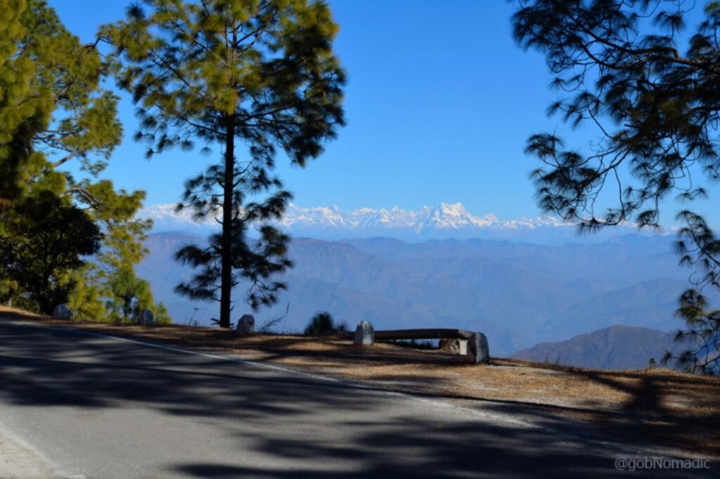
Pauri Garhwal, situated in Uttarakhand, India, serves as a district with its administrative hub in Pauri town. While it’s occasionally called Garhwal district, it’s essential to distinguish it from the broader Garhwal region of which it forms just a portion. This picturesque district in Uttarakhand boasts a rich cultural heritage and stunning natural beauty, making it a popular destination for travelers and a unique part of the greater Garhwal region.
History
Human civilization in the Garhwal Himalayas progressed in tandem with the broader Indian subcontinent. The initial historical dynasty, the Katyuri kings, governed unified Uttarakhand from 800 to 1100, leaving behind inscriptions and temples as enduring records of their reign. Subsequently, following the Katyuri era’s decline, the Garhwal region fragmented into over sixty-four principalities, each led by chieftains. By the mid-15th century, Chandpurgarh emerged as a dominant principality under the rule of Jagatpal (1455 to 1493), a direct descendant of Kanakpal. This era marked a significant chapter in the region’s history, shaping its socio-political landscape for centuries to come.
Demography
As per the 2011 census, Pauri Garhwal district in India is home to 687,271 residents, a figure nearly matching the population of Equatorial Guinea in 2014 and the US state of North Dakota. This places it at the 506th position among Indian districts out of a total of 640. The district’s population density stands at 129 people per square kilometer (330/sq mi), with a negative population growth rate of -1.51% from 2001 to 2011. Pauri Garhwal exhibits a sex ratio of 1103 females per 1000 males and an impressive literacy rate of 82.02%. Scheduled Castes and Scheduled Tribes constitute 17.80% and 0.32% of the population, respectively.
Geography
Pauri Garhwal district spans an area of 5,230 square kilometers (2,020 sq mi), straddling both the Gangetic plain and the Lower Himalayas. Positioned between 29° 45′ to 30°15′ North Latitude and 78° 24′ to 79° 23′ East Longitude, it occupies a unique geographical space. To its southwest lies Uttar Pradesh’s Bijnor district, while it shares its borders, moving clockwise from west to southeast, with Uttarakhand’s Haridwar, Dehradun, Tehri Garhwal, Rudraprayag, Chamoli, Almora, and Nainital districts. This diverse terrain offers a blend of natural beauty and geographical diversity within Pauri Garhwal.
Administration
In 1960, the former Garhwal district underwent a transformation, splitting into Pauri Garhwal and Chamoli districts. Nearly four decades later, in 1997, another section was extracted from Pauri Garhwal district and combined with segments of Chamoli and Tehri Garhwal districts, culminating in the establishment of Rudraprayag district. Currently, the district is organized into 15 tehsils, grouped into 6 sub-divisions, along with 15 developmental blocks and a total of 3,142 vibrant villages, all contributing to the administrative and cultural diversity of the region.