Pincodes of Ri Bhoi
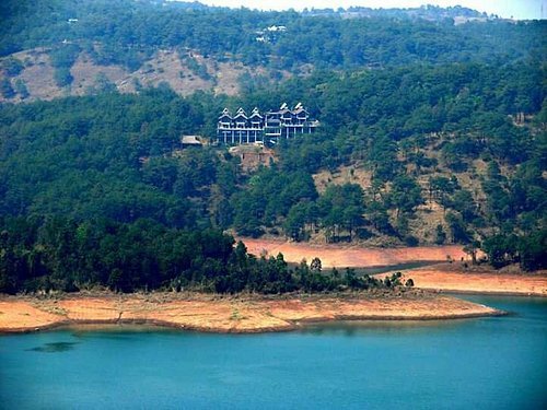
You can learn more about the fascinating Ri Bhoi district of Meghalaya, India, using Ri Bhoi Pincode. This area is well known for its beautiful scenery, undulating hills, and vibrant Khasi culture. With the help of these pincodes, you can discover quiet lakes, sleepy villages, and beautiful settings that perfectly capture the spirit of Meghalaya. Ri Bhoi Pincode offers doors to a world where nature and culture coexist perfectly, making it the perfect location for anyone wanting an immersive experience in northeastern India’s natural splendor, whether they are trekking in the Jaintia Hills, visiting holy sites, or taking part in local festivals.
Here is a list of Ri Bhoi Pincodes
| No. | Location | Pincode | District | State |
|---|---|---|---|---|
| 1 | Barua Basti | 793104 | Ri Bhoi | Meghalaya |
| 2 | Bhoilymbong | 793103 | Ri Bhoi | Meghalaya |
| 3 | Byrnihat | 793101 | Ri Bhoi | Meghalaya |
| 4 | Epip Byrnihat | 793101 | Ri Bhoi | Meghalaya |
| 5 | Hatumling | 793102 | Ri Bhoi | Meghalaya |
| 6 | Jorabat | 793101 | Ri Bhoi | Meghalaya |
| 7 | Killing Centre | 793101 | Ri Bhoi | Meghalaya |
| 8 | Kynjoin Umran | 793102 | Ri Bhoi | Meghalaya |
| 9 | Kyrdem | 793103 | Ri Bhoi | Meghalaya |
| 10 | Kyrdem Kulai | 793105 | Ri Bhoi | Meghalaya |
| 11 | Lailad | 793102 | Ri Bhoi | Meghalaya |
| 12 | Marmain | 793102 | Ri Bhoi | Meghalaya |
| 13 | Marngar | 793102 | Ri Bhoi | Meghalaya |
| 14 | Mawbri | 793103 | Ri Bhoi | Meghalaya |
| 15 | Mawhati | 793105 | Ri Bhoi | Meghalaya |
| 16 | Mawlasnai | 793103 | Ri Bhoi | Meghalaya |
| 17 | Mawlong | 793102 | Ri Bhoi | Meghalaya |
| 18 | Mawrong | 793105 | Ri Bhoi | Meghalaya |
| 19 | Niangbari | 793102 | Ri Bhoi | Meghalaya |
| 20 | Nongladew | 793102 | Ri Bhoi | Meghalaya |
| 21 | Nongpoh | 793102 | Ri Bhoi | Meghalaya |
| 22 | Rongmen | 793103 | Ri Bhoi | Meghalaya |
| 23 | Saiden | 793102 | Ri Bhoi | Meghalaya |
| 24 | Sanidon | 793105 | Ri Bhoi | Meghalaya |
| 25 | Tamul Kuchi gaon | 793101 | Ri Bhoi | Meghalaya |
| 26 | Ucc | 793122 | Ri Bhoi | Meghalaya |
| 27 | Umden | 793102 | Ri Bhoi | Meghalaya |
| 28 | Umdihar | 793102 | Ri Bhoi | Meghalaya |
| 29 | Umiam | 793103 | Ri Bhoi | Meghalaya |
| 30 | Umktieh | 793103 | Ri Bhoi | Meghalaya |
| 31 | Umran | 793105 | Ri Bhoi | Meghalaya |
| 32 | Umrit | 793102 | Ri Bhoi | Meghalaya |
| 33 | Umroi | 793103 | Ri Bhoi | Meghalaya |
| 34 | Umsaw | 793123 | Ri Bhoi | Meghalaya |
| 35 | Umsawnongbri | 793102 | Ri Bhoi | Meghalaya |
| 36 | Umshakhon Mathon | 793102 | Ri Bhoi | Meghalaya |
| 37 | Umsning | 793105 | Ri Bhoi | Meghalaya |
| 38 | Umsohlait | 793105 | Ri Bhoi | Meghalaya |
About Ri Bhoi
In the Indian state of Meghalaya, there is an administrative district called Ri Bhoi. The district office is situated in Nongpoh. There are 258,840 people living in the district, which has a land area of 2378 km², as of 2011. After South Garo Hills, it is the second-least populated district in Meghalaya (out of seven) as of 2011.
History
On June 4, 1992, the previous Civil Sub-Division was upgraded to become the Ri Bhoi District, which thus inherited the District’s hierarchical structure. The District is located between North Latitudes 25 15′ and 26 15′ and East Longitudes 91 45′ and 92 15′. It was created by carving away the former East Khasi Hills District. Geographically, it includes a portion of each of the following Khasi kingdoms: Myrdon Sirdarship, the entire Nongpoh Sirdarship (formerly known as the Nongpoh Syiemship), parts of Mylliem Syiemship, Khyrim Syiemship, Nongspung Syiemship, and Nongkhlaw Syiemship. Currently, one of the disappeared Khasi States, Nongwah Syiemship demands its administrative and territorial restoration.
Geography
The District is located between 25°40′ and 25°21′ longitude and 90°55’15 to 91°16′ latitude. Its borders are as follows: the Kamrup District to the north; the Jaintia Hills and Karbi Anglong Districts of Assam to the east; and the West Khasi Hills District to the west. At Patharkhmah, there are 561 villages, three C and RD Blocks, and one administrative unit. The district of Ri Bhoi is 2448 km² in size. The district’s headquarters are in Nongpoh, which is 50 km from Guwahati and 53 km from Shillong, the state capital.
Economy
Ri-Bhoi was identified as one of the 250 most backward districts in the nation (out of 640) by the Ministry of Panchayati Raj in 2006. The district in question is among the three in Meghalaya that are presently getting financial support from the Backward Regions Grant Fund Program (BRGF).
Demography
The population of the Ri-Bhoi district is 258,840, or about the same as the population of Vanuatu, according to the 2011 census. Based on this, it is ranked 580th out of 640 in India. The population density of the district is 109 people per square kilometer, or 280 people per square mile. Between 2001 and 2011, the population growth rate was 34.02%. In Ri Bhoi, there are 951 females for every 1000 males and a 77.22% literacy rate. The population is composed of 88.89% Scheduled Tribes.
Transport
With the sole airport in Umroi, a four-lane highway connecting Jorobat to Lad-Umroi, the Shillong Bye-pass connecting the Umroi-Bhoirymbong area to Mawryngkneng in East Khasi Hills, and the district serving as the primary route to Assam, Mizoram, Tripura, Manipur, Nagaland, and other Meghalayan stations, the region enjoys the best connectivity in the entire state. The District is traversed by National Highway No.37, which runs from Jorabat to Shillong.