Pincodes of Sehore
Sehore District, located in Madhya Pradesh, India, is a region known for its natural beauty and cultural heritage. With diverse landscapes and a rich history, Sehore offers a unique blend of tradition and modernity. The district is characterized by its lush greenery, serene lakes, and numerous temples. Sehore is also known for its agricultural significance, contributing to the region’s economy. Explore the vibrant culture, beautiful surroundings, and historical sites that make Sehore a captivating destination. Sehore pincodes represent specific areas within this extremely beautiful region of Madhya Pradesh, India.
Here is a list of Sehore Pincodes
| No. | Location | Pincode | District | State |
|---|---|---|---|---|
| 1 | Aabidabad | 466111 | Sehore | Madhya Pradesh |
| 2 | Aamon | 466448 | Sehore | Madhya Pradesh |
| 3 | Aarya | 466115 | Sehore | Madhya Pradesh |
| 4 | Ahmedpur | 466665 | Sehore | Madhya Pradesh |
| 5 | Aipur Ashta | 466116 | Sehore | Madhya Pradesh |
| 6 | Akola | 466554 | Sehore | Madhya Pradesh |
| 7 | Amirganj | 466446 | Sehore | Madhya Pradesh |
| 8 | Amlaha | 466113 | Sehore | Madhya Pradesh |
| 9 | Arniyaganji | 466221 | Sehore | Madhya Pradesh |
| 10 | Aroliya | 466116 | Sehore | Madhya Pradesh |
| 11 | Ashta | 466116 | Sehore | Madhya Pradesh |
| 12 | Ashta Fort | 466116 | Sehore | Madhya Pradesh |
| 13 | Badiyakhedi | 466001 | Sehore | Madhya Pradesh |
| 14 | Bager | 466116 | Sehore | Madhya Pradesh |
| 15 | Baibori | 466331 | Sehore | Madhya Pradesh |
| 16 | Baijnath | 466125 | Sehore | Madhya Pradesh |
| 17 | Bairagarhkhuman | 466651 | Sehore | Madhya Pradesh |
| 18 | Baktal | 466001 | Sehore | Madhya Pradesh |
| 19 | Baktara | 466448 | Sehore | Madhya Pradesh |
| 20 | Balagaon | 466331 | Sehore | Madhya Pradesh |
| 21 | Bamulia | 466111 | Sehore | Madhya Pradesh |
| 22 | Bamuliyabhati | 466116 | Sehore | Madhya Pradesh |
| 23 | Baneta | 466554 | Sehore | Madhya Pradesh |
| 24 | Barkheda | 466116 | Sehore | Madhya Pradesh |
| 25 | Barkheda Hasan | 466665 | Sehore | Madhya Pradesh |
| 26 | Basudev | 466331 | Sehore | Madhya Pradesh |
| 27 | Bayan | 466445 | Sehore | Madhya Pradesh |
| 28 | Bedakhedi | 466114 | Sehore | Madhya Pradesh |
| 29 | Bhadakui | 466331 | Sehore | Madhya Pradesh |
| 30 | Bhanwarikalan | 466221 | Sehore | Madhya Pradesh |
| 31 | Bhaukhedi | 466115 | Sehore | Madhya Pradesh |
| 32 | Bhoura | 466116 | Sehore | Madhya Pradesh |
| 33 | Bijlone | 466001 | Sehore | Madhya Pradesh |
| 34 | Bijori | 466001 | Sehore | Madhya Pradesh |
| 35 | Bilkisganj | 466111 | Sehore | Madhya Pradesh |
| 36 | Bishankhedi | 466115 | Sehore | Madhya Pradesh |
| 37 | Bordikalan | 466115 | Sehore | Madhya Pradesh |
| 38 | Borkheda | 466331 | Sehore | Madhya Pradesh |
| 39 | Brijisnagar | 466115 | Sehore | Madhya Pradesh |
| 40 | Budhni T.n. | 466445 | Sehore | Madhya Pradesh |
| 41 | Budni Ghat | 466445 | Sehore | Madhya Pradesh |
| 42 | Chakaldi | 466446 | Sehore | Madhya Pradesh |
| 43 | Chandbad jageer | 466665 | Sehore | Madhya Pradesh |
| 44 | Charnal | 466665 | Sehore | Madhya Pradesh |
| 45 | Chhapar | 466116 | Sehore | Madhya Pradesh |
| 46 | Chhatri | 466661 | Sehore | Madhya Pradesh |
| 47 | Chhipaner | 466331 | Sehore | Madhya Pradesh |
| 48 | Chhitgaonmoji | 466331 | Sehore | Madhya Pradesh |
| 49 | Chinch | 466331 | Sehore | Madhya Pradesh |
| 50 | Chupadiya | 466114 | Sehore | Madhya Pradesh |
| 51 | Dabri | 466115 | Sehore | Madhya Pradesh |
| 52 | Deevadia | 466115 | Sehore | Madhya Pradesh |
| 53 | Dhabla | 466111 | Sehore | Madhya Pradesh |
| 54 | Dhamnda | 466113 | Sehore | Madhya Pradesh |
| 55 | Dhoulpur | 466331 | Sehore | Madhya Pradesh |
| 56 | Dhuradakalan | 466120 | Sehore | Madhya Pradesh |
| 57 | Digwad | 466331 | Sehore | Madhya Pradesh |
| 58 | Dimawar | 466331 | Sehore | Madhya Pradesh |
| 59 | Dobi | 466554 | Sehore | Madhya Pradesh |
| 60 | Dolatpur | 466115 | Sehore | Madhya Pradesh |
| 61 | Doraha | 466661 | Sehore | Madhya Pradesh |
| 62 | Dungariya | 466554 | Sehore | Madhya Pradesh |
| 63 | Dupadiya | 466116 | Sehore | Madhya Pradesh |
| 64 | Foodra | 466116 | Sehore | Madhya Pradesh |
| 65 | Gavakheda | 466114 | Sehore | Madhya Pradesh |
| 66 | Gillor | 466331 | Sehore | Madhya Pradesh |
| 67 | Gopalpur | 466331 | Sehore | Madhya Pradesh |
| 68 | Guradi | 466115 | Sehore | Madhya Pradesh |
| 69 | Guradiyavarma | 466118 | Sehore | Madhya Pradesh |
| 70 | Gwali | 466118 | Sehore | Madhya Pradesh |
| 71 | Hakimabad | 466116 | Sehore | Madhya Pradesh |
| 72 | Harrajkhedi | 466116 | Sehore | Madhya Pradesh |
| 73 | Hasnabad | 466001 | Sehore | Madhya Pradesh |
| 74 | Heerapur | 466111 | Sehore | Madhya Pradesh |
| 75 | Ichawar | 466115 | Sehore | Madhya Pradesh |
| 76 | Itarshi | 466331 | Sehore | Madhya Pradesh |
| 77 | Jahajpura | 466445 | Sehore | Madhya Pradesh |
| 78 | Jamoniya Fathepur | 466115 | Sehore | Madhya Pradesh |
| 79 | Janpur Bavdiya | 466001 | Sehore | Madhya Pradesh |
| 80 | Jasmat | 466120 | Sehore | Madhya Pradesh |
| 81 | Jatakheda | 466001 | Sehore | Madhya Pradesh |
| 82 | Jawaharkheda | 466554 | Sehore | Madhya Pradesh |
| 83 | Jawar | 466221 | Sehore | Madhya Pradesh |
| 84 | Jhalki | 466115 | Sehore | Madhya Pradesh |
| 85 | Jharkheda | 466661 | Sehore | Madhya Pradesh |
| 86 | Jontala | 466448 | Sehore | Madhya Pradesh |
| 87 | Joshipur | 466445 | Sehore | Madhya Pradesh |
| 88 | Kachnariya | 466651 | Sehore | Madhya Pradesh |
| 89 | Kajlaas | 466221 | Sehore | Madhya Pradesh |
| 90 | Kannod | 466116 | Sehore | Madhya Pradesh |
| 91 | Khachrod | 466117 | Sehore | Madhya Pradesh |
| 92 | Khadi | 466119 | Sehore | Madhya Pradesh |
| 93 | Khadli | 466446 | Sehore | Madhya Pradesh |
| 94 | Khaikheda | 466445 | Sehore | Madhya Pradesh |
| 95 | Khajuriya Kasam | 466120 | Sehore | Madhya Pradesh |
| 96 | Khajuriyakalan | 466651 | Sehore | Madhya Pradesh |
| 97 | Khamaliya | 466001 | Sehore | Madhya Pradesh |
| 98 | Khandwa | 466651 | Sehore | Madhya Pradesh |
| 99 | Kheri | 466446 | Sehore | Madhya Pradesh |
| 100 | Kotri | 466114 | Sehore | Madhya Pradesh |
| 101 | Kulaskalan | 466111 | Sehore | Madhya Pradesh |
| 102 | Kurawar | 466116 | Sehore | Madhya Pradesh |
| 103 | Kurinayapura | 466331 | Sehore | Madhya Pradesh |
| 104 | Ladkui | 466331 | Sehore | Madhya Pradesh |
| 105 | Lasudiakhas | 466114 | Sehore | Madhya Pradesh |
| 106 | Loraskhurd | 466125 | Sehore | Madhya Pradesh |
| 107 | Magarda | 466665 | Sehore | Madhya Pradesh |
| 108 | Mahodiya | 466001 | Sehore | Madhya Pradesh |
| 109 | Maina | 466125 | Sehore | Madhya Pradesh |
| 110 | Manjharkui | 466446 | Sehore | Madhya Pradesh |
| 111 | Mardanpur | 466446 | Sehore | Madhya Pradesh |
| 112 | Metwada | 466118 | Sehore | Madhya Pradesh |
| 113 | Mograram | 466001 | Sehore | Madhya Pradesh |
| 114 | Molukhedi | 466114 | Sehore | Madhya Pradesh |
| 115 | Mugli | 466116 | Sehore | Madhya Pradesh |
| 116 | Muktarnagar | 466651 | Sehore | Madhya Pradesh |
| 117 | Mundlakhurd | 466001 | Sehore | Madhya Pradesh |
| 118 | Mungavli | 466001 | Sehore | Madhya Pradesh |
| 119 | Murawar | 466221 | Sehore | Madhya Pradesh |
| 120 | Muskara | 466113 | Sehore | Madhya Pradesh |
| 121 | Nandgaon | 466331 | Sehore | Madhya Pradesh |
| 122 | Nandner | 466448 | Sehore | Madhya Pradesh |
| 123 | Naplakhedi | 466001 | Sehore | Madhya Pradesh |
| 124 | Narsinghkheda | 466115 | Sehore | Madhya Pradesh |
| 125 | Nasrllaganj | 466331 | Sehore | Madhya Pradesh |
| 126 | Nimota | 466331 | Sehore | Madhya Pradesh |
| 127 | Nipaniakalan | 466114 | Sehore | Madhya Pradesh |
| 128 | Nipaniya | 466001 | Sehore | Madhya Pradesh |
| 129 | Nougaon | 466120 | Sehore | Madhya Pradesh |
| 130 | Paatan | 466445 | Sehore | Madhya Pradesh |
| 131 | Pachama | 466001 | Sehore | Madhya Pradesh |
| 132 | Panguradiya | 466445 | Sehore | Madhya Pradesh |
| 133 | Paraswada | 466554 | Sehore | Madhya Pradesh |
| 134 | Pilikarar | 466445 | Sehore | Madhya Pradesh |
| 135 | Piplaani | 466331 | Sehore | Madhya Pradesh |
| 136 | Rehti | 466446 | Sehore | Madhya Pradesh |
| 137 | Rithwad | 466331 | Sehore | Madhya Pradesh |
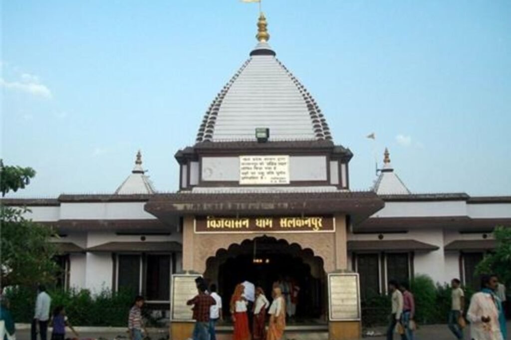
| 138 | Salkanpur | 466446 | Sehore | Madhya Pradesh |
| 139 | Sardarnagar | 466554 | Sehore | Madhya Pradesh |
| 140 | Satrana | 466331 | Sehore | Madhya Pradesh |
| 141 | Sehore | 466001 | Sehore | Madhya Pradesh |
| 142 | Sehore City | 466001 | Sehore | Madhya Pradesh |
| 143 | Sehore Englishpura | 466001 | Sehore | Madhya Pradesh |
| 144 | Sehore Ganjbajariya | 466001 | Sehore | Madhya Pradesh |
| 145 | Sehore Mandi | 466001 | Sehore | Madhya Pradesh |
| 146 | Sehore Rak | 466001 | Sehore | Madhya Pradesh |
| 147 | Sehore Town | 466001 | Sehore | Madhya Pradesh |
| 148 | Semalpani | 466331 | Sehore | Madhya Pradesh |
| 149 | Semlijadid | 466115 | Sehore | Madhya Pradesh |
| 150 | Semradangi | 466001 | Sehore | Madhya Pradesh |
| 151 | Semrikatkuna | 466446 | Sehore | Madhya Pradesh |
| 152 | Sewda | 466125 | Sehore | Madhya Pradesh |
| 153 | Shahganj | 466554 | Sehore | Madhya Pradesh |
| 154 | Shyampur | 466651 | Sehore | Madhya Pradesh |
| 155 | Siddikganj | 466120 | Sehore | Madhya Pradesh |
| 156 | Siradi | 466651 | Sehore | Madhya Pradesh |
| 157 | Sonthi | 466651 | Sehore | Madhya Pradesh |
| 158 | Sonthiya | 466331 | Sehore | Madhya Pradesh |
| 159 | Soyat | 466446 | Sehore | Madhya Pradesh |
| 160 | Sudamapuri | 466331 | Sehore | Madhya Pradesh |
| 161 | Tiladiya | 466331 | Sehore | Madhya Pradesh |
| 162 | Torniya | 466115 | Sehore | Madhya Pradesh |
| 163 | Uljhawan | 466111 | Sehore | Madhya Pradesh |
| 164 | Veerpur Kolardem | 466111 | Sehore | Madhya Pradesh |
About Sehore
Sehore District, located in central India, is a part of Madhya Pradesh state and falls under the jurisdiction of Bhopal Division, with its administrative center in the town of Sehore.
History:
Sehore District in Madhya Pradesh, India, has a rich history that dates back centuries. In ancient times, it was known as ‘Sheetalpuri,’ a place of serenity and significance. The region witnessed the rule of various dynasties, including the Mauryas, Guptas, and Rajputs.
During medieval times, it was part of the Malwa Sultanate and later became a prominent center of the Mughal Empire. The district’s history also includes the Maratha influence, followed by British colonial rule.
In 1947, Sehore, like many other regions, gained independence from British rule and became part of the newly formed state of Madhya Pradesh. Today, it stands as a vibrant district with a blend of historical and modern elements, contributing to the cultural and administrative landscape of the state.
Geography:
Sehore District, situated in the heart of Madhya Pradesh, India, boasts a diverse geographical landscape. It spans across an area characterized by rolling hills, fertile plains, and significant river systems. The district’s topography varies from the Vindhyan Plateau in the north to the fertile plains in the south.
Several rivers, including the Betwa, Kolar, and Barna, traverse the district, contributing to its agricultural richness. These water bodies not only support agriculture but also add to the natural beauty of the region.
The climate of Sehore District is characterized by distinct seasons, with hot summers, a monsoon season bringing ample rainfall, and cool winters. This climatic variation influences the region’s agriculture, with crops like wheat, soybean, and gram being prominently cultivated.
Sehore’s geographical diversity, coupled with its proximity to the state capital, Bhopal, makes it an important part of Madhya Pradesh’s landscape, both in terms of agriculture and administration.
Demographics:
As of the 2011 census, Sehore District had a population of 1,311,332, ranking it 373rd among all Indian districts. The population density in the district was approximately 199 people per square kilometer. The sex ratio in Sehore was 918 females for every 1,000 males, and the literacy rate stood at 71.11%. About 18.95% of the population resided in urban areas.
Regarding language, the 2011 Census of India reported that Hindi was the primary language for 95.38% of the district’s population. Urdu was spoken by 2.31%, and Malvi was the first language for 1.46% of the residents in the district.