Pincodes of Senapati
Senapati Pincodes: Nestled in the picturesque state of Manipur, Senapati is a region marked by its unique pincodes, each defining a distinct locality within this vibrant district. These pincodes facilitate efficient postal services, ensuring seamless communication and connectivity for residents and businesses alike. Senapati, surrounded by breathtaking hills and lush valleys, boasts a rich cultural heritage and a close-knit community. Whether you’re sending a letter, receiving a package, or simply navigating the region, Senapati’s pincodes are your key to unlocking the treasures of this enchanting district.
Here is a list of Senapati Pincodes
| No. | Location | Pincode | District | State |
|---|---|---|---|---|
| 1 | Bunglong | 795118 | Senapati | Manipur |
| 2 | Chalwa (p) | 795112 | Senapati | Manipur |
| 3 | Chandraman | 795122 | Senapati | Manipur |
| 4 | Chawanamei | 795104 | Senapati | Manipur |
| 5 | Cheljang | 795112 | Senapati | Manipur |
| 6 | Chingai Khullen | 795104 | Senapati | Manipur |
| 7 | Galam | 795118 | Senapati | Manipur |
| 8 | Ganel | 795112 | Senapati | Manipur |
| 9 | Gangpijang | 795118 | Senapati | Manipur |
| 10 | Haipi | 795122 | Senapati | Manipur |
| 11 | Hengbung | 795129 | Senapati | Manipur |
| 12 | Ichaigojang | 795118 | Senapati | Manipur |
| 13 | Irang | 795112 | Senapati | Manipur |
| 14 | J Phaijang | 795107 | Senapati | Manipur |
| 15 | Jangnoi | 795118 | Senapati | Manipur |
| 16 | Kaibi | 795104 | Senapati | Manipur |
| 17 | Kalapahar | 795122 | Senapati | Manipur |
| 18 | Kangpokpi | 795129 | Senapati | Manipur |
| 19 | Kangpokpi Mission | 795129 | Senapati | Manipur |
| 20 | Karong | 795007 | Senapati | Manipur |
| 21 | Keithelmanbi | 795122 | Senapati | Manipur |
| 22 | Kheijang | 795122 | Senapati | Manipur |
| 23 | Koide | 795015 | Senapati | Manipur |
| 24 | Kolhen | 795112 | Senapati | Manipur |
| 25 | Laii | 795104 | Senapati | Manipur |
| 26 | Lairouching | 795007 | Senapati | Manipur |
| 27 | Lakhamei | 795015 | Senapati | Manipur |
| 28 | Liyai | 795104 | Senapati | Manipur |
| 29 | Liyal Khunou | 795104 | Senapati | Manipur |
| 30 | Maiba | 795015 | Senapati | Manipur |
| 31 | Makeng Ngarolu | 795118 | Senapati | Manipur |
| 32 | Makhan Bazar | 795015 | Senapati | Manipur |
| 33 | Makokchung | 795118 | Senapati | Manipur |
| 34 | Mao | 795150 | Senapati | Manipur |
| 35 | Maohiing | 795129 | Senapati | Manipur |
| 36 | Maohing | 795129 | Senapati | Manipur |
| 37 | Maram | 795015 | Senapati | Manipur |
| 38 | Molkon | 795118 | Senapati | Manipur |
| 39 | Motbung | 795107 | Senapati | Manipur |
| 40 | Mutukhong | 795118 | Senapati | Manipur |
| 41 | N. khenjang | 795107 | Senapati | Manipur |
| 42 | Nurathel | 795107 | Senapati | Manipur |
| 43 | Oinam | 795007 | Senapati | Manipur |
| 44 | Oklong | 795106 | Senapati | Manipur |
| 45 | Pangjang | 795118 | Senapati | Manipur |
| 46 | Paomata Centre | 795104 | Senapati | Manipur |
| 47 | Persian | 795122 | Senapati | Manipur |
| 48 | Pfukhro | 795150 | Senapati | Manipur |
| 49 | Phaibung Khullen | 795104 | Senapati | Manipur |
| 50 | Phaikon | 795118 | Senapati | Manipur |
| 51 | Phuba | 795015 | Senapati | Manipur |
| 52 | Phunanamei | 795150 | Senapati | Manipur |
| 53 | Pudunamei | 795150 | Senapati | Manipur |
| 54 | Purul | 795015 | Senapati | Manipur |
| 55 | Rajamei | 795007 | Senapati | Manipur |
| 56 | S.Bolkot | 795107 | Senapati | Manipur |
| 57 | Saitu | 795107 | Senapati | Manipur |
| 58 | Sangpei Khullen | 795118 | Senapati | Manipur |
| 59 | Sapermeina | 795107 | Senapati | Manipur |
| 60 | Saranamei | 795104 | Senapati | Manipur |
| 61 | Senapati | 795106 | Senapati | Manipur |
| 62 | Siraffi | 795104 | Senapati | Manipur |
| 63 | T Waichong | 795112 | Senapati | Manipur |
| 64 | T. awkhumbung | 795118 | Senapati | Manipur |
| 65 | Tadubi | 795104 | Senapati | Manipur |
| 66 | Tamei | 795125 | Senapati | Manipur |
| 67 | Taphou | 795129 | Senapati | Manipur |
| 68 | Thanamba | 795122 | Senapati | Manipur |
| 69 | Thengjang | 795112 | Senapati | Manipur |
| 70 | Thingba Khullen | 795007 | Senapati | Manipur |
| 71 | Thingba Khunou | 795007 | Senapati | Manipur |
| 72 | Thingsat | 795107 | Senapati | Manipur |
| 73 | Thonglang | 795129 | Senapati | Manipur |
| 74 | Tingpibung | 795118 | Senapati | Manipur |
| 75 | Tokpa | 795122 | Senapati | Manipur |
| 76 | Toribari | 795129 | Senapati | Manipur |
| 77 | Tumuyan Khullen | 795106 | Senapati | Manipur |
| 78 | Tungjoy | 795104 | Senapati | Manipur |
| 79 | Willang | 795007 | Senapati | Manipur |
| 80 | Yangkhullen | 795007 | Senapati | Manipur |
| 81 | Zelengphai | 795118 | Senapati | Manipur |
About Senapati District
Senapati, an integral part of the northeastern Indian state of Manipur, stands as one of its 16 districts. The district’s current configuration took shape in December 2016, marking the division of the Sadar Hills region in the south into a distinct Kangpokpi district. Within Senapati, the administrative hub is situated in the municipality of Tahamzam. This reorganization was aimed at enhancing governance efficiency and better serving the unique needs of the region’s diverse communities. Senapati district, with its rich cultural tapestry and natural beauty, plays a pivotal role in the socio-economic landscape of Manipur, contributing to the state’s overall development.
History
The history of Senapati district in Manipur is a tapestry of cultural diversity and socio-political evolution. It was originally inhabited by various Naga tribes. Over the centuries, it witnessed the influences of empires like the Burmese and the British. Senapati played a crucial role in the Anglo-Manipur War of 1891, contributing to Manipur’s integration with British India. Post-independence, it remained a significant district, witnessing socio-political developments and the creation of Kangpokpi district in 2016. Today, Senapati stands as a vibrant district, preserving its rich cultural heritage while actively participating in Manipur’s modern development and growth.
Demography
As of the 2011 census, Senapati district in India was home to approximately 479,148 residents, a population roughly equivalent to that of the entire nation of Belize. This places Senapati at the 565th position among the 640 districts in India. The district exhibits a population density of 109 individuals per square kilometer (280 per square mile), reflecting its relatively moderate population distribution. Notably, Senapati experienced a significant population growth rate of 25.16% during the decade spanning 2001 to 2011. In terms of gender balance, the district maintains a sex ratio of 939 females for every 1000 males, and its literacy rate stands at 75%.
Geography
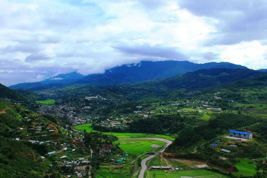
Senapati District is situated in the northern region of Manipur state, spanning between 93.29° and 94.15° East Longitude and 24.37° and 25.37° North Latitude. It is bordered by Kangpokpi District to the south, Ukhrul district to the east, Tamenglong district to the west, and Kohima District and Phek district of Nagaland state to the north. The district’s elevation ranges from 1061 meters to 1788 meters above sea level, offering diverse landscapes. Among its attractions is the Dzuko Valley, celebrated for its natural beauty, seasonal blossoms, and wildlife. Notably, it hosts the endemic Dzuko lily, closely related to the Shirui lily found in neighboring Ukhrul district.
Administration
The administrative framework of Senapati District is efficiently structured to ensure the smooth functioning of governance. At its helm is the Deputy Commissioner (DC), who serves as the district’s administrative head and also holds the crucial role of District Magistrate. Assisting the DC are key officials including the Additional Deputy Commissioner (ADC), Assistant Commissioner (AC), and the Sub-Divisional Officers, each overseeing specific sectors such as development, revenue, and relief. Law and order are maintained under the coordination of the Superintendent of Police (SP) Senapati. This administrative setup encompasses the Deputy Commissioner’s Office, various Sub-Divisional Officers, and multiple Subdivisional Heads, all collectively contributing to the efficient governance of Senapati District.