Pincodes of South Garo Hills
You may reach the fascinating South Garo Hills district of Meghalaya, India, by using the South Garo Hills Pincode. These pincodes provide an opportunity to discover the pristine natural beauty, tribal customs, and verdant landscapes that characterize the Garo Hills region, which is tucked away in the middle of the region. Whether you’re hiking through the Nokrek Biosphere Reserve, learning about the distinctive culture of the Garo people, or finding hidden waterfalls, the South Garo Hills Pincode reveals a world where tradition and nature coexist peacefully, making it a haven for those who enjoy the outdoors and exploring different cultures in northeastern India.
Here is a list of South Garo Hills Pincodes
| No. | Location | Pincode | District | State |
|---|---|---|---|---|
| 1 | Baghmara | 794102 | South Garo hills | Meghalaya |
| 2 | Balkhalbazar | 794102 | South Garo hills | Meghalaya |
| 3 | Balsalgiri | 794102 | South Garo hills | Meghalaya |
| 4 | Dambuk Agal | 794114 | South Garo hills | Meghalaya |
| 5 | Emangiri | 794102 | South Garo hills | Meghalaya |
| 6 | Mahesh Khola | 794114 | South Garo hills | Meghalaya |
| 7 | Mendikgiri | 794102 | South Garo hills | Meghalaya |
| 8 | Nilwalgiri | 794102 | South Garo hills | Meghalaya |
| 9 | Panda | 794102 | South Garo hills | Meghalaya |
| 10 | Rongra | 794114 | South Garo hills | Meghalaya |
| 11 | Siju | 794102 | South Garo hills | Meghalaya |
| 12 | Warimagiri | 794114 | South Garo hills | Meghalaya |
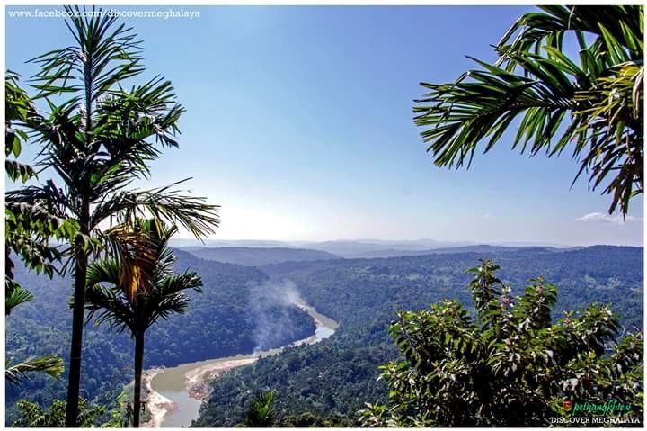
About South Garo Hills
Located in the southern region of Meghalaya, the South Garo Hills district was established on June 18, 1992. The district’s headquarters are in Baghmara, the only town in the district; it is a hilly and challenging environment. The district is located between latitudes 25˚10′ and 25˚35’N and longitudes 90˚15′ and 91˚0′ E. It is 1887 square kilometers in size. Its borders are as follows: Bangladesh to the south, Bangladesh to the east, the West Garo Hills district to the west, and East Garo Hills district to the north.
History
Following the British East India Company’s acquisition of Bengal’s Diwani from the Mughal Emperor at the end of the 18th century, relations between the British and the Garos began. As a result, the British took control of all the estates that bordered the Garo Hills, which had hitherto been essentially semi-independent.
Even though the British had taken over governmental power from the Mughals, they shared the Mughals’ aversion to having direct authority over the Estates or their tributaries. The internal administration of the Zamindars’ domains continued unhindered. As the Mughals had done before, they were actually given the task of using their retainers to assist keep the hill Garos under control.
Geography
The district office is situated at Baghmara. The district is spread across 1850 Square kilometer. At the time, South Garo Hills had five assembly constituencies; today, it has three.
Economy
One of the 250 most backward districts in the nation, according to the Ministry of Panchayati Raj, is South Garo Hills. The district in question is among the three in Meghalaya that are presently getting financial support from the Backward Regions Grant Fund Program (BRGF).
Demography
The South Garo Hills district contains 142,334 residents, or nearly equal to the population of Saint Lucia, according to the 2011 census. As a result, it is now ranked 604th out of 640 in India. The population density of the district is 77 people per square kilometer, or 200 people per square mile. Between 2001 and 2011, the population growth rate was 41.19%. In South Garo Hills, there are 944 females for every 1000 males and a 72.39% literacy rate. Of the total population, 94.31% are Scheduled Tribes.
Plants and animals
The 220 square kilometer (84.9 sq mi) Balphakram National Park was established in the South Garo Hills district in 1986. It is shared by two other districts with 47 square kilometer (18.1 sq mi) of Nokrek National Park, which was created in 1986. The Siju and Baghmara Pitcher Plant Wildlife Sanctuaries are located there as well. The region is home to at least one native species of gecko, Cyrtodactylus karsticolus.