Pincodes of Tamenglong
Here is a list of Tamenglong Pincodes
| No. | Location | Pincode | District | State |
|---|---|---|---|---|
| 1 | Akhui | 795141 | Tamenglong | Manipur |
| 2 | Atang Khunou | 795125 | Tamenglong | Manipur |
| 3 | Atengba | 795141 | Tamenglong | Manipur |
| 4 | Awangkhul | 795159 | Tamenglong | Manipur |
| 5 | Bhalok | 795141 | Tamenglong | Manipur |
| 6 | Bongoijang | 795141 | Tamenglong | Manipur |
| 7 | Chaiton | 795125 | Tamenglong | Manipur |
| 8 | Charoi Tupul | 795159 | Tamenglong | Manipur |
| 9 | Chongmun | 795147 | Tamenglong | Manipur |
| 10 | Dailong | 795141 | Tamenglong | Manipur |
| 11 | Dullen (t/c/d) | 795125 | Tamenglong | Manipur |
| 12 | Haochong | 795159 | Tamenglong | Manipur |
| 13 | Illong | 795125 | Tamenglong | Manipur |
| 14 | Jampii (t/c/d) | 795125 | Tamenglong | Manipur |
| 15 | Kadi | 795125 | Tamenglong | Manipur |
| 16 | Kahulong | 795141 | Tamenglong | Manipur |
| 17 | Kambiron | 795147 | Tamenglong | Manipur |
| 18 | Kasanlong | 795125 | Tamenglong | Manipur |
| 19 | Keikao | 795141 | Tamenglong | Manipur |
| 20 | Khongjaron | 795141 | Tamenglong | Manipur |
| 21 | Khongjaron Khunthak | 795141 | Tamenglong | Manipur |
| 22 | Khongsang | 795159 | Tamenglong | Manipur |
| 23 | Khoupum | 795147 | Tamenglong | Manipur |
| 24 | Khumphung | 795125 | Tamenglong | Manipur |
| 25 | Kuilong | 795125 | Tamenglong | Manipur |
| 26 | Lemta | 795125 | Tamenglong | Manipur |
| 27 | Lenglong | 795125 | Tamenglong | Manipur |
| 28 | Longpram | 795141 | Tamenglong | Manipur |
| 29 | Lukhambi | 795159 | Tamenglong | Manipur |
| 30 | Magulong | 795125 | Tamenglong | Manipur |
| 31 | Mukti Khullen | 795147 | Tamenglong | Manipur |
| 32 | Nagaching | 795159 | Tamenglong | Manipur |
| 33 | Namtiram | 795141 | Tamenglong | Manipur |
| 34 | New Kabui khullen | 795159 | Tamenglong | Manipur |
| 35 | New Lambala | 795125 | Tamenglong | Manipur |
| 36 | New Pallong | 795141 | Tamenglong | Manipur |
| 37 | None | 795159 | Tamenglong | Manipur |
| 38 | Nungba | 795147 | Tamenglong | Manipur |
| 39 | Nungnang | 795147 | Tamenglong | Manipur |
| 40 | Nungtek | 795159 | Tamenglong | Manipur |
| 41 | Rengpang | 795147 | Tamenglong | Manipur |
| 42 | Sibilong | 795147 | Tamenglong | Manipur |
| 43 | Songpram | 795141 | Tamenglong | Manipur |
| 44 | Takou | 795125 | Tamenglong | Manipur |
| 45 | Tamenglong | 795141 | Tamenglong | Manipur |
| 46 | Tamenglong Khunjao | 795141 | Tamenglong | Manipur |
| 47 | Tharon | 795141 | Tamenglong | Manipur |
| 48 | Thingra | 795159 | Tamenglong | Manipur |
| 49 | Thuilon | 795141 | Tamenglong | Manipur |
| 50 | Tousem | 795141 | Tamenglong | Manipur |
| 51 | Upper Selsi (t/c/d) | 795125 | Tamenglong | Manipur |
| 52 | Wairengba | 795141 | Tamenglong | Manipur |
About Tamenglong District
Tamenglong district, located in northeastern India, is one of Manipur state’s 16 districts. As of the 2011 census, it held the distinction of being the least populous district in Manipur. However, in 2016, a significant administrative change occurred when the Nungba subdivision was bifurcated to form a distinct district of its own. This transformation reflected the evolving demographics and administrative considerations within the region. Tamenglong district, despite its low population, plays a vital role within the state, contributing to Manipur’s cultural and geographical diversity, and the creation of the Nungba district was a step towards addressing local governance and development needs more effectively.
Histrory
In 1919, the British Government established four sub-division offices in Manipur Hills, known as North East Sub-Division, North West Sub-Division, South East Sub-Division, and South West Sub-Division. The North West Sub-Division initially had its headquarters in Khunjao, Tamenglong Village (Nriangluang), with Mr. William Shaw serving as the Sub-Divisional Officer. However, in 1923, the headquarters was relocated to its current site, known as Tamenglong headquarters, situated about 3 kilometers away from Khunjao. Subsequently, the Manipur North West Sub-Division was renamed Tamenglong Sub-Division. Tamenglong attained the status of a full-fledged district in 1969, with the appointment of its first Deputy Commissioner.
Demography
According to the 2011 census, Tamenglong district in India recorded a population of 140,651, placing it at the 607th rank out of a total of 640 districts. The district exhibits a population density of 32 inhabitants per square kilometer (83/sq mi), reflecting a notable growth rate of 25.69% during the decade from 2001 to 2011. Tamenglong maintains a sex ratio of 953 females for every 1000 males, indicating a relatively balanced gender distribution. The literacy rate in the district stands at 70.4%, signifying educational progress. These demographic statistics paint a snapshot of the population composition in Tamenglong as of the 2011 census, offering valuable insights into its demographic landscape.
Geography
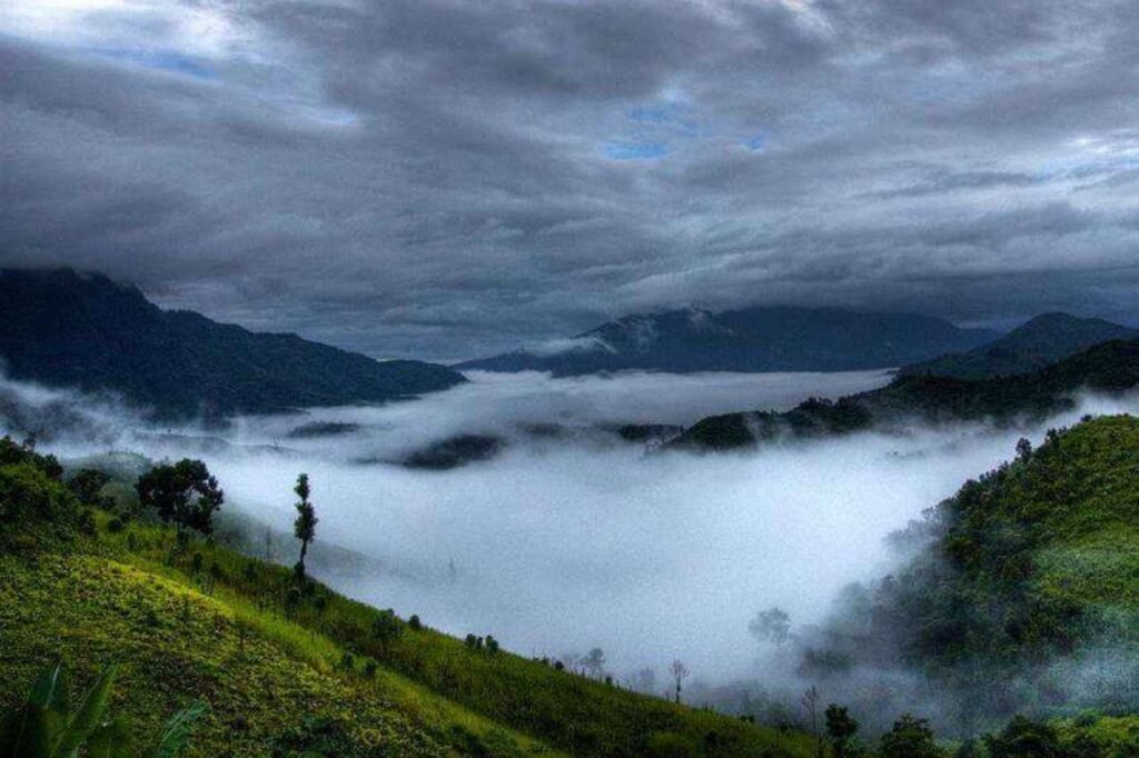
Situated in the northeastern region of India, this district is surrounded by Nagaland state and Senapati district to the north, while the Assam state borders it on the west. To the south lies the newly established Noney district, and to the east, it shares its boundary with Kangpokpi district, which was formerly a part of Senapati district. Serving as the district’s administrative center is Tamenglong town. Covering a total land area of 4,391 square kilometers, as of the 2011 census, which includes the Nungba subdivision, this district is known for its scenic beauty and cultural diversity.