Pincodes of Ukhrul
Ukhrul Pincodes: Explore the postal codes of Ukhrul, a picturesque district in Manipur, India. Ukhrul is known for its stunning landscapes and rich cultural heritage. Here, we provide a comprehensive list of Ukhrul’s pincodes, making it easy for you to locate specific areas, post offices, and destinations within this enchanting region. Whether you’re sending mail, ordering online, or simply curious about the postal system in Ukhrul, our Ukhrul Pincodes directory will assist you in finding the right code for your location. Discover the precise pincodes that connect you to the heart of Ukhrul and its vibrant communities.
Here is a list of Ukhrul Pincodes
| No. | Location | Pincode | District | State |
|---|---|---|---|---|
| 1 | Ashi | 795145 | Ukhrul | Manipur |
| 2 | Chadong | 795145 | Ukhrul | Manipur |
| 3 | Chamu | 795142 | Ukhrul | Manipur |
| 4 | Chassad | 795145 | Ukhrul | Manipur |
| 5 | Chingai (p) | 795142 | Ukhrul | Manipur |
| 6 | Chingjaroiedbo | 795142 | Ukhrul | Manipur |
| 7 | Chither (p) | 795142 | Ukhrul | Manipur |
| 8 | Grihang | 795145 | Ukhrul | Manipur |
| 9 | Huime | 795144 | Ukhrul | Manipur |
| 10 | Huining | 795142 | Ukhrul | Manipur |
| 11 | Hundung | 795142 | Ukhrul | Manipur |
| 12 | Jessami Edno | 795142 | Ukhrul | Manipur |
| 13 | Kachal | 795144 | Ukhrul | Manipur |
| 14 | Kagai | 795142 | Ukhrul | Manipur |
| 15 | Khamasom | 795142 | Ukhrul | Manipur |
| 16 | Kharasom | 795142 | Ukhrul | Manipur |
| 17 | Khayang | 795142 | Ukhrul | Manipur |
| 18 | Khongdei Simphung | 795144 | Ukhrul | Manipur |
| 19 | Kongpat Khunou | 795145 | Ukhrul | Manipur |
| 20 | L Tangkhul | 795145 | Ukhrul | Manipur |
| 21 | Lambui | 795145 | Ukhrul | Manipur |
| 22 | Lamlang Gate | 795142 | Ukhrul | Manipur |
| 23 | Leisan | 795142 | Ukhrul | Manipur |
| 24 | Leiting | 795145 | Ukhrul | Manipur |
| 25 | Litan | 795145 | Ukhrul | Manipur |
| 26 | Lungphu | 795145 | Ukhrul | Manipur |
| 27 | Maku | 795145 | Ukhrul | Manipur |
| 28 | Maokot | 795145 | Ukhrul | Manipur |
| 29 | Mapum | 795142 | Ukhrul | Manipur |
| 30 | Ngairou | 795142 | Ukhrul | Manipur |
| 31 | Ngari Khullen | 795144 | Ukhrul | Manipur |
| 32 | Nungbi Khunou | 795142 | Ukhrul | Manipur |
| 33 | Nungshang | 795142 | Ukhrul | Manipur |
| 34 | Paorei | 795142 | Ukhrul | Manipur |
| 35 | Paoyii | 795142 | Ukhrul | Manipur |
| 36 | Phadang | 795144 | Ukhrul | Manipur |
| 37 | Phungcham | 795142 | Ukhrul | Manipur |
| 38 | Phungyar | 795145 | Ukhrul | Manipur |
| 39 | Poii | 795142 | Ukhrul | Manipur |
| 40 | Pushing | 795142 | Ukhrul | Manipur |
| 41 | Rajai Khunou | 795142 | Ukhrul | Manipur |
| 42 | Sanakeithel | 795145 | Ukhrul | Manipur |
| 43 | Semol | 795145 | Ukhrul | Manipur |
| 44 | Shongshak | 795145 | Ukhrul | Manipur |
| 45 | Sirarakhong | 795142 | Ukhrul | Manipur |
| 46 | Siroi | 795142 | Ukhrul | Manipur |
| 47 | Siyamongjam | 795145 | Ukhrul | Manipur |
| 48 | Somdal | 795144 | Ukhrul | Manipur |
| 49 | Sorang Phung | 795142 | Ukhrul | Manipur |
| 50 | Sorde | 795145 | Ukhrul | Manipur |
| 51 | T.C. ground | 795142 | Ukhrul | Manipur |
| 52 | Thawai | 795145 | Ukhrul | Manipur |
| 53 | Thiwa | 795144 | Ukhrul | Manipur |
| 54 | Tolloi | 795142 | Ukhrul | Manipur |
| 55 | Tuinem | 795142 | Ukhrul | Manipur |
| 56 | Tungou | 795142 | Ukhrul | Manipur |
| 57 | Tushem | 795142 | Ukhrul | Manipur |
| 58 | Ukhrul | 795142 | Ukhrul | Manipur |
| 59 | Yangangpokpi | 795145 | Ukhrul | Manipur |
About Ukhrul District
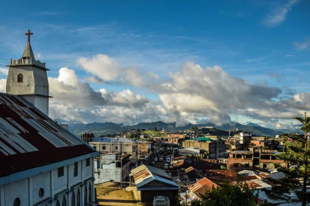
Ukhrul, alternatively known as Hunphun, stands as a prominent town within the state of Manipur, India, and is renowned as the ancestral homeland of the Tangkhul Nagas. It holds the distinction of serving as the administrative hub for the Ukhrul district, overseeing the governance of the region’s numerous villages. Within this district, there are four sub-divisions tasked with administering the villages and their surrounding areas, though the villages themselves are overseen by local ‘village heads’. Moreover, Ukhrul boasts fame for being the habitat of the exquisite Shirui Lily, adding to its cultural and natural allure.
History
Ukhrul, located in Manipur, has a rich history steeped in the traditions of the Tangkhul Nagas, its indigenous inhabitants. The region’s history is marked by ancient tribal customs and a unique cultural heritage. Over the years, it has witnessed socio-political changes, including the integration into the Indian Union in the mid-20th century. Ukhrul played a crucial role in the Naga insurgency, with several significant events occurring in the district. Today, it stands as a testament to the harmonious blend of tradition and modernity, reflecting the resilience and cultural vibrancy of its people while continuing to evolve in a dynamic world.
Demography
According to the 2011 census, Ukhrul district in India had a population of 183,998, earning it a rank of 593rd out of 640 districts. The district boasted a population density of 40 inhabitants per square kilometer, with a notable population growth rate of 30.07% between 2001 and 2011. The sex ratio in Ukhrul was 948 females for every 1000 males, and the literacy rate stood at 81.87%. The majority of residents were Tangkhul Nagas, comprising 87.2% of the population. In terms of languages spoken, 88.83% used Tangkhul as their primary language, while Thadou, Kuki, Nepali, Khezha, and Hindi were also spoken to varying degrees. Following the separation of Kamjong district, Ukhrul’s population in 2011 was 138,382, with a sex ratio of 942 females per 1000 males.
Geography
Located in the northeastern corner of Manipur, Ukhrul District stretches between latitudes 24° 29′ and 25° 42′ N and longitudes 94° 30′ and 94° 45′ E, encompassing Kamjong District. It shares borders with Nagaland to the north, Kamjong District to the south, Myanmar to the east, and Senapati and Kangpokpi Districts to the west. This district, covering a total area of 4,544 square kilometers, boasts the distinction of being Manipur’s highest hill station. Its hilly terrain varies in elevation from 913 meters to 3,114 meters above sea level, with Khayang Peak at 3,114 meters being the highest, and Shirui Kashong Peak at 2,835 meters being another notable landmark. Numerous rivers originate from the slopes of Shirui Peak, and the landscape is characterized by small ranges and flowing rivers.
Administration
In 1969, the present district was established as Manipur East District, with its headquarters in Ukhrul village. It encompassed Ukhrul North, Ukhrul Central, Phungyar Phaisat, Kamjong Chassad, and Ukhrul South as sub-divisions. However, in 1983, it was officially renamed Ukhrul District, following Manipur Gazette Notification No.174 on August 5, 1983. Prior to the district’s division into Ukhrul and Kamjong Districts, it comprised three assembly constituencies: Phungyar Assembly Constituency (43-ST), Ukhrul Assembly Constituency (44-ST), and Chingai Assembly Constituency (45-ST). Additionally, the Ukhrul District Autonomous Council (UADC) was established in 1971 under the Manipur (Hill Areas) District Council Act, 1971.