Pincodes of West Garo Hills
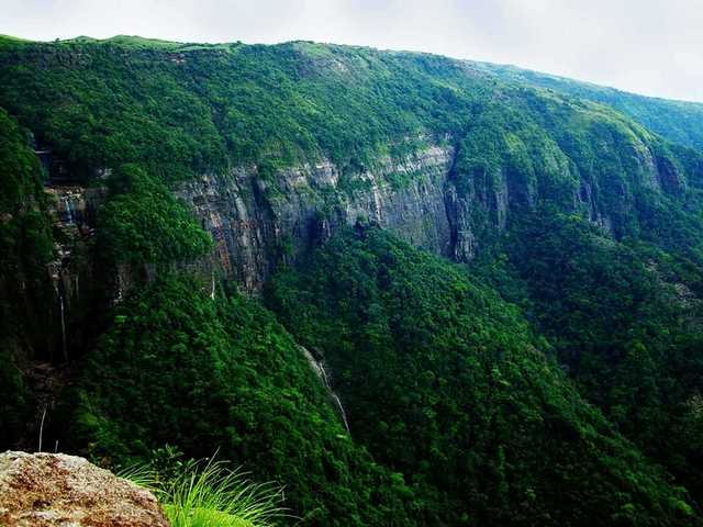
West Garo Hills Pincode reveals the charm of the West Garo Hills district in Meghalaya, India. It’s a gateway to pristine landscapes, tribal heritage, and unique cultures. Explore dense forests, wildlife sanctuaries, and the vibrant lifestyle of the Garo people. Whether you’re hiking through Balpakram National Park, engaging in local festivities, or experiencing the warm hospitality of the Garo community, West Garo Hills Pincode offers an authentic glimpse into the region’s natural beauty and cultural richness. This area is a treasure trove for those seeking an immersive experience in the northeastern part of India.
Here is a list of West Garo Hills Pincodes
| No | Location | Pincode | District | State |
|---|---|---|---|---|
| 1 | Achigchonggiri | 794002 | West Garo hills | Meghalaya |
| 2 | Ampati | 794115 | West Garo hills | Meghalaya |
| 3 | Anugiri | 794002 | West Garo hills | Meghalaya |
| 4 | Araimile | 794101 | West Garo hills | Meghalaya |
| 5 | Bajengdoba | 794002 | West Garo hills | Meghalaya |
| 6 | Balunghat | 794106 | West Garo hills | Meghalaya |
| 7 | Bandelkona | 794115 | West Garo hills | Meghalaya |
| 8 | Barengapara | 794103 | West Garo hills | Meghalaya |
| 9 | Batabari | 794104 | West Garo hills | Meghalaya |
| 10 | Belguri | 794109 | West Garo hills | Meghalaya |
| 11 | Betsing | 794115 | West Garo hills | Meghalaya |
| 12 | Bhaitbari | 794104 | West Garo hills | Meghalaya |
| 13 | Bhajamara | 794104 | West Garo hills | Meghalaya |
| 14 | Bholarbhita | 794104 | West Garo hills | Meghalaya |
| 15 | Bolangitak | 794109 | West Garo hills | Meghalaya |
| 16 | Bolchugre | 794005 | West Garo hills | Meghalaya |
| 17 | Borjhora | 794109 | West Garo hills | Meghalaya |
| 18 | Captain Reserve | 794101 | West Garo hills | Meghalaya |
| 19 | Chandabhui | 794103 | West Garo hills | Meghalaya |
| 20 | Chapahati | 794106 | West Garo hills | Meghalaya |
| 21 | Chati | 794103 | West Garo hills | Meghalaya |
| 22 | Chengapara | 794103 | West Garo hills | Meghalaya |
| 23 | Chokpotgiri | 794005 | West Garo hills | Meghalaya |
| 24 | Dadengiri | 794104 | West Garo hills | Meghalaya |
| 25 | Dajongpara | 794002 | West Garo hills | Meghalaya |
| 26 | Dakopgiri | 794101 | West Garo hills | Meghalaya |
| 27 | Damalgiri | 794105 | West Garo hills | Meghalaya |
| 28 | Dekubazar | 794005 | West Garo hills | Meghalaya |
| 29 | Dhopgiri | 794005 | West Garo hills | Meghalaya |
| 30 | Dimapara | 794103 | West Garo hills | Meghalaya |
| 31 | Dobasipara | 794005 | West Garo hills | Meghalaya |
| 32 | Edenbari Rongkhon | 794002 | West Garo hills | Meghalaya |
| 33 | Fulbari | 794104 | West Garo hills | Meghalaya |
| 34 | Gabil | 794002 | West Garo hills | Meghalaya |
| 35 | Gachuapara | 794103 | West Garo hills | Meghalaya |
| 36 | Gambigre | 794005 | West Garo hills | Meghalaya |
| 37 | Ganchudari | 794103 | West Garo hills | Meghalaya |
| 38 | Garobadha | 794105 | West Garo hills | Meghalaya |
| 39 | Garodoba | 794105 | West Garo hills | Meghalaya |
| 40 | Gatsingbazar | 794104 | West Garo hills | Meghalaya |
| 41 | Gongrengiri | 794005 | West Garo hills | Meghalaya |
| 42 | Gopinath Killa | 794106 | West Garo hills | Meghalaya |
| 43 | Grenggandi Agal | 794105 | West Garo hills | Meghalaya |
| 44 | Gumaijhora | 794104 | West Garo hills | Meghalaya |
| 45 | Haldibari | 794105 | West Garo hills | Meghalaya |
| 46 | Halloidanga | 794109 | West Garo hills | Meghalaya |
| 47 | Haripur | 794104 | West Garo hills | Meghalaya |
| 48 | Hatugaon | 794109 | West Garo hills | Meghalaya |
| 49 | Holidayganj | 794104 | West Garo hills | Meghalaya |
| 50 | Jengrapara | 794109 | West Garo hills | Meghalaya |
| 51 | Jingjal | 794002 | West Garo hills | Meghalaya |
| 52 | Joshipara | 794103 | West Garo hills | Meghalaya |
| 53 | Kalaichar | 794115 | West Garo hills | Meghalaya |
| 54 | Kalaipara | 794106 | West Garo hills | Meghalaya |
| 55 | Kalchengapara | 794105 | West Garo hills | Meghalaya |
| 56 | Kapasipara | 794103 | West Garo hills | Meghalaya |
| 57 | Katuli | 794115 | West Garo hills | Meghalaya |
| 58 | Kawahagra | 794106 | West Garo hills | Meghalaya |
| 59 | Kharapara | 794103 | West Garo hills | Meghalaya |
| 60 | Killapara | 794103 | West Garo hills | Meghalaya |
| 61 | Lower Chandmari | 794002 | West Garo hills | Meghalaya |
| 62 | Mahendraganj | 794106 | West Garo hills | Meghalaya |
| 63 | Majerchar | 794106 | West Garo hills | Meghalaya |
| 64 | Manlakandi | 794104 | West Garo hills | Meghalaya |
| 65 | Matchakgiri | 794002 | West Garo hills | Meghalaya |
| 66 | Mechanpani | 794104 | West Garo hills | Meghalaya |
| 67 | Melliam | 794105 | West Garo hills | Meghalaya |
| 68 | Mendal | 794002 | West Garo hills | Meghalaya |
| 69 | Mendipathar | 794112 | West Garo hills | Meghalaya |
| 70 | Mihanpara | 794103 | West Garo hills | Meghalaya |
| 71 | Monobari | 794105 | West Garo hills | Meghalaya |
| 72 | Mukhdangra | 794105 | West Garo hills | Meghalaya |
| 73 | Nangwalbibra | 794107 | West Garo hills | Meghalaya |
| 74 | New Bhaitbari | 794104 | West Garo hills | Meghalaya |
| 75 | Nogorpara | 794106 | West Garo hills | Meghalaya |
| 76 | Okkapara | 794105 | West Garo hills | Meghalaya |
| 77 | Paham | 794104 | West Garo hills | Meghalaya |
| 78 | Pedaldoba | 794109 | West Garo hills | Meghalaya |
| 79 | Photamati | 794109 | West Garo hills | Meghalaya |
| 80 | Purakhasia | 794103 | West Garo hills | Meghalaya |
| 81 | Raja Apal | 794002 | West Garo hills | Meghalaya |
| 82 | Rajabala | 794104 | West Garo hills | Meghalaya |
| 83 | Raksamgiri | 794109 | West Garo hills | Meghalaya |
| 84 | Raribazar | 794002 | West Garo hills | Meghalaya |
| 85 | Resubelpara | 794108 | West Garo hills | Meghalaya |
| 86 | Rimrangapara | 794103 | West Garo hills | Meghalaya |
| 87 | Rombazar | 794104 | West Garo hills | Meghalaya |
| 88 | Rongkhon | 794002 | West Garo hills | Meghalaya |
| 89 | Rongmatchokgiri | 794104 | West Garo hills | Meghalaya |
| 90 | Rongram | 794002 | West Garo hills | Meghalaya |
| 91 | Rongsakhona | 794105 | West Garo hills | Meghalaya |
| 92 | Sabribari | 794104 | West Garo hills | Meghalaya |
| 93 | Salmanpara | 794115 | West Garo hills | Meghalaya |
| 94 | Sasengpara | 794103 | West Garo hills | Meghalaya |
| 95 | Selsella | 794105 | West Garo hills | Meghalaya |
| 96 | Shankinigiri | 794005 | West Garo hills | Meghalaya |
| 97 | Shyamnagar | 794104 | West Garo hills | Meghalaya |
| 98 | Sibbari | 794103 | West Garo hills | Meghalaya |
| 99 | Silkhigiri | 794103 | West Garo hills | Meghalaya |
| 100 | Sulgre | 794115 | West Garo hills | Meghalaya |
| 101 | Teporpara | 794105 | West Garo hills | Meghalaya |
| 102 | Tikrikilla | 794109 | West Garo hills | Meghalaya |
| 103 | Tura | 794001 | West Garo hills | Meghalaya |
| 104 | Zekabari | 794105 | West Garo hills | Meghalaya |
| 105 | Zigzak | 794115 | West Garo hills | Meghalaya |
About West Garo Hills
In the Indian state of Meghalaya, the Garo Hills contains the administrative district known as West Garo Hills. The district’s administrative center is located at Tura town. The district has a 3714 km² total area. Its population was 643,291 in 2011. After East Khasi Hills, it is the second most populated district in Meghalay as of 2011.
Meghalaya’s westernmost region is home to the West Garo Hills district. The district is bordered to the east by the East Garo Hills district, to the southeast by the South Garo Hills district, to the north and northwest by the Goalpara district of Assam state, and to the south by Bangladesh.
History
The Garo Hills district was divided into the West Garo Hills district and the East Garo Hills district on October 22, 1976. In June 1992, the West Garo Hills district was further separated into the South Garo Hills district and the West Garo Hills district as it exists today.
Economy
West Garo Hills was listed as one of the 250 least developed districts in the nation by the Ministry of Panchayati Raj in 2006. The district in question is among the three in Meghalaya that are presently getting financial support from the Backward Regions Grant Fund Program (BRGF).
Demography
The district is predominantly Christian, but there is also a sizable Muslim and Hindu community. The population of the West Garo Hills district, as of the 2011 census, is 643,291, or about the same as that of the US state of Vermont or the nation of Montenegro. Based on this, it is ranked 514th out of 640 in India. There are 173 people living in the district per square kilometer (450/sq mi). Between 2001 and 2011, the population growth rate was 24.02%. West Garo Hills has a 68.38% literacy rate and a sex ratio of 979 females for every 1000 males.
Languages
In the district, Garo is the most often spoken language. A’Tong is among the several languages grouped under Garo. Locally referred to as Deshi, Goalpariya is the second most common language. The next most common languages are Hajong, Koch, and Rabha. A tiny minority speaks Assamese language. While Hindu non-tribals learn Bengali as their MIL, Muslim non-tribals, together with the Rabhas, Koches, and Hajongs of the plain region, mostly study Assamese. The district contains a tiny minority of Hindi-speaking residents.