Pincodes of Wokha
Explore the intricate web of Wokha pincodes, unlocking access to every nook and corner of this vibrant district in Nagaland. Whether it’s the heart of the town or the serene outskirts, Wokha pincodes seamlessly facilitate precise deliveries and connectivity. These codes serve as a guiding beacon for parcels, letters, or pinpointing locations within this picturesque region. Delve into the diverse tapestry of Wokha through its pincodes, ensuring your correspondence finds its way accurately, enriching local experiences and streamlining logistical needs effortlessly.
Here is a list of Wokha Pincodes
| No. | Location | Pincode | District | State |
|---|---|---|---|---|
| 1 | Aitepyong | 797100 | Wokha | Nagaland |
| 2 | Baghty | 797111 | Wokha | Nagaland |
| 3 | Bhandari | 797111 | Wokha | Nagaland |
| 4 | Chukitong | 797111 | Wokha | Nagaland |
| 5 | Doyang Hydel project | 797100 | Wokha | Nagaland |
| 6 | Elumnyu | 797111 | Wokha | Nagaland |
| 7 | Englan | 797111 | Wokha | Nagaland |
| 8 | Humtsu | 797111 | Wokha | Nagaland |
| 9 | Longtsung | 797100 | Wokha | Nagaland |
| 10 | Lotsu | 797100 | Wokha | Nagaland |
| 11 | Mekhukla | 797111 | Wokha | Nagaland |
| 12 | Moilan | 797100 | Wokha | Nagaland |
| 13 | N. longidong | 797111 | Wokha | Nagaland |
| 14 | Nyiro | 797111 | Wokha | Nagaland |
| 15 | Pangti | 797100 | Wokha | Nagaland |
| 16 | Pongitong | 797111 | Wokha | Nagaland |
| 17 | Sanis | 797100 | Wokha | Nagaland |
| 18 | Sungro | 797100 | Wokha | Nagaland |
| 19 | Tsungtsutong | 797111 | Wokha | Nagaland |
| 20 | Wokha | 797111 | Wokha | Nagaland |
| 21 | Wokha Village | 797111 | Wokha | Nagaland |
| 22 | Wozhru | 797111 | Wokha | Nagaland |
| 23 | Yamhon | 797100 | Wokha | Nagaland |
| 24 | Yikhum | 797111 | Wokha | Nagaland |
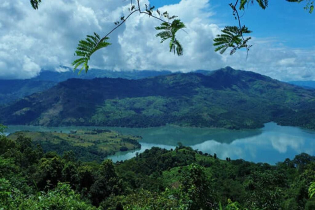
About Wokha
Wokha, nestled in Nagaland, stands as a significant town and municipal center, serving as the hub of Wokha District. Situated approximately 75 km north of Kohima, the state capital, it derives its name, ‘Wokha,’ from the Lotha language, signifying a ‘head count’ or ‘census.’ With a population of 35,004, it predominantly thrives with the vibrant community of Lotha Nagas. This scenic town embraces its cultural heritage while offering a glimpse into Nagaland’s essence. Wokha’s essence lies in its blend of tradition and progress, welcoming visitors to witness the beauty of its landscape and the warmth of its people.
History
Established as the district headquarters of the Naga hills under Assam by the British in 1876, Wokha saw transitions in administrative roles. Despite the shift to Kohima in 1878, Wokha retained its status as a subdivision, later moving to Mokokchung in 1889. Post-Independence, Wokha became a sub-division in 1957 under Naga Hills Tuensang Area until it attained district status in 1973. This journey marks Wokha’s evolution from a pivotal administrative center to a district, witnessing shifts and transformations in its governance, playing a significant role in the historical narrative of Nagaland’s administrative landscape.
Demography
Wokha, Nagaland’s third-largest town, boasts a population of 35,004 as per the 2011 census. With an impressive average literacy rate of 96%, comprising 97% male and 95% female literacy, education thrives here. About 10.57% of Wokha’s populace is under 6 years old. Religion shapes the town, with 92% identifying as Christian, while Hinduism (5%) and Islam (2%) form notable minorities. Lotha, the predominant native language, echoes through the region, accompanied by Nagamese and English. Wokha stands as an educational and cultural hub, embracing diversity while retaining the essence of its native roots.
Geography
Wokha sits at an elevation averaging 1,313 meters (4,793 feet) at 26.1°N 94.27°E, embracing a warm temperate climate designated as Cwa by Köppen and Geiger. Summers in Wokha span from 16.1°C to 32°C, while winters see lows of 2°C. Throughout the year, the average temperature lingers around 17.8°C. Rainfall graces Wokha with an average annual precipitation of 1940 mm, painting the landscape with lush greens and ensuring a climate conducive to the region’s diverse flora and fauna. This region’s weather patterns make Wokha an inviting and varied terrain for visitors and inhabitants alike.
Administration
In 1844, Captain Brodie led the inaugural colonial exploration of the Lotha Naga region. The first documented encounter between Europeans and the Lothas occurred in 1841 with Lieutenant Biggs. Wokha, initially the district headquarters during the British colonial expansion into the Naga Hills, saw a shift to Kohima in 1878. Consequently, Wokha was demoted to a sub-division within the colonial administration. The administrative center moved to Mokokchung, further diminishing Wokha’s role in colonial governance, shaping the historical evolution of administrative hubs within the region.