Tirupur Pincode
Enter the Pincode or Location Below in the Box
Pincodes of Tirupur
Tirupur Pincode 641601, is a thriving center in Tamil Nadu, India, well-known for its colorful apparel and textile sector. The city is a major contributor to India’s textile exports since it is a hub for innovation and entrepreneurship. The region is a hub for employment possibilities and enterprises connected to the textile industry since it is peppered with textile units, manufacturers, and trading centers. Along with a variety of marketplaces, educational facilities, and cultural diversity, Tirupur Pincode 641601 creates a vibrant metropolitan environment. A fascinating trip through the center of this industrial city may be had at Tirupur Pincode 641601, whether you’re looking to explore commercial opportunities or take in the textile culture.
Here is a list of Tirupur Pincode
About Tirupur
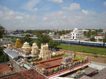
Tamil Nadu, in India, contains the city of Tiruppur, also known as Tirupur. Tiruppur is the fifth-largest city and the administrative center of the Tiruppur district in Tamil Nadu. It is also an urban agglomeration. Situated on the banks of the Noyyal River, it has been ruled by the Early Pandyas, the Medieval Cholas, the Later Cholas, the Mysore Kingdom, and the British at various points in history.
It lies roughly 50 km east of Coimbatore, 50 km south of Erode, 50 km north of Dharapuram, and 450 km southwest of Chennai, the state capital. The municipal corporation that oversees Tiruppur was founded in 2008 and has a total size of 159.6 square kilometer split up into 60 wards.
History
During the Sangam era, Tiruppur was a part of the Kongu Nadu area controlled by the Cheras. The area was connected to India’s east and west coasts by a well-known Roman trading route. Kanchi Maanadhi and the fertile sand it deposited on its banks are mentioned in Chola stone carvings, which date back to the tenth century CE, when the Cholas, a medieval tribe, conquered the Kongu Nadu.
By the fifteenth century, the Vijayanagara Empire had taken control of the area, and thereafter the chieftains of the Madurai Nayaks, known as Palayakkarars, governed it. After a string of battles with the Madurai Nayak Dynasty, the area was ruled by the Kingdom of Mysore in the latter half of the 18th century.
Geography
On the banks of the Noyyal River, at 11.1075°N 77.3398°E, is where you will find Tiruppur. Covering an area of 159.6 square kilometer, it has an average elevation of 295 meters.
Demography
Tiruppur’s population was 444,352 in 2011; the city had a sex ratio of 955 females for every 1,000 males, which was much higher than the 929 national average. There were 48,802 children under the age of six in all, 23,984 girls and 24,818 boys. Scheduled Tribes made up 0.06% of the population and Scheduled Castes, 5.47% of the total. In contrast to the 72.99% national average, the city’s literacy rate was 78.17%.
There were 124,617 dwellings in the city. In all, 207,358 workers were counted, including 490 cultivators, 721 primary agricultural laborers, 3,492 in household industries, 191,882 other workers, 10,773 marginal workers, 89 marginal cultivators, 74 marginal agricultural laborers, 470 marginal workers in household industries, and 10,140 other marginal workers.
Climate
Temperatures in Tiruppur range from 35 to 22 °C (95.0 to 71.6 °F) on average, with a hot, semi-arid climate. The hot, dry months of March, April, and May are when summertime occurs. During the summer, the highest temperature will be approximately 35 °C (95 °F), and the lowest will be approximately 29 °C (84.2 °F). The months of June, July, and August are considered the monsoon season. The key characteristics of these months are lowered temperatures and light precipitation. The months of September, October, November, December, and January are the post-monsoon or winter months.
Economy
90% of India’s exports of cotton knitwear come from Tiruppur, which is dubbed the country’s knitwear capital. For the past thirty years, it has boosted India’s textile sector. It helps India generate a significant quantity of foreign exchange. Exports totaled ₹ 17,500 crores during the 2013 fiscal year. With an average monthly salary of about ₹ 9,000, the city employs a large number of people.
More than 600,000 people work in Tiruppur’s more than 10,000 apparel manufacturing industries. Each month, the cluster exports textiles valued at ₹ 25 billion on average. Europe has a strong demand for the cotton knitwear we send there.