south-Andaman Pincodes

Enter the Pincode or Location Below in the Box

Pincodes of South Andaman

South Andaman Pincodes is a captivating part of the Andaman and Nicobar archipelago, situated in the southeastern region of the Bay of Bengal. It is the southernmost major island in the Andaman group and is known for its stunning natural beauty, pristine beaches, lush tropical forests, and a wide range of outdoor activities.
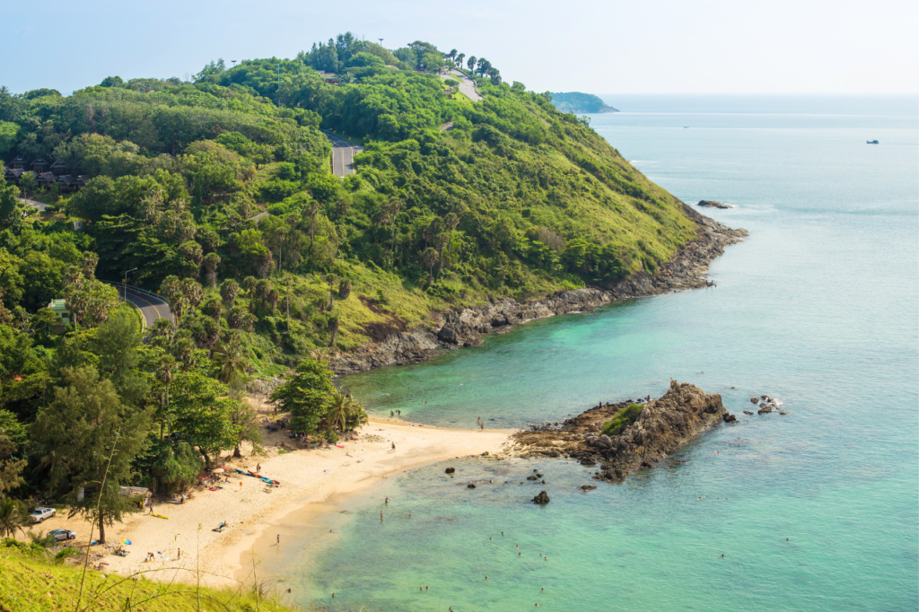
South-Andaman Pincodes

Here is a list of South Andaman Pincodes

No.LocationPincodeDistrictState
1Aberdeen bazar744104South AndamanAndaman And nicobar islands
2Bambooflat744107South AndamanAndaman And nicobar islands
3Beachdera744108South AndamanAndaman And nicobar islands
4Beodnabad744105South AndamanAndaman And nicobar islands
5Bimbiton744105South AndamanAndaman And nicobar islands
6Brijgunj744103South AndamanAndaman And nicobar islands
7Calicut744105South AndamanAndaman And nicobar islands
8Chouldari744103South AndamanAndaman And nicobar islands
9Dundas Point744206South AndamanAndaman And nicobar islands
10Garacharama744105South AndamanAndaman And nicobar islands
11Guptapara744103South AndamanAndaman And nicobar islands
12Haddo744102South AndamanAndaman And nicobar islands
13Havelock744211South AndamanAndaman And nicobar islands
14Havelock bazar744211South AndamanAndaman And nicobar islands
15Herbertabad744109South AndamanAndaman And nicobar islands
16Humferygunj744110South AndamanAndaman And nicobar islands
17Hut bay744207South AndamanAndaman And nicobar islands
18Jirkatong744206South AndamanAndaman And nicobar islands
19Junglighat744103South AndamanAndaman And nicobar islands
20Kalatong744206South AndamanAndaman And nicobar islands
21Mathura744206South AndamanAndaman And nicobar islands
22Miletilak744206South AndamanAndaman And nicobar islands
23Neil Island744104South AndamanAndaman And nicobar islands
24Netajinagar744207South AndamanAndaman And nicobar islands
25Ograbanj744103South AndamanAndaman And nicobar islands
26Peal Island744211South AndamanAndaman And nicobar islands
27Port Blair744101South AndamanAndaman And nicobar islands
28Ramakrishnapur744207South AndamanAndaman And nicobar islands
29Rubber Research station744111South AndamanAndaman And nicobar islands
30Rutland744105South AndamanAndaman And nicobar islands
31School Line744103South AndamanAndaman And nicobar islands
32Shadipur744106South AndamanAndaman And nicobar islands
33Shoalbay744206South AndamanAndaman And nicobar islands
34Sippighat744105South AndamanAndaman And nicobar islands
35Sitapur744104South AndamanAndaman And nicobar islands
36Stewertgunj744107South AndamanAndaman And nicobar islands
37Strait island744211South AndamanAndaman And nicobar islands
38Tushnabad744103South AndamanAndaman And nicobar islands
39Vivekandapur744207South AndamanAndaman And nicobar islands
40Wandoor744103South AndamanAndaman And nicobar islands
41Wimberlygunj744206South AndamanAndaman And nicobar islands

About South Andaman Island

South Andaman Island, the southernmost landmass within the Great Andaman Chain, harbors the majority of the Andaman Islands’ population. It falls under the South Andaman administrative district, a part of the Indian union territory of Andaman and Nicobar Islands, and encompasses the capital, Port Blair. The island includes the tehsils of Ferrargunj and Port Blair.

South Andaman Island, the third largest in the group, is situated immediately to the south of Middle Andaman Island and Baratang, separated by a narrow channel only a few hundred meters wide. It stretches 83 kilometers in length, with a maximum width of 28 kilometers, covering an area of 1,262 square kilometers. Unlike its northern counterparts, South Andaman is less rugged in terrain.

Notable urban centers on the island include Bambooflat and Garacharma. Bambooflat, also known as Bamboo Flat, is a village in the Ferrargunj Tehsil of South Andaman district, Andaman and Nicobar Islands, a union territory of India. It is located 17 kilometers north of the district headquarters and 13 kilometers from the state capital, Port Blair, with a Pin code of 744107.

Garacharma is a census town in the Andaman district of the Andaman and Nicobar Islands, a union territory of India. As per the 2001 India census, Garacharma had a population of 9,431, with males constituting 53% and females 47% of the population. The town boasts an average literacy rate of 74%, surpassing the national average of 59.5%. Male literacy stands at 78%, and female literacy at 69%. In Garacharma, 12% of the population is under 6 years of age.

FAQs

Is Great Andaman and South Andaman same?

The Andamans extend north-south for about 360 km and include more than 300 islands, some two dozen of them inhabited. The three major islands are North Andaman, Middle Andaman, and South Andaman closely positioned and collectively known as Great Andaman.

How to get to South Andaman?

There are daily flights from various cities such as Bangalore, Hyderabad, Delhi, Mumbai, Kolkata and Chennai to Andaman's capital Port Blair. The Veer Savarkar International Airport in Port Blair has daily flights from these cities and airlines such as Air India, GoAir, IndiGo, Spicejet and Vistara serve the airport.

What language is spoken in South Andaman?

Most of the people speak Bengali and Hindi However, Tamil, Telugu, Malayalam are also common in Andaman & Nicobar island. The habitants of the Andaman Islands have Andamanese which is a small group that speak Andamanese language.

Which is the highest peak of South Andaman?

Mount Harriet, 55 Kms by road/ 15 Kms by ferry and trek from Port Blair was the summer headquarters of the Chief Commissioner during British Raj. This place is ideal for fascinating overview of the nearby islands and the sea.

Which is the best month to visit Andaman?

The best time to visit Andaman & Nicobar Islands is considered between October and May as the weather is pleasant, just perfect for sightseeing, water sports, and beach excursion. Monsoons (July to September) are not always recommended because of the high tidal waves, incessant rains and strong winds.